Mapping Control Stations NM/C/131 and NM/B/337 Revisited
In 1971 Senior Surveyor JW (Bill) Witzand was in charge of the Ground Control Survey Section (GCSS) of the Topographic Surveys Branch, National Mapping Melbourne. That year the section comprised :
|
Andrew Greenall, Surveyor Class 1 (first year with Natmap) (*) |
|
Paul Wise, Surveyor Class 1 (first year with Natmap) |
|
Dave Abreu, Field Assistant |
|
Bob Goldsworthy, Technical Officer, Grade 1 (*) |
|
Noel Goldsworthy, Field Assistant (*) |
|
Ed Ainscow, Technical Assistant, Grade 2 (*) |
|
(*) not in the field for the full season. |
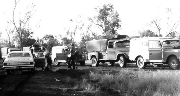
For the majority of the season Andrew and Dave were teamed driving an International C1300 with Paul in the last Natmap Forward Control Land Rover, due to load restrictions. Depending on the work, Paul’s assistant was one or both of the Goldsworthy brothers, driving either a Land Rover or International. When Ed and/or Bill joined the party they both drove Land Rovers.
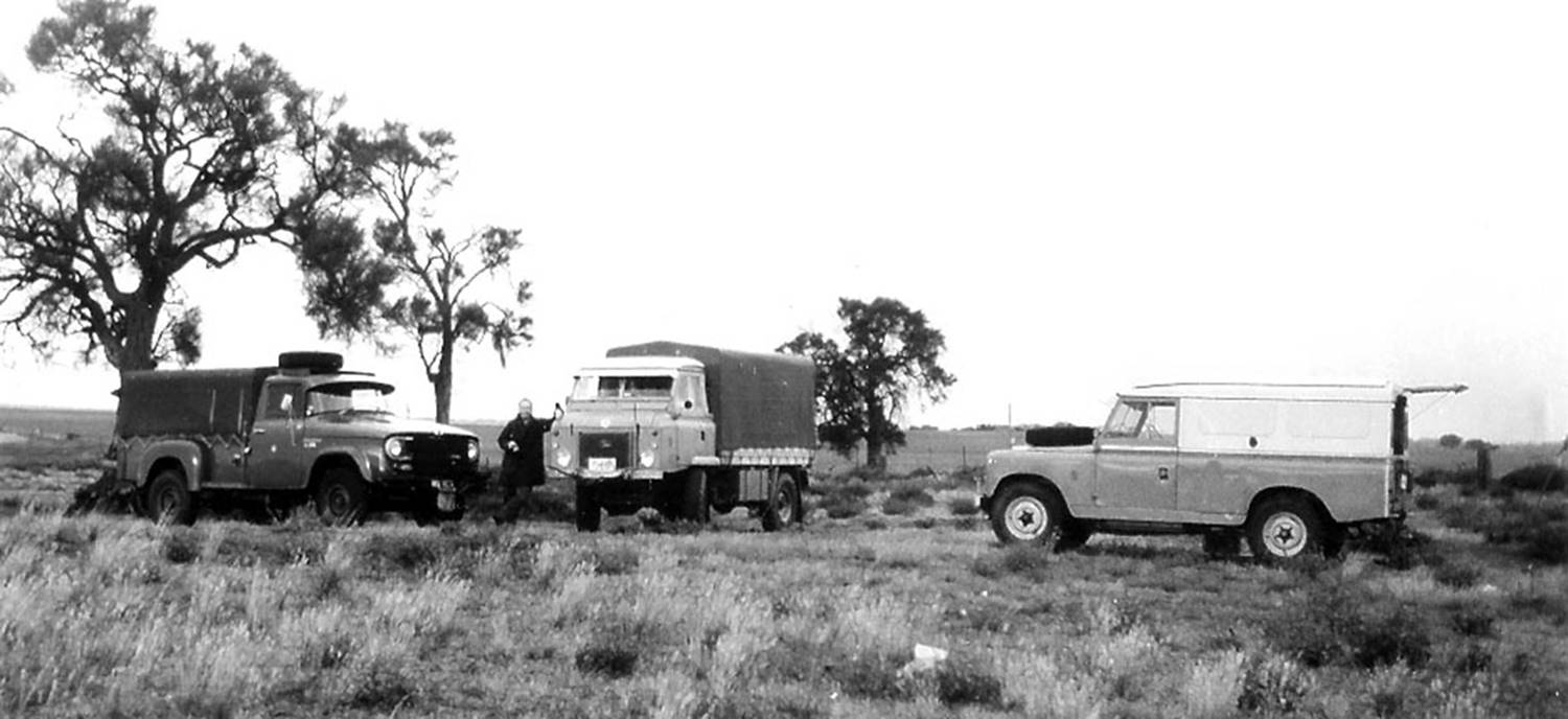
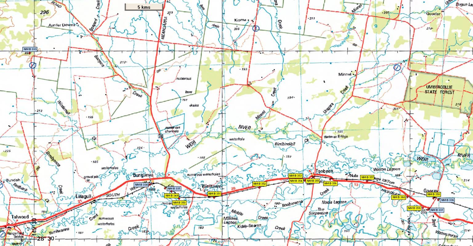
Field party vehicles at Swan Hill test-line in 1971 : (L-R) Dave’s International C1300, Paul with his Forward Control Land Rover and Bill’s 109” wheel-base Land Rover (Andrew Greenall photo)
The program for the year was traversing to second order specifications, using MRA-2 Tellurometers for distance measuring and Wild T2 theodolites for angular work, including sun and σ Octantis astronomical observations for azimuth. In some locations the stations to be used had been previously established, otherwise the party was to establish the necessary marks. To this end, as well as the necessary survey and camping equipment the vehicles carried, star pickets, water pipe, cement, white and black paint and various tools plus a station mould and dyes. The work started near Ouyen in Victoria and ended near Springsure in Queensland some nine months later.
Second order traverse specifications required that the distance measuring and angular observations be done at certain periods of the day when atmospheric conditions were best suited to the task. Between these times any station establishment work could be undertaken provided the centre mark remained undisturbed throughout. The trick was that on arrival at the site, and after ensuring line of sight to the previous station, an area for the station block of about a square metre was cleared to a solid ground level. Then a square hole was dug with the spade, one spade width by one spade width and the length of the spade blade deep. In the centre of this hole a star picket was driven to refusal. By placing the station mould on top of the hole the length of picket needed above ground could be gauged and any excess removed. A centre punch was used to mark the definitive station centre in the picket. Now the tripod for the instruments could be setup precisely over the centre mark and firmly set in place. As required either the theodolite or Tellurometer could now be set on the tripod. By carefully working around the tripod, the hole with its star picket could be filled with concrete and the station mould and dyes set. Reference Marks (RM) and witness posts could also be emplaced and when the concrete had dried the station painted. By the end of the day with all the survey observations completed a finished survey station could be left behind.
The New South Wales station NM/C/131 and Queensland station NM/B/337 were both established by Paul and Noel during 1971 but unlike many of the other stations established that year, these two stations were close to the road so accessing them again did not require any special transport.
NM/C/131
NM/C/131 also called Eumungerie (NSW2001) and now NSW4025 was originally a New South Wales Lands Department 4th order station. It was close enough to 32°S, 148.5°E to meet the requirements for a mapping control station. Experience had shown that such stations sometimes had no ground mark and had been coordinated by angular intersection from surrounding stations. The location was an isolated rocky outcrop on private property some 50 kilometres north of Dubbo, New South Wales, and west of the Newell Highway. Earlier in 1971, a Natmap field party had exhaustively swept the summit of the rock with a bannister brush in a search for a ground mark, but none had been found.
As well as establishing a permanent ground mark on Eumungerie, the new station was connected to the first order trigs of Sappa Bulga and Talbragar to the south and east of Dubbo respectively.
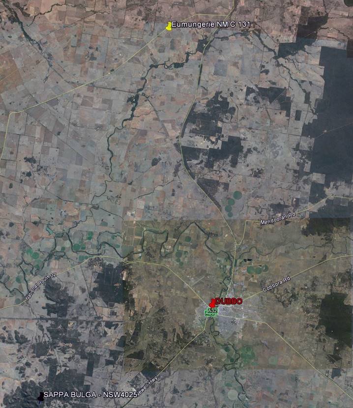
Location of NM/C/131 and Sappa Bulga on Google Earth image
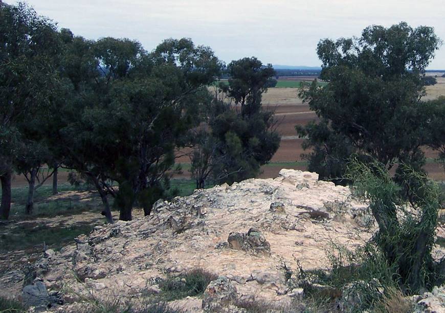
In 2011, almost exactly 40 years after establishing the station, Paul revisited the location. As there was no-one at the homestead Paul walked in from the nearest main road across the paddock. The station block and RMs were still intact and solid, but most of the paint had been eroded away by the elements although traces were still visible. Most notable was that the surrounding trees had grown substantially blocking the remembered 360° view over the surrounding flat farmlands. Sappa Bulga, however, was still visible on the southern horizon. The following photographs refer.
Isolated rocky outcrop known as Eumungerie and marked as NM/C/131, looking east from the road in 2011
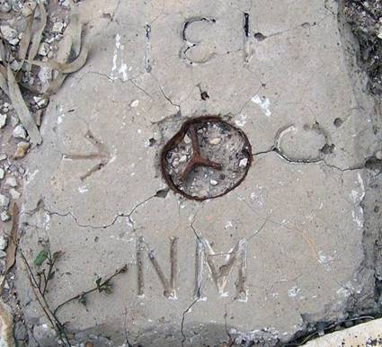
NM/C/131 station block and one of two RMs in 2011
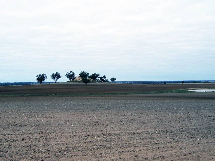
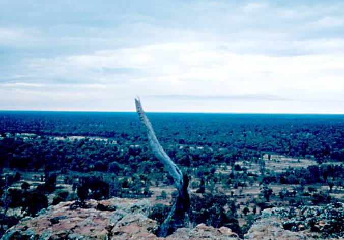
2011 view from NM/C/131 south to Sappa Bulga on the horizon
NM/B/337
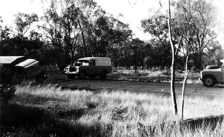
A mapping control station was also required near 28.5°S, 150°E some 30 kilometres west of Goondiwindi, Queensland, on the Barwon Highway. The region lies in the flood plain of the Macintyre River, which forms part of the border between New South Wales and Queensland. The region is very flat with dense tree cover and the nearest higher terrain was some 60 kilometres to the west of the required station. Survey control was bought in from the north to a point on this higher terrain, marked as NM/B/333. Then, the only intermediate high point above the tree canopy was the silo complex at Bungunya railway siding about 20 kilometres to the east of NM/B/333 and still some 40 kilometres from the required point. The party was not equipped with portable tower sections so the idea was to use the existing railway survey between Bungunya and Gooray siding, near the required point. The railway survey had bearings and distances, the bearings being converted to azimuths by observing σ Octantis along the straights near Bungunya and Gooray. At Bungunya, an observing station on the silo machinery tower was used to connect the control survey from NM/B/333 into that of the railway, and near Gooray a survey station on the railway was connected to NM/B/337.
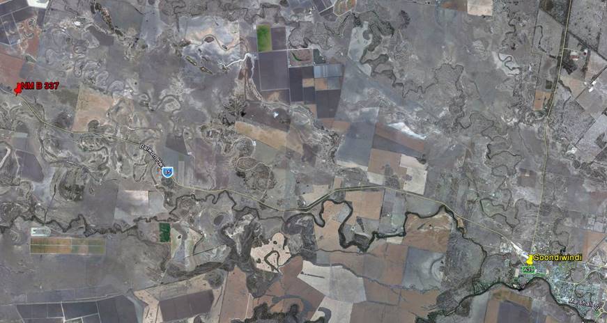
Location of NM/B/337 on Barwon Highway west of Goondiwindi on Google Earth image
At NM/B/333 in 1971, looking east over a flat, tree covered plain
Section of 1:250,000 scale map showing the survey stations between NM/B/333 and NM/B/337. The blue are the 1971 stations and yellow are the 1972 tower stations.
Andrew Greenall’s photos below recorded two incidents while in the area. The first shows the convoy being stopped by curious Queensland police after our movements were reported by suspicious locals. The second shows Paul’s FCLR being rescued after it slid into a table drain in ice like road conditions. Paul was not the only one rescued that day as it turned out that a few kilometres behind Paul the same fate had occurred to Dave’s International. Because of the road conditions both vehicles were travelling at very low speed and no damage was sustained.
Curious Queensland Police question Natmap convoy : Dave in front of Paul at police car door with Noel shielding his eyes with Ed behind him (Andrew Greenall photo)
Paul’s FCLR (lower left) being assisted from the table drain by the two Land Rovers (Andrew Greenall photo)
After the traverse was fully computed back in the office, it was found that there was a problem with the railway survey data and the final accuracy of NM/B/337 was suspect. In 1972 a field party led by Reg Ford, with Ted Caspers, Bill Stuchbery, Graham Lawrence, Dave Dzur and Laurie Edebohls used towers to connect NM/B/333 to NM/B/337. The towers were used on the plains’ section between Bungunya and Gooray using the clear lanes of the road and railway reserve to get the longest lines of sight possible. Even so eleven intermediate station were required!
1972 tower traverse : left photo (B-T) Ted Caspers, Dave Dzur, Graham Lawrence, Reg Ford and Laurie Edebohls legs; right photo shows Bill Stuchbery observing from tower with Wild T2 theodolite (Bill Stuchbery photos)
Paul first revisited NM/B/337 in early 1981 and as shown by the photos below the station was in good condition with the station block and witness posts still retaining some of their paint.
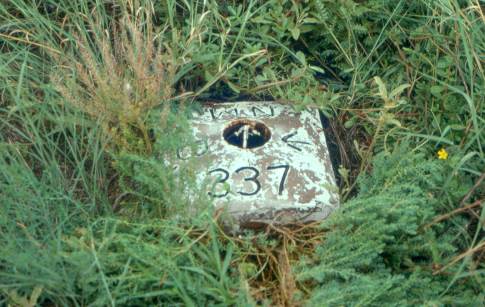
NM/B/337 station block in 1981
Witness Posts of NM/B/337 visible in 1981
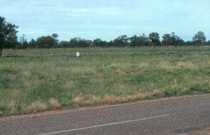
A second visit in February 2010 saw the station still intact but by now the elements had removed all the paint. Given that in the intervening years there had been severe flooding in this region at least twice, the station’s condition is remarkable. Nearby sites for the 1972 traverse stations were also visited but no sign of any ground mark could be found. As these marks were close to the road and associated drainage features it is most likely that post-flood road repairs destroyed these marks.
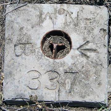
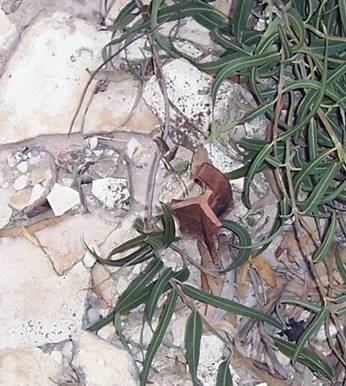
NM/B/337 station block in 2010
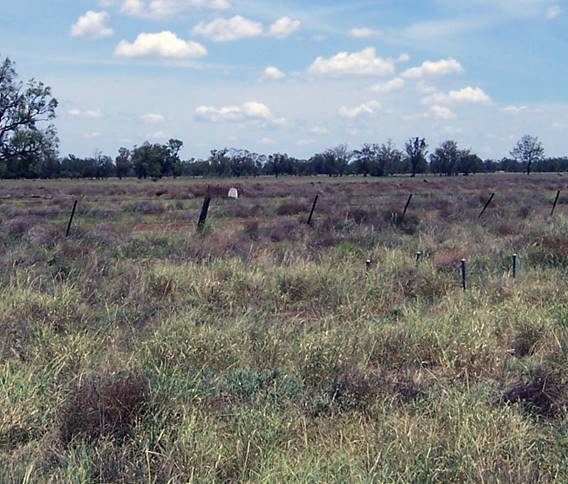
Witness Posts of NM/B/337 visible in 2010
|
Other photographs from 1971 survey |
|
|
|
|
|
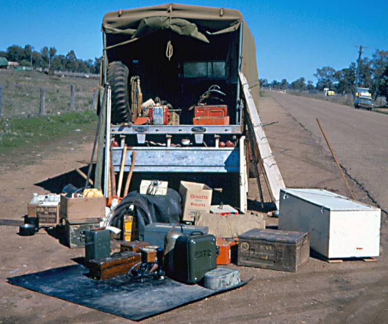
Sorting equipment needed to be back-packed to railway line. |
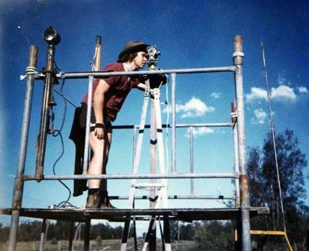
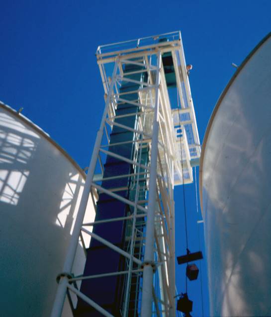
Technical equipment being lifted to observing platform on Bungunya silo machinery tower. |
|
|
|
|
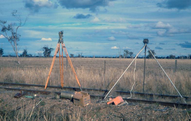
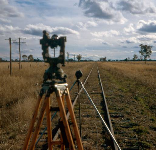
Wild T2 theodolite and signal lamp set on rail centre-line to connect railway survey to control survey; photo on right is taken looking to the west to Bungunya silo. |
|
This article was prepared by Paul Wise in October 2015 with assistance from Bill Stuchbery. Unless indicated otherwise all photos are by Paul Wise.