CIRCA EARLY 1970s TRACK NOTES :
LAVERTON TO AYERS ROCK VIA WARBURTON
WARNING : THESE NOTES ARE SOME 40 YEARS OLD AND ARE PROVIDED FOR THEIR HISTORICAL VALUE AND NOT FOR NAVIGATIONAL PURPOSES AS THE TRACKS AND THEIR LOCATIONS HAVE CHANGED
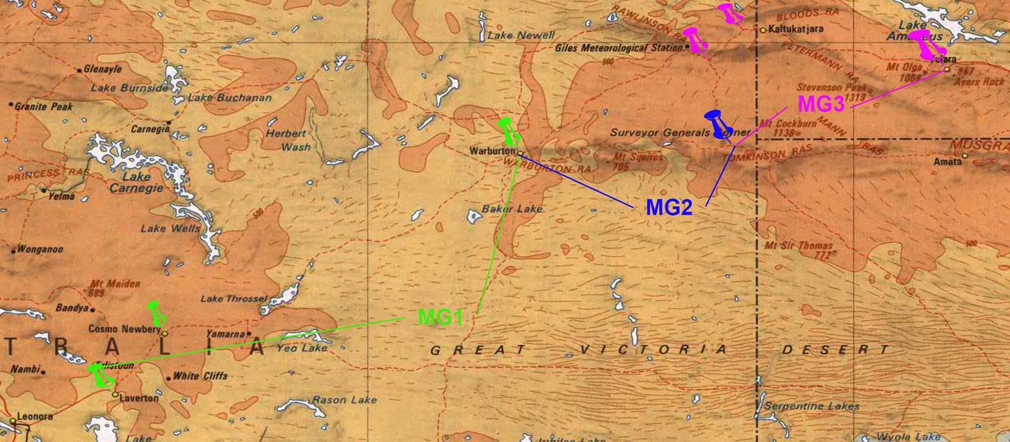
This route could be undertaken then in a two wheel drive vehicle and the notes were provided in three sections :
|
Route |
Map colour |
Original description |
Today’s description |
|
Light green |
Laverton – Cosmo Newberry Mission – Warburton Ranges Mission. Distance 354 miles. |
Laverton to Warburton via the Great Central Road |
|
|
Blue |
Warburton Ranges Mission via Blackstone to the T-junction on the Beadell Highway between Giles and Mt Davies. Distance 156 miles. |
Warburton to Giles Mulga Park Road via Blackstone Warburton Road. Blackstone is today Papulankutja. |
|
|
Magenta |
T-junction on the Beadell Highway between Giles and Mt Davies to Ayers Rock, via Petermann Ranges and Mt Olga. Distance 272 miles. |
Intersection of Giles Mulga Park Road with Blackstone Warburton Road to Ayers Rock via Giles Mulga Park Road, Great Central Road and Tjukaruru Road. Ayers Rock today is Uluru and Docker River is Kaltukatjara. |
The concrete blocks mentioned in the notes are Bench Marks installed by Department of Interior or later National Mapping levelling parties who undertook this work as part of the program to extablish the Australian Height Datum in 1971. More detail can be found in this paper.
Courtesy Brian Shaddick