AERODIST BLOCK 39 : SELECTED STATION’S REVISITED
Introduction
During their recent travels Bill and Fiona Stuchbery revisited several stations occupied for Aerodist line measuring operations in 1973. Details of this work can be found in Laurie McLean’s paper The Aerodist Years available via this link. This article describes the current condition of the stations visited. Refer Figure 1.
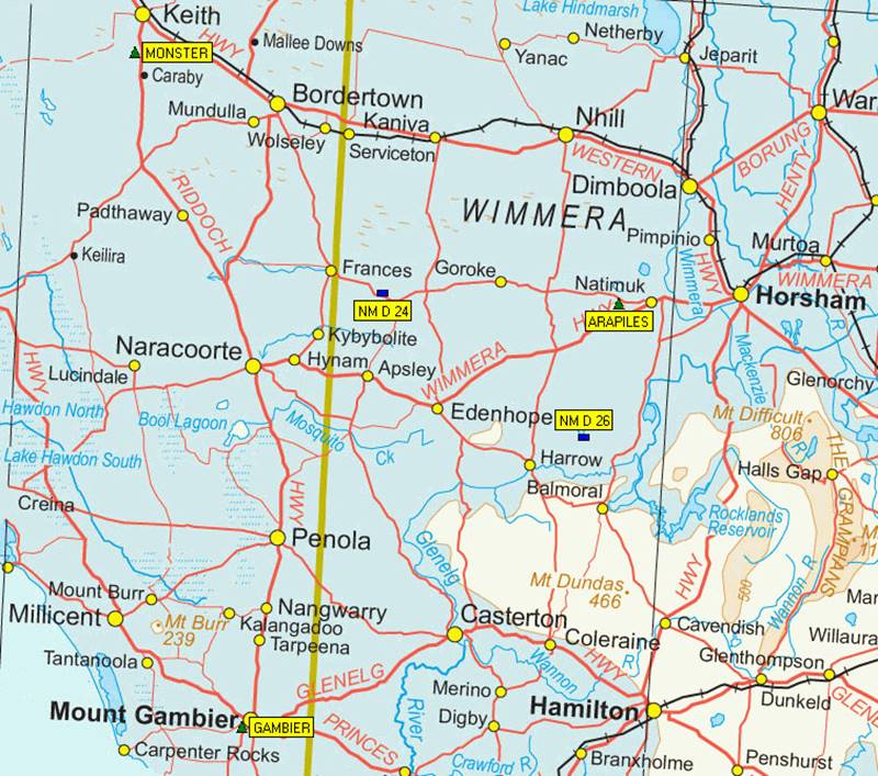
Figure 1 : Map showing locations of stations visited.
Stations visited
NM/D/24 and 26 were both originally established by National Mapping Ground Marking field parties during the first half of 1973.
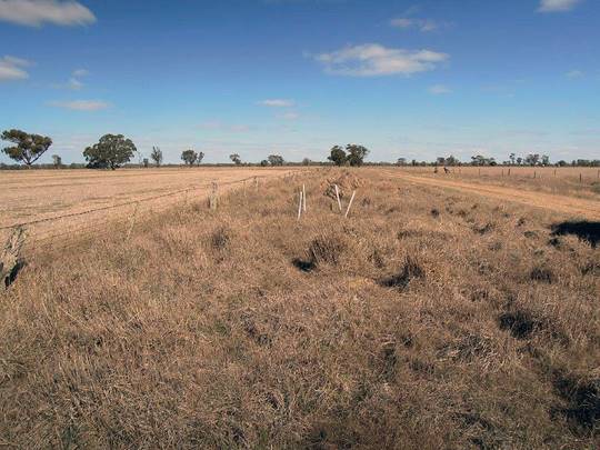
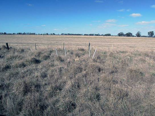
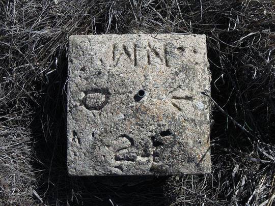
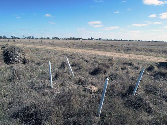
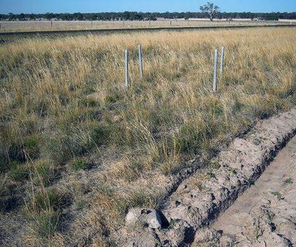
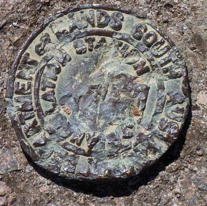
NM/D/24 : Visited on 2 April 2016, the station is sited between the track and fence with the area used for the harvesting of additional feed. The block was still solid but loose from the ground being only held in place by the central star picket. The station showed signs of being under water for long periods as indicated by the wearing of the lettering. The witness posts have been knocked about but were still solid. RMs were not sighted. Refer Figure 2.
|
|
|
|
NM/D/24 in the landscape. |
|
|
|
|
|
NM/D/24 block (left) and witness posts (right). |
|
|
Figure 2 : Photographs at NM/D/24 acquired 2 April 2016. |
|
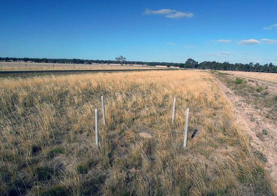
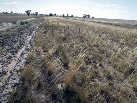
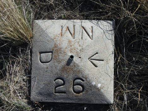
NM/D/26 : Visited on 2 April 2016, the station is sited between the track and fence. The block and witness posts were in excellent condition and looked almost new, apart from the obvious loss of paint from all surfaces. RM2 and 3 were sited and also in good condition. RM1 was gone. Bill had previously occupied this point on 2 August 1973 during Aerodist line measuring operations. Refer Figure 3.
|
|
|
|
NM/D/26 in the landscape. RM2 is visible in the right photograph. |
|
|
|
|
|
NM/D/26 block (left) and RM3 (right). |
|
|
Figure 3 : Photographs at NM/D/26 acquired 2 April 2016. |
|
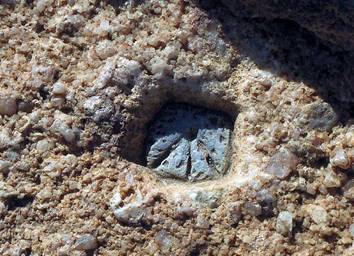
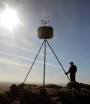
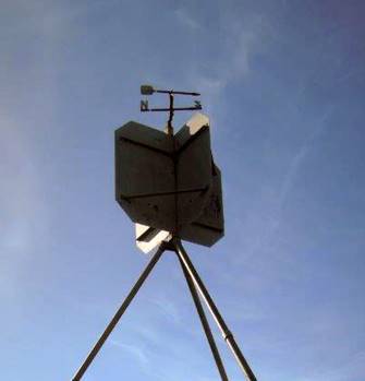
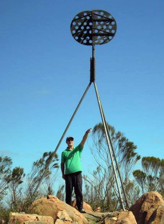
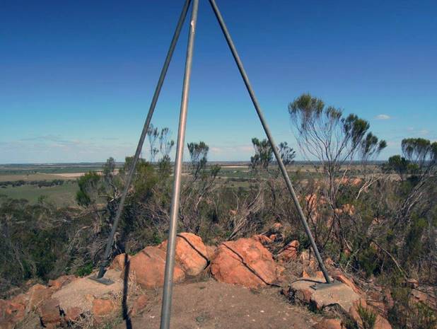
Arapiles an original Victorian Lands Department Trig of circa 1950s : Visited on 3 April 2016 the station mark was a small lead plug inset into the base rock and still in good condition. The poles and vanes were also in a very good condition. The trig is a few minutes’ walk from the car park up some stone/concrete steps and commands a 360 degree view. Bill had previously occupied this point on 1-2 August 1973 during Aerodist line measuring operations. Refer Figure 4.
|
|
|
|
|
Arapiles ground mark (left) and beacon (centre & right). |
||
|
Figure 4 : Photographs at Arapiles acquired 3 April 2016. |
||
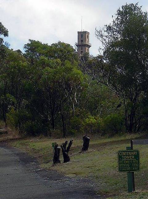
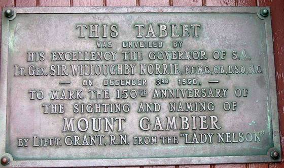
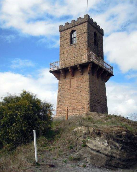
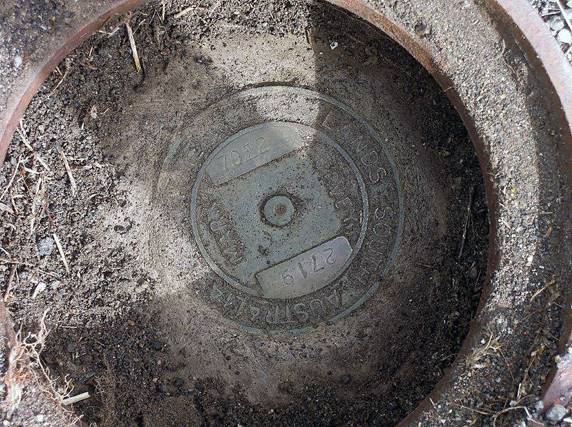
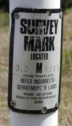
Gambier an original Royal Australian Survey Corps Trig of circa 1940s. Its location is at the foot of Centenary Tower at Mt Gambier : Visited on 6 April 2016 the station mark was a brass bolt set into the tower’s foundation, and still in good condition. A new South Australian Lands Department mark (Gambier Ecce 7022/2719) was located to the west of the tower in a standard steel circular enclosure with lid, and marked by white painted witness post with warning plaque. The tower is a solid 200 metre walk from the car park and commands a 360 degree view. Bill had previously occupied this point, with Ken Brown, on 3-6 August 1973 during Aerodist line measuring operations. He recalls that time being miserably cold and wet! Laurie McLean recalls he undertook the earlier reconnaissance of Gambier with Bill Forster, around Anzac Day, 1973, to ensure that the site would be suitable for use for the later Aerodist line measuring. Refer Figure 5.
|
|
|
|
Centenary Tower at Mt Gambier and plaque. |
|
|
|
|
|
Centenary Tower (left) with witness post and standard steel circular enclosure with lid, for South Australian Lands Department mark (Gambier Ecce) in the foreground. Gambier ground mark is located at the base of the tower as shown in the composite photograph at right. |
|
|
|
|
|
South Australian Lands Department mark Gambier Ecce 7022/2719 (left) and witness post plaque (right). |
|
|
Figure 5 : Photographs at Gambier acquired 6 April 2016. |
|
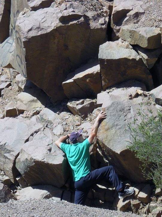
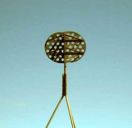
Monster an original South Australian Lands Department Trig of circa 1940s : Visited on 2 April 2016 the station mark plaque has been defaced but the inscription and 860 number (T2/860) is still readable. The poles and vanes were also in good condition. The trig is an easy 10 minute walk from the car park and commands a 360 degree view. Refer Figure 6.
|
|
|
||
|
Difficult climb-on access to Monster (left) but the new road to the top is just over there (right)! |
|||
|
|
|
|
|
|
Monster ground mark (left) and beacon (centre & right). |
|||
|
Figure 6 : Photographs at Monster acquired 2 April 2016. |
|||
Note that while it is not entirely clear from existing available information, it is highly likely that the sites at Arapiles, Gambier and Monster were first emplaced and beaconed by the then Australian Survey Corps pre WW2.
Conclusion
The condition of these stations is similar to other stations visited elsewhere. Where there has been no vandalism the stations are generally still solid with only weathered paintwork. Witness posts and RMs may have sometimes been destroyed but where they still exist they too are still solid.
Acknowledgement
This article is the result of the interest and effort of Bill and Fiona Stuchbery, who provided the photographs and notes.
Postscript
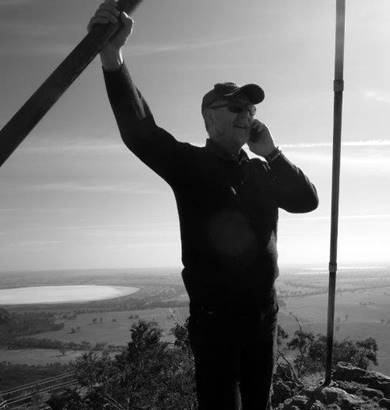
In the forty plus years since the 1973 Aerodist operations, communications have advanced such that from the top of Arapiles, Bill, as shown in the photograph below, was able to contact me at home and report on their activities. To locate both NM/D/24 and NM/D/26, GPS was used using the stations GDA94 coordinates. Within metres of the stations the GPS advised they were Arriving at destination. Times have certainly changed!!
Compiled by Paul Wise, April 2016.