Australia : Colonies, States/Territories & Federation
(Note: This article is an update of the one that was printed in the NatMap News No. 50 of December 1984. In checking its currency the attached two papers were found which provide a similar overview albeit from 1894 and 2013, plus a 1971 paper focusing on the instruments of establishment or alteration of the various boundaries.)
Since 1909, when the Australian Capital Territory, was incised from the State of New South Wales, the seven mainland States of Australia have existed with their current geographic boundaries. Why are their boundaries where they are and why were they determined to be so?
Many of the answers are contained in a document by the Department of Lands, NSW, dated 26 August 1889:…"How the area of New South Wales has been altered from time to time by the subdivision of the Australian Continent into the different Colonies". However before that we must go back to 1494 even before Australia was known by that name, if known at all!
In 1494, the Treaty of Tordesillas split the known world between the two great powers of the time Spain and Portugal, into equal hemispheres. As the Pope was the arbiter in the dispute between Spain and Portugal as to “whose Territory was whose”, the line of demarcation or Pope’s Line was finally settled as being longitude 51º west. This line gave Portugal west Africa and eastern South America while Spain got western South America and all of today’s North America and Canada. Of interest to us in Australia is how longitude 51º west affected the lesser known world on the other side of the globe.
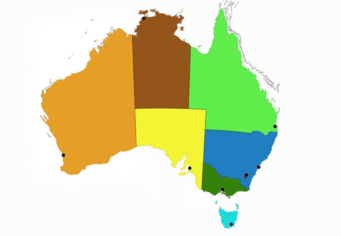
Once the 51st meridian passes the North or South Pole it becomes the 129th meridian or 129º east (if your geography is a little rusty the border between Western Australia and the Northern Territory and South Australia today is longitude 129º east). McIntyre (1987) said:…“the Treaty of Tordesillas does not expressly state that the Line was to run right round the world – indeed the words ‘from north to south’ imply the opposite.…it was the common understanding that there must be a Line of Demarcation in the east as otherwise it would be meaningless to have one in the west.” McIntyre then speculates that locating this Line in the east bought the Portuguese down Australia’s east coast in 1522.
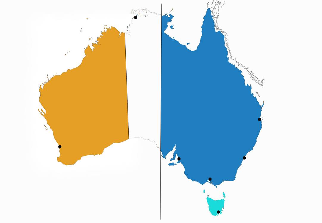
Nevertheless Australia had its first boundary; today’s Western Australia would have been Portuguese territory (red on Map 1) and everything east of 129º east Spanish territory (yellow on Map 1).
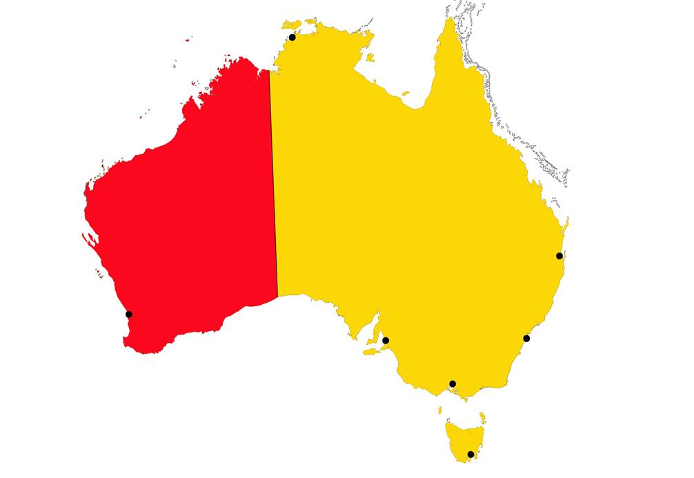
Map 1 : Showing meridian 129º east defining Portuguese (red) and Spanish (yellow) territory in 1494.
Note that on this and all following maps the positions of the State capitals are retained as points of reference.
The Australian Capital Territory is added at the appropriate time.
This boundary existed for some three hundred years but was never established.
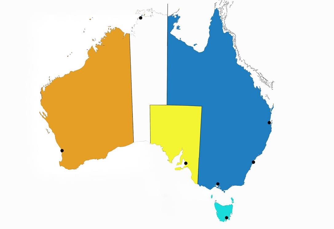
Another proposal to subdivide Australia, which never came to fruition, was made by Captain James Vetch and published by the Royal Geographical Society in their journal of 1838. Vetch tried to give each colony equal areas, possess a tract of sea coast with possible harbour sites and be as compact as possible as can be seen on Map 2.
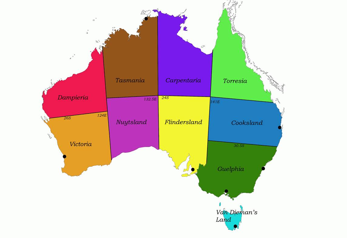
Map 2 : Showing Vetch’s 1838 proposal to subdivide Australia.
Note that the positions of the coastal State capitals are retained as points of reference.
The 12 October 1786 and 2 April 1787 Royal Commissions to Governor Phillip declared the Territory of New South Wales as:…"extending from the northern cape or extremity of the coast, called Cape York, in the latitude of 10 degrees 37 minutes south, to the southern extremity of the said Territory of New South Wales, or South Cape, in the latitude of 43 degrees 39 minutes south and all the country inland to the westward as far as the one hundred and thirty-fifth degree of longitude reckoning from the meridian of Greenwich including all the islands adjacent in the Pacific Ocean within the latitude aforesaid of 10 degrees 37 minutes south, and 43 degrees 39 minutes south..." (blue area on Map 3). New Zealand was thus considered to be included in the commission of the Governor of New South Wales until 1814.
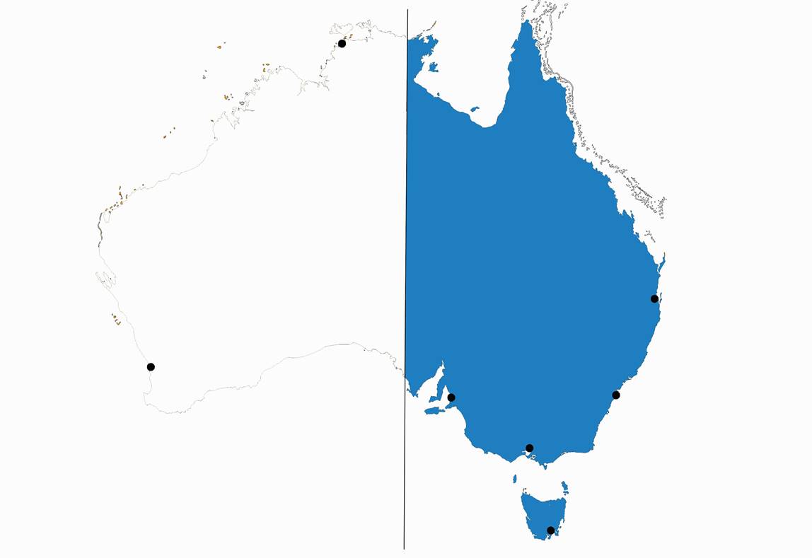
Map 3 : The 1788 Territory of New South Wales is shown in blue.
By act Van Diemen's Land was separated from New South Wales and created into a Colony by virtue of an order of His Majesty dated 14 June 1825. The Proclamation of 12 December 1825 describing the boundaries stated:…"the said island and offshore islands and territories lying to the south of Wilsons Promontory in 39 degrees and 12 minutes of south latitude and to the northward of the 45 degrees of south latitude and between 140 and 150 degrees of latitude east of Greenwich and also Macquarie Island lying to the southward of the said Van Diemen's Land…" (light blue area on Map 4). The name Tasmania was proclaimed on 1 January 1856.
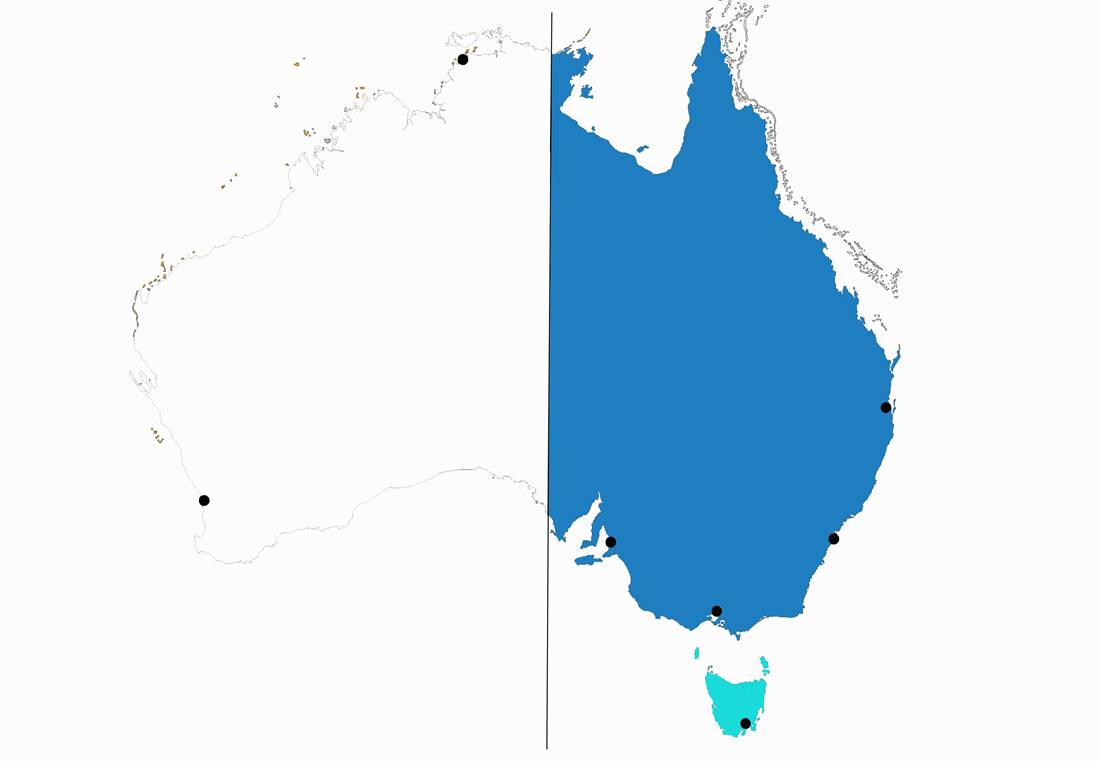
Map 4 : The 1825 Colony of Van Diemen's Land, later named Tasmania, and some of its islands is shown in light blue.
Although Western Australia had been occupied at King George's Sound [Albany, WA] in 1826, Captain Fremantle, H.M.S. Challenger (despatched from India to Swan River) had formally taken possession of:…"all that part of New Holland which is not within the Territory of New South Wales”, it does not appear that the boundaries were definitely described until 1831, when in a Commission issued to Captain Stirling (then Lieutenant Governor) appointing him:…"Governor and Commander-in-Chief of His Majesty's Settlement on the west coast of Australia or New Holland"; the limits of his authority were:…"from Cape Londonderry (latitude : 13 degrees 44 minutes S) to West Cape Howe (latitude : 35 degrees 8 minutes S) and from Hartog's Island 112 degrees 52 minutes to 129 degrees east longitude"; again in the supplementary Commission granted to the Governor in 1873:…“as extending from the parallel of 13 degrees 30 minutes south latitude to West Cape Howe in the parallel of 35 degrees 8 minutes south latitude and from Hartog's Island on the Western Coast in east longitude 112 degrees 52 minutes to east longitude 129 degrees reckoning from the meridian of Greenwich, including all the islands adjacent in the Indian Ocean within the latitudes and longitudes aforesaid" (orange area on Map 5).
Map 5 : His Majesty's Settlement on the west coast in 1873, is shown in orange.
By Act on 15 August 1834:…"an Act to empower His Majesty to erect South Australia into a British Province or Provinces and to provide for the colonization and government thereof...and whereas His Majesty on or about 10 February 1836, by Letters Patent ...did hereby fix the boundaries of the same Province in manner following, on the north the 26 degrees of south latitude, on the south the Southern Ocean, on the west the 132 degrees of east longitude, on the east the 141 degrees of east longitude..." (the yellow area on Map 6).
Map 6 : The Province or South Australia “for the colonization and government thereof” in 1836, is shown in yellow.
The Colony of Victoria was separated from New South Wales, and the issue of writs of 1st July 1851, for election of members of Council for Victoria, was the legal symbol of separation from New South Wales. The boundary of the new Colony was described:… "on the north and north-east by a straight line drawn from Cape Howe to the nearest source of the Murray River, and thence by the course of that river to the eastern boundary of the Colony of South Australia, shall be erected into a separate Colony to be known and designated the Colony of Victoria (green area on Map 7)…and whereas doubts have been ascertained as to the true meaning of the said description of the boundary of the said Colony, it is hereby declared and enacted that the whole watercourse of the said River Murray from its source therein described to the eastern boundary of the Colony of South Australia is and shall be within the Territory of New South Wales...” [this means that the border “moves” because it is wherever the water in the Murray River meets the Victorian river bank].
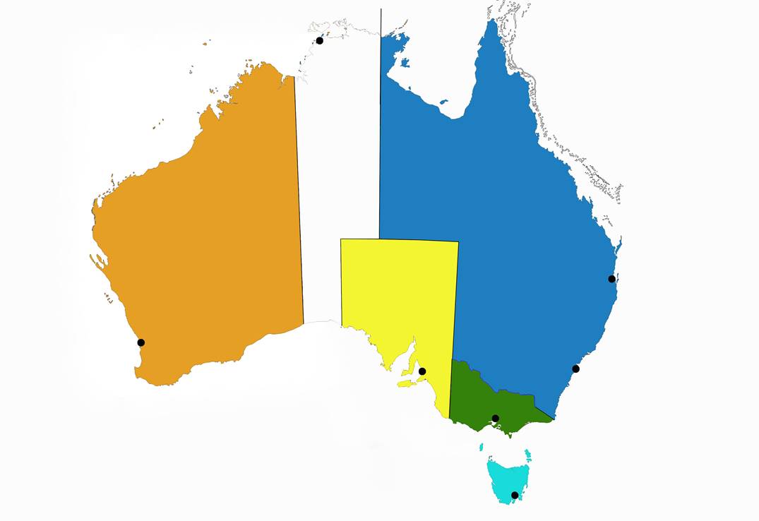
Map 7 : The 1851 Colony of Victoria is shown in green.
Acts 18 and 19 of 16 July 1855, also defines the boundaries of New South Wales as:… "all that portion of Her Majesty's territory of Australia or New Holland lying between the 129th and 154th degrees of east longitude, reckoning from the meridian of Greenwich, and northward of the 40th degree of south latitude, including all the islands adjacent in the Pacific Ocean within the latitude aforesaid, and also including Lord Howe Island, being in or about the latitude of 31 degrees 30 minutes south and the 159th degree of east longitude, reckoning from the said meridian of Greenwich, save and except the territories comprised within the boundaries of the Province of South Australia and the Colony of Victoria, as at present established". In essence, New South Wales expanded west to 129 east longitude to absorb the yet “unclaimed” territory (the white area on Map 6 all became part of NSW as shown on Map 8).
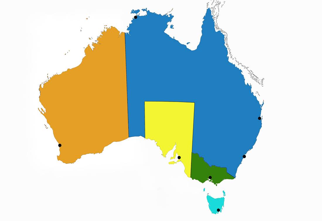
Map 8 : New South Wales expands west in 1855 to 129º east longitude, to absorb the yet “unclaimed” territory.
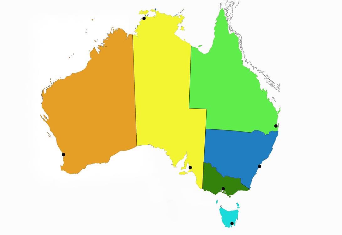
Queensland (light green area on Map 9) was separated from New South Wales and erected into a separate Colony by Letters Patent bearing the date 6th June 1859 and proclaimed in the NSW Government Gazette on 1st December 1859 by Sir William Denison, Governor:...“so much of the said Colony of New South Wales as lies to the northward of a line commencing on the sea coast at Point Danger in latitude about 18 degrees 8 minutes south, and following the range thence which divides the waters of the Tweed, Richmond, and Clarence Rivers from those of the Logan and Brisbane Rivers, westerly to the Great Dividing Range, between the waters falling to the east coast and those of the River Murray; following the Great Dividing Range southerly to the range dividing the waters of Tenterfield Creek from those of the main head of the Dumaresq River; following that range westerly to Dumaresq River and following that river [‘middle of the channel’ vide Crown Solicitors opinion, Misc. 22.630] (which is locally known as the Severn) downward to its confluence with the Macintyre River; thence following the Macintyre River, which, lower down becomes the Barwon, downward to the 29th parallel of south latitude, and following that parallel westerly to the 141st meridian of east longitude, which is the eastern boundary of South Australia, together with all and every adjacent Islands, their members and appurtenances in the Pacific Ocean...".
Map 9 : The 1859 Colony of Queensland is shown in light green. Note that its initial western boundary is 141º east.
This description left some doubt as to what constituted the western boundary north of the 26th parallel; but in a despatch from Governor Bowen to the Secretary of State (the Duke of Newcastle), September 5th 1861:…"in reference to the co-operation of Queensland in sending out expeditions to search for Mr Burke and party, paragraph 9 reads "one result of these expeditions is certain, even if they should be unsuccessful in their primary object, they will assuredly add largely to our present knowledge of the shores of the Gulf of Carpentaria, of the rivers running into it, and of the interior of the north-eastern portion of the Australian Continent”. It is further believed that a speedy consequence of the knowledge thus acquired will be the formation of a settlement on the "Plains of Promise" (as they were named by Captain Stokes, R.N. late of H.M.S. Beagle) at the Head of the Albert River. It becomes my duty therefore to request that I might be furnished with your Grace's Instructions as to the course I should recommend to the Government and Legislature of Queensland, in case any such settlers on the Gulf of Carpentaria to the west of the 141st meridian of longitude, should claim the protection, and desire to place themselves under the jurisdiction of Queensland" (it would therefore appear from this despatch that the 141st meridian was at this time recognised as the western boundary throughout).
In reply to Governor Bowen, a despatch was sent from the Secretary of State, dated 14th December 1861:..."I have no objection to your proposal that the territory should be temporarily annexed to the Colony of Queensland, and I shall accordingly cause Letters Patent to be issued for giving effect to this arrangement in pursuance of the powers conferred on Her Majesty by the recent Act of Parliament 24 and 25 Vic. C. 44. It must, however, be distinctly understood (as I gather from the 14th paragraph of your despatch it is understood) by the Legislature of Queensland, that the annexation of this territory, which will be revocable under the terms of that Act, will probably be in fact revoked, when the growth of population or other circumstances shall, in the opinion of Her Majesty's Government, render separation desirable for the interest of the new territory."
The Governor of Queensland stated:…"that Queensland...has undertaken the Provisional Charge under Her Majesty's letters Patent dated 13th March, 1862, of the entire north-eastern corner of the Australian Continent including the shores of the Gulf of Carpentaria up to the 138th meridian of east longitude. The boundary as now defined was proclaimed 23rd June, 1862” (Queensland expanded west to 138º east as shown on Map 10).
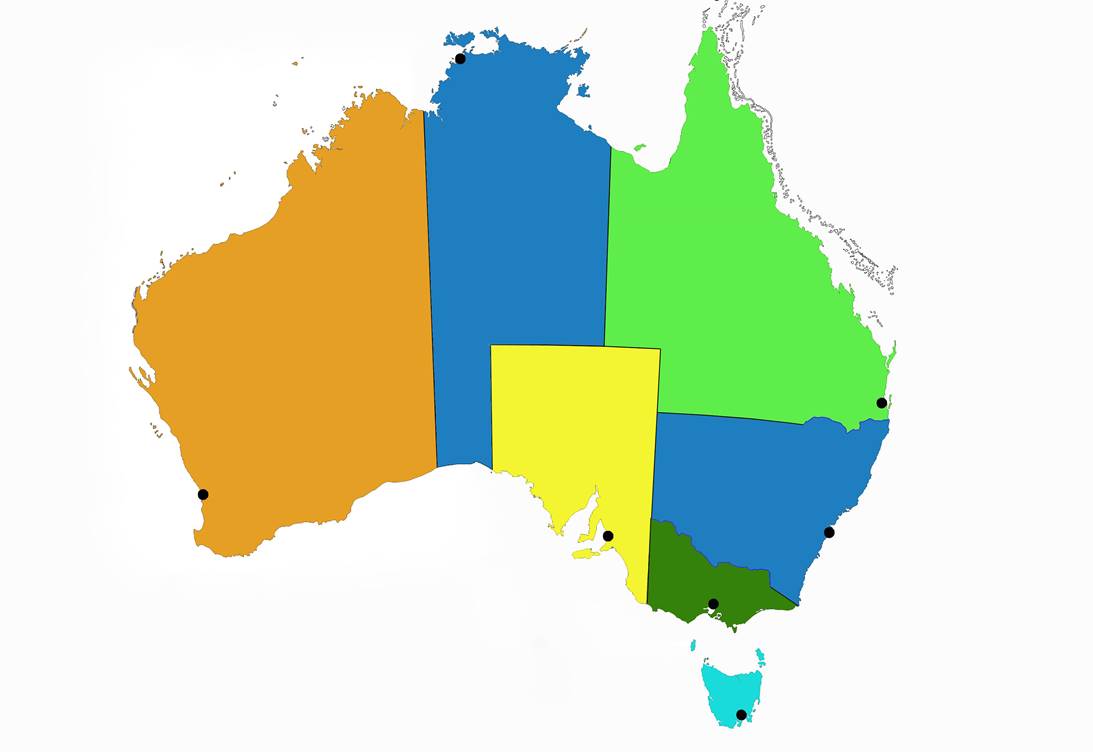
Map 10 : Showing Queensland’s 1862 expansion west to 138º east.
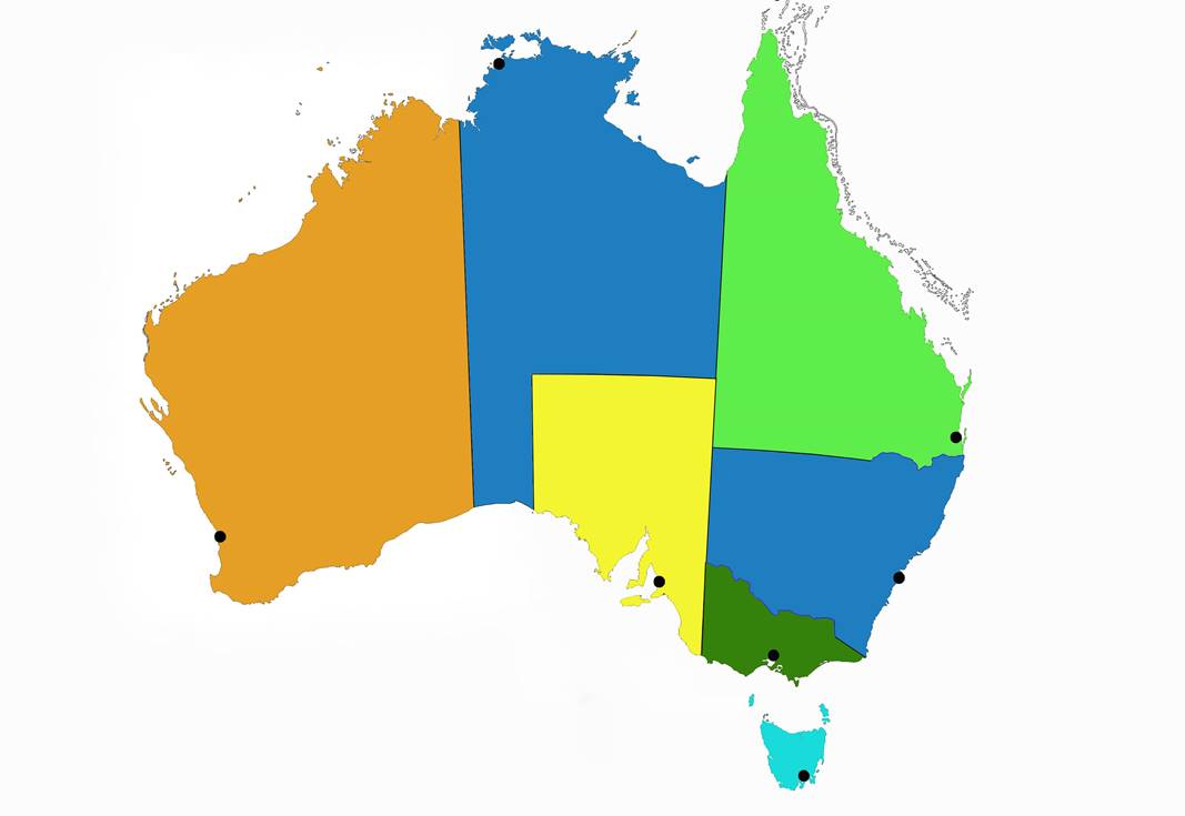
Under similar legal mechanisms as above, on 22nd July 1861:…"so much of the Colony of New South dales being to the south of the 28 degrees south latitude as lies between the western boundary of South Australia and the 129 degree east longitude shall be and the same is hereby detached from the Colony of New South Wales and annexed to the colony of South Australia, and shall for all purposes whatever be deemed to be part of the last mentioned Colony from the day on which this Act of Parliament shall be proclaimed therein". This Act enabled the expansion of South Australia to the west to the existing Western Australia border but only as far north as the 28th parallel.
There still remained that portion to the north of the 28th parallel and between the 129th degree and 138th degree of east longitude as belonging (although detached) to New South Wales. By Letters Patent, dated 6th July, 1863:…"so much of the Colony of New South Wales as lay to the northward of the 26th parallel of south latitude and between the 129th degree and 138th degree of east longitude" was annexed to South Australia until it was:…"the Royal pleasure to make other disposition thereof". South Australia thus gained from New South Wales the territory to its west and then the territory to its north as shown on Map 11.
Map 11 : Showing the expansion of South Australia (in yellow) to the west and north by 1863.
The Commonwealth of Australia Consolidation Act received the Royal assent on 9 July 1900. On 1 January 1901 by proclamation all the colonies of Australia were federated under the name of the Commonwealth of Australia, the designation of "Colonies" being at the same time changed to that of "State".
Under the Northern Territory Acceptance Act of 1910:…“that part of South Australia to the north of the 26th parallel of south latitude” [known as the Northern Territory of South Australia] was transferred by South Australia to the Commonwealth upon terms previously agreed upon by the respective Cabinets on 1 January 1911 and is now known as the Northern Territory (shown in brown on Map 12).
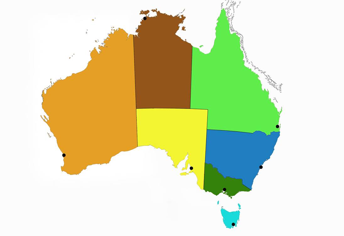
Map 12: Area in brown transferred by South Australia to the Commonwealth in 1911 and known as the Northern Territory.
The Commonwealth and the State of NSW entered into an agreement on 18 October 1909 for the surrender to, and acceptance by, the Commonwealth of an area of 912 sq. miles as the seat of Government of the Commonwealth.
In December 1909 The Seat of Government Acceptance Acts were passed by the Commonwealth and NSW Parliaments approving the agreement and on 5 December 1910 a proclamation was issued vesting the Territory in the Commonwealth on and from 1 January 1911. This Territory was named the Australian Capital Territory and is shown in red on Map 13.
Map 13 : Showing the Australian Capital Territory in red.
By Proclamation of 1 February 1927, under the Northern Australia Act of 1926:…“that part of Northern Territory situated north of the 20 degree parallel of south latitude” became known as North Australia and that part south of the 20th parallel was called Central Australia. This Act was repealed, however, in 1932 leaving the boundaries of the States as we know them today.
The above is only a summary. New Zealand was once part of New South Wales and New Guinea part of Queensland. These lesser known facts were found in a paper An Account of the Boundaries of the Austral-Asian Colonies by W. D. Campbell, read in November, 1894. Campbell’s paper is here with active links from the contents to the relevant section. The 2013 view is given in this paper The Story behind the Land Borders of the Australian States – A Legal and Historical Overview by Dr Gerard Carney. The 1971 paper Colonial and State Boundaries in Australia focuses more on the instruments of establishment or alteration of the various boundaries.
Paul Wise
February 2014
References
Campbell, W. D. (1894) An Account of the Boundaries of the Austral-Asian Colonies, The Surveyor, January 7, 1895, Vol. VIII, No. 1, pp. 5-34.
McIntyre, K.G. (1987), The Secret Discovery of Australia, Pan Books, Sydney (first published 1977, Souvenir Press).