Natmap’s Geodetic Observatory at Orroral Heritage Listed

Natmap’s Geodetic Observatory at Orroral circa 1980s
At its meeting of 2 June 2016, the ACT Heritage Council decided to register the obsolete Natmap Orroral Geodetic Observatory.
The following was part of a media article, which read :
|
Historic Canberra bus shelters and rare geodetic observatory heritage listed By Denholm Samaras. Posted 10 Jun 2016, 11:51am Inner Canberra's timber bus shelters and an isolated observatory that once provided Australia with its official time have been added to the ACT's heritage register. The ACT Heritage Council said the antiquated bus shelters and the decommissioned Orroral Observatory were placed on the list to ensure they remained for generations to come. Observatory was one of two of its kind in southern hemisphere
Photo: The Observatory enabled the measurements of the Earth's shape within millimetres of accuracy. (ABC News: Supplied) The Orroral Observatory, located past Tharwa about 60 kilometres south of the Canberra CBD was named after the local Indigenous word 'Orongo' meaning 'tomorrow'. "This is a very interesting one, for a long time it was Australia's fundamental geodetic facility," Dr Jaireth said. "It provided Australia with its official time." The Orroral Observatory was highly functional, it enabled the measurements of the Earth's shape within millimetres of accuracy." The data the observatory gathered helped to confirm plate tectonics theory and informed international research on natural phenomena and disasters. "It was only one of two geodetic observatories in the southern hemisphere between 1974 and 1999, the only such facility in the ACT until its functions were transferred to the Mt Stromlo Observatory in 1999," Dr Jaireth said. |

Orroral was initially established in 1965 as part of the National Aeronautics and Space Administration’s (NASA) communications network. It and other stations were important to the success of space exploration programs including the Apollo program to put a man on the Moon, and the Mercury, Mars, Jupiter and Saturn missions. After NASA consolidated its ACT activities at Tidbinbilla, Orroral became obsolete.
Construction of the observatory's main structure, its circular dome roof, began in 1974 and it was occupied by Natmap the following year. At first it was called a Lunar Laser Ranger facility because an important function was to fire laser pulses at the Moon to enable calculations concerning continental drift to be made. It took about 2.5 seconds for the laser pulses to flash across the 385,000 kilometres separating the Earth from the Moon and back again via reflective mirrors placed on the lunar surface by American astronauts and unmanned spacecraft.
The History of Satellite Laser Ranging in Australia may be read via this link, and John Luck's 1990 paper titled Performance of the Upgraded Orroral Laser Ranging System is also available.
In the following years, pulses of laser light reflected by sets of mirrors on orbiting satellites enabled calculations to be made concerning the changing shape of our planet. The observatory monitored changes in the Earth's rotation and the movement of tectonic plates. Four caesium atomic clocks at Orroral were so precise in their measurements that they could determine the travel time of a laser pulse to the Moon to within a nanosecond (a thousand millionth put of the second). One clock was designated as the national primary standard of time and was maintained with the objective of keeping Australian time accurate to 100 nanoseconds.
The functions of the Orroral Observatory, were relocated by Natmap, to Mt Stromlo after it was decommissioned in November 1998. Various obsolete structures and equipment at the Orroral Observatory site including a cabin for workers, sheds, water storage tanks and thick cables were then removed leaving just the shell.
The Orroral Geodetic Observatory today, being a 9 metre diameter hemispherical dome surmounting a grey-brick cylindrical building and survey pillar NM/C/106 within a trapezoidal fenced area atop granite boulder, 22.6 metres south east of the observatory dome, is at the top of a ridge at the end of a trail, called the Granite Tors Walking Track.
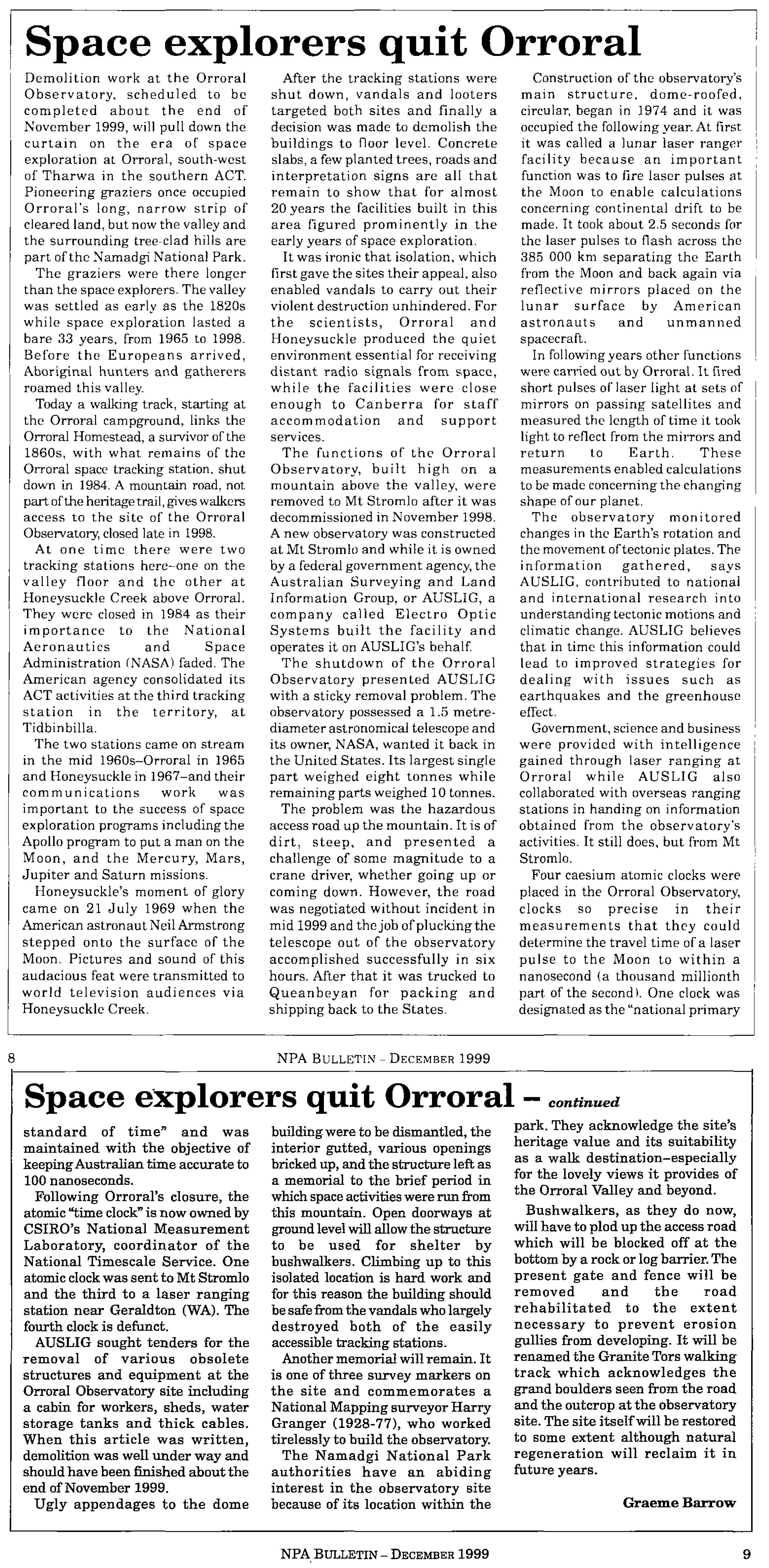
The ACT Heritage Council’s, Heritage (Decision about Registration of the Orroral Geodetic Observatory, Tennent) Notice 2016, can be read here with an updated version here. Both documents include interesting photographs towards their end. Also available is Matthew Higgins article Features Ancient and Modern Works of Man in the Orroral Valley from page 16 of The Canberra Times newspaper of Sunday 2 January 1994 and from the National Parks Association (ACT) Incorporated, December Bulletin, Vol.36, No.4, pp.8-9, Graeme Barrow's 1999 article Space Explorers Quit Orroral.
Courtesy John Manning and Bob Twilley
|
Orroral in operation |
|
|
|
|
|
Orroral Geodetic Observatory |
Dome opened for operations |
|
|
|
|
Observatory control room |
Laser ranging mirror assembly |
|
|
|
|
Laser pulse being emitted |
|
|
|
|
|
Orroral in winter snow and summer bushfire smoke |
|
|
Photographs courtesy Dave Abreu |
|


