 Recollections………

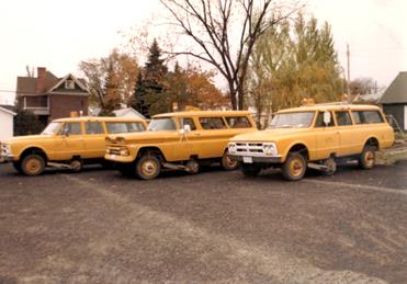
“A (J)GEM of a Fleet”
|
|
|
|
|
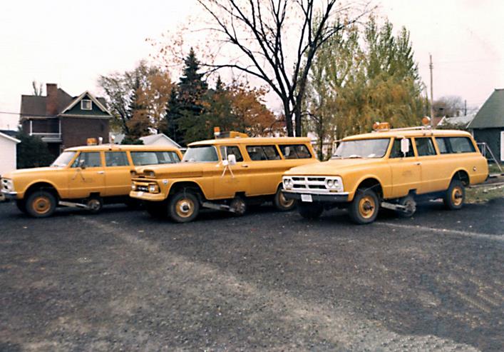
(Johnson) Ground Elevation Meters (L-R) : National Mapping, Royal Australian Army Survey Corps, United States Geological Survey (a photograph of the Canadian vehicle, originally unavailable, may now be viewed via this link). |
||
Ground Elevation Meters (GEM) were mainly operated by Australian and North American mapping and defence agencies in the 1960s and early 1970s. In Australia they were called Johnson Ground Elevation Meters (JGEM) after one of the patent holders. Apart from being modified for Australian right-hand drive and 240 volt power to the pendulum heater, vehicles on both continents had the same technical capability. Bob Barrett (United States Geological Survey) recalls that when the American manufacturer Sperry Sun stopped making them: “we bought all their parts, (pendulums, etc.) and one was built in Rolla [Missouri] - this one was state-of-the-art, with a Northstar computer”.
The GEM became available about 1961 and was demonstrated, in the USA, to National Mapping (Natmap) and Royal Australian Army Survey Corps (RA Survey) in 1963. Each agency ordered one at some $80,000 a piece and the vehicles arrived in Australia in 1964. Natmap's GEM was delivered in August 1964 after which acceptance testing and operator training was undertaken at the Army's School of Military Survey at Balcombe, Victoria in conjunction with RA Survey's GEM.
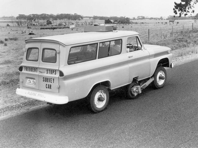
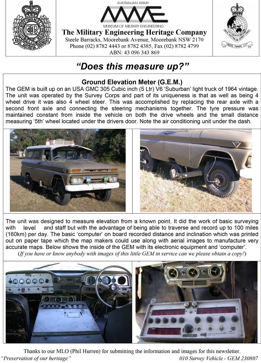
The Johnson Ground Elevation Meter was a modified General Motors Corporation (GMC), four-wheel drive van. Vehicle features included four wheel steering, and airconditioning (for the on-board electronic equipment and not specifically crew comfort). The vehicle had a special, smaller ‘fifth’ road wheel on the right side on Australian supplied models. Further, a ‘bar’ between the front and rear axles had an electronic pendulum attached. The fifth wheel accurately measured the distance travelled during operations by generating signals at a frequency proportional to the speed. Simultaneously, the longitudinal angle of the vehicle was continuously measured by the pendulum generating a current proportional to the sine of the angle of tilt. The on-board computer combined the two measurements and provided the height variation at any point in the run visually, as well as on a paper printout. Tyre pressures for the three road wheels on the measuring side of the vehicle were critical for measurement accuracy. Accordingly the GEM was fitted with an engine operated air compressor and an air pressure monitoring and control system for the three measuring side road wheels.
Sperry-Sun Well Surveying Company (not Sperry Rand as in some literature) the manufacturers, claimed fourth-order levelling standard, 24/7 in all weather. However, these claims could not be met under Australian conditions largely due to the quality of the then road surfaces - the fifth wheel required a relatively smooth surface to maintain accuracy. Nevertheless, National Mapping did obtain results with an error of less than 10 feet (3m) in 50 miles (80km) at 15 miles an hour (25kph) on reasonably good road surfaces, averaging 100 miles (160km)/day. Overall, around 5% of all National Mapping vertical control was obtained using the Johnson Ground Elevation Meter. In flat country, where the sealed road system was reasonably extensive, the JGEM demonstrated that a network of heights could be obtained which would allow contouring for 1:100,000 scale mapping from 1:80,000 scale aerial photography.
The USGS have kindly allowed the reproduction of their ‘Topographic Instructions of the United States Geological Survey, Supplemental Control Elevations by Elevation Meter, Book 2, Chapter 2F4, 1970’ which provides greater technical and operational detail. As far as it is known Australian operations proceeded along similar lines.
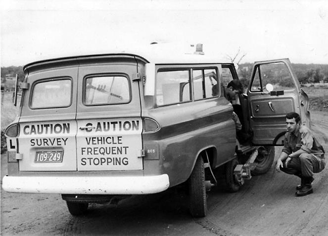
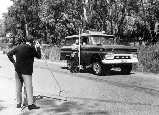
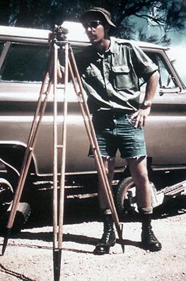
Essentially, road routes over which the JGEM operated were planned so that each started and ended as near as practicable to an existing point of known elevation (formally referred to as a level traverse Bench Mark). The reference to existing Bench Marks provided a consistent datum for the height values obtained by the JGEM. Any such Bench Marks were, however, generally placed a little distant from the road surface. Therefore, the difference in height from the Bench Mark and the road surface alongside the JGEM’s fifth wheel was measured with a level and staff. Along each route, mapping control photo reference points where new elevation values were required were identified on aerial photographs. As required, the level and staff could be used to determine the difference between the road surface height alongside the fifth wheel at each such location and the identified photo reference point nearby.
With its fifth wheel lowered, the JGEM would be carefully driven along each of the routes. It would be started and stopped where planned and the crew members would use the level and staff to obtain height differences between JGEM determined road surface values and selected Bench Marks or photo reference points as required. At each identified location, with the JGEM stopped, the computer reading would be noted or printed out as necessary. Each route was driven twice, generally out and back, thus two JGEM traverse runs were created. Any misclose in elevation was linearly adjusted along each run and applied to the road surface elevations at the required locations within the run. The mean of the two elevations thus obtained for each location was then adopted as the road surface height near respective photo reference point locations.
From Annual Reports, Natmap’s JGEM operated in NSW and Queensland. John Hook, who operated RA Survey’s equipment, recalled his areas of operation in NSW and Victoria and prior work, by the Corps, in Queensland (refer Figure 1).
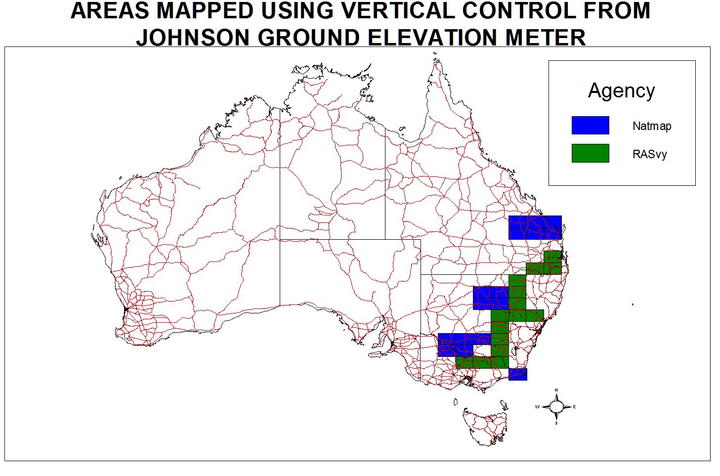
Figure 1 : Johnson Ground Elevation Meter areas of operation in Australia.
As well as being used to obtain vertical mapping control points, Natmap’s JGEM was applied to two other notable tasks where reasonably accurate elevation data were required. One such task was to to obtain longitudinal height profiles of a number of airstrips, mainly in outback Queensland and New South Wales. A consistent height datum for each airstrip profile was obtained by a connection to the nearest Bench Mark. These profiles were used in the calibration of a radar-based Airborne Profile Recorder system. Between 1962 and 1970, Natmap used the services of a contractor who operated this Canadian developed system to obtain vertical control for mapping purposes.
The other Natmap JGEM task was map accuracy checks. In 1970, the last year that this JGEM was known to have been operated, it was used in Central Queensland to check height values at points where map sheet contour lines crossed selected roads. By early December of that year Natmap’s JGEM had become unserviceable and Laurie McLean recalls bringing it: “from Broken Hill to Melbourne on the back of a RLH series 4x4 Bedford truck”.
RA Survey’s John Hook recalls that: “in 1969 the boss said to me – here is the JGEM and here is the manual. Nobody knows anything about it. Go and learn! I drove it for the next 3 years. Each 1:250,000 scale map required 36 points (9 runs of photography and 4 points across [RA Survey used an analytical block adjustment technique]), and I can remember the 6 x 1:250,000 scale map areas that I did (refer Figure 1). I don’t think it was used much after that. They got me back to the Survey School [then Bonegilla] in about 1985 to run a course on the GEM but I don’t know if they did any production work after that”.
The RA Survey’s JGEM is believed to be the only one of the original manufactured fleet still in existence. It is currently housed at the Museum of Military Engineering at Moorebank NSW where it is undergoing refurbishment (see photographs below).
|
|
|
|
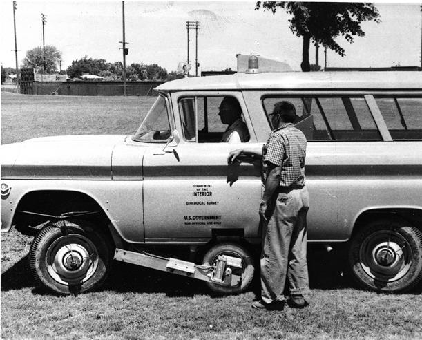
USGS GEMs – note left-hand drive |
|
|
|
|
|
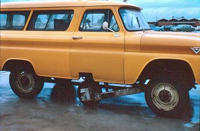
Natmap’s JGEM with Norm Hawker |
RA Svy’s JGEM with John Hook |
|
|
|
|
Natmap’s JGEM with Norm Hawker |
RA Svy’s JGEM with Spr Bob McDonough driver & Cpl John Hook |
|
|
|
|
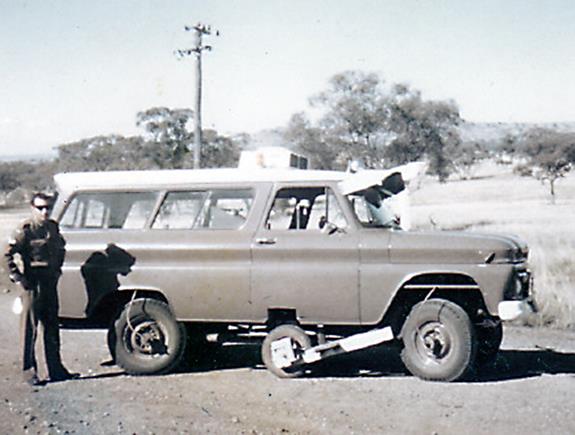
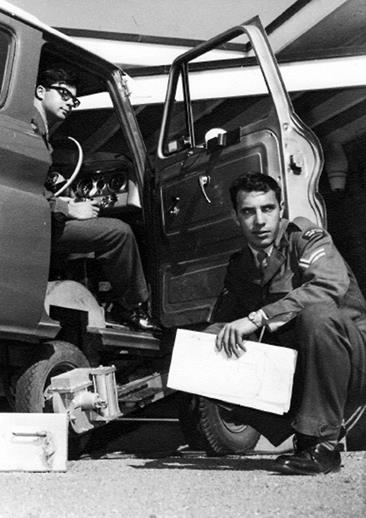
Using Level & Staff to get elevation of 5th wheel |
|
|
|
|
|
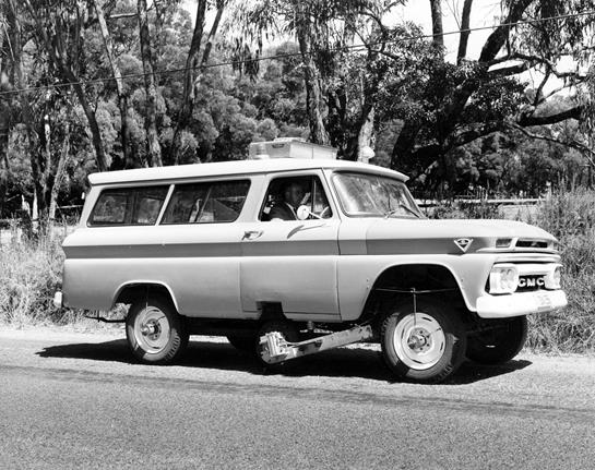
Natmap’s JGEM in four-wheel steer |
RA Svy’s JGEM with Spr Lyn Thompson driver & Cpl John Hook |
|
|
|
|
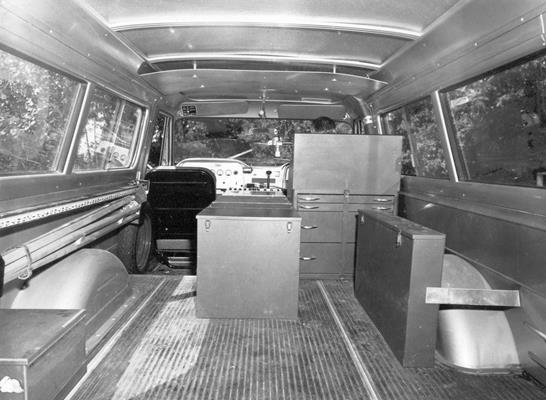
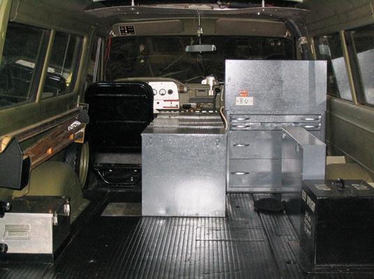
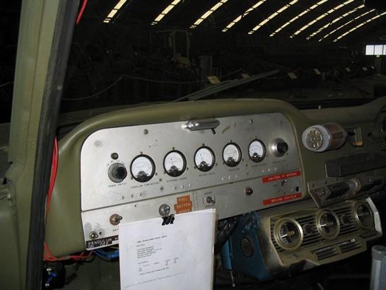
Natmap’s JGEM interior |
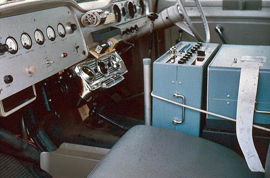
RA Svy’s JGEM interior |
|
|
|
|
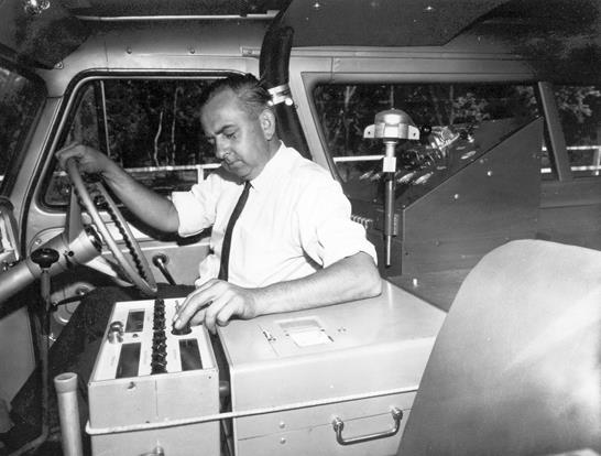
Natmap’s JGEM with Norm Hawker operating |
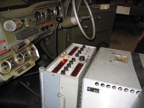
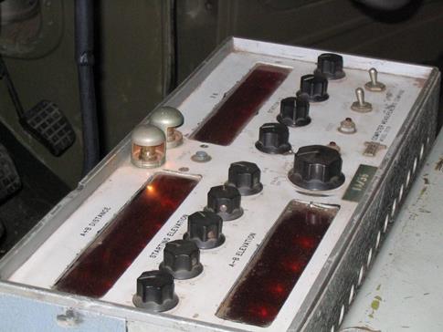
RA Svy’s JGEM showing computer and read-out |
|
|
|
|
Natmap’s JGEM with computer print-out |
RA Svy’s JGEM showing read-out |
|
|
|
|
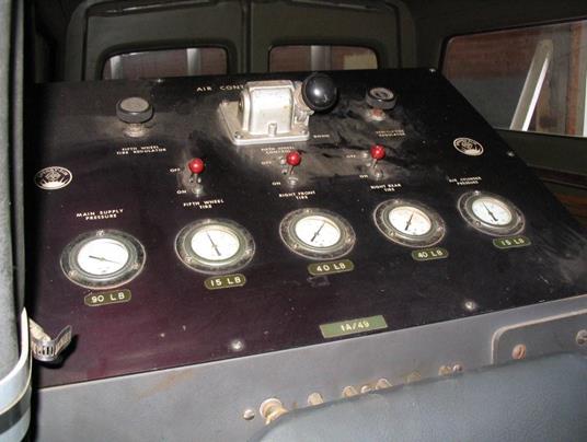
RA Svy’s JGEM showing 5th wheel monitoring and air-conditioning (under dash) |
RA Svy’s JGEM showing auto-inflation control panel |
|
|
|
|
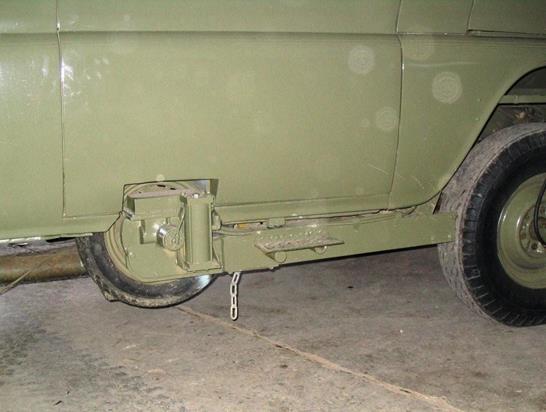
RA Svy’s JGEM showing 5th wheel retracted |
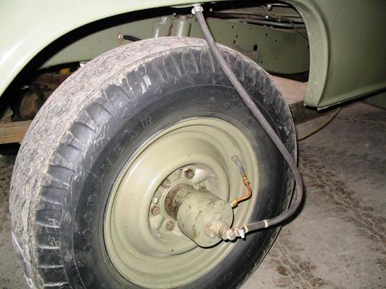
RA Svy’s JGEM showing tyre “auto-inflation” fittings |
|
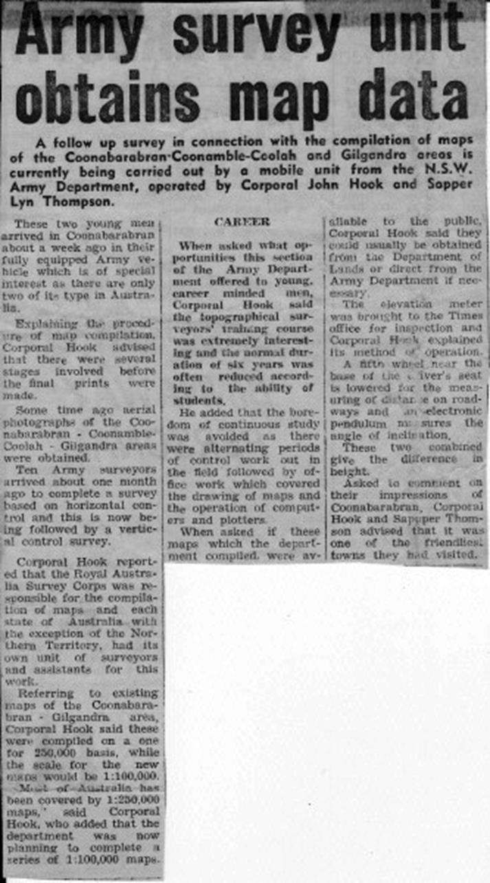
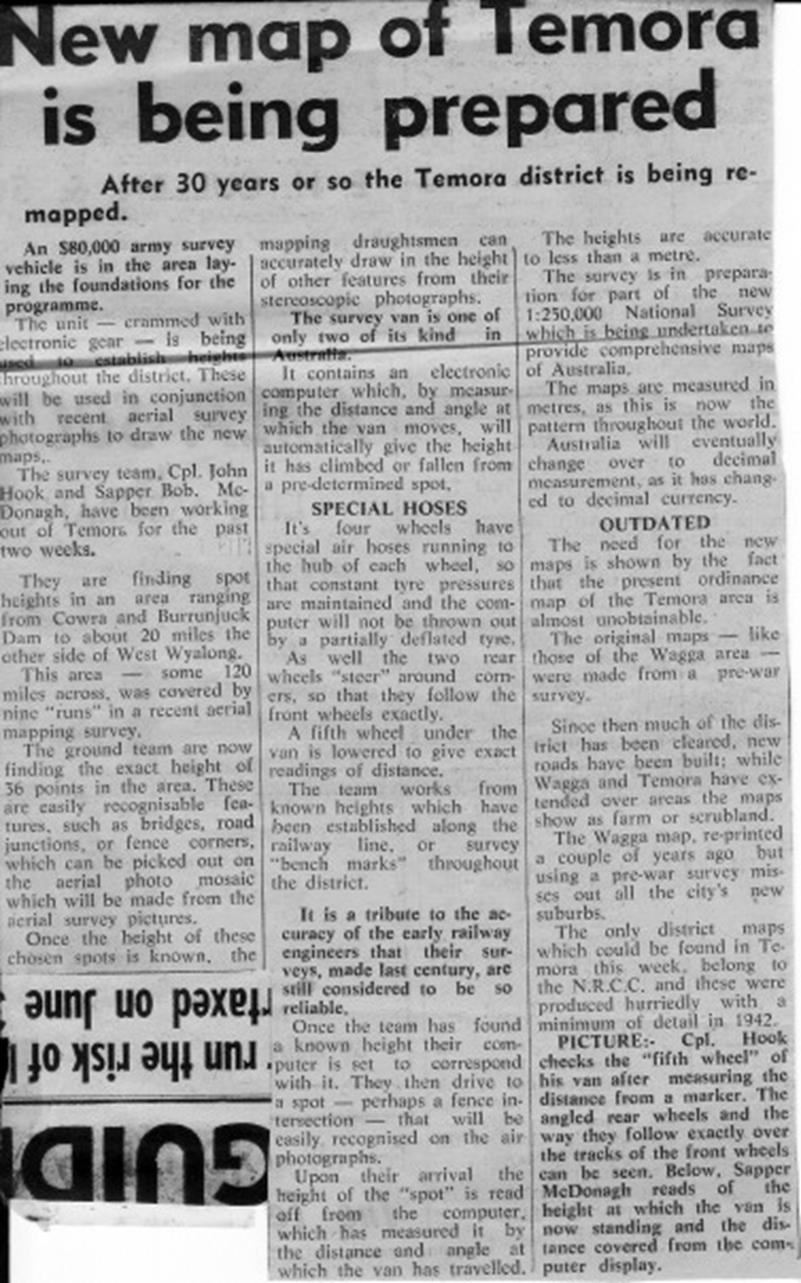
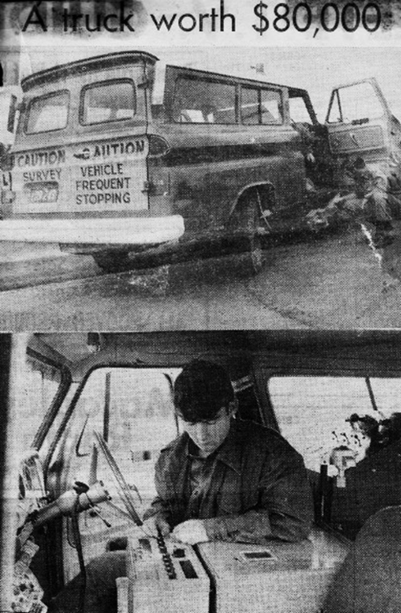
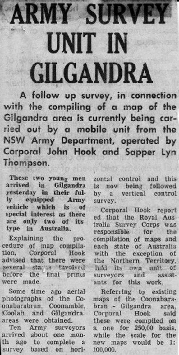
Cuttings from local newspapers re RA Survey’s JGEM operating in NSW (courtesy John Hook)
|
|
|
|
|
|
|
|
|
|
|
|
|
|
|
|
|
|
Photos of refurbished GEM at Moorebank |
|

|
Contributors
|
|
|
Recent interest in the JGEM was sparked by inquiries from Mike Cecil, former Head of Military Technology at the Australian War Memorial, now retired and living in the United States. Mike brought together information from both North America and Australia, and has submitted an article about the JGEM for publication in Army Motors: the Journal of the Military Vehicle Preservation Association. Once published, a copy will be added to this webpage.
|
|
|
Technical and historical information used for both his article and this page has been kindly provided by:
|
|
|
Paul Wise |
ex-National Mapping |
|
Laurie McLean |
ex-National Mapping |
|
Frank Leahy |
ex-National Mapping |
|
Bob Skitch |
ex-Royal Australian Survey Corps |
|
John Hook |
ex-Royal Australian Survey Corps |
|
Patrice Lascelles |
Natural Resources, Canada |
|
Keith Brady |
U.S. Geological Survey, Office of Communications and Publishing |
|
Bob Barrett |
ex-United States Geological Survey |
|
Paul Martyn-Jones |
RAEME Association NSW Inc. |
|
Menzies, R.W. & Wise, P.J. (2011) The 1:100,000 Scale Topographic Mapping Program – Assisted by Technology, 100 Years of National Topographic Mapping Conference, Canberra 2011, Paper 7 from CD-ROM. |
|
|
‘Topographic Instructions of the United States Geological Survey, Supplemental Control Elevations by Elevation Meter, Book 2. Chapter 2F4, 1970’ reproduced with permission of U.S. Geological Survey, Department of the Interior/USGS. |
|
|
Article updated with additional information : 15 April 2015 |
|