Program 1966
With the completion of all loops of First Order traversing and triangulation required for the 1966 National Geodetic Adjustment, field work for 1966 by the Geodetic Survey Branch was to be directed mainly towards providing horizontal and vertical control for the 1:100 000 scale mapping programme by means of second order Theodolite/Tellurometer traversing.
Two main field parties were organised; these would be under the direction of the Surveyors Class 2, O.J. Bobroff and J.W. Witzand. The field party leaders would be A. Roelse under O.J. Bobroff and R.A. Ford under J.W. Witzand.
Two new Surveyors Class 1 joined the Geodetic Survey Branch, P.H. Langhorne and A. Porteous. The later would join A. Roelse and the former would join R.A. Ford. Their duties in the first year would be familiarisation with National Mapping party management and field techniques, be second in charge of party, and to act as an observer.
The 1966 field programme which was to include a few small first order geodetic connections, was drawn up as follows:
(i) Mills Cross and Parkes radio telescope connections, NSW
(ii) Second order Theodolite/Tellurometer traversing for mapping control westward from Anna Plains - Mandora area, WA
O.J. Bobroff would direct these operations, field party leader A. Roelse.
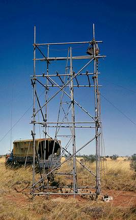
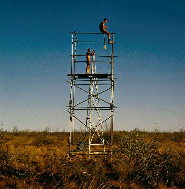
(iii) Helen Springs NT - Ord River, WA, second order Theodolite/Tellurometer traverse (including towers) for mapping control.
(iv) Cassilis - Burleigh Queensland, second order Theodolite/Tellurometer traverse (including towers) for mapping control.
(v) First order Geodetic Traverse Borroloola - Pellew Islands, NT.
(vi) Second order control along 18° and 19° parallels of latitude, west of Stuart Highway.
J.W. Witzand would direct these operations, field party leader R.A. Ford.
Item (vi) was cancelled during the field season. It was replaced by some urgently required Aerodist station selection, marking and clearing in the Barkly Tableland and a first order connection to a Wild BC4 Camera site at Culgoora, NSW
Some new techniques would be required for second order traversing particular as it was to be pushed ahead at a fast pace, the idea being to show that it was an economical method of acquiring horizontal and vertical mapping control.
Control points were to be established at half degree intervals of longitude along each degree parallel of latitude, in the areas to be controlled. As it would be impossible to establish them so exactly, they could be within 5 miles for longitude and three miles for latitude, however this was later reduced to 3 miles for longitude and 1½ miles for latitude.
Where possible mapping photography showing the area within which the control point was required would be premarked in the office to ensure that control suited photogrammetric requirements.
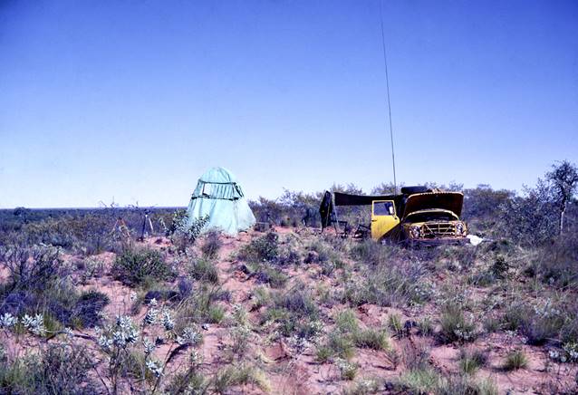
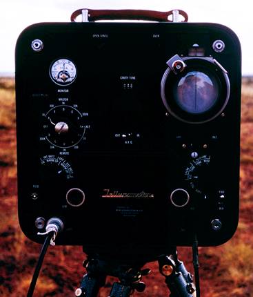
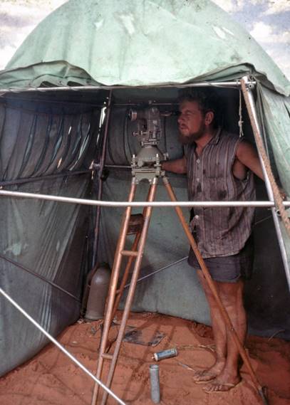
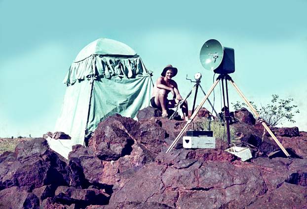
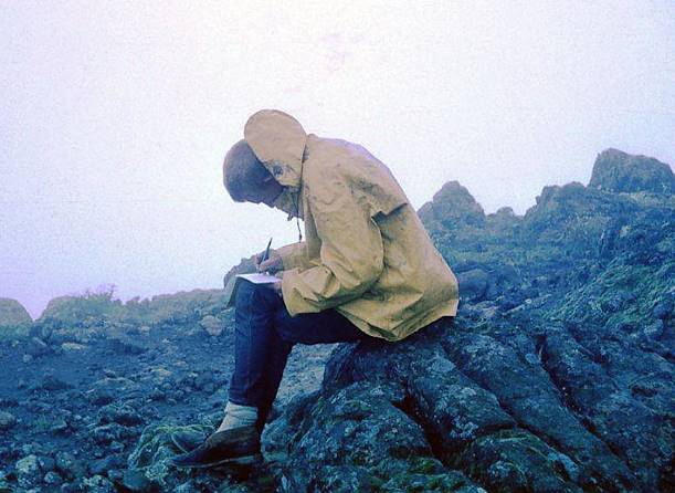
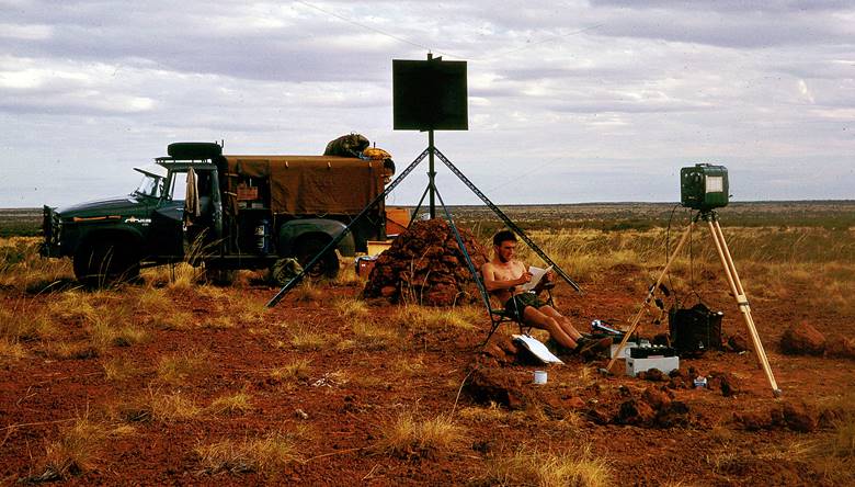
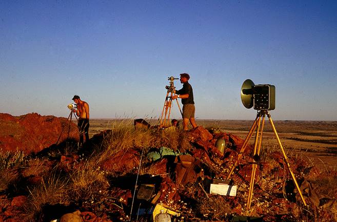
To avoid gross error field computations for latitude, longitude and reverse azimuth were to be carried forward as the traverse progressed; these traverses would be of the “reconnoitre as they progress” type. Observations and measurements were to be with the Wild T3 and Tellurometer to the same specifications as first order but for only one night. Observing screens were to be used and simultaneous reciprocal azimuths taken along every fourth line.
It would only be necessary to permanently mark stations at mapping control points; if these were on a sandridge a recovery mark similar to that established at first order stations would be set in on firm ground clear of the sand ridge. Intermediate points would be marked only with a steel picket driven to about 6 inches above ground level to which would be attached a metal tag bearing the station number.
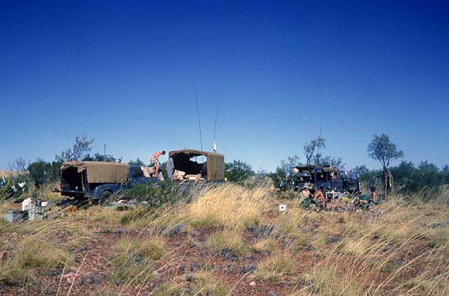
Second Order Theodolite/Tellurometer traversing for mapping control Anna Plains - Mandora, WA
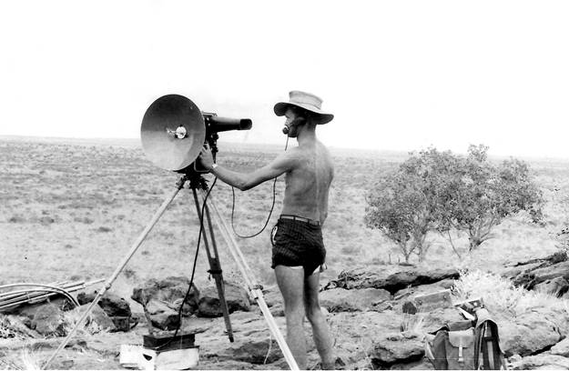
It had been decided that the most economical target to use for second order traversing was the light, the reasons being:
(i) Clearing; narrow forward lane only required; no wide forward and back lanes as with beacons.
(ii) Beacons; as none would be required a big saving would be made in expensive transport costs and time spent in erecting.
To use the best visibility to advantage a more powerful light than the 10 volt war time army “Lamp Signalling Daylight” was required. The requirement was a light that could be seen at up to 20 miles with a theodolite in the good late afternoon visibility. O.J. Bobroff investigated this matter and selected a Lucas vehicle light, the 700 SLR, as being suitable. It was nicknamed the “Flamethrower” and was fitted with a 12 volt Mazda tungsten-iodine globe. He then designed a suitable sight and a fitting to mount the light on the orthodox Lucas Lamp tripod. These modifications were made in our own workshop and the overall result was a very effective target which has been used extensively since that date. At a later date, after some experimentation by J. Fox a modification was made to some of the old 10 volt army “Lamps Signalling Daylight” which enabled the 12 volt tungsten-iodine globe to be fitted. This lamp also became very useful in the daylight. Variable resistances were made to enable the power to be adjusted as darkness approached.
The field party leader was A. Roelse, observers were R. James, R. Goldsworthy and J. Fox. O.J. Bobroff would direct the operation and would be with the field party for a considerable time.
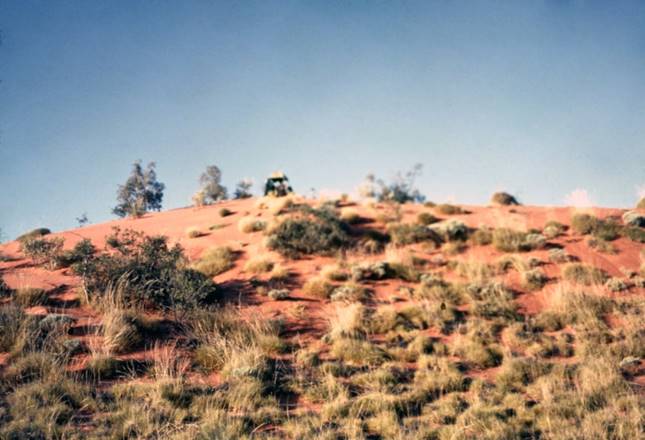
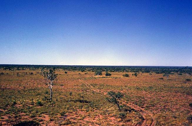
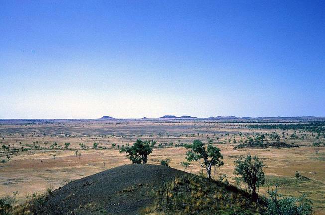
Office map reconnaissance and firsthand knowledge of the general area indicated that the task appeared to be most difficult and in the field that certainly proved to be the case. The experienced officers involved considered this survey to be one of the most difficult on which they had been engaged.
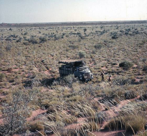
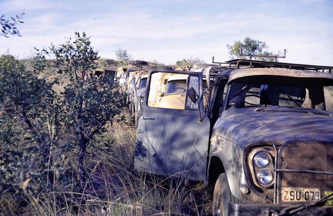
There was considerable low wattle in the area; this bush is one of the most effective at “staking” tyres in Australia; in that hot climate the tyre rubber becomes pliable and much more prone to puncture than in a cold climate. In addition owing to the sandy terrain tyre pressures were of necessity kept low, thus shortening their life. Soon most tyres had been badly “staked” and had to be “sleeved” which made them even more prone to puncture.
Other difficulties with the vehicles were:
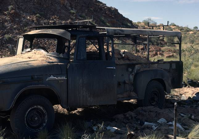
Fires: Build-up of pieces of spinifex close to the exhaust pipe caused several minor fires and one major fire which badly damaged one vehicle.
Clogged Radiators: Spinifex seed in particular and wattle blossom to a less extent clogged the air passages of the radiators and caused the vehicle to boil. Cleaning these involved removing the radiator from the vehicle - a long slow job.
High Temperatures: Towards the end of the season when the weather became really hot, most of the travelling had to be done at night to prevent boiling radiators, petrol vapour locks and general discomfort of the individual.
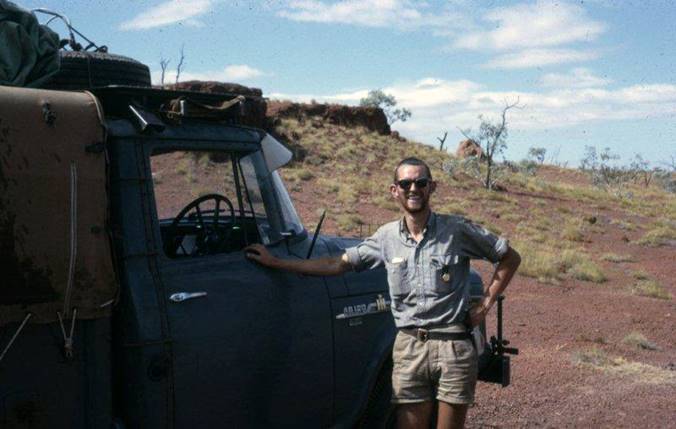
Vehicle damage: The rough terrain caused many broken springs, shackles, chassis/body mounts and differentials in all type of vehicles on the survey. Figure 1 shows a more serious repair the replacement of an engine while on the job.
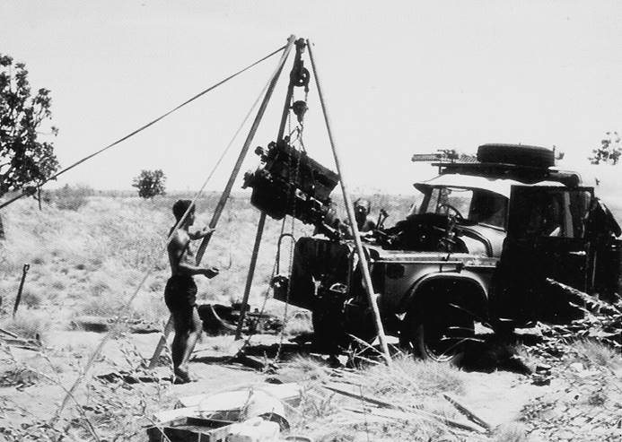
Figure 1: Replacing an engine in an International 1½ ton Utility.
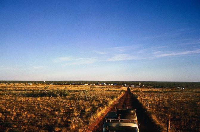
There were three west-east traverses, along the 19º, 19º 30' and 20º parallels of latitude commencing from established WA Lands Department stations at their western end. These traverses were formed into closed loops by a north-south traverse joining their eastern extremities.
The method used was “reconnaissance as you progress”; two observing parties and a rear party to show lights were utilised. To select the new station, with these three parties in position the centre observing party often moved forward to join the forward party after dark when the evening observations had been completed. This was possible because of the short lines involved. At first light the next high ground ahead was selected, a magnetic bearing taken and the leading party then moved forward to locate the next station.
Radio calls at prearranged times and mirror flashes enabled the establishment of the new forward point by about midday. Simultaneous reciprocal vertical angles were observed at 1400 hours local mean time, the Tellurometer measurement fitted in at the most convenient time, horizontal angles in the late afternoon/evening followed immediately by a Sigma Octantis simultaneous reciprocal azimuth where required.
Using this method progress was slow but it was steadily forward and only fell down where vehicle trouble prevented the arrival of an observation or light showing party at their destination by the required time.
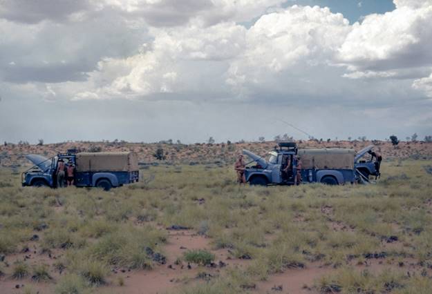
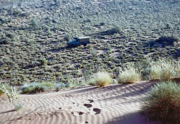
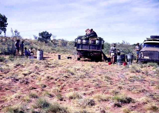
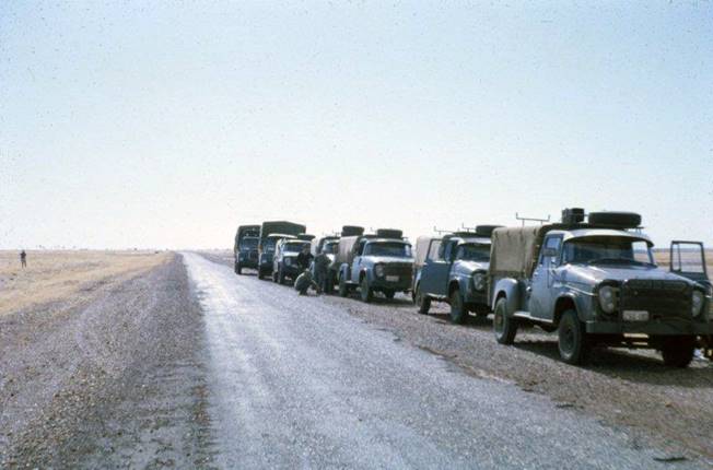
The Bedford supply trucks were constantly on the move keeping petrol, water and food up to the observing parties. As the traverse drew to a close, owing to support vehicle trouble the party was on short rations of food and water. All were out of tea, coffee and sugar.
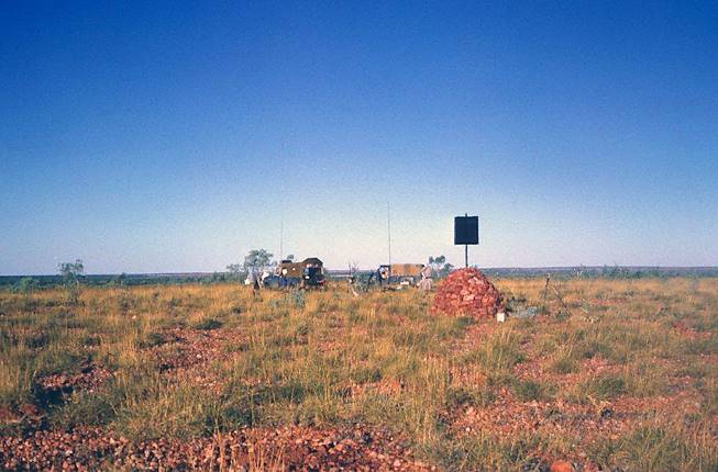
Approximately 89 stations were observed - 84 new, 5 established stations - the distance traversed approximately 670 miles. These traverses provided full control for eighteen 1:100 000 scale map sheets and part control for those sheets to the north, south and east of the traverse lines. The mapping control points were marked for spot photography.
At the completion of the season the field party returned to Perth by road. The vehicles were left with Stores and Transport, Karrakatta for repairs and storage until 1967. The equipment was loaded into containers for transport to Melbourne and the field party returned to Melbourne by air.
Helen Springs, NT - Ord River, WA Theodolite/Tellurometer traverse (including towers)
R. Ford would be in charge of this field party, P.H. Langhorne would be second in charge and was attached to the party for experience in all aspects of National Mapping's field techniques. D. Hutton would be the only other fully experienced observer, R. Gray a partially experienced observer would be in the party and further training was to be given to L. Wilson. MRA-3 Tellurometers would be used, the MRA-2 instruments having gone to Antarctica.
The field party left Melbourne on 5 May picking up in Adelaide 2 WRE Field Assistants and their vehicles loaded with scaffolding. En route Helen Springs a stone and cement ledge about 1 foot wide was built around the base of the Johnston Geodetic Station cairn near Kulgera; also a steel beacon was erected on Wycliffe Sandridge where the wooden pole had been destroyed by white ants.
Observing commenced at Mt Willeray near Helen Springs on 19 May. The first section to Hooker Creek had been reconnoitred by H.A. Johnson in 1964 and C. Golya had built cairns and cleared lines where possible; however quite a few towers would be required; these lines had to be proved then towers and scaffolding erected. As all stations were to be only one night occupations, to avoid having to wait for concrete tower blocks to dry, the tower feet were bolted to heavy pieces of eucalypt trunk about 5 feet long and buried in the sand.
In the section between Mt Willeray and Hookers Creek one established and 22 new stations were observed, 8 towers being required, distance 215 miles with a further 165 miles to Ord River. From Hooker Creek on, R.A. Ford reconnoitred ahead selecting station sites and proving lines by helio with the assistance of the foremost observing party. Two towers were required between Hooker Creek and Inverway Homestead but from that point westward the terrain became rough and broken giving longer lines and no towers. However access became much more difficult.
As the country along the 18º parallel of latitude was flat and timbered the traverse was taken along the broken ridges some 10-12 miles to the north; the required mapping control points were established by single line spur traverses with simultaneous reciprocal azimuths observed along each spur line as a check.
Latitude, longitude and reverse azimuth field computations were carried forward by P.H. Langhorne; at tower stations NM/G/142 and 143 about midway between Mt Willeray and Hookers Creek, the field computations revealed a 6 second difference between the geodetic and astronomical azimuth. As it was very windy at the time it was considered a light or tower may have moved off line; the observers were told to replumb the towers, realign the lights and do one more night's work. This was done without substantially altering the earlier results. As the instruction was to keep the traverse moving it was felt no further time should be spent in further investigation so the towers were dismantled and the traverse continued.
It was disappointing not to be able to pin down the reason for this difference in the azimuth; all had hoped to achieve first order standards with the one nights observing allowed, however it was not to be, and the traverse could only be classified good second order. With the short lines involved in that particular area lights and towers had to be perfectly on line to retain accuracy.
The traverse was completed to the Army Survey Corps station Turner, near Turner Homestead by 14 July; two established plus 33 new stations were observed, also 4 stations on spurs for mapping control, the overall distance was 380 miles, time taken eight weeks.
The field party now had a long trip before them; to Tennant Creek then across the Barkly Highway to Mt Isa, and on to Richmond in central Queensland, for the second task.
Cassilis – Burleigh, Qld, Theodolite/Tellurometer traverse (including towers)
The field party arrived in the Richmond area, Qld, on 26 July, R, Ford and P.H. Langhorne commenced reconnaissance immediately. They met R.A. Vassil of the Topographic Branch as requested and went with him while he selected the mapping control points to be included in the traverse. These were in areas premarked in the office on aerial photographs. When these stations had been selected the reconnaissance was continued.
Once again towers were required, three in all including the established station. One established and 11 new stations were observed with the usual simultaneous reciprocal azimuths along every fourth line. The distance was 80 miles, time 2½ weeks.
As the traverse was finishing J.W. Witzand arrived by plane from Melbourne; he brought news that the field party's next job was to be Aerodist marking on the Barkly Tableland and then near the Stuart Highway. The Topographic Branch needed assistance to get a large area prepared as their measuring party was now moving very quickly.
He was also to do a reconnaissance from Mt Davy (near Winton), via Longreach, to Mt Portwine east of Barcaldine, firstly by a two day aerial reconnaissance, then a ground trip by a vehicle from the field party. P.H. Langhorne and R.A. Ford accompanied him on the reconnaissance flight which showed the traverse would not be easy and quite a few towers would be required.
J.W. Witzand then started on his ground reconnaissance; E. Ainscow accompanying him as driver. Also at about this time M. Stevens and L. Wilson returned to Melbourne and resigned. The balance of the field party then moved to Mt Isa.
Aerodist Station Marking, Barkly Tableland, Daly Waters area NT
For this task the party was divided into two groups, one under R.A. Ford, the other under P.H. Langhorne. They met J. Madden of the Topographic Branch in Mt Isa and received the necessary maps, field books, air photos, station markers and chainsaws etc. J. Madden and E. Seton would also be in the area using a helicopter on Aerodist station marking; the geodetic parties were to join them later at Borroloola, NT to use the aircraft for the Pellew Island geodetic connection.
The main difficulty experienced by all parties in getting this work under way was heavy rain which marooned the whole populace in Mt Isa for about four days. Work finally commenced on 20 August near Camooweal with the country still saturated but gradually improving.
Two changes were made to the regular technique of the Topographic Branch station marking parties:
(i) Azimuths were observed to Sigma Octantis instead of the sun; the geodetic observers were skilled at this observation and their Wild T3 theodolites were not equipped at that time with the orthodox sunfilter.
(ii) Besides setting the theodolite over the station mark to observe angles and take measurements to reference marks, it was also set up over one of the reference marks from where angles between the station mark and the other two reference marks were observed and measurements taken. This system as used at the geodetic stations ensured a check on all distances measured; it was later adopted by all Aerodist station establishment field parties.
The main feature of the Aerodist station marking was the enormous amount of clearing required; this was not apparent on the open Barkly Tableland but became very much so once the timbered areas near the Stuart Highway were reached. At two of the geodetic stations where towers were originally used because of the timber, eight Aerodist lines were required. It was suggested to the Topographic Branch, Melbourne that towers might be the solution in this area; instructions were received that the lanes must be cleared. This was done and it included the necessity to cut down the trees so carefully blazed with the shield and station number and then painted, when on the geodetic tower traverse of 1961.
The Tellurometer connections between the islands of the Pellew group off Borroloola in the Gulf of Carpentaria were completed, using the helicopter for access; in addition two other Aerodist stations were connected by Theodolite/Tellurometer traverse to first order geodetic stations.
A further task in this area was the inspection of geodetic survey marks along the Stuart Highway between Mataranka and Powell Creek, it having been reported that telephone line clearing and construction had destroyed some marks. This report proved to be badly astray, the supposedly lost station mark was located as also were most of the missing reference marks. However some blazed trees had been bulldozed over when the clearing was being widened for the new line.
All these tasks were completed by 14 October. In nine weeks approximately two established and 24 new stations had been marked and cleared to Aerodist specifications.
The field party now received instructions to proceed to Narrabri, NSW where some first order survey was required. The move to that area including vehicle maintenance in Mt Isa took eight days. By then it was 23 October.
Wild BC4 Camera Site Connection, Culgoora NSW - Reconnaissance Kaputar - Bendemeer
The task was to connect this camera site to the geodetic chain. The camera site was in the timbered grounds of the C.S.I.R.O. Solar Observatory at Culgoora; the geodetic connection was to be made by a single triangle involving the first order geodetic stations, Mt Kaputar, Mt Grattai and a point to be selected on the concrete roof of the modern two storey observatory. From there a single line connection was required to the camera site some 500 metres away. From this ground level position it was not possible to see the mountains.
Mt Grattai was a hard climb of some three hours; P.H. Langhorne occupied that station for the measuring and observing, Mt Kaputar was almost a “drive on” in a National Park. Both were magnificent mountains with a commanding view over the western plains. The station mark on Mt Kaputar was missing and had to be replaced when information became available; in the meantime observations were done from a reference mark.
All angles in the triangle were observed and all sides measured; the observation party on Mt Grattai was washed out in heavy rain just as they finished their task. The connection from the observatory roof to the camera site was then completed.
J.W. Witzand arrived by air from Melbourne at this time. A first order Theodolite/Tellurometer traverse was required from Mt Kaputar to Mt Bendemeer (near Brewarrina) some 200 miles west. He left in wet conditions to do a feasibility reconnaissance. R. Ford followed two days later; they met at Brewarrina to compare notes and return together, re-checking first impressions. The terrain was most unsuitable for Theodolite/Tellurometer traversing; was very flat, well timbered with 30 to 50 foot trees and with a general, unapparent slope of about one foot per mile towards the west.
The only satisfactory method of traversing in this terrain was with at least 60 foot towers; the only other alternative was very short lines along the cleared line of the road with low towers at each bend; it being a minor road these bends were particularly numerous. A report was made for the Supervising Surveyor.
Back in the Culgoora area wet conditions persisted; an attempt was made to measure the 65 mile line Mt Kaputar - Rossmore (Rossmore was a second order Army station). Using the MRA-3 Tellurometer one measurement only was completed just as heavy rain set in causing the party to seek shelter. The second measurement was never made as it was impossible to re-occupy Rossmore during the remaining short period spent in that area.
Having completed a season of greatly varied work the survey party returned to Melbourne, arriving on November 11.
Mills Cross and Parkes Radio Telescope connections, NSW
Early in 1966 a small field party under A. Roelse had a pleasant job in making connections from these points to the primary geodetic survey.
Summary - Second Order Traversing for Mapping Control
The traversing completed this year in three widely different types of terrain showed that this was a viable method of providing control for mapping of 1:100 000 or even larger scale.
The traverses in the sandridge country in N.W. Australia were probably in as difficult terrain for this type of operation as could be found in Australia. Although progress was slow there was never any doubt that each traverse could be completed and an effective result had been obtained.
The Helen Springs - Ord River traverse was in a mixture of flat timbered terrain which required some towers, and terrain very suitable for this type of traversing. In eight weeks, 380 miles were completed, 33 new stations established (10 using towers), and two existing station were occupied.
The Cassilis - Burleigh traverse in Queensland was in almost flat terrain; 11 new stations established (three using towers) and one existing station was observed. Time 2½ weeks, distance 80 miles.
Now that two field parties had gained experience in the necessary techniques it was confidently expected improved output could be expected in the future.
Field Parties 1966
Helen Springs, NT - Ord River, WA Second order Mapping Control traverse (including towers)
Cassilis - Burleigh, Queensland Second order Mapping Control traverse (including towers)
Aerodist station establishment, Barkly Tableland, Daly Waters area NT
Mt Kaputar - Culgoora, BC4 Camera site connection, NSW
R.A. Ford Senior Technical Officer Grade 1
P.H. Langhorne Surveyor Class 1
R.R. Gray Technical Assistant Grade 2
M.J. Stevens Technical Assistant Grade
R.L. Wilson Field Assistant
D.M. Roberts Field Assistant
I.B. Munro Field Assistant
P.C. Symons Field Assistant
K.D. Beanland Field Assistant
K.L. Williams Field Assistant
D.E. Ainscow Field Assistant
A. Johns Field Assistant ) Barkly Tableland and
D. Girvan Field Assistant ) Culgoora only
J. Eaton Field Assistant (WRE)
E. Skeen Field Assistant (WRE)
Anna Plains - Mandora area, second order mapping control traverse
O.J. Bobroff Surveyor Class 2
A. Roelse Surveyor Class 1
A. Porteous Surveyor Class 1
R. James Technical Assistant Grade 2
R. Goldsworthy Technical Assistant Grade 2
J. Fox Technical Assistant Grade 2
N. Moncrieff Technical Assistant Grade 2
D. Yates Field Assistant
A.J. Wright Field Assistant
V. Bosnic Field Assistant
J. Welsh Field Assistant
H. Irving-Bell Field Assistant
N. Samsonakis Field Assistant
? Mackay Field Assistant
B. Sutherland Field Assistant
L. Manna Field Assistant (WRE)


