Program 1968
The 1968 field programme was arranged as follows:
(i) Completion of the high precision measurements Muchea to Culgoora, then commencing on the Culgoora - Thursday Island baseline.
O.J. Bobroff would direct this task and also be party leader until F.J. McCoy was available.
(ii) Second order Theodolite/Tellurometer traversing for mapping control in WA;
(iii) Two helicopter contracts, also some orthodox traversing.
(iv) Simultaneous reciprocal azimuths, Muchea - Eclipse Hill, WA
J.W. Witzand would direct this task, field party leader P.H. Langhorne.
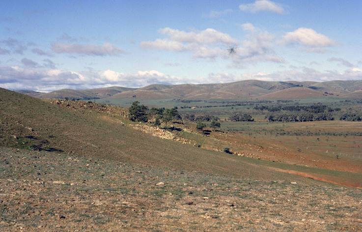
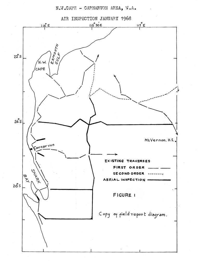
As a preliminary to the second order traversing in WA, aerial reconnaissance was made in January to ascertain the areas suitable for the helicopter work and those suitable for orthodox traversing. J.W. Witzand, P.H. Langhorne and R.A. Ford went on this reconnaissance. The areas inspected first were in the general area of Carnarvon - Exmouth Gulf and inland to the 118° 30' meridian of longitude; see diagram, Figure 1. Most of this area was suitable for either helicopter-borne or orthodox traversing. Before leaving the area an inspection of the Houtman Abrolhos Islands was made.
Moving to the Kalgoorlie area, further reconnaissance was carried out in the Cape Arid area, east of Esperance; this found to be suitable for either helicopter borne or orthodox traversing but the adjacent area from the coast to the Transcontinental Railway Line would require towers as it was flat with clumps of mallee scrub. With the aerial reconnaissance complete they now returned to Melbourne.
As a result of this reconnaissance a helicopter contract of six weeks commencing on 8 May was drawn up to complete the area reconnoitred less the east-west traverses along the 26º and 27° parallels of latitude shown on the diagram (Figure 1).
When this contract was completed the field party would continue with traversing by orthodox methods in the Shark Bay area plus some marking for spot photography until it was time to start the next contract on 19 August. This second contract would commence where the first contract concluded. It was hoped it would be at 27º 00' lat and 115º 30' longitude. This traverse would be east along the 27° parallel of latitude, closing on the First Order Traverse near Wiluna. Further, widely scattered, short mapping control spur traverses would be completed in the Nullagine and Ashburton Downs areas and any time left would be utilised on spot photography.
Just as the field parties were making their final preparations it was announced that H.A. Johnson who had been Supervising Surveyor, Geodetic Survey Branch since its inception, was retiring from that position; he would remain with National Mapping as a Surveyor Class 1 in a temporary capacity, working under the Director on field revision of various 1:250 000 scale maps. A.G. Bomford became Supervising Surveyor, Geodetic Survey Branch.
Second Order Theodolite/Tellurometer mapping control traversing in WA
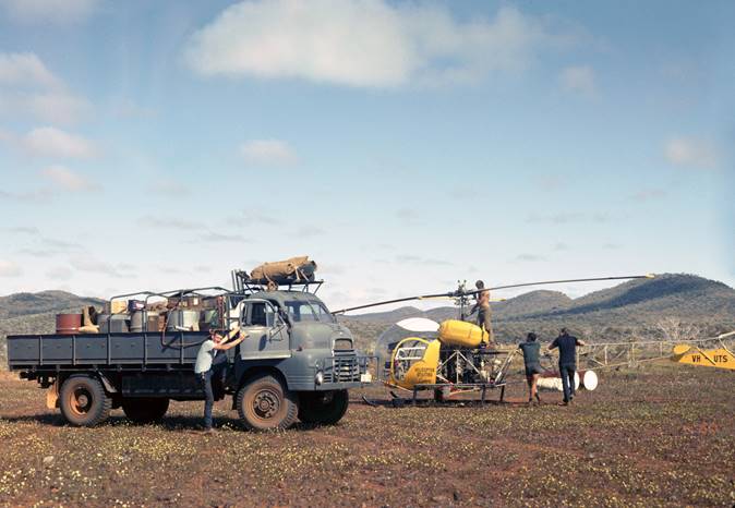
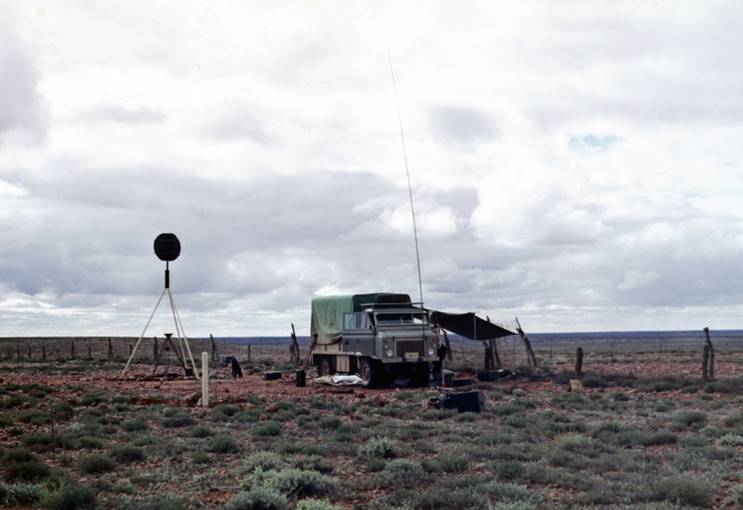
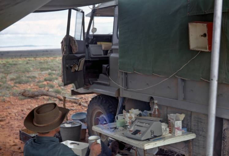
The party packed the equipment in containers for transport to Perth, then followed by air. The following party arrangements which were very similar to the previous year were made for the helicopter contract:
P.H. Langhorne would be in charge, would do the reconnaissance and control the observer’s movements.
R.A. Ford would be second in charge, would look after the helicopter book work, would do the geographical co-ordinate computations and also the simultaneous reciprocal azimuth computations to keep a check on the quality of the observations and measurements
Observers on the helicopter traversing would be J. Fox, D. Hutton, D. Roberts, V. Bosnic and D. Girvan.
J. Patrick under direction of P.H. Langhorne would complete some short Theodolite/Tellurometer traverses by vehicle, some level connections and some marking for spot photography. Observers would be R. Goldsworthy and E. Ainscow
A simultaneous reciprocal azimuth was required along the line Muchea - Eclipse Hill near Perth. This would be done by J. Patrick and J. Fox under the supervision of R. Ford before they moved north.
The party left Perth on 23 April leaving those involved in the azimuth observations at Muchea and Eclipse Hill to complete their task. The route was via Geraldton and Carnarvon to the base camp on the Mt Vernon - Ashburton Downs road about mid-way between those homesteads. All assembled in that area by 2 May except for the party under J. Patrick which was to work on short traverses in the Exmouth Gulf area.
First Helicopter Contract
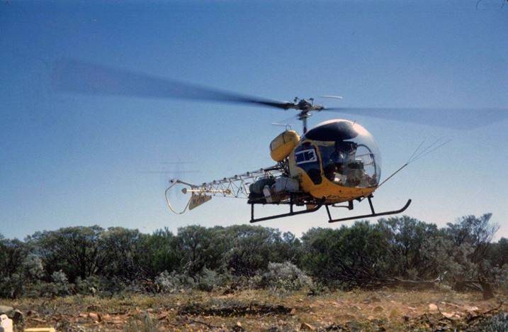
The helicopter was delayed a couple of days, it arrived on 7 May but too late to start that day. Work started next day but the aircraft only flew for 1½ days before breaking down. Luckily this time there were no long vehicle trips to get observers down. D. Roberts once again was the only one. He and his booker were guided from Mt Boggola by mirror flashes to R. Ford's vehicle which got to within about two miles of the hill.
The field party also had another lucky break; the area was remote and it was feared the unexpected delay would involve a long trip to bring in water but while the aircraft was out of action it rained heavily and very good water was available for a few days from pools in the Ashburton River.
Once the aircraft was repaired things moved quickly and after three days observing the vehicles were able to move from this remote area. It was a very long trip to the next base camp; owing to the circuitous route necessary, the distance was over 300 miles of fairly rough tracks and took over one day.
The routine adopted on the previous year’s helicopter borne traversing was again followed, P.H. Langhorne selecting the stations, the observing parties were put up and then brought down, the base camp moved, more reconnaissance, etc. At times P.H. Langhorne and R.A. Ford were both on the reconnaissance and at times one or the other used the helicopter to show a light from the forward or rear stations to enable full use to be made of all the observers.
All observing parties were usually brought back to the base camp for the weekly rest day which was organised to coincide with that of the pilot. Field computations were kept up to date so that the quality of the work was always known.
The first closure on to an existing first order traverse was completed by 22 May, the second by 1 June and the third by 8 July. During the remainder of the first helicopter contract there was no existing traverse point upon which to close. This was done during the second contract when the traverse was completed to close on the existing first order traverse near Wiluna.
Very wet weather closed in as the contract was completed; it slowed work only slightly in the last week but heavy rain over the last couple of days flooded the camp to a depth of six inches. It was interesting to see the helicopter lift itself out of this water and move to a drier area. The contract was completed on 21 June when the aircraft and crew left for warmer, drier areas.
Progress during the contract was:
|
Week |
Stations occupied |
Miles traversed |
|
1 |
5 |
90 |
|
2 |
7 |
164 |
|
3 |
8 |
131 |
|
4 |
10 |
137 |
|
5 |
4 |
68 |
|
6 |
8 |
114 |
|
|
42 |
704 |
The aircraft was unserviceable 8.5 days, most of this was in weeks 1 and 5.
Seven simultaneous reciprocal and seven single ended azimuths were observed.
Owing to the boggy conditions after the rain and the closure of all roads by the local council the field party could not move for 14 days and even then over boggy tracks and roads with detours around bad patches. Two vehicles had to be left in the bush with the station owner promising to get them back to his homestead when possible.
It was lucky for National Mapping that this rain did not fall earlier in the contract; work would have been at a standstill as base camps, and more particularly fuel for the aircraft, could not have been moved. A helicopter is very expensive when it is on hire and cannot be used.
For further details of helicopter traversing refer Technical Report No.9, “Helicopter borne traversing control for 1:000 000 mapping - April, November 1968” by J.W. Witzand, P.H. Langhorne and R.A. Ford.
The field party eventually got to Carnarvon after a very wet trip, over the only passable roads via Mullewa and Geraldton. Here extensive reorganisation was necessary for the next tasks as J. Patrick had left at short notice and R. Goldsworthy who was second in charge of that party was to return to Melbourne for a period. P.H. Langhorne was also to go to Melbourne until the next helicopter contract was due to start.
A short aerial reconnaissance was made over the Shark Bay area to assist in planning; luckily from the air that area looked dry enough to resume field work so the following programme was decided:
(i) R. Ford would take the main field party to the Shark Bay - Yaringa area and complete a series of short traverses for mapping control including establishing a point on Faure Island. There would also be a 60 mile rather difficult traverse east from the coast along the 27º parallel of latitude. A number of established stations including 4 on Dirk Hartog Island were to be marked for spot photography.
(ii) J. Fox would take a small party on marking for spot photography a number of established stations mainly on the first order traverse which runs east from Carnarvon almost along the 25º parallel of latitude and junctions with the traverse along the Great Northern Highway. Points along the Highway and some north of Wiluna were also to be marked.
Theodolite/Tellurometer traversing, spot photo marking, Shark Bay - Yaringa area WA
The field party arrived in the Shark Bay area on 11 July; the observers available were D. Hutton, D. Roberts and D. Girvan. The first traverse reconnoitred was that north from Middle to Cape Peron, two stations only being required. This was immediately completed with a simultaneous reciprocal azimuth along the final line. The computations showed a large difference between the astronomical azimuth and the carried forward geodetic azimuth; it was obvious there was a large error somewhere. The field data was checked and found to be accurate and a second azimuth was observed; this showed the error was either in previous WA Lands Department field work or the data they had supplied.
As a boat had already been hired to take the observing party to Faure Island the discrepancy in the Cape Peron traverse had to be left until the situation could be examined. This chance occurred soon after the Faure Island connection was completed. The party leader, puzzling over possibilities wondered if one of the observed angles on the WA traverse had been applied the wrong way. The station summary of Flag, the last station where horizontal angles had been observed was with the party. The co-ordinates of Middle were calculated from Flag changing the forward bearing as mentioned. With the new co-ordinates of Middle our two station traverse was recomputed; the final geodetic bearing was now found to agree well with the astronomical bearing. Before leaving the horizontal angle at Flag was re-observed and confirmed the supplied bearing from Flag to Middle was in error and thus all the co-ordinate data of Middle was in error.
Two other short connections were completed, followed by the difficult traverse in timbered country along the 27º parallel of latitude. The opening line of 30 miles from the high ground along the coast was a good start, but after that, a line of nine miles was the best achieved, most of the others being only two to four miles. There were 11 stations in about 60 miles and this included the opening 30 mile line.
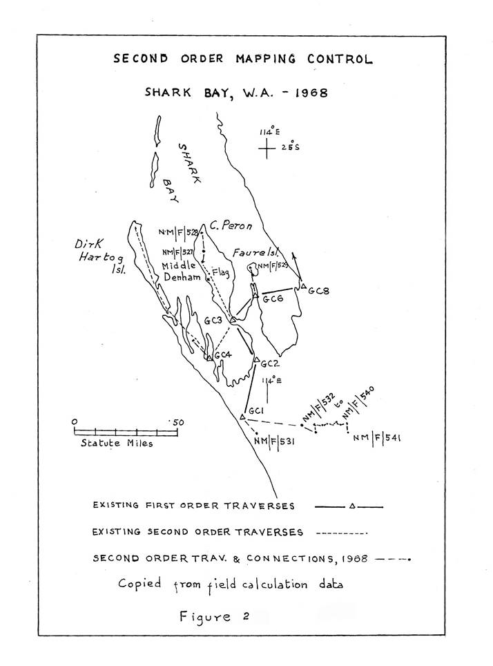
All work in the area was completed by 9 August, four weeks from the commencing date. During that time 15 new stations were established marked and observed, also five established stations were occupied; the stations required for mapping control were marked for spot photography, overall 19 stations were so marked. These included the four established stations on Dirk Hartog Island which was visited by D. Roberts and his booker. Figure 2 shows the traverses in this area.
During this period J. Fox and his party, after considerable difficulty with boggy conditions in the early stages, had completed his long trip on station marking for spot photography; about 25 being marked.
All now assembled in Geraldton on 10 August for the commencement of the next helicopter contract.
Second Helicopter Contract
P.H. Langhorne had arrived a day or so earlier and had made a quick aerial reconnaissance along the 27º parallel of latitude from the concluding station of the previous helicopter contract (approx longitude 115º 30') as far west as the Wiluna area (approximately longitude 120º). He reported no major difficulty could be seen to prevent helicopter borne traversing generally along that line.
He also brought back news that it had been decided that the field party should try and connect the Houtman Abrolhos Islands to the first order traverse stations near Geraldton. This would be done immediately following the helicopter contract and would involve towers as the lines were long and the islands only just above sea level. The necessary towers and scaffolding would be sent by Bedford truck from Melbourne at the appropriate time.
To commence the helicopter contract the field party left Geraldton on 14 August and established a base camp on the Murchison River near Meeberrie Homestead. The river in this area being dry but providing shade and firewood from the river gums. A busy preparatory period was necessary to change to airborne work again.
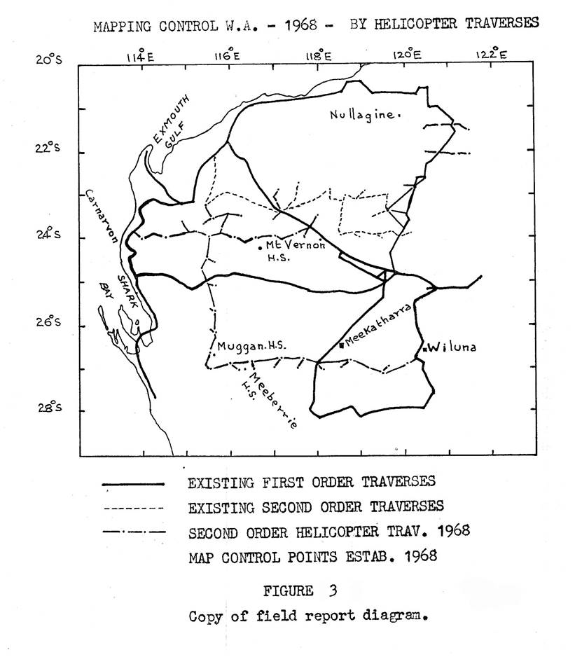
The helicopter arrived on 19 August and the reconnaissance commenced immediately. All was now routine for the field party as for many it was their third stint at this type of operation. It will suffice to say that the traverse along the 27º parallel of latitude, a distance of approximately 300 miles, with 15 new and three established stations, was completed in 15 working days. See Figure 3 for the traverses in this area.
This completed the traversing in the southern area. The long move to the Nullagine mining area near Mt Sydney took three days and the base camp was established at Carawine Pool on 6 September. This was a very nice spot on the Oakover River not far from the western fringe of the Great Sandy Desert.
Unfortunately the helicopter did not arrive; it became unserviceable at Meekatharra soon after the field party left. With repeated, almost daily reports that it was about to leave, the delay eventually extended to over a week. In these circumstances, where the length of the delay is unknown, the party leader cannot afford to get the traversing started by vehicle; if he organises such work and the helicopter does arrive further delay is caused in changing back to a helicopter borne operation.
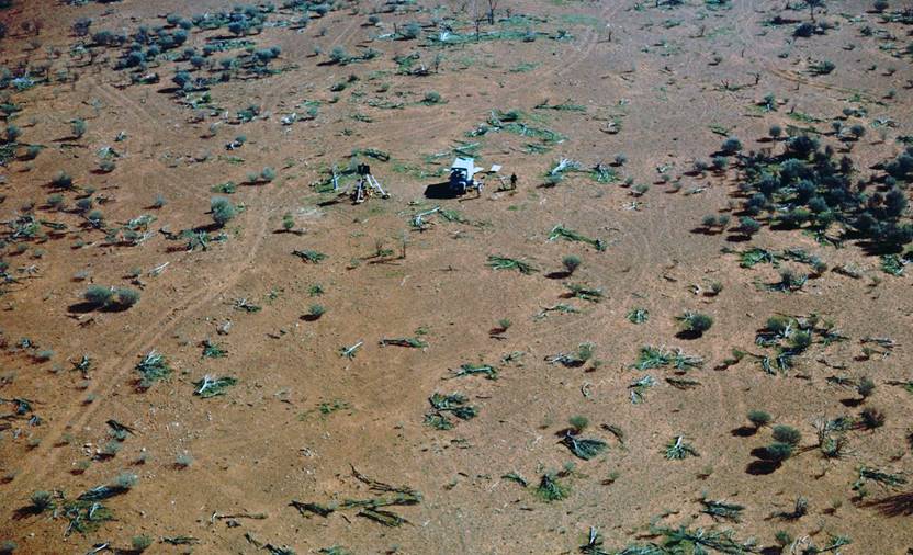
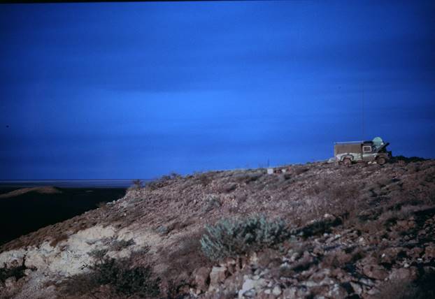
To reduce the size of the party waiting at the base camp, R. Ford took two field assistants on a station marking trip for spot photos in the Hammersley Ranges and Ashburton areas. This would save a lot of expensive helicopter time in locating the station and having to land to mark it before the photographs could be taken. Eleven Stations were marked including quite a few climbs of approximately one hour in the Hammersley Ranges. A reconnaissance was also done of two established stations which would be required for the helicopter traversing. This work was completed by 25 September and a good helicopter base camp was selected near Ashburton Downs. Figure 4 shows the station mark at Mt Tom Price traverse station marked for spot photography.
Once the helicopter arrived in the Mt Sydney area P.H. Langhorne quickly completed his reconnaissance and the four short traverses were completed in about 10 days, Figure 5 shows the loading of equipment onto the helicopter near the base camp at Carawine Pool and Figure 6 the dust clouds raised whenever it landed or took off from a sandridge.
Another long move now had to be made by the survey party to a camp near Ashburton Downs. The helicopter was used to fulfil a spot photo mission en route by completing those points marked in the Hammersley Ranges; this time R. Goldsworthy did the photography. All assembled at the Ashburton Downs base camp by 27 September.
The small amount of traversing required in that area was completed by 1 October. P.H. Langhorne and most of the survey party left for Geraldton to prepare for the Houtman Abrolhos Islands connection. R. Ford with J. Fox as photographer, and two field assistants with the Bedford supply truck, took over the helicopter for the spot photography programme.
Moving the camp each day over quite long distances to keep Avgas up to the aircraft, this party completed the spot photographs of 48 control stations in the final seven days of the contract.
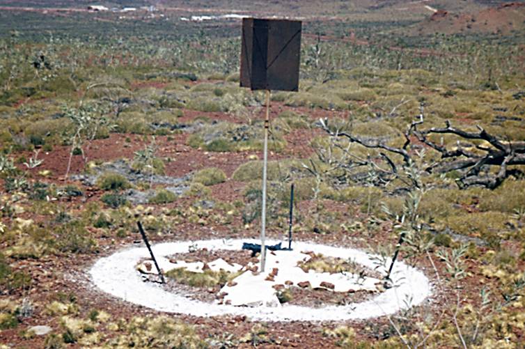
Figure 4: Station mark at Mt Tom Price traverse station marked for spot photography by helicopter.
Circular mark is of lime and cement mix. Small plastic strips were already in position.
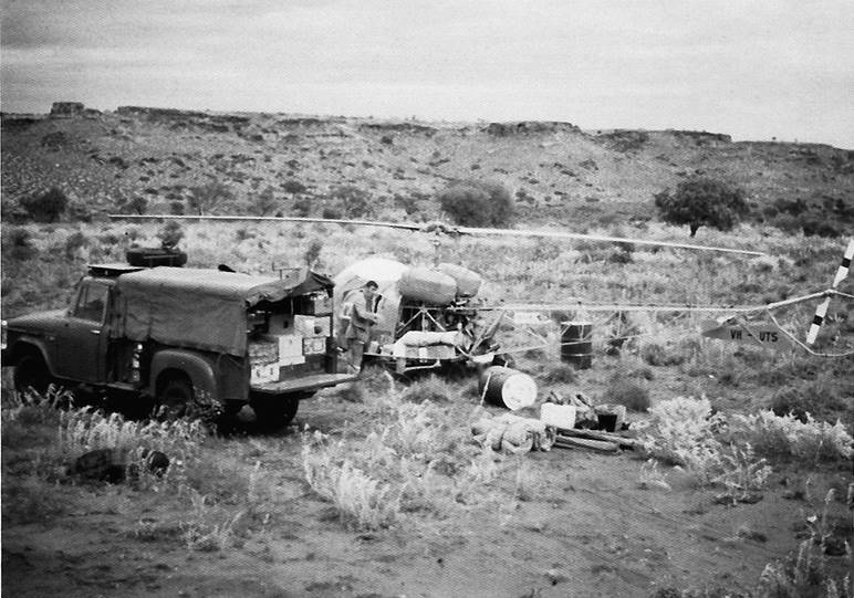
Figure 5: Loading the helicopter near the base camp at Carawine Pool.
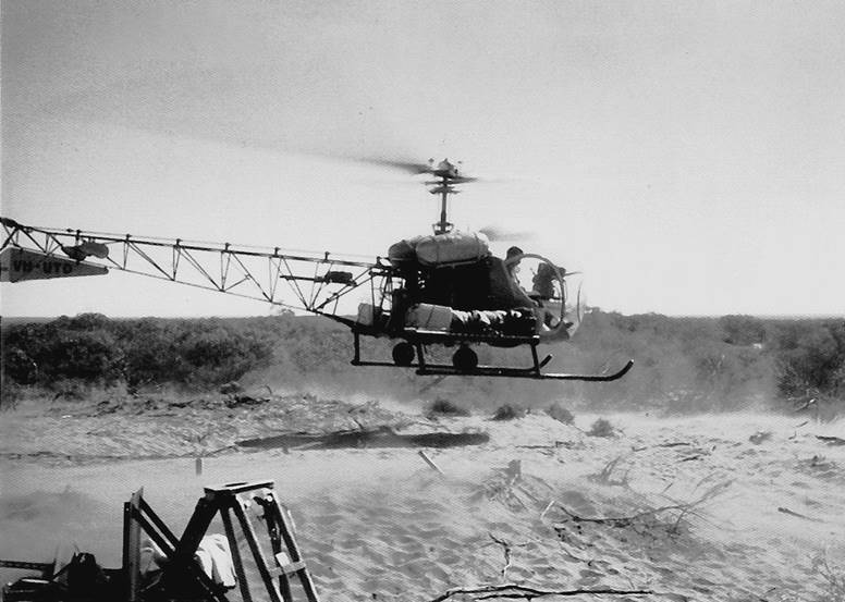
Figure 6: Dust clouds raised when landing or taking off from a sandridge.
This was a very high average as on previous occasions, when solely engaged on spot photo work only about four stations per day were completed. The high completion rate was mainly due to the fact that almost all of the stations had been pre–marked enabling the helicopter to stay airborne. The helicopter contract was concluded on 9 October, the photo party then proceeded Geraldton, arriving 12 October.
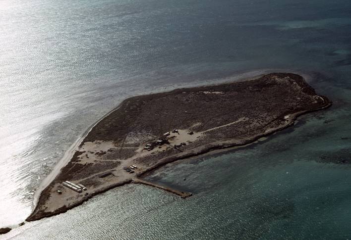
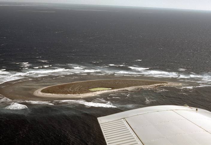
Houtman Abrolhos Islands connection
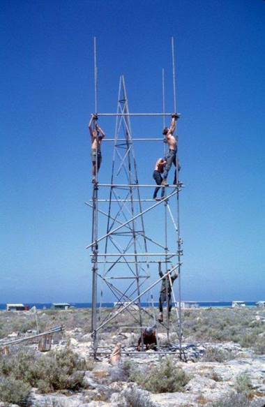
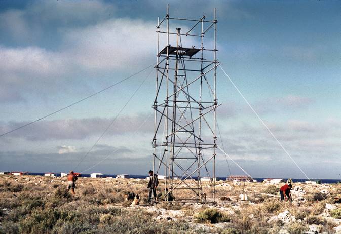
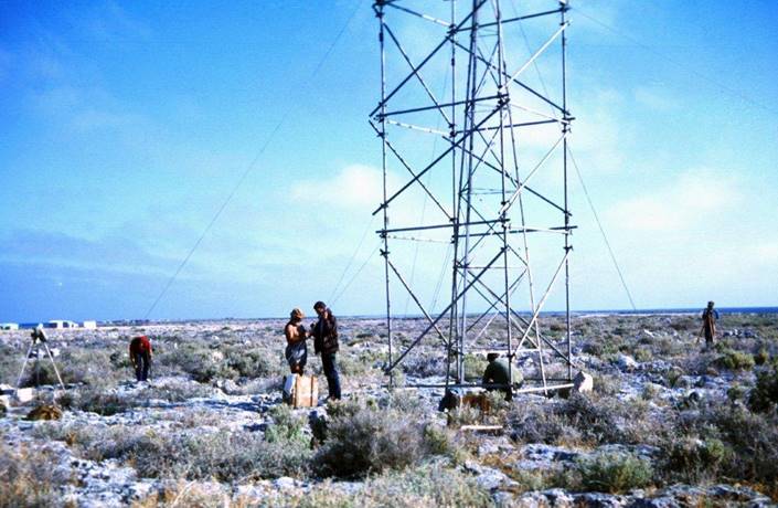
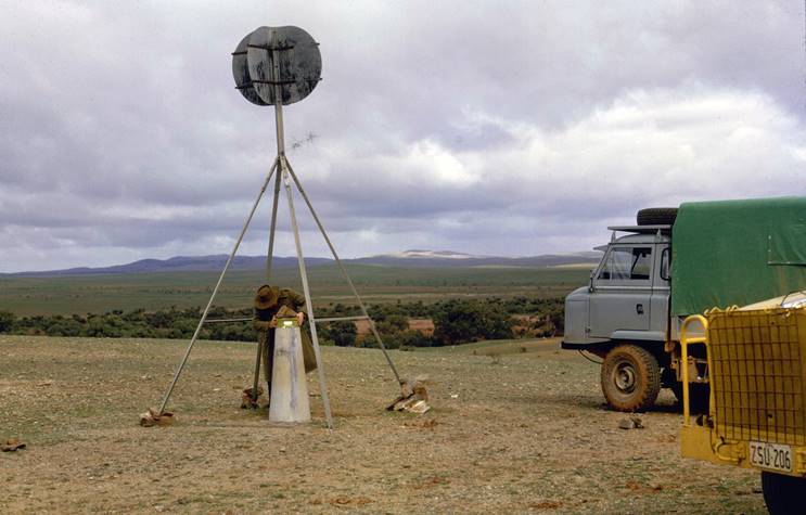
P.H. Langhorne and the field party moved to Geraldton where the Bedford with the towers and scaffolding joined them. The observers available were R. Goldsworthy, D. Roberts, D. Girvan and V. Bosnic. All went by boat to the Houtman Abrolhos Group, 30 foot towers and scaffolding were erected on Hummock Island (NM/F/633) and East Wallabi Island (NM/F/637). Post Office Island (NM/F/634), Gun Island (NM/F/635) and Rat Island (NM/F/636) were marked and occupied. R. Ford arrived with the photo party and contacted P.H. Langhorne by radio.
It was arranged for J. Fox and two Field Assistants to go by plane to the islands to assist and for R. Goldsworthy to return by the same plane to commence the observations and measuring from the mainland stations. The connection from Hummock Island to the first order station Wokatherra Hill was not too difficult and was soon completed; all three left on the mainland were busy showing lights, observing or booking.
To assist in the more difficult connection from East Wallabi Island, J. Fox and the two Field Assistants returned by plane. R. Ford and this party reconnoitred a higher point (NM/F/632) in place of Mt Albert from which difficulty in measuring was being experienced. By erecting a 30 foot plus tower without scaffolding at NM/F/632 and putting the light very high both there and at East Wallabi, the lights were seen and the horizontal angles finally completed. The measurements were completed from ground level at NM/F/632 to the top of the tower at East Wallabi. All work on this rather interesting survey was completed by 20 October and the island party arrived back in Geraldton next day.
After collecting the equipment from the boat, repacking their vehicles and finalising field books, P.H. Langhorne and the field party left for Perth where the equipment was put in containers for transport to Melbourne, the vehicles being left with Stores and Transport, Karrakatta for overhaul. The Ferguson tractor which had been stored at Meekatharra aerodrome for the last twelve months was taken to Kalgoorlie and loaded for rail transport to Melbourne.
Fixed Wing Aircraft, Spot Photography mission
Arrangements had been made to complete the still outstanding spot photography of the mapping control points already marked, as soon as the Houtman Abrolhos Islands survey was completed.
A fixed wing aircraft was hired at Geraldton for the four day programme. J. Fox was the photographer with relief available from R. Goldsworthy where necessary. R. Ford would assist with station location and navigation. All went well on this trip; great help was given by an interested pilot, John Walmsley, who knew the area and was a good navigator.
His suggestion for the quickest, and most economical on fuel method of taking spot photographs was to locate the point at 3000ft the height at which the highest photograph was to be taken, then spiralling down to get the remain two required photographs. From the low level position the plane travelled in a climbing attitude to arrive over the next point at the required 3000ft altitude. Spiralling down to take the photos is very quick and uses little fuel while spirally up is slow and uses a lot of fuel and on this type of trip this is an important factor in planning a day’s flying.
During this photographic trip all marked stations previously not photographed were completed, except for two which could not be located.
The statistics were:
|
Tuesday |
29 October |
22 stations photographed |
Geraldton to Carnarvon area |
|
Wednesday |
30 October |
15 stations photographed |
Carnarvon and inland |
|
Thursday |
31 October |
20 stations photographed |
Carnarvon and inland |
|
Friday |
1 November |
18 stations photographed |
Carnarvon, inland, Abrolhos Islands |
|
|
Total |
75 in four days |
|
The air charter was completed in the late afternoon, the photo party left Geraldton by air for Perth at 1930 and Perth for Melbourne by air at 0145 arriving in Melbourne on Saturday morning 2 November.
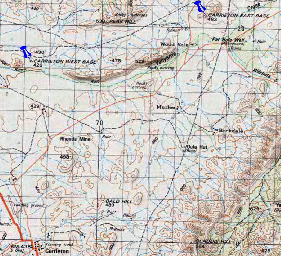
Ooldea area, SA - Mt Bendemeer, NSW High precision measuring
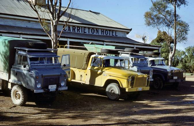
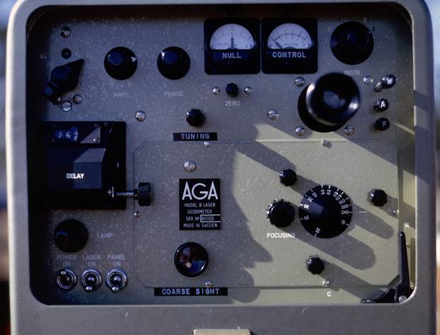
The field party left Melbourne in mid-May and proceeded to the Carrieton base in SA where further testing of the MRA-4 Tellurometer was carried out.
O.J. Bobroff was the party leader, observers were A. Wright, D. Yates and J. Martin; three Field Assistants made up the balance of the field party.
When the tests were completed the party moved to the Ooldea area on the Transcontinental Railway. Measurements began in late June, proceeding eastward from Imamura traverse station. Some of the measurements completed late in the previous year were remeasured.
For Geoidal profile purposes an approximate midpoint had to be established on the long line, Sketching Pile - Michael; this midpoint fell in the almost dry Lake Torrens.
O.J. Bobroff arranged a helicopter for this purpose; the point was established almost exactly on line Sketching Pile - Michael therefore no horizontal angle observations were required, only simultaneous reciprocal vertical angles and Tellurometer measurements.
After the Flinders Ranges had been crossed, in the vicinity of Frome Downs, F.J. McCoy arrived to take over as party leader and O.J. Bobroff returned to Melbourne. The going was fairly easy from this point to Mt Bendemeer; this section of the survey was completed in early August; in all approximately 57 lines were measured.
The field party then moved to northwest NSW and the Manilla base line, where about two weeks testing of the MRA-4 Tellurometer was completed. O.J. Bobroff arrived to supervise the tests and Supervising Surveyor K. Leppert joined the party for a short period.
Mt Kaputar, NSW - Maurice Hill, Queensland. High precision traversing
Late in August with the tests completed, F.J. McCoy returned to again take over as party leader. G. Oversell, a Canberra Technical Assistant joined the field party, followed a little later by E. Ainscow.
Between Mt Kaputar and Maurice Hill, high precision measurements were taken along all lines; horizontal and vertical angles, and also simultaneous reciprocal azimuths were observed at Gulf Creek, Texas, Gowrie, Kingaroy, Mt Stanley and Tiaro. Overall about 27 lines were measured and 28 stations observed during this section of the survey which was completed late in October and the field party returned to Melbourne.
Field Parties 1968
Helicopter borne second order traversing WA - two contracts
P.H. Langhorne Surveyor Class 1
R.A. Ford Senior Technical Officer Grade 1
J. Fox Technical Officer Grade 1
D. Roberts Technical Assistant Grade 2
V. Bosnic Technical Assistant Grade 2
D. Hutton Technical Assistant Grade 2
P. Blake Field Assistant
D. Ireland Field Assistant
D. Girvan Field Assistant
D. Lewington Field Assistant
H. Hodge Field Assistant
J. Weller Field Assistant
L. Dawson Field Assistant (part time)
J. Patrick Surveyor Class 1 )
R.W. Goldsworthy Technical Assistant Grade 2 )
D.E. Ainscow Technical Assistant Grade 2 ) detached party under
E. Rollo Field Assistant ) P.R. Langhorne on control
L. Marden Field Assistant ) point connections by vehicle.
V. Elias Field Assistant )
E. Skeen Field Assistant (W.R.E.) )
Second Order Mapping Control traversing - Shark Bay area WA
R.A. Ford Senior Technical Officer Grade 1
D. Roberts Technical Assistant Grade 2
D. Hutton Technical Assistant Grade 2
D. Girvan Field Assistant
D. Lewington Field Assistant
J. Weller Field Assistant
L. Marden Field Assistant
Spot photography station marking party
J. Fox Technical Officer Grade 1
E. Ainscow Technical Assistant Grade 2
H. Hodge Field Assistant
V. Bosnic Technical Assistant Grade 2
E. Rollo Field Assistant
High precision measuring and some traversing Ooldea, SA via Mt Kaputar to Maurice Hill, Qld.
O.J. Bobroff Surveyor Class 2
F.J. McCoy Surveyor Class 1
A. Wright Technical Assistant Grade 2
D. Yates Technical Assistant Grade 2
J. Martin Technical Assistant Grade 2
T. Wignell Field Assistant
M. Tonks Field Assistant
V. Samoilenko Field Assistant
G. Oversell Technical Assistant Grade 2 ) End of period only.
E. Ainscow Technical Assistant Grade 2 )
Houtman Abrolhos Island connection
P.H. Langhorne Surveyor Class 1
R.A. Ford Senior Technical Officer Grade 1 ) Mainland only
J. Fox Technical Officer Grade 1
R.W. Goldsworthy Technical Assistant Grade 2
D. Roberts Technical Assistant Grade 2
V. Bosnic Technical Assistant Grade 2
D. Hutton Technical Assistant Grade 2
P. Blake Field Assistant
D. Girvan Field Assistant
D. Lewington Field Assistant
H. Hodge Field Assistant
J. Weller Field Assistant
L. Dawson Field Assistant
L. Marden Field Assistant
N. Hubbard Field Assistant
E. Rollo Field Assistant
V. Elias Field Assistant