Peter Hugh Clemence (1925-2019)
RAAF Officer and Commercial Pilot
ANARE and Nat Map 1950s to 1970s
Personal details
Peter Clemence was born at St Leonard’s Private Hospital at 23 Turner Street East Malvern on 18 March 1925. (Around this time the area was known as East Caulfield.) His parents were Arthur (Bob) Clemence (1899‑1962) and his wife Alice Mary Clemence née Stephens (1899-1948). At various times Peter’s father Bob Clemence worked in sales, as a traveller and as a clerk. Peter’s mother Alice Stephens worked as a stenographer before her marriage and during the 1930s worked as a secretary. Immediately prior to her marriage Alice Stephens lived with her parents Edwin Thomas Stephens and Alice Maud Stephens née Minson at 6 Ewart Street Malvern. Bob and Alice Clemence had two children: Peter and Pat.
About Peter’s parents
Peter’s father Arthur (Bob) Clemence was born at St Kilda on 23 February 1899. On 2 June 1918 at age 19 years Bob Clemence joined the Australian Imperial Force at Melbourne. At that time Bob Clemence lived with his parents at 19 Finch Street East Caulfield; Bob nominated his father William Alfred Clemence as his next of kin. On enlistment Bob stated his occupation as motor driver and mechanic. After training at Broadmeadows he was posted to the Australian Flying Corps at Laverton on 18 August 1918. On 18 September 1918 Bob Clemence was posted as 3rd air mechanic at Laverton and after a period in hospital with measles he was posted as a flying cadet on 24 October 1918. The AIF was disbanded after the World War I Armistice was signed on 11 November 1918 and as a consequence Bob Clemence was discharged on 24 December 1918 after 205 days service.
Peter’s parents Bob Clemence and Alice Stephens married in 1922. Afterwards they lived at several addresses in Malvern and Caulfield and in the 1940s were living at 24 McPherson Street Coburg which was Alice’s home when she died on 24 October 1948. McPherson Street was listed as Peter’s residence in 1954, although he was likely serving elsewhere with the Royal Australian Air Force.
Peter’s married life
Peter married Patricia Helen in the early 1950s. (We haven’t located her maiden name or other details.) Initially they resided in a weatherboard bungalow at 16 Rotherwood Drive East Malvern but in 1972 a few years after Peter had left the RAAF they were residing at 5 Cypress Avenue Glen Waverley. By the mid-1970s Peter and his family had moved to the Mornington Peninsula to enjoy the bayside weather. Initially they resided at 10 Berkeley Court Mt Eliza but by 1980 they had moved to 27 Ravenscourt Crescent Mt Eliza which was to remain as the family home for the rest of Peter’s life.
Peter and Patricia Clemence were to have three daughters and a son. Amanda Jane became a nurse, Wendy Louise became a hairdresser, and in 1980 Christine Mary was still a student. Their son David was born in 1966 and graduated from the University of Melbourne with a bachelor degree in veterinary science in 1988. In 2005, David purchased the Cardinia Veterinary Centre that now practises as The Animal Doctors @ Pakenham.
RAAF Service 1943-1967
A few days after his 18th birthday Peter Clemence enlisted in the Royal Australian Air Force at Melbourne on 26 March 1943, Service Number O33191. He served in the RAAF for 24 years and was discharged on 31 March 1967 at age 42 years. At discharge Peter held the rank of Flight Lieutenant with No 5 Squadron RAAF. At enlistment Peter was intending to become an air gunner but early in his RAAF career he was steered into becoming a pilot.
To his disappointment Peter Clemence didn’t get to see much combat flying during his RAAF career. He qualified as pilot after the war in the European theatre had ceased. After returning from England in 1945 he was posted to the RAAF base at Williamtown to the north of Newcastle in New South Wales. Here he was preparing for overseas duty when the war in the Pacific theatre ended in August 1945. Peter’s tour of duty in Korea was after the armistice had been signed in 1953. During his time with Nat Map in the 1970s Peter spoke of being unable to obtain a posting to Vietnam before his RAAF discharge.
On 1 October 1945 Peter Clemence was issued with a Royal Aero Club Aviators’ Certificate. The certificate stated that Peter was an RAAF warrant officer (student) based at RAF Millom and had 22.2 flying hours. Bordering on the Irish Sea at Walney Island near Barrow-in-Furness in Cumberland (Cumbria) about 80 kilometres north of Liverpool RAF Millom opened in January 1941.
Initially a bombing and gunnery school, between 1942 and 1945 RAF Millom operated as No 2 Observer Advanced Flying Unit. By 1944 when Peter Clemence was at RAF Millom they were using twin‑engine Avro Ansons and Vickers Wellingtons, a British twin-engined, long-range medium bomber. Much of Peter’s pilot training was on a Wellington. Peter had returned to Australia prior to August 1945.
During the Korean War, Peter served as a Flying Officer with No 77 (Fighter) Squadron RAAF for some 305 days between 12 December 1953 and 12 October 1954. During his tour of duty in Korea Peter had to make a forced landing in his twin-engine Gloster Meteor jet fighter. Fortunately he managed to walk away.
On 2 July 1950, No 77 (Fighter) Squadron RAAF was the first United Nations unit committed to operations in Korea. From April 1951 the Squadron was equipped with British-made Gloster Meteor twin-engine jet fighters. Following heavy losses from opposing MiG 15 fighters, No 77 Squadron operated in the ground attack role from December 1951 until the official end of hostilities with the signing of the the Korean Armistice Agreement on 27 July 1953. The Squadron remained in South Korea on garrison duties until returning to Australia in November 1954.
Peter’s final Royal Australian Air Force posting was with No 5 Squadron RAAF. Initially formed in 1917, No 5 Squadron was reformed in 1964 at RAAF Base Fairbairn (Canberra) to serve in Malaysia. The Squadron used Iroquois helicopters for troop insertion and extractions, resupply operations and medical evacuations during the Malaysian-Indonesian Confrontation between July 1964 and April 1966. However, we have been unable to yet confirm if Peter served in Malaysia.
Flying with for ANARE with the RAAF 1956-1957
During 1955-56 the RAAF provided an Antarctic Flight group consisting of one Beaver aircraft (A95-201) and Auster (A11-201) to winter at Mawson base. The pilots were: Squadron Leader Doug Leckie and Flying Officer John Seaton. They were supported by Sergeants Geoff Johansen (airframes) and Gerry Sundberg (engines). The RAAF flight personnel and aircraft departed Melbourne on 27 December 1955 onboard the MV Kista Dan.
Flying commenced on 5 January 1956 and a total of 548 hours were flown in 301 sorties. These RAAF personnel were relieved in December 1956. The incoming 1956-57 RAAF commander, then Flight Lieutenant Peter Clemence also went south for the 1955-56 summer principally to learn the conditions and was involved in the erecting of the hanger at Mawson.
The wintering ANARE surveyors based at Mawson for 1956 and 1957 were Syd Kirkby and Morris Fisher, respectively.
During 1956-57 Peter Clemence’s RAAF Antarctic Flight group relieved the Leckie group in December 1956 and brought in an additional Beaver aircraft. This RAAF Flight operated two DeHavilland Beavers (A95-201 and A95-202) and an Auster (A11-201) in support of ANARE operations from Mawson Base. RAAF Antarctic Flight personnel were: Temporary Squadron Leader Peter Clemence, Flying Officer Douglas Johnston, Flight Sergeant Ron Pickering and Corporal NW Nev Merideth. They travelled south on the MV Kista Dan on 17 December 1956 and returned in December 1957.
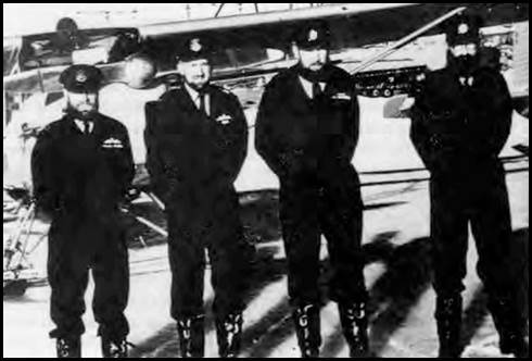
The RAAF Antarctic Flight 1956-57.
L-R: Peter Clemence, Doug Johnston, Ron Pickering, and Nev Merideth.
RAAF image.
Returning to Antarctica with Jayrow Helicopters 1969-1975
In 1965 Gordon Rose purchased a former Royal Australian Navy Bristol Sycamore helicopter as a start to Jayrow Helicopters Pty Ltd at Melbourne’s Moorabbin airport. The aircraft was subsequently registered as VH-GVR. In February 1967 another Sycamore (VH-SYC) was registered to GV Rose Motors to replace VH-GVR that had crashed. Peter Clemence became Jayrow’s chief pilot soon after leaving the RAAF.
For the summer of 1969-70 Jayrow Helicopters Pty Ltd provided three Hughes 500 helicopters (VH-BLN, VH-BLO and VH-SFS) for the summer season based at Moore Pyramid in the Prince Charles Mountains. The summer survey party comprised Nat Mappers Max Rubeli, Chris Hutchison and Eddy Burke. Helicopter flying went from 6 January to 1 March 1970 and was undertaken over Davis, the Amery Ice Shelf, Mawson, Moore Pyramid, Beaver Lake and Stinear Nunataks.
In the ANARE summer season for 1969-70 a total of 240 helicopter hours were flown. The Jayrow helicopter pilots were: Peter Clemence (chief pilot), Lance Yeates and Phil Cooke. Helicopter engineers were: Peter Smart and Dave King.
In 1971-72 the summer survey party for the Prince Charles Mountains comprised John Manning, Eddy Burke, Mick Skinner and Andrew Greenall. These Nat Mappers and aircraft support travelled south on the MV Nella Dan. Three Hughes 500 369HS helicopters were provided by Jayrow Helicopters, namely: VH-BLN, VH-BLO and VH-SFS.
The helicopters were based at Mt Cresswell in the southern Prince Charles Mountains and flew a total of 543 hours in 791 sorties. The Jayrow helicopter pilots were: Peter Clemence (chief pilot), Vic Barkell and Ron Newman (pilot/engineer). Helicopter engineers were: Eckhardt Schneider and Jim Marsh.
In January-February 1973 Jayrow Helicopters provided two Hughes 500 369HS helicopters (VH-BLN and VH-BLO) to support the MV Thala Dan relief voyage to Casey station and to Macquarie Island. These aircraft flew a total of 29 hours in 82 sorties. Helicopter pilots were: Peter Clemence and Gerry Leatham. Helicopter engineer was: K Kelly.
In the ANARE summer season for 1974-75 three Hughes 500 369HS helicopters (VH-CHD, VH-BLN and VH‑BLO) were provided from Jayrow Helicopters; that company’s last contract with ANARE. The expedition travelled south in the MV Nella Dan.
Operations that summer were in Enderby Land from a base at Knuckey Peaks where generally poor weather was experienced. The 1974-75 Jayrow helicopter pilots were: Peter Clemence, Gerry Leatham and Gary Doyle. Helicopter engineers were Keith Angel and Laurie John. The helicopters flew a total of 337 hours 45 minutes in 536 separate sorties during the season. The summer survey party comprised Nat Mappers Rom Vassil and Oz Ertok nominally for aerial photography with Bob Goldsworthy, Steve Bennett and Mike Morgan nominally for geodetic traversing.
On 29 December 1974, helicopter VH-CHD was destroyed at a cost of $98,637 when pilot Gerry Doyle attempted to take off with one skid still tied down. On 21 February 1975, the rotors of VH-BLN and VH-BLO collided on the helideck of the Nella Dan; resulting in damage costing $23,912 and rendering VH-BLO unserviceable for the rest of the season.
Places associated with Peter Clemence’s flying in Antarctica between 1956 and 1975 are shown in Figures A1 and A2 in the Appendix A. Peter Clemence continued as Jayrow’s chief pilot for some years after the company ceased flying for ANARE.
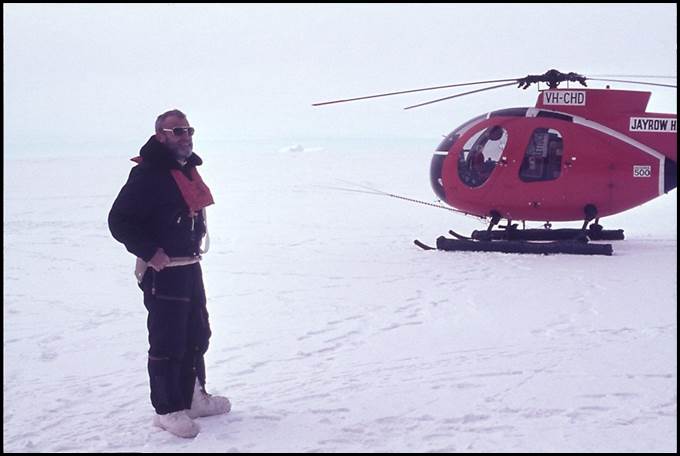
Peter Clemence in Enderby Land 1974.
XNatmap image from Oz Ertok.
Another aviation incident during the 1974-75 ANARE summer season
Early in 1974-75 ANARE summer season, high altitude aerial photography operations were flown over Enderby Land from the Knuckey Peaks base. On one sortie in the Forrester Stephen’s Pilatus Porter fixed-wing (VH-FSB) the crew comprised pilot Gus Van Scalina, navigator Rom Vassil and camera operator Oz Ertok.
The crew were all wearing oxygen masks, thermal clothing and gloves as the cabin temperature in the unheated and unpressurised Porter was below minus 40 degrees Celsius. After completing one photography run and with the turboprop Porter cruising at 20 000 feet on auto pilot during the next run, Rom noticed that the pilot was no longer making heading corrections when requested. Rom looked at the pilot and to his horror saw that Gus was unconscious. Oz was still busy working over the camera view finder when he received a firm tap on the shoulder from Rom and advice that Gus had collapsed. Although he served as a technician in the Turkish Air Force prior to coming to Australia in 1971, Oz was not a pilot and had no formal flying experience; neither had Rom. But this was a desperate situation and something extraordinary needed to be done. Oz left the camera and his oxygen supply and sat in the right side seat of the Porter. He noticed Gus had a bad colour, his head was flopped to one side and that his oxygen mask was pushed to the side of his face off his mouth and nose. In the right side seat, Oz noticed he had no oxygen mask as he sat behind the aircraft’s dual controls.
Oz knew that to save Gus’s life and to remain conscious himself the aircraft had to quickly descend from its 20 000 feet operating level to below 10 000 feet where there was sufficient atmospheric oxygen to breathe normally. But Oz wasn’t sure how this could be done on autopilot and whether he would be able to control the plane if he switched off the auto pilot. A decision was needed and only Oz could make it.
With some trepidation Oz switched off the auto pilot and pushed the control column forward to commence the descent. Almost immediately, the aircraft began to shake violently. Fortunately Oz had the presence of mind to recall that the Porter needed a high power setting to maintain 20 000 feet and during the initial descent this setting had caused the aircraft to over-speed. Oz then operated the throttle lever to reduce engine power and by flying manually descended the aircraft to 9,000 feet where the crew could all breathe without oxygen.
Oz then flew the Porter back to the Knuckey Peaks base that was about 120 kilometres distant. The flight time was about one hour. Oz also contacted the base on the aircraft radio to advise of the situation. Once over the base, Oz circled the area three times to reduce the fuel load. Fortunately as the aircraft was circling Gus regained consciousness and although not fully recovered was able to land the aircraft. Gus’s landing of the aircraft was forced by Oz who despite prompting to the contrary knew such a manoeuvre was well beyond his own capabilities.
After this incident (that was promptly reported to Australian aviation authorities) further high altitude (on-oxygen) flying was prohibited by the Department of Civil Aviation due to the pilot’s recent medical event. Gus later flew the Porter back to Mawson. Here unfortunately, on 23 January 1975 at the Gwamm airstrip on the plateau above the base it was blown over during a blizzard in the night, rolled several times and was destroyed at a cost of $125,000.
The heavy Wild RC9 aerial survey camera was carried onboard the aircraft in its mounting frame. Such cameras can only be placed but not secured in the mounting. As the aircraft rolled around in the storm the camera came out of its mounting and caused further damage as it was thrown around the cabin.
Later the camera was returned to the manufacturer in Switzerland for repair but was never able to operate again with its original metric precision.
Thus out of the three helicopters and one fixed-wing aircraft that went south for the 1974-75 ANARE summer season only one helicopter was serviceable by late February 1975.
Recognition of Peter Clemence’s Antarctic service
Peter Clemence was awarded the Polar Medal on 5 January 1960, this was a British award under the Imperial honours system that Australia used until the 1980s. Several geographic features in Antarctica were named for Peter’s contributions to the Australian National Antarctic Research Expedition in 1957.
Clemence Fjord between Fisher Island and Lied Promontory in the Larsemann Hills was named for Squadron Leader Peter Clemence officer commanding the RAAF Flight at Mawson in 1957 who made landings in the Larsemann Hills in support of the field party there.
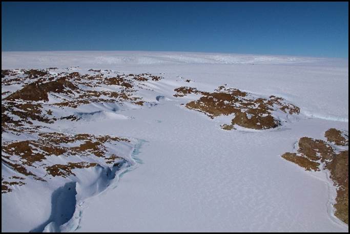
Clemence Fjord in 2009.
Adam Christensen image from Australian Antarctic Gazetteer, catalogue ID: IA21764.
Clemence Massif is an elongated, mostly ice-free rock outcrop, about 28 kilometres long and rising to 1 325 metres. It is located on the eastern side of the Lambert Glacier at its northern end where the Glacier flows in to the Amery Ice Shelf. Clemence Massif was discovered from an ANARE Beaver aircraft in 1957 flown by Flying Officer Doug Johnston and was named for Squadron Leader Peter Clemence who commanded the Antarctic Flight at Mawson in 1957.
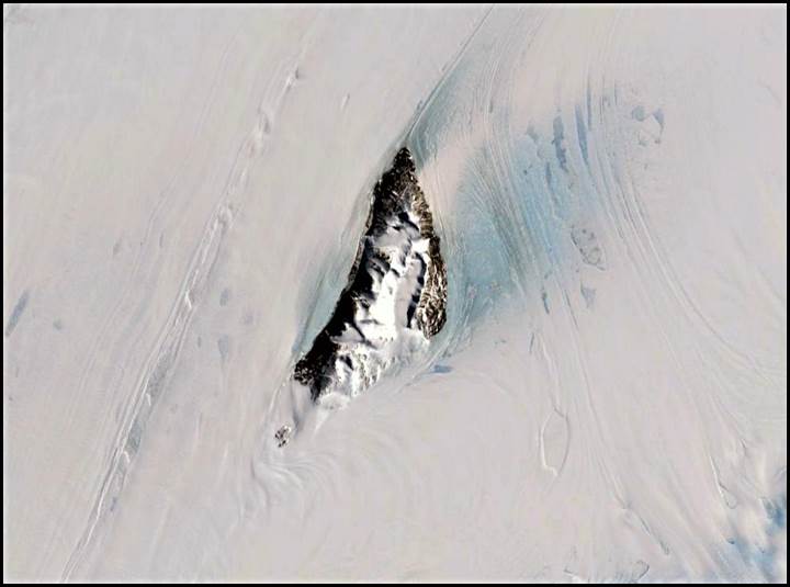
Clemence Massive in January 1999.
U S Geological Survey satellite image from Google Earth.
Amanda Bay is in the south eastern part of Prydz Bay to the east of the Larsemann Hills. Prydz Bay is to the north east of the Amery Ice Shelf. Amanda Bay was photographed by an ANARE aircraft on 26 August 1957 and named for Amanda Jane Clemence the first-born child of Squadron Leader Peter Clemence who commanded the Antarctic Flight at Mawson in 1957.
Amanda Rookery is an emperor penguin colony on sea-ice on the western side of Amanda Bay. It was discovered on 26 August 1957 from an ANARE aircraft. The rookery is named after the daughter of Squadron Leader Peter Clemence pilot of the aircraft from which the colony was discovered.
David Parer and Elizabeth Parer-Cook wrote Peter Clemence : Memories of an Antarctic Aviator for the Mawson Stories section on the ANARE Club website. The article is available via this link.
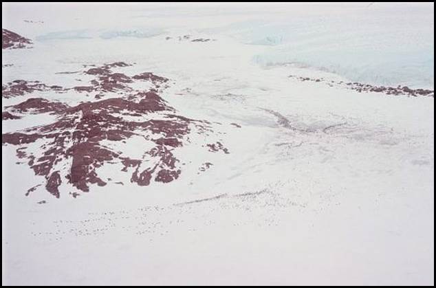
Amanda Rookery in 1981.
Gavin Johnstone image from Australian Antarctic Gazetteer, catalogue ID: IA21764.
Support for National Mapping Aerodist survey operations 1969-1974
Between 1969 and 1974, Peter Clemence supported Nat Map’ airborne distance measuring program (Aerodist) to establish horizontal photogrammetric ground control for 1:100 000 scale topographic mapping in the more remote areas of Australia including the Great Sandy and Gibson Deserts and the Kimberley region in Western Australia. Peter flew Hughes 500 369HS helicopters for Jayrow Helicopters Pty Ltd. (Peter did not fly for Nat Map in either 1971 or 1973 as Jayrow was not contracted to Nat Map in those years.) The areas where Jayrow Helicopters provided support for Nat Map Aerodist field operations in 1969, 1970, 1972 and 1974 are shown in Figures B1 and B2 in the Appendix B. Peter Clemence flew in part but not in all of these areas with the flying duties being shared with other pilots as mentioned below.
Aerodist ground marking 1969
Between 3 June and 4 October 1969 Jayrow Helicopters supported National Mapping’s Aerodist ground marking operations in the Northern Territory and Western Australia. The helicopter used throughout this period was a jet engined Hughes 500 369HS (VH-SFS). Peter Clemence flew at various times on this contract with relief pilots being Cliff Dohle and Phil Cooke. These pilots were supported by engineers: Peter Smart, Jim Hammond, Dave King and Eckhart Schneider.
The helicopter contract started at Andado Homestead on the western edge of the Simpson Desert about 230 kilometres south east of Alice Springs. Later main bases were Ringwood Homestead (110 kilometres east of Alice Springs); Balgo Mission (now Wirrimanu) in the Tanami Desert about 200 kilometres south of Halls Creek in Western Australia; Christmas Creek Homestead (now Wankatjunka) on the northern fringe of the Great Sandy Desert about 200 kilometres west of Halls Creek; Swindell Field and Kidson Field isolated former oil search landing grounds in the Great Sandy and Gibson Deserts, respectively; Giles Weather Station 270 kilometres west of Ayers Rock (Uluru); Ayers Rock; and Alice Springs.
Kidson No 1 Well drill site where Nat Map had its 1969 helicopter camp.
Laurie McLean image 1972.
Aerodist measuring in the Northern Territory 1970
In late September 1970, Jayrow Helicopters pilot Lloyd Knight operated a Hughes 500 369HS helicopter (VH-BLN) in support of Aerodist measuring operations from a camp at the Docker River Aboriginal community (now Kaltukatjara) in the far south west of the Northern Territory. Lloyd had to ground the aircraft for an engine replacement in the middle of measuring operations.
Fortunately three of the four remote parties positioned on survey marks in the field could be recovered by vehicles. The remaining party (Nat Mappers Laurie McLean and Frank Ayers) were at survey point NM/G/301 in the sandhills north of Lake Neale that was not readily accessible by vehicle. Field party leader John Manning resupplied this remote party with food and water (ice) dropped from the Aerodist measuring aircraft Grand Commander 680 FL (VH‑EXZ).
While the helicopter was being overhauled Peter Clemence relieved Lloyd Knight as pilot. The remote party at NM/G/301 was recovered on Tuesday 6 October by Peter Clemence in helicopter VH-BLN after the engine had been replaced by engineer Dave King.
Aerodist measuring in Western Australia 1972
The Jayrow Helicopters contract to support Aerodist measuring operations in Western Australia ran from about 5 May 1972 and concluded about 11 November 1972. For this contract two two Hughes 500 369HS helicopters (VH-BLN and VH-BLO) operated simultaneously but independently in the field. The helicopter pilots were Cliff Dohle, Vic Barkell, Howard Bosse, Terry Ellis, Peter Clemence and Phil Cooke. The pilots were supported with engineers who included Eckhart Schneider, Peter Smart and Dave King.
The main helicopter bases in 1972 were usually at survey control stations, namely: R199 on the Connie Sue Highway about 190 kilometres north of Rawlinna; NM/F/677 (Lake Minigwal) about 110 kilometres south-east of Laverton; NM/F/446 about 300 kilometres east of Laverton; and R 208 about 50 kilometres north of Neale Junction in the Great Victoria Desert; at camp at about 27º 17′ S and 127º 20′ E on a level traverse south-east of Sulphur Knob in the Great Victoria Desert; at NM/F/17 Mt Samuel; near NM/F/25 Mt Johnson; at Carnegie Homestead; near Mt Eureka about 150 kilometres east of Wiluna; from Wiluna; at Balfour Downs Homestead; at Kidson Field landing ground in the Gibson Desert; from a fly camp on the WAPET Kidson track at Lake Auld near NM/F/187 in the Great Sandy Desert; at NM/F/246 MacDougall Knoll about 160 kilometres south of Kidson Field; at NM/F/602 on the Gunbarrel Highway in the Van Der Linden Lakes area of the Gibson Desert about 145 kilometres west of Giles Weather Station; from the Blyth airstrip centre party camp 75 kilometres west of Warburton Aboriginal Community; at NM/F/644 about 110 kilometres north of Loongana on the Trans-Australia rail line about 540 kilometres east of Kalgoorlie; and from Forrest on the Trans‑Australia rail line about 640 kilometres east of Kalgoorlie.
Aerodist measuring in the Kimberley September-October 1974
Peter Clemence was one of the two Jayrow Helicopters pilots who supported Nat Map Aerodist measuring operations in the Kimberley from 5 September to 2 November 1974. Two Hughes 500 369HS helicopters were used (VH-BLO and VH‑SFS). As in 1972 the two helicopters operated simultaneously but independently in the field. During the 1974 operations the two helicopters flew a total of 250.51 hrs. The helicopters positioned two-man Aerodist remote instrument parties from helicopter camps to survey control marks and retrieved them when measuring had been completed.
In 1974 Peter Clemence operated from Wyndham and from helicopter camps in the field at Lowya Creek, Plain Creek and Lansdowne Homestead. He was relieved by Vic Barkell around 20 October 1974.
The Lowya Creek helicopter camp was on the north side of the creek near a pleasant waterhole on this tributary of the King Edward River. It was just off the Gibb River to Kalumburu track between Doongan and Theeda homesteads at about 14º 56′ S latitude and 126º 14′ E longitude. The remote parties operated from Lowya Creek from around 5 September to 2 October 1974 during that time Peter and Nat Mapper Laurie McLean flew to Wyndham to undertake equipment tests.
In sharp contrast to Lowya Creek, the helicopter camp near Plain Creek was in recently burnt out country away from water. It was further south on the Gibb River to Kalumburu track about 50 kilometres north of Gibb River homestead (at about 16º 1′ S and 126º 25′ E). The helicopter operations were based from Plain Creek from 3 to 10 October 1974.
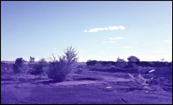
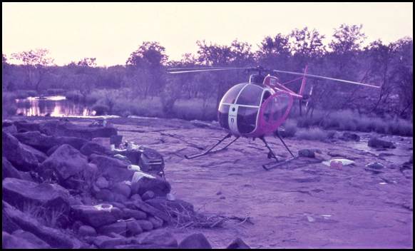
On final approach to Plain Creek camp October 1974.
Laurie McLean image.
The helicopters were based at Lansdowne homestead from 11 to 21 October 1974. Here all field party members were treated like guests by the hospitable Quilty family. The party was accommodated in the stockmen's quarters and mostly when in camp took breakfast and dinner with the family and other station staff. Peter Clemence was relieved by Vic Barkell after Lansdowne Homestead.
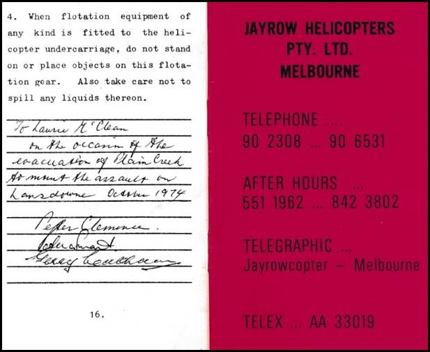
A 1974 memento from Peter Clemence et al.
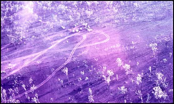
Peter Clemence’s overnight camp on the King Edward River near Kalumburu in October 1974.
Laurie McLean image.
1974 was the last year of Nat Map’s Aerodist measuring program that had commenced in 1963 to obtain horizontal control for the 1:100 000 scale National Topographic Map Series. It was also the last year that Nat Map obtained helicopter support from Jayrow Helicopters.
Vale
Peter Clemence died suddenly in hospital on 18 June 2019 from a lung condition; he was 94 years of age. Peter’s funeral was held at the St James the Less Anglican Church at the corner of Nepean Highway and Koetong Parade Mt Eliza on Thursday 27 June 2019. The service commenced at 12 noon; a private cremation followed.
Peter was survived by his children and by his grandchildren.
Former National Mapping supervising surveyor Rom Vassil was among the mourners at Peter’s funeral. Rom had worked with Peter with Nat Map in 1969 and with ANARE in Enderby Land in 1974-75 and in recent years had occasionally met him down the street in Mt Eliza.
Places related to Peter Clemence’s time in Antarctica 1956-1975
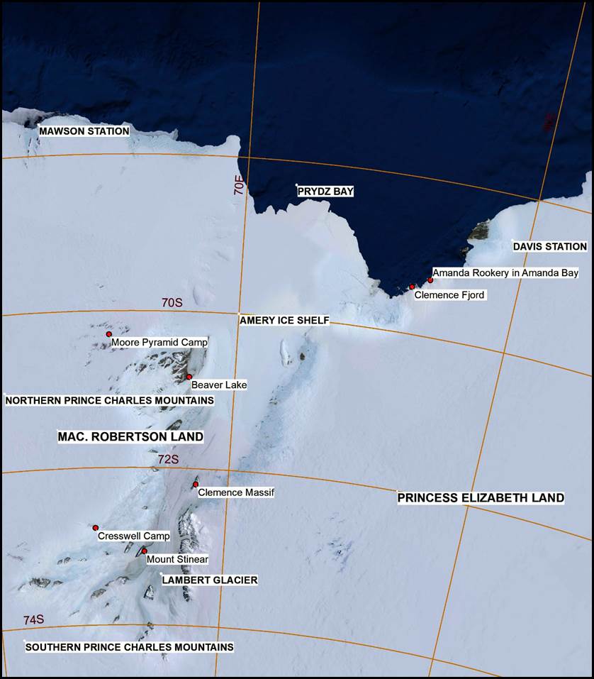
Figure A1: Places east of Mawson (1956-1972).
Map prepared by Paul Wise 2019.
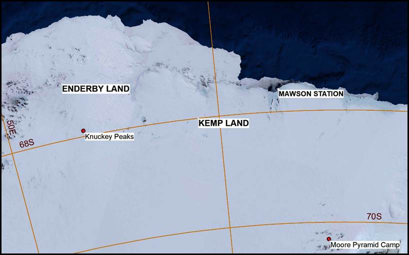
Figure A2: Places west of Mawson (1974-1975).
Map prepared by Paul Wise 2019.
National Mapping operational areas 1969-1974
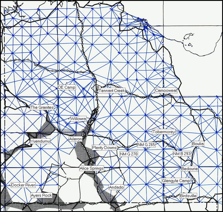
Figure B1: Part of Nat Map’s operational areas in 1969 and 1970.
Notes: With the exception of Camooweal annotations show helicopter camps used for Aerodist ground marking or measuring operations. Peter Clemence flew from some of these camps in 1969 and 1970. The blue lines show Aerodist lines measured over various years in this area. Figure B1 was prepared by Paul Wise.
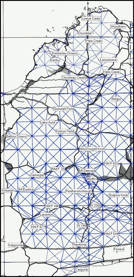
Figure B2: Part of Nat Map’s operational areas between 1969 and 1974.
Notes: Annotations show helicopter camps used for Aerodist ground marking or measuring operations in 1969, 1971, 1972 and 1974. Peter Clemence flew from some of these camps in 1969, 1972 and 1974. The blue lines show Aerodist lines measured over 1971, 1972 and 1974. Figure B2 was prepared by Paul Wise.
Prepared by Laurie McLean, July 2019