![Description: MC910216361[1]](mng56_files/image001.png)
![Description: MC900441735[1]](mng56_files/image002.png) Flashback…
Flashback… 
NMG 56 some 53 years on
In a recent exchange of emails, Dr David Nash, Visiting Fellow Australian National University, said that he had visited and photographed a 1958 Natmap trig, NMG 56, last July (2012).
NMG 56 was indeed established in 1958 by Reg Ford’s field party and forms one of a chain of beacons stretching from Aileron, NT to Halls Creek, WA. It stands atop Mt Davidson some 600km north-west of Alice Springs. Refer map at Figure 1.
Figure 1 : Map showing 1958 First Order Trigs and location of Mount Davidson, NT.
In the Natmap specifications of the time it was constructed of a 10ft Oregon centre pole over the station mark with four bondwood vanes of 3ft by 2ft attached. The centre pole was surrounded by a 10ft diameter stone cairn 6ft high. Refer Figure 2. Three reference marks were cemented into the surrounding rock and accurately connected to the station mark before the cairn was constructed. It was foreseen that any future survey work would be done from the reference marks to avoid dismantling the cairn.
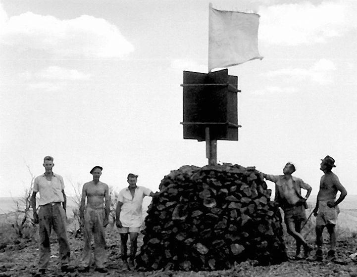
Figure 2 : The first cairn built by National Mapping
(and typical of those constructed from then on)
at Moorkaie triangulation station, near Broken Hill, March 1954 –
H.A. (Bill) Johnson is second from the left and E.J. (Ted) Caspers is on the far right.
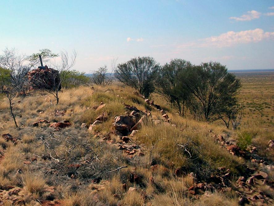
Figure 3 : Approaching, from the west, NMG 56 on Mount Davidson, NT, July 2012.
(Courtesy
David Nash : provided under 'Attribution-NonCommercial Creative Commons').
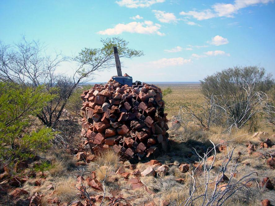
Figure 4 : At NMG 56 on Mount Davidson, NT, July 2012.
(Courtesy
David Nash : provided under 'Attribution-NonCommercial Creative Commons'
and edited for privacy reasons).
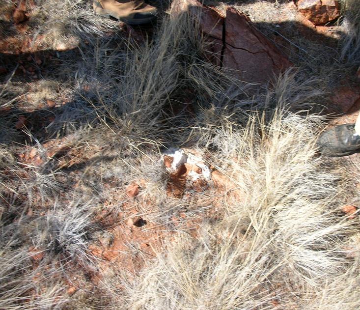
Figure 5 : Reference Mark (RM) at NMG 56 on Mount Davidson, NT, July 2012.
(Courtesy David Nash : provided under 'Attribution-NonCommercial Creative Commons').
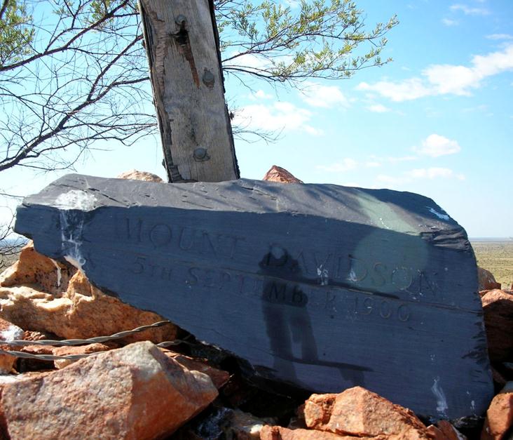
Figure 6 : Memorial stone to Alan Davidson placed by his descendants on NMG 56 cairn on the prominence named after him, NT, July 2012.
Note the twisted fencing wire likely used to brace the centre pole and the heads of the bolts used to attach the vanes.
(Courtesy David Nash : provided under 'Attribution-NonCommercial Creative Commons').
As you can see by David’s photos, the cairn and most of the centre pole remain but the vanes have gone, likely through a combination of the wind and rain. In the photo at Figure 3 you can see the remains of fencing wire which was possibly used to brace the top of the beacon and maintain its verticality. In that same photo you can also see the bolts that held the vanes to the centre pole. The remnants of the vanes, that can be seen, indicate that the vanes were probably torn off by the wind along the axis where the vanes would have vibrated against the edge of the centre pole.
The engraved slate in the photos, which reads ‘Mount Davidson, 5th September 1900’, was brought from the UK by the Davidson descendants and placed on the cairn as a centenary memorial to Alan Davidson on 5 September 2000.
Alan Davidson is credited with
finding the first gold at The Granites in 1900 while prospecting by camel. Several gold
mining ventures failed over the years until the construction of the modern
Granites Gold Mine. The mine produced its first bar of gold on 1 July 1986.
North Flinders Mines pursued an aggressive exploration program on this original
exploration licence and, following the signing of further agreements with
traditional land owners, additional exploration licences were granted in 1998.
Gold was discovered at what is descriptively named Dead Bullock Soak later that
year. Over the next few years, additional ore bodies were found and given such
colourful names as Triumph Hill, The Villa, Furmarole, Avon, Callie, Colliwobble
Ridge and Sleepy Hollow.
Allan
Davidson, trained in surveying, metallurgy and mining engineering, is
one of Australia’s least-known inland explorers. His two expeditions, however,
north of Alice Springs yielded, as fellow explorer Charles Winnecke writes, ‘a
very material contribution to the topography and geology of a space hitherto
blank in the map of Australia’. He discovered indications of gold at Tanami
and The Granites which led to the later development of the gold mines there.
This is probably the only occurrence of a monument to the geodetic survey being also used as a base for a monument to the man after whom the mount is named.
Thanks to David for his interest and use of his photos.