Aerodist Control Station Establishment : 1963 to 1974
1 Introduction.
To help meet the needs of Australia's ongoing development, in 1965 the Commonwealth government approved the acceleration of the national topographic mapping program with the object of completing mapping coverage of the country at 1:100,000 scale with contours at a 20 metre vertical interval by the end of 1975.
Recognising the need for such a future mapping program, since the early 1960s the Division of National Mapping had been seeking a surveying system that could be efficiently deployed as a timely and cost-effective means of determining the positions of horizontal control stations across vast areas of the Australian continent. Already impressed with the way the South African Tellurometer microwave distance measuring system had increased the speed and accuracy of the geodetic survey the new South African airborne microwave distance measuring system was adopted as appropriate technology.
The Aerodist system overcame the line of sight constraint of the ground based method that reduced the lengths of lines that could be measured and impacted on control station site selection options.
McLean (2013) stated:…“In July 1962, Nat Map took delivery of its initial set of Aerodist equipment but this set failed acceptance tests and was returned to the supplier. In January 1963, a second set was delivered and later accepted. This second set comprised a master control unit (Red frequency code) and an ancillary master unit (that had a separate Blue measuring frequency code). The master units had related sub-systems to record distance measurement readings on a chart recorder and for gathering meteorological and other data. The set also included four ground-based remote units (Red 1, Red 2, Blue 1 and Blue 2). One of these units would be operated from a survey station at either end of a line that was then measured by the aircraft flying between the two remote stations. The master units were firstly mounted in a helicopter and were later mounted in fixed wing aircraft”.
Generally, National Mapping used the Aerodist system to measure distances between non-intervisible ground survey stations, building up a regular pattern of 1º of latitude and longitude (but sometimes 30') quadrilaterals. The Aerodist survey configuration was basically a series of braced quadrilaterals of measured lines, linked to and contained within the existing geodetic network that formed discrete blocks of trilateration. Refer Map B.
Based on National Mapping’s long held philosophy that marking ground survey stations was only a small fraction of the cost of occupation Aerodist control stations were permanently marked. Initially it seems that the specifications for such marking were evolving as early Aerodist control stations were upgraded in later years. This view is supported by a statement by the then Assistant Director Joe Lines, at a conference on Control for Mapping by Geodetic and Photogrammetric Methods held at the University of New South Wales in 1967 (University of New South Wales, 1967). When asked about the provision of an azimuth mark at Aerodist stations Lines stated that "from 1967 an azimuth mark has been provided".
While McMaster (1980) reported Nat Map's Aerodist program, only an overview of Aerodist control station establishment (or ground marking as it was called at the time) was able to be included. Yet in every year of the Aerodist measuring program some control station establishment took place. Between 1966 and 1970, however, a separate ground marking program was undertaken which has never been documented. This ground marking was undertaken independently from the Aerodist measuring program to help ensure that measuring operations would not be delayed by a lack of available control stations. This paper aims to fill the gap in documented Aerodist ground marking activities.
2 Ground Marking Operations to the end of 1965.
By the end of 1965 Aerodist had operated for three field seasons. In 1963 Aerodist established 27 stations, 15 stations in 1964 and 9 in 1965 a total of 51 stations. These totals of stations established may be inconsistent with those totals quoted in papers of the time but are consistent with information at the completion of the Aerodist program (the later strengthening of early blocks through the addition of stations appears to be the reason for this inconsistency). Carl McMaster recalled that in these early years, parties under Syd Kirkby and Con Veenstra also accessed a number of trigonometrical stations established by Australian Army Survey units and the Royal Australian Navy during World War 2, mainly on the Great Dividing Range between Bundaberg and Proserpine but also on offshore features. These stations were cleared and marked in preparation for future Aerodist measuring and spot-photography.
In his 1966 paper Aerodist in Australia, 1963-64, Joe Lines stated:…“reconnaissance, [Aerodist ground] marking, air photo identification and heighting absorb something like 40 per cent of the manpower requirement in the field operations. Aerodist stations, unlike classical trigonometrical survey stations, can be sited in locations convenient to communications and developing areas. In practice, all weather vehicle access is desirable as the rate of movement on the ground generally controls the pace of the survey”. However, as Aerodist measuring operations moved west into more remote areas ground movement was slowed down by the natural conditions.
Conversely as McLean (2013) noted the transfer of the Aerodist master equipment from the relatively slow speed, short range helicopter into a faster, longer endurance, fixed-wing aircraft enabled more operational measuring time. A third master unit and additional ground remotes expanded the Aerodist system’s capability. In addition, as Aerodist operations moved west after 1966 helicopters were usually deployed to position the remote parties. To make efficient use of the increased Aerodist measuring potential and the ability to position remote parties irrespective of the terrain, ground marking needed to be completed in advance. This requirement led to Aerodist line measurement and Aerodist ground marking becoming discrete programs.
By 1965 it appears that the establishment of Aerodist control stations was starting to occur semi-autonomously as Rom Vassil recalled his party working around Mackay and on Manifold Island under Syd Kirkby's supervision. Around mid-1966 a block of stations between Charters Towers and Cloncurry were established and have been identified as the first to be undertaken by a dedicated ground marking party.
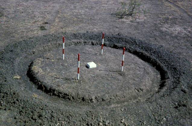
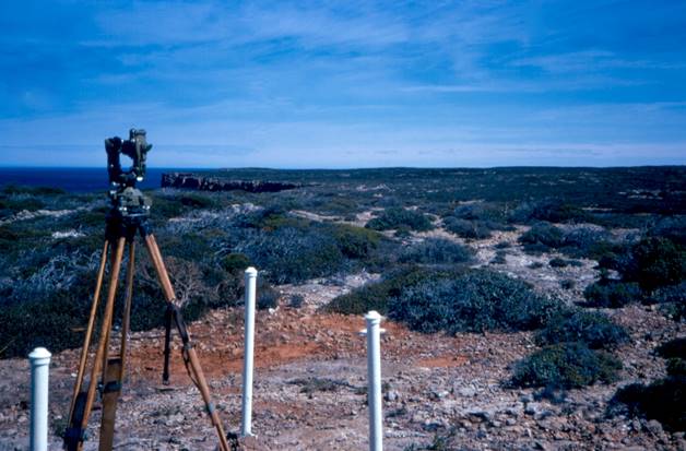
Aerodist station : 1966 Barkley Tablelands
3 Ground Marking Operations 1966 - Overview.
In 1966 Aerodist ground marking operations began in the New South Wales region around Hay and continued in the Queensland region bounded by Bundaberg, Charleville and Clermont. As part of these marking operations 26 Aerodist stations were established.
By July of that year Rom Vassil and his party were working their way along the Flinders Hwy in Queensland from Charters Towers to Cloncurry. Their program to establish 24 stations is demarcated as the first undertaken by a separate, from Aerodist measuring, ground marking operation.
At the end of this program at Mt Isa, Rom handed over to John Madden. John was to continue the now fully autonomous ground marking operation and establish stations in the eastern Northern Territory. This program saw the establishment of 41 stations in an area between the Queensland/Northern Territory border west to the Stuart Highway and the Barkley Highway north to Mataranka/the Roper River. In addition four stations were established on the islands of the Sir Edward Pellew Group in the Gulf of Carpentaria.
As Reg Ford (1979) documented in his report on the Geodetic Survey of Australia (Chapter 16) the geodetic party assisted in the Northern Territory work and Reg also lists those geodetic personnel involved. The geodetic party established some 24 stations as well as clearing others for future Aerodist measuring operations. John Madden’s party also included senior surveyor Ted Seton and had helicopter support which was used to establish 11 stations in addition to four stations in the Pellew Group. For expediency the stations in the Pellew Group used the combined resources of both the ground marking and geodetic parties.
The helicopter, a Bell 47G-3B-1 (VH-AHH), was chartered from Sydney based Rotorwork Pty Ltd. During the charter it operated from Daly Waters, Nutwood Downs Station, Borroloola, Batten Creek (at its confluence with the McArthur River; this location was the helicopter base for establishing the four Pellew Group stations), Snake Lagoon, Pungalina Station (no longer exists), and Running Creek.
3.1 Ground Marking Personnel – 1966.
(as are known for the north Queensland and Northern Territory work)
|
Rom Vassil |
Party Leader for the Queensland work |
|
John Madden |
Party Leader for the Northern Territory work |
|
|
|
|
Dick Carter |
|
|
Richard Cavanagh |
|
|
Col Cheary |
|
|
Terry Douglas |
|
|
Neil Fenton |
|
|
Russ Gray |
|
|
Alan Mould |
|
|
Murray Porteous |
|
3.2 Ground Marking Vehicles – 1966.
(as are known for the north Queensland and Northern Territory work)
|
ZSU 047 |
International C1300 |
|
ZSU 133 |
International C1300 |
|
ZSU 136 |
International C1300 |
|
ZSU 183 |
International C1300 |
|
ZIS 612 |
Commer Van |
3.3 Ground Marking Operations 1966 - Summary.
Ninety-five stations were established in 1966; 26 by semi-autonomous Aerodist parties and 69 by ground marking parties with geodetic party assistance in the NT, of which 15 stations utilised helicopter access.
4 Ground Marking Operations 1967 - Overview.
The 1967 ground marking party established stations in the north-west of the Northern Territory from Tennant Creek and the Stuart Highway west to the Northern Territory/Western Australia border and north to the Victoria Highway.
Their work was assisted by a helicopter, a Fairchild-Hiller FH-1100 (VH-UTZ), chartered from Sydney based Helicopter Utilities. During the charter it operated from bases at Hooker Creek (Lajamanu), Wave Hill (Kalkarindji), Victoria River Downs and Timber Creek in the Northern Territory and from Kununurra in Western Australia. The pilots included George Treatt with engineers including Graham Tadgell and Roy Rayner.
For the first time private sector survey contractors were used to establish Aerodist control stations. Thirty-eight stations were emplaced in Queensland in an area bounded by the Flinders Highway to the north to the Warrego Highway in the south and Emerald in the east to the Queensland border with both South Australia and the Northern Territory in the west.
4.1 Ground Marking Personnel – 1967.
(as are known)
|
John Madden |
Party Leader (for part of the field season) |
|
Syd Kirkby |
Party Leader (for part of the field season) |
|
Dave Thompson |
Party Leader (for part of the field season) |
|
|
|
|
John Doherty |
|
|
Terry Douglas |
|
|
Neil Fenton |
|
|
Alan Mould |
|
|
John Nolton |
|
|
Lawrie O'Connor |
|
|
Murray Porteous |
|
|
Len Tyzack |
|
4.2 Ground Marking Vehicles – 1967.
(as are known)
|
ZSU 201 |
Bedford |
|
ZSU 039 |
International C1300 |
|
ZSU 089 |
International C1300 |
|
ZSU 135 |
International C1300 |
4.3 Ground Marking Operations 1967 - Summary.
Nineteen stations were established by ground marking in 1967 of which 12 stations utilised helicopter access. In addition another 38 Aerodist stations were established under contract totalling 57 stations for the year.
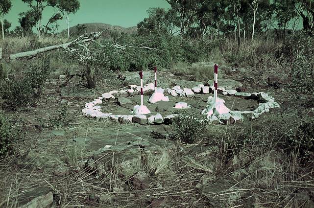
Aerodist station : 1967 Northern Territory
5 Ground Marking Operations 1968-1969.
August Jenny's papers Groundmarking for Aerodist - 1968 and Groundmarking for Aerodist - 1969 have detailed the Ground Marking for Aerodist that occurred in 1968 and 1969.
In summary, in 1968 thirty-one stations mainly in the Northern Territory were established by the Aerodist ground marking party. Helicopters were used by the party to access twenty-seven of these stations. The helicopters operated from bases at NM/G/135, NM/G/142, Hooker Creek, Tanami Bore, Refrigerator Bore, Mt Doreen, Anningie, Willowra, Ringwood and Hay River.
After working in the Northern Territory, the Aerodist ground marking party established a further four stations by vehicle around Longreach in Queensland and three stations in New South Wales to the west of Bourke.
For 1969 the Aerodist ground marking party established forty-one stations in the Northern Territory and Western Australia. A helicopter was used for access to all of these stations. It operated from bases at Andado, Ringwood, Balgo, No 51 Well on the Canning Stock Route, Christmas Creek, Swindell Field, Kidson No 1 Drill Site, NM/F/145, Giles, Bench Mark NTS76/78, Ayers Rock and Areyonga.
During this 1968-69 work 79 Aerodist stations were established.
6 Private Sector Survey Contractors Ground Marking Operations 1968-1969.
During 1968 and 1969 further private sector contract ground marking was also undertaken. In 1968, twelve stations were established along the Plenty Highway between the Northern Territory/Queensland border and the Stuart Highway, followed in 1969 by a further 9 stations. These 9 stations extended the 1968 work up to the Barkley Highway in the Northern Territory and added stations in the gap between the 1967 and 1968 contract work in western Queensland.
The result of the 1967-1969 contract work was 59 stations in a block bounded by Charters Towers and Charleville in Queensland to Tennant Creek and Alice Springs in the Northern Territory.
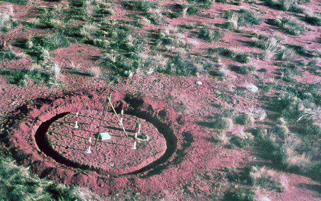
Aerodist station : 1969 Simpson Desert
7 Ground Marking Operations 1970 - Overview.
The establishment of Aerodist control stations was planned for a vast (almost half) area of Western Australia during 1970. Specifically the Nullarbor Plain, Great Victoria Desert, Little Sandy Desert, Gibson Desert and the southern fringes of the Great Sandy Desert. Given the remoteness of the region access to most stations was by helicopter.
Prior to the Western Australian program commencing reconnaissance for second order traversing was undertaken from 10-18 March in southern New South Wales and northern Victoria around Swan Hill, Balranald, Ivanhoe, Woomelang and Charlton. The Party Leader was Reg Ford with Simon Cowling, Les Dawson and Dave Abreu in Forward Control Landrovers ZSM 666 and ZSM 667 which had a series of mechanical problems during the trip. (Paul Wise recalled that one of his first tasks in 1971 was second order Tellurometer traversing in this same area using the access diagrams drawn by Reg Ford).
The main field party left Melbourne in April led by Reg Ford. Enroute Kalgoorlie stations NM/F/554, 555, 556, 557, & 558 were established on the Nullarbor north of the Eyre Highway.
At Kalgoorlie Bill Witzand took over the party and the helicopter contract started around 6 May finishing at No. 24 Well on the Canning Stock Route on 17 August. The helicopter contractor was Jayrow Helicopters Pty Ltd from Moorabbin, Victoria who provided the two Hughes 500 369HS helicopters (VH-BLN & VH-SFS). It is believed that Phil Cooke in VH-BLN with engineer Eckhart Schneider were in the field until the end of June. Vic Barkell in VH-SFS with engineer Dave King saw out the remainder of the contract period.
The helicopters used the following locations as bases :
|
Kalgoorlie |
|
NMF 61 (along the Trans-Continental Railway east of Kitchener) |
|
Laverton |
|
Mulga Hill (approx. halfway between Laverton & Neale Junction) |
|
Neale Junction |
|
R 199 (200km north of Rawlinna on the then road to Warburton) |
|
NMF 263 (on the then road from Neale Junction to Emu) |
|
Warburton Mission |
|
Tugaila Rockholes (approx. halfway between Laverton & Warburton) |
|
Carnegie Homestead |
|
MacNamara Well east of Wiluna |
|
Balfour Downs Homestead |
|
Canning Stock Route between Nos 23 & 24 Well |
The field party then drove across to Alice Springs via Sandy Blight Junction. After servicing the vehicles the party then carried out five second order Tellurometer connections as described in the following table.
|
Station connected |
Higher Order station |
Vicinity |
|
NM/G/306 |
MORDRED (NTS 331) |
Santa Teresa (85km south-west of Alice Springs) |
|
NM/G/296 |
SINGLETON (NM/G/128) |
115km west of Yuendumu |
|
NM/G/280 |
TOPS (NTS 063) |
80km north-east of Ti-Tree |
|
NM/G/281 |
NM/G/5 |
20km south of Banka Banka |
|
CHAPPLE NTS 360 |
HARRIS NTS 051 |
Narwietooma (150km north-west of Alice Springs) |
On 21 September 1970 Simon Cowling with Noel Goldsworthy and Alan Vicchi left the main party and in Landrover ZSM 916 and Bedford ZSU 311 headed to Queensland to visit and restore various existing ground marks. They also carried out several third order levelling connections in the Springsure area before proceeding to Charleville to join up with the main party who had by now arrived from the Northern Territory.
The party then split into two groups. Simon Cowling’s sub-party proceeded through Wanaaring to Bourke, mainly doing levelling connections and also levelling the Windorah aerodrome runways for use as a datum for the Adastra airborne profiling contract.
Dave Abreu recalled being in Bill Witzand’s sub-party. This party travelled through mainly western Queensland clearing trig stations in preparation for future Aerodist measuring operations and levelling airstrip runways at Bedourie, Boulia, Eromanga, Thargomindah, Orientos and Innaminka also for use as datums for airborne profiling. A further seven new Aerodist stations were also established.
By the end of November it had become too hot for accurate levelling so the party returned to Melbourne on 1 December.
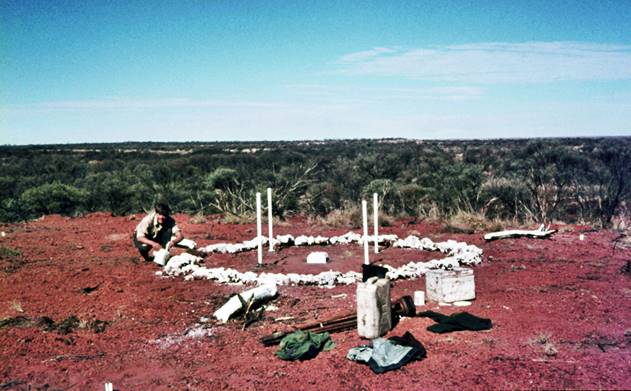
Aerodist station : 1970 Western Australia
7.1 Ground Marking Personnel – 1970.
Party Leaders :
|
Reg Ford |
Party Leader Melbourne to Kalgoorlie – Party left in late April and Reg flew back to Melbourne around 6 May |
|
Bill Witzand |
Took over as Party Leader from Reg Ford in Kalgoorlie and apart from period 24 June to 3 August was in the field for the season |
|
Simon Cowling |
Deputy Party Leader from 6 May to 1 December |
|
Graham McNamara |
Took over as Party Leader from Bill Witzand from 24 June to 3 August |
Technical and other staff :
|
Paul McCormack |
Left with the party in April and returned to Melbourne around 6 June |
|
Bob Goldsworthy |
Left with the party in April returning to Melbourne 24 June & then re-joined the party in Alice Springs on 28 August |
|
Adrian Wright |
Replaced Bob Goldsworthy from 24 June to 6 August |
|
Eddie Ainscow |
Left with the party in April returning to Melbourne around 3 July after a chainsaw accident on 19 June & re-joined the party in Alice Springs on 28 August |
|
Dave Abreu |
Brief return to Melbourne in August |
|
Les Dawson |
In the field for the season |
|
Noel Goldsworthy |
In the field for the season |
|
Peter Blake |
In the field for the season |
|
Roy Turner |
In the field for the season |
|
Ted Graham |
In the field for the season |
|
Alan Vicchi |
Left with the party in April resigning at Cunamulla at the end of October |
|
Jim Steed |
Cadet Surveyor – joined party at Charleville for rest of the season |
7.2 Ground Marking Vehicles – 1970.
|
Bedford ZSU 311 (Driver : Ted Graham) |
|
LRover Series 2A ZSM 916 |
|
LRover Series 2A ZSM 917 |
|
LRover Series 2A ZSM 918 |
|
LRover Series 2A ZSM 919 |
|
Forward Control LRover ZSM 666 |
|
Bedford ZSU 262 (Driver : Dave Abreu) |
|
Note : Near the end of the ground marking work in WA, on 6 August at Balfour Downs Bedford ZSU 262 was in such poor overall condition that it was driven to Kalgoorlie by Dave Abreu and Adrian Wright. It was transported back to Adelaide by train accompanied by Adrian Wright. |
|
Forward Control LRover ZSM 667 |
|
Note : Around 13 July FCLR ZSM 667 had axle problems at Warburton Mission. It may have been decommissioned in WA as it is not on the list of vehicles repaired after the party arrived at Alice Springs. In any event it was replaced by International C1300 ZSU 236 driven to Alice Springs from Melbourne by Bob Goldsworthy & Eddie Ainscow. |
|
International C1300 ZSU 236 |
7.3 Ground Marking Operations 1970 - Summary.
Fifty-two (52) stations were established by ground marking in 1970 in Western Australia of which 46 stations utilised helicopter access. In addition elements of the Aerodist measuring party established two additional stations in the Northern Territory by helicopter from a base at Tennant Creek. Ground marking also established seven stations by vehicle in western New South Wales and Queensland.
8 Aerodist Ground Marking 1971 - 1974.
At the end of the 1970 field season the majority of ground marking for Aerodist had been completed and the separate ground marking program was no longer required. Further ground marking, totalling 76 stations was now easily undertaken in conjunction with Aerodist measuring operations. Access to the station sites was by vehicle, helicopter, locally chartered fishing vessels and Department of Shipping and Transport Navaids vessels. As depicted in Annexure A , these later ground marking operations were undertaken as follows : in 1971 (southern New South Wales around Dubbo, in Western Australia's Kimberley region and in the Coral Sea offshore from Cairns); in 1972 (Western Australia near Caiguna and east and west of Kalgoorlie); in 1973 (southern New South Wales and northern Victoria and in Western Australia offshore from Onslow and Esperance) and in 1974 (Kimberley region of Western Australia).
Aerodist station : 1972 Western Australia
In 1971 a major survey was undertaken to use Aerodist to position selected island and reefs of the central and northern Coral Sea and Torres Strait. The southern area of the Coral Sea was first surveyed with Aerodist in 1966. The Royal Australian Navy (RAN) survey vessel HMAS Paluma, supplemented by locally hired boats, was used to transport the remote parties between the inshore islands in the region between Bundaberg and Proserpine. Some of these islands had existing Royal Australian Navy survey points which were upgraded during Nat Map's occupation. In 1967, HMAS Teal a naval coastal mine‑sweeper, transported a National Mapping reconnaissance and ground marking party around the central Barrier Reef. This party also established local survey control by running Tellurometer traverses from the Aerodist stations and fixing stations on various features including shipwrecks and shifting sand cays. Offshore stations up to 500km off the coast were established and connected by Aerodist to the existing network in 1969 with several lines over 300km in length measured. The RAN again supplied offshore transport using the mine‑sweepers, HMAS Hawk and HMAS Gull. The 1971 Coral Sea survey was supported by two Navaids vessels, the MV Cape Pillar and the MV Cape Don which changed over with the MV Cape Moreton. Chartered from the Department of Supply and Transport all three Navaids vessels were equipped with LARC (Light Amphibious Resupply Cargo) vehicles which facilitated landing at the various islets and reefs. The shore‑based remote party that operated along the eastern side of the Cape York Peninsula was transported from base camps by a chartered helicopter because of the difficult access to the geodetic stations. During the 1971 survey two of the longest lines ever measured by Aerodist exceeded 373km.
In the offshore area of Port Hedland, Western Australia, in 1973 eight points were fixed by Aerodist trilateration. As the nature of the offshore features did not permit any ground mark to be placed, a total of some twenty-four Aerodist lines were measured to intersect four photogrammetric points in the region of Tryal Rocks and a photogrammetric point on Geographe Shoals, North Turtle Island, Little Turtle Island and Bedout Island.
9 Aerodist Ground Marking’s legacy.
The Aerodist system provided horizontal control for just over half of mainland Australia and extended the control survey network to various reefs and islands. Some 3,000 lines were adjusted in 29 block adjustments that coordinated the positions of 480 survey control stations. This achievement was significantly assisted by the prior establishment of 219 stations by the discrete ground marking program as detailed above. Access to 141 (65%) of the 219 stations was by helicopter.
The Ground Marking program established nearly half of the total of mainland Australian stations. In addition the contract work amounted to 13%.
The following Annexure and zoomable maps provide a diagrammatic summary.
Annexure A : Aerodist control station establishment from 1963 to 1974 depicted by annual progress.
Map A : the 1971 map of the National Geodetic Survey (NM/MISC/71/018) has been updated to reflect the complete 1963-74 Aerodist program and overlaid with the locations of established Aerodist control stations. Private sector survey contract stations are shown in green, discrete ground marking stations in red and Aerodist measuring party (plus a few stations established by other Nat Map parties) stations in blue. The two State survey stations are shown in black. In the offshore area of Port Hedland, Western Australia, the twenty-four Aerodist trilateration lines are shown.
Map B : the 1980 map showing the boundaries of the Aerodist Block Adjustments (NMP/80/054) overlaid with the locations of all Aerodist control stations. The relationship of a station to its block is readily seen.
Map C : the first and lower order geodetic networks of Australia integrated with a topographic base map. This composite map is then overlaid with the locations of the established Aerodist control stations and their numbers or in the Great Barrier Reef area their names. To keep the map at a high resolution but small file size some station information has been reduced to just the station number.
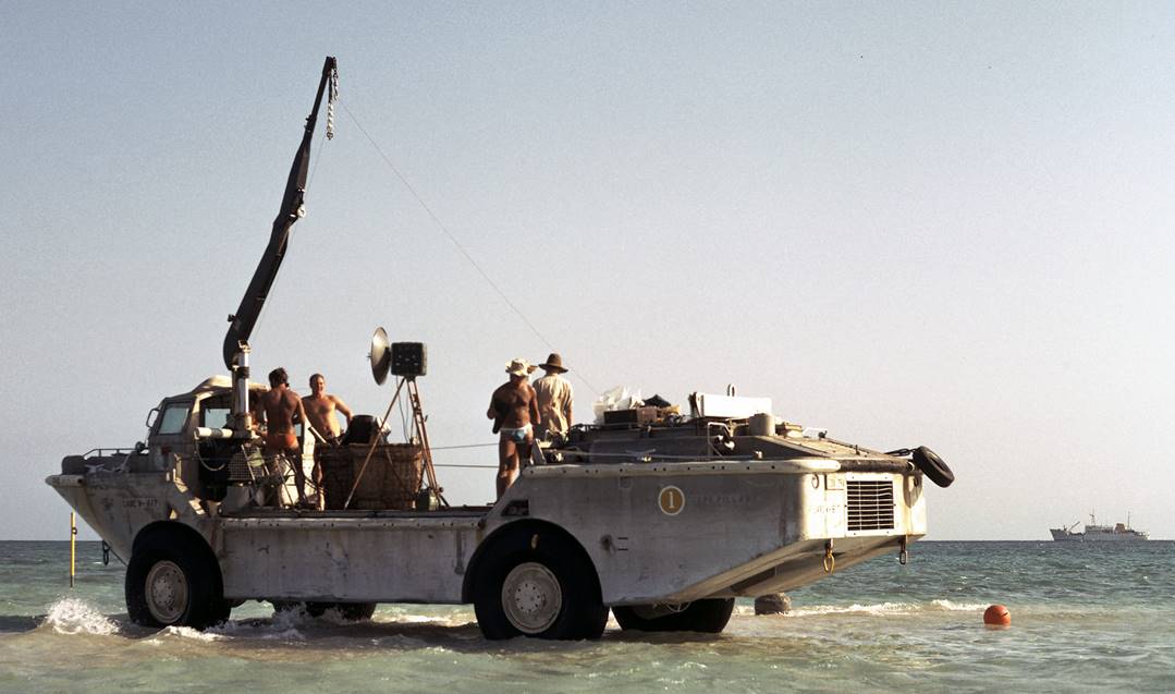
Aerodist station : 1971 Coral Sea (Aerodist remote equipment on LARC over the ground mark on the sand cay with the Cape Pillar in the background)
Acknowledgements
The information has come from existing records and the recollections of Laurie McLean, Carl McMaster, Dave Abreu, Lawrie O’Connor, Simon Cowling, Rom Vassil, Murray Porteous, and Syd Kirkby. Their contributions are greatly appreciated.
Paul Wise
March 2014
References
Ford, RA (1979) The Division of National Mapping’s part in the Geodetic Survey of Australia, The Australian Surveyor, vol. 29, no. 6, pp. 375-427; vol. 29, no. 7, pp. 465-536; vol. 29, no. 8, pp. 581-638. Available at http://xnatmap.org/adnm/ops/prog/rafgeosvy/16.htm
Lines, JD (1966) Aerodist in Australia, 1963-64, The Australian Surveyor, June, 1966, pp.733-751. Available at http://xnatmap.org/adnm/ops/prog/aerodist6364.htm
McLean, LW (2013) Aircraft Support for National Mapping Field Operations 1950s-1990s. Available at http://xnatmap.org/viat/docs/04%20adist.htm
McLean, LW (2013) Personal communications November 2013 – February 2014.
McMaster, CG (1980) Division of National Mapping Aerodist Program, Technical Report 27.
Turner, LG; Kirkby, SL; Veenstra, C; Ely, JH and others (1962-1968), Aerodist Log Book, an unpublished manuscript of Aerodist equipment testing and operations from January 1962 to August 1968, prepared by officers of the Division of National Mapping, Melbourne.
University of New South Wales (1967), Control for Mapping by Geodetic and Photogrammetric Methods (Ed. P. V. Angus-Leppan), Report on Colloquium held at the University Of New South Wales 22-24 May, 1967, pp.203, accessed at : http://www.gmat.unsw.edu.au/about/school_pubs/pdfmono/mono00.pdf