|
Aerodist control station establishment from 1963 to 1974 depicted by annual progress – Annexure A |
||
|
Year |
Description |
Location |
|
1963 |
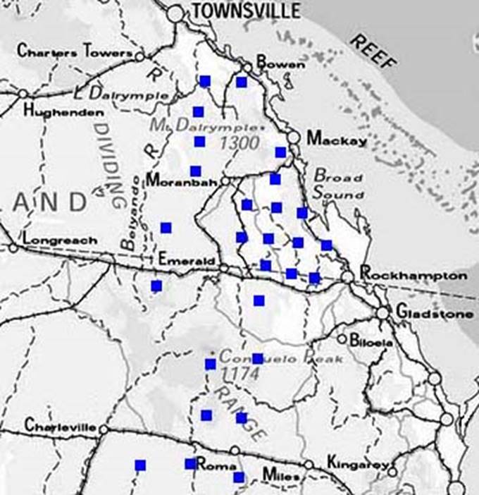
Twenty-seven stations in Queensland were the first established by the Aerodist measuring party. By the end of 1969 most of these stations had been upgraded to revised Aerodist ground marking specifications. |
|
|
|
Total stations established at end of 1963: 27 |
|
|
1964 |
A further fifteen stations were established by the Aerodist measuring party. Also, an existing NSW survey station was adopted for Aerodist use. |
|
|
|
Total stations established at end of 1964: 42 |
|
|
1965 |
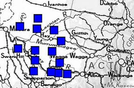
Eight stations in New South Wales and one in Queensland were established. This year saw the first use of a semi-autonomous marking party operating separately from Aerodist measuring operations. The use of this marking party was the genesis of a discrete ground marking program that used dedicated parties in future years. |
|
|
|
||
|
|
Total stations established at end of 1965: 51 |
|
|
1966 |
Fourteen stations were established in New South Wales and a furher fourteen were established in Queensland using dedicated ground marking parties that operated separately from Aerodist measuring operations. |
|
|
|
||
|
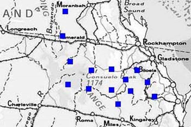
A block of twenty-four stations in Queensland were the first to be established under a separate ground marking program using a dedicated ground marking party. |
|
|
|
|
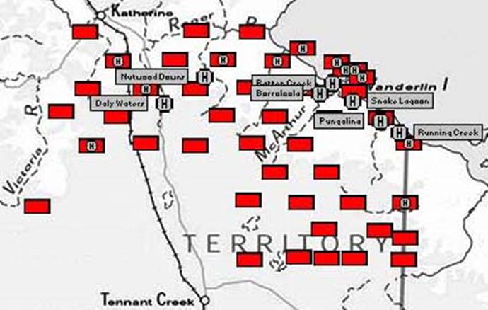
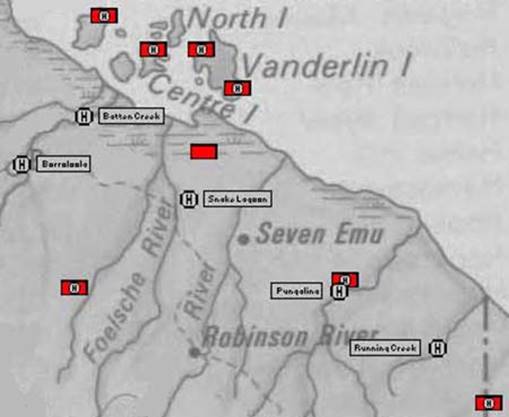
Forty-five stations were established in the Northern Territory by a dedicated ground marking party and by assigned geodetic survey parties. Helicopter support was used to access fifteen of these stations; operating from bases at Daly Waters, Nutwood Downs, Borroloola, Batten Creek, Snake Lagoon, Pungalina and Running Creek. Geodetic survey parties under Reg Ford and Peter Langhorne were assigned to establish twenty-four of the forty-five stations. |
Enlargement to show area east of Borroloola |
|
|
Total stations established at end of 1966: 148 |
|
|
1967 |
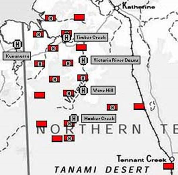
A dedicated Aerodist ground marking party established nineteen stations in the Northern Territory. A helicopter was used to access twelve of these stations. It operated from bases at Hooker Creek, Wave Hill, Victoria River Downs and Timber Creek in the Northern Territory and from Kununurra in Western Australia. |
|
|
|
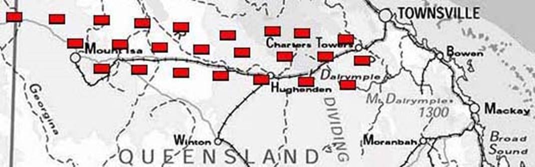
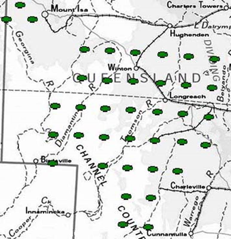
Private sector survey contractors were used to establish thirty-eight stations in far western Queensland. |
|
|
|
Total stations established at end of 1967: 205 |
|
|
1968 |
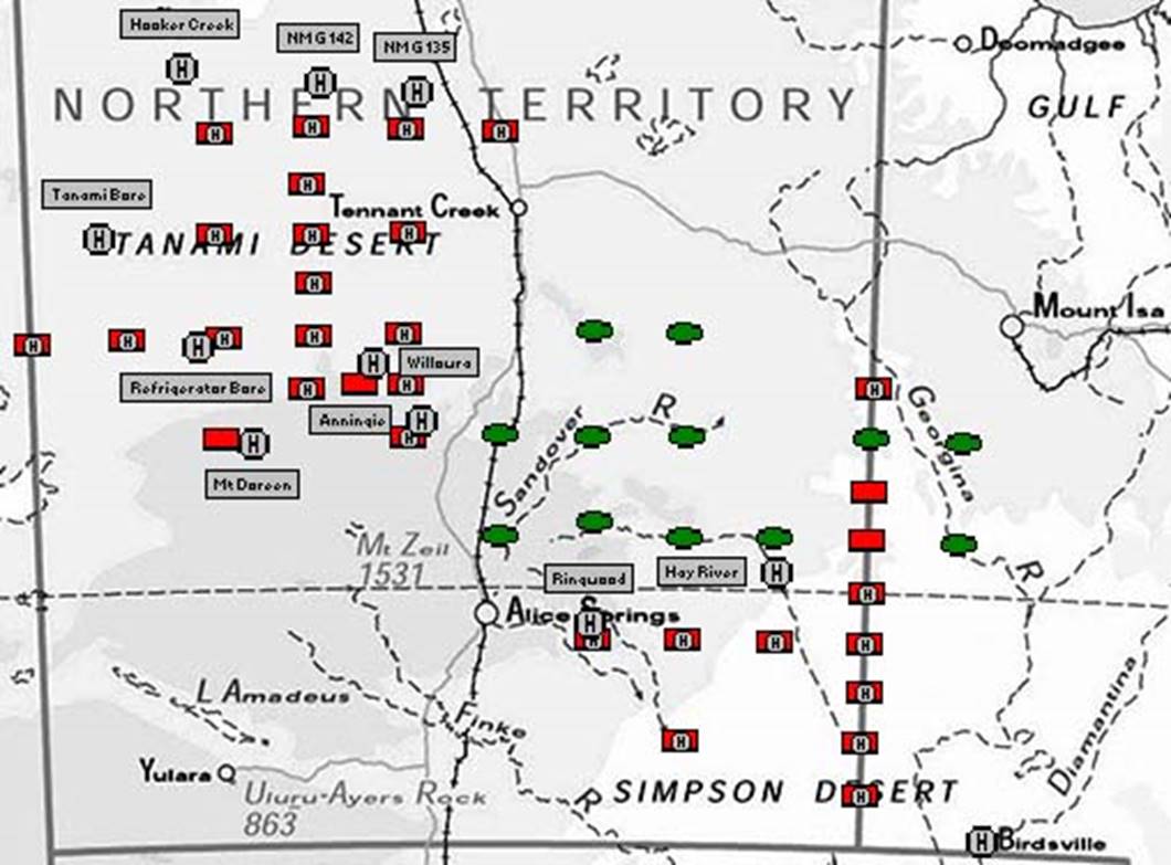
Thirty-one stations mainly in the Northern Territory were established by the Aerodist ground marking party. These stations are depicted in red on the diagram. Helicopters were used by the party to access twenty-seven of these stations. The helicopters operated from bases at NM/G/135, NM/G/142, Hooker Creek, Tanami Bore, Refrigerator Bore, Mt Doreen, Anningie, Willowra, Ringwood and Hay River.
A further twelve stations were established in the Northern Territory and Queensland by private sector survey contractors. These stations are depicted in green on the diagram. |
|
|
|
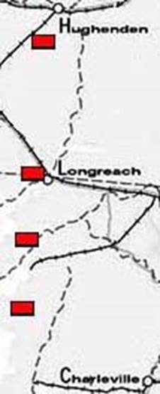
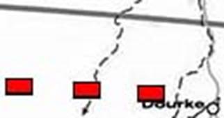
After working in the Northern Territory, the Aerodist ground marking party established a further four stations around Longreach in Queensland and three stations in New South Wales to the west of Bourke. |
|
|
|
||
|
|
Total stations established at end of 1968: 255 |
|
|
1969 |
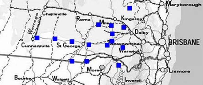
Nine stations were established by private sector survey contractors in central and western Queensland and in the Northern Territory. This was the last use of private sector survey contractors for Aerodist station establishment. |
|
|
|
|
|
|
|
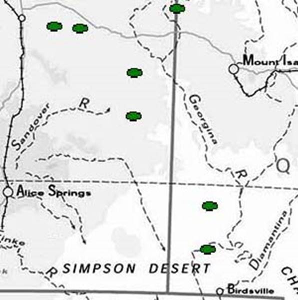
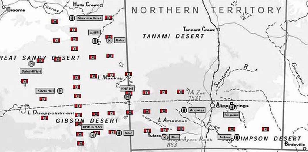
The Aerodist ground marking party established forty-one stations in the Northern Territory and Western Australia. A helicopter was used for access to all of these stations. It operated from bases at Andado, Ringwood, Balgo, No 51 Well on the Canning Stock Route, Christmas Creek, Swindell Field, Kidson No 1 Drill Site, NM/F/145, Giles, Bench Mark NTS76/78, Ayers Rock and Areyonga. |
|
|
|
Total stations established at end of 1969: 305 |
|
|
1970 |
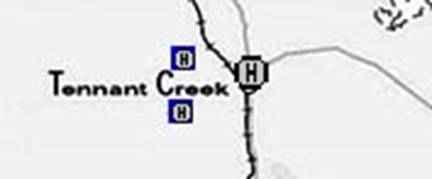
Aerodist measuring party elements established two additional stations by helicopter from a base at Tennant Creek. |
|
|
|
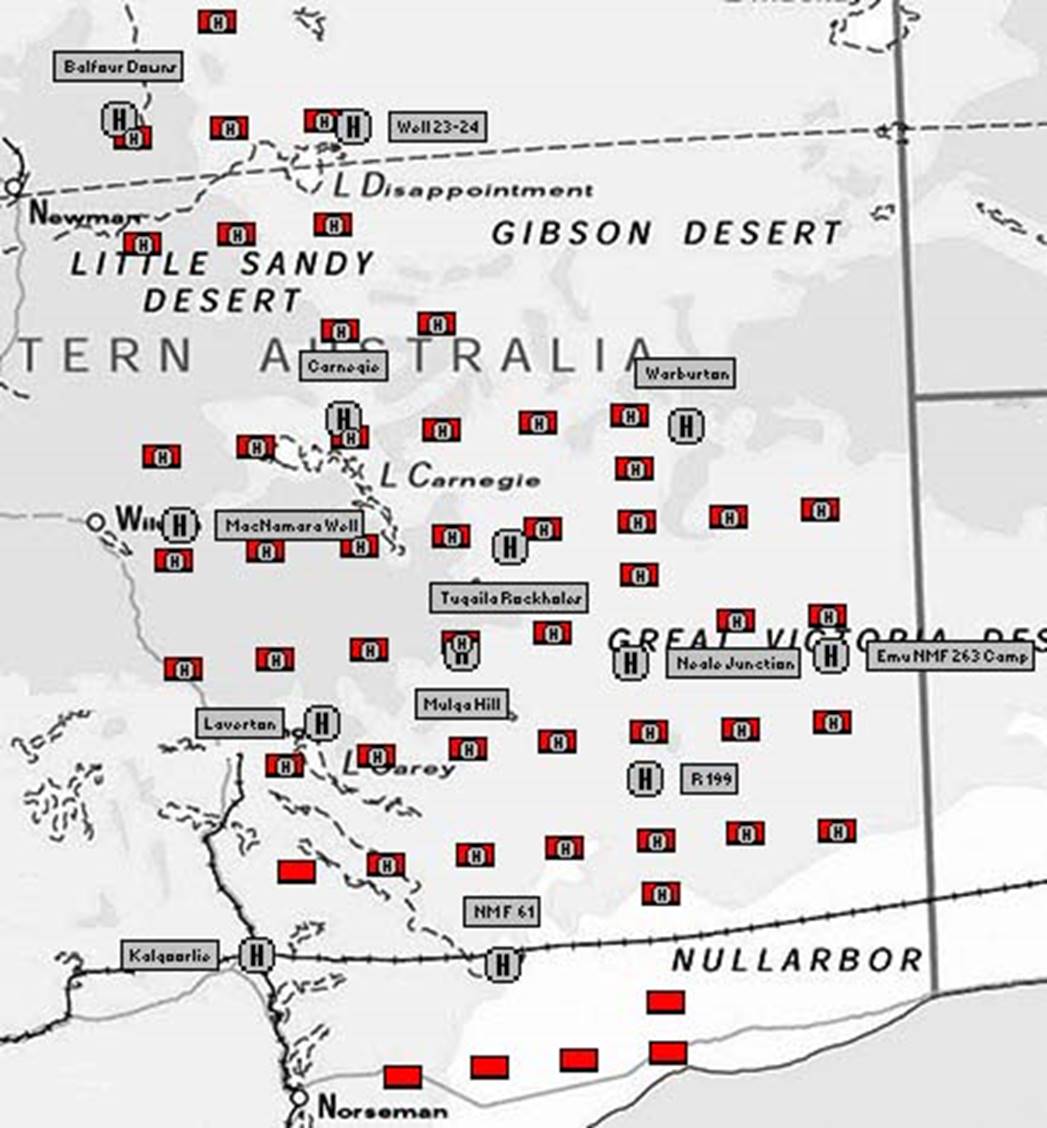
Fifty-two stations were established in Western Australia by the last dedicated ground marking party. A helicopter was used to access forty-six of these stations from bases at Kalgoorlie, NM/F/61, R199 (200km north of Rawlinna), Neale Junction, NM/F/263, Mulga Hill (about halfway between Neale Junction and Laverton), Laverton, Tugaila Rockholes (about halfway between Laverton and Warburton), MacNamara Well (east of Wiluna), Warburton Mission, Carnegie, Balfour Downs and from a camp between No 23 Well and No 24 Well on the Canning Stock Route. |
|
|
1970 |
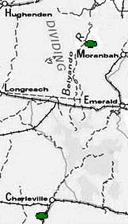
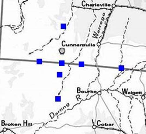
Seven stations in western New South Wales and Queensland were established by ground marking parties. Also, an existing Queensland survey station was adopted for Aerodist use.
|
|
|
|
Total stations established at end of 1970: 366 |
|
|
1971 |
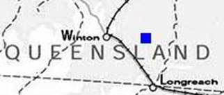
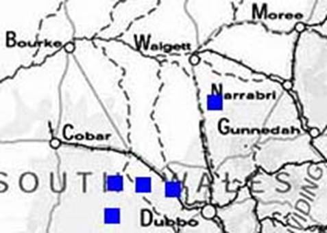
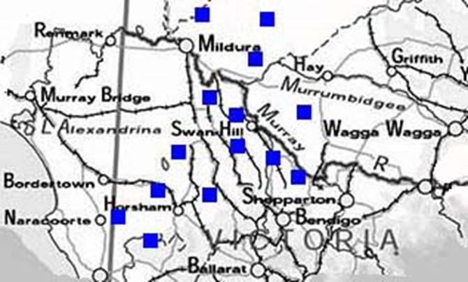
An additional five stations were established by elements of the Aerodist measuring party around Dubbo in central New South Wales. |
|
|
|
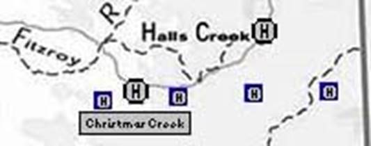
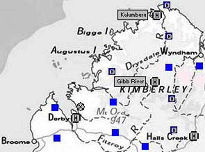
Aerodist measuring party elements also established an additional four stations in the south-east Kimberley region of Western Australia. Access to these stations was by helicopter from bases at Halls Creek and Christmas Creek. |
|
|
|
Total stations established at end of 1971: 375 |
|
|
1972 |
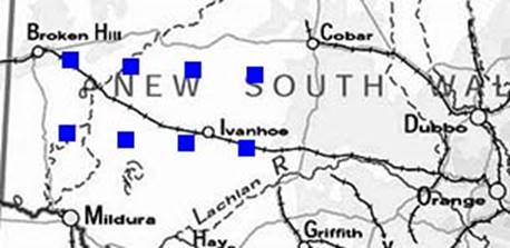
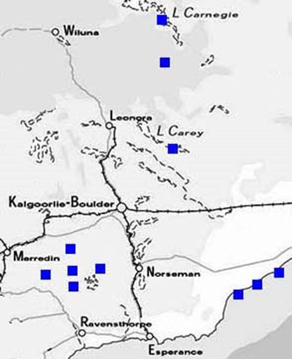
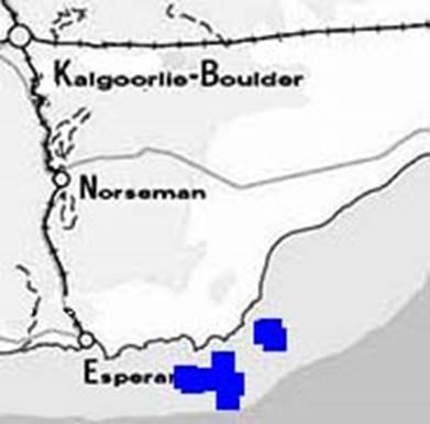
Eight additional stations were established in southern Western Australia by the Aerodist measuring party. These stations were on the coast to the south-west of Caiguna and also to the west of Kalgoorlie. A further three stations were established to the north-east of Kalgoorlie by a party led by Bob Goldsworthy. |
|
|
|
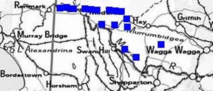
Sixteen stations were established in south-western New South Wales by a Canberra-based field party for co-ordination by a new helicopter-borne system. However, the technology could not be deployed successfully. The stations were cleared and measured by the Aerodist party in 1973. |
|
|
|
Total stations established at end of 1972: 402 |
|
|
1973 |
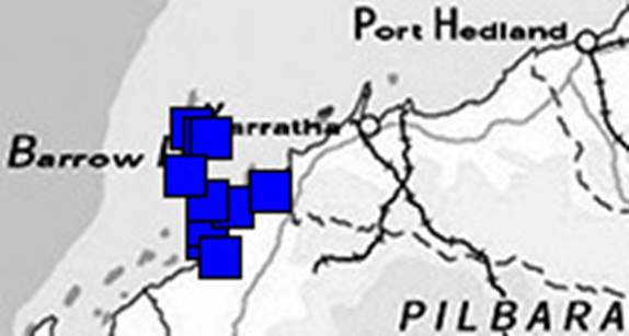
Ten stations established by the Aerodist measuring party to co-ordinate the positions of Barrow Island and Montebello Islands off Western Australia. |
|
|
|
Five stations established by the Aerodist measuring party to co-ordinate the positions of eastern islands in the Archipelago of the Recherche off Western Australia. |
|
|
|
Fourteen stations established by the Aerodist measuring party in southern New South Wales and eastern Victoria. |
|
|
|
Total stations established at end of 1973: 431 |
|
|
1974 |
The Aerodist measuring party established twelve stations in the Kimberley region of Western Australia. Helicopters were used from bases at Halls Creek, Derby, Gibb River and Kalumburu to access five of these stations. |
|
|
|
|
|
|
|
Total stations established at end of 1974: 443 |
|
|
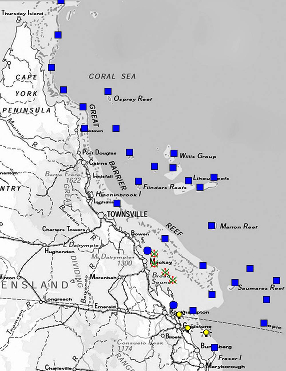
1966-1971 |
Thirty Aerodist stations were established on significant islands, reefs and cays in the Great Barrier Reef and the Coral Sea from Sandy Cape to Thursday Island in the Torres Strait and extending to the outermost reefs. Owing to local conditions on the reefs and cays some of these stations could not be established to full Aerodist ground marking specifications. In addition, seven extisting survey marks were later occupied; three being lighthouses and four being originally emplaced by the Naval Hydrographer. |
|
|
|
Total stations established between 1963 and 1974 for the Aerodist program: 473 |
|
|
Note : The above maps were derived with reference to :
- the 1970 map of the National Geodetic Survey (NM/MISC/71/018) – the base for Map A. After 1970 the map was not updated hence it does not accurately depict all later Aerodist activity.
- the 1980 map showing the boundaries of the Aerodist Block Adjustments (NMP/80/054) – the base map for Map B. Published in McMaster (1980) after the Aerodist program was complete this map has been used as the primary basis for the locations of the 480 Aerodist control stations.
- some one thousand National Mapping Council Station Summaries which had to be visually inspected to extract relevant information.
- In addition to the 473 control stations specifically established by National Mapping for Aerodist, two existing State survey stations, three lighthouses, four stations marked by the Naval Hydrographer, one Aerodist station marked by the Royal Australian Survey Corps, and two stations marked by MA Nicholas and Associates, were occupied during Aerodist line measuring operations. MA Nicholas had previously been a surveyor with National Mapping in the late 1950s-early 1960s. These twelve existing survey stations were subsequently included during the relevant block adjustment and new co-ordinates derived. The addition of these twelve survey stations brings the total number of control stations fixed (co-ordinated) by the Aerodist program to 485.
|
||