Field Operations 1956
The 1956 program was again to start early in February and was to be:
(i) Reconnaissance, Byre Peninsula to Gawler Range.
(ii) Beaconing and observing, Eyre Peninsula to Gawler Range.
(iii) Reconnaissance, Oodnadatta northward, as far as possible in the time available.
(iv) Beaconing and observing, William Creek northward, as far as possible in the time available.
As the Olympic Games were to be held in Melbourne during November the field party was promised that the season would end early enough for all to be back in Melbourne by the commencement date.
(i) and (ii) would proceed simultaneously; the Senior Surveyor would keep the reconnaissance ahead of the observing party and would supply access sketches direct to the party leader. (At this stage with the reconnaissance so little ahead of the beaconing and observing, it was necessary to make carbon copies of the access sketches for distribution to each observer and many hours were spent on this by the party leader).
R.A. Ford, Surveyor Grade 1 (acting) would be in charge of beaconing and observing when the Senior Surveyor proceeded ahead on reconnaissance.
A young graduate Surveyor, B.S. Maddy and a Field Assistant (Survey), G. Gracey, had joined National Mapping. A short training course in theodolite observing was organised in Melbourne. These two officers plus Field Assistants, W. Sticklan, A. Colvin and G. Cruickshanks attended.
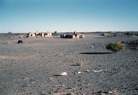
The field party moved to Eyre Peninsula in mid-February where station marking and cairn building instruction was given to the new staff by the Senior Surveyor before leaving to continue the reconnaissance. Field Assistant (Survey), S. Custance, then took charge of the beaconing party. Beaconing was completed by the first week of March at Mt Hope, one of the more southerly stations of the chain.
Senior Surveyor, H.A. Johnson, returned from his reconnaissance and R.A. Ford arrived from Melbourne both joining the field party at Mt Hope. Unfortunately at this time S. Custance had to be rushed to hospital with appendicitis. On discharge he returned to Melbourne and resigned soon after. Once again the party was left with only one experienced observer.
Observing started at Three Brothers with R. Ford instructing G. Gracey and W. Sticklan. Two separate set ups were made so that both could observe at the same time. This arrangement was to be continued for the first few stations after which they both would become independent observers. Individual instruction would then be given to B. Maddy by R. Ford in conjunction with his normal observing program.
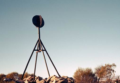
Oregon observing pegs were to be used on all stations where it was possible to insert them. Two types were carried, 3 inch x 3 inch x 18 inches for firm ground and 3 inch x 3 inch x 36 inches for sandridges; both had very long tapering points. A steel “cap” was carried to protect them while driving the pegs to ground level. A long handled heavy wooden mallet was used; this was later changed to a steel sledge hammer.
It was not easy to position the pegs, then drive them in and finish up with the tripod head both horizontal and over the station mark. Rocks beneath the surface tended to force the pegs to take a path other than planned. Holes were drilled in the top of the pegs to take the ferrules of the theodolite tripod. On rocky hills where it was not possible to use pegs, a good practice was to ensure the tripod setup was changed each night. If this was done and results of each night agreed it was almost certain the set up was not influencing the observations.
Three of the Second Order stations established by National Mapping in its first triangulation scheme, Tooligie, Three Brothers and South Block were incorporated in the new primary chain. It was found that the station mark at Tooligie had been removed; it was easily re-established as the reference marks were located. The old South Australian stations Darke Peak and Caralue Bluff which had been used by National Mapping in 1951 as third order points for Bureau of Mineral Resources purposes were also incorporated in the primary chain along with Army second order station, Mt Neild.
There were numerous long lines in this scheme; consequently it was not easy for the new observers as heliographs and lights were essential on the more difficult sights. Some of the longer distances were:
Wedge - South Block |
67.4 miles |
Wedge - Caralue |
61.6 miles |
Wedge – Darke |
59.2 miles |
Nott - Caralue |
56.6 miles |
Wudinna - Darke |
47.1 miles |
Mt Wedge was hard to see at all times - there was much smoke haze; it was autumn now and the farmers were “burning-off”. By the last week of April the south to north section of the scheme from South Block to the Gawler Range had been completed; some seventeen stations in all plus the three third order points established for the Bureau of Mineral Resources.
As the survey party had no inter-party radio communication, a program of projected movements of all sub-parties was made out and carbon copies supplied to them. This was to ensure all were aware where each sub-party should be operating at a given time. Delays often occurred but luckily the theodolite helped keep a check on this, the observing screen being clearly visible in the evening when a station was occupied.
The Senior Surveyor now left for Oodnadatta to continue his reconnaissance, R. Ford taking over the observing party to complete the west to east section of the triangulation chain which was to connect with the Army primary chain on the line Tent Hill South - Mt Whyalla. At this time a three ton Commer four wheel drive truck which had been on order for some time, arrived from Melbourne. This type of vehicle was to prove of great value in the years ahead.
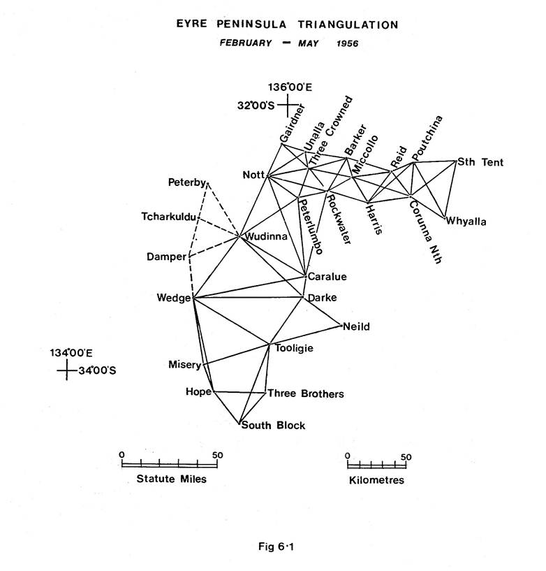
To complete the observing to Tent Hill South - Mt Whyalla a further eight stations were occupied and by mid May the task was completed. Just at the right time too, as winter had now arrived, it was cold and wet with many slippery and boggy tracks. Figure 6.1 shows the triangulation diagram.
R. Ford with three Field Assistants, one Land Rover and one Morris returned to Melbourne to collect beaconing material, the remainder of the party joined H.A. Johnson at William Creek to continue beaconing and observing northward.
Observing and beaconing progressed steadily northward from William Creek towards Oodnadatta. R. Ford and the party from Melbourne plus R. James, Field Assistant ex Geodimeter Party, arrived and joined the observing team south of Oodnadatta at Mt Kingston North. Observing was completed to the Oodnadatta area by the end of June.
By Tuesday, 3 July, all National Mapping personnel had assembled in Oodnadatta - this included the Geodimeter party who arrived with considerable difficulty. The long low International panel van was a necessity to give the equipment a gentle ride but it was useless in rough country, particularly where short steep creek crossings were involved.
This meeting was necessary as National Mapping had been transferred from the Department of the Interior to the Department of National Development from 1 July 1956. All purchase and petrol books had to be replaced with those of the new Department and those of the Department of Interior returned to Melbourne. Henceforth our name was to be the “Division of National Mapping”.
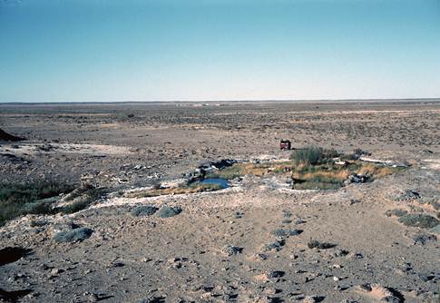
The Senior Surveyor now proceeded north to continue the reconnaissance, R. Ford again taking over the observing parties and commencing in the vicinity of Oodnadatta. After the first week heavy rain commenced necessitated a return to Oodnadatta; the annual picnic race meeting had just been held and many of the local residents were trapped in town. This time came in handy to measure a sub-base of ½ mile between two Commonwealth Railways bench marks, then by a single triangle carry a height value to O’Hallorans Hill station mark. Observations were also completed on O'Hallorans and one other hill while the tracks were drying.
H.A. Johnson who was now close to the SA-NT border, rang and advised that the rain had been heavier in the north and it would be impossible to move in that area for a while. In the meantime the party was to re-observe three hills in the William Creek area where triangular misclosures had indicated further observations were necessary. Mounts Anna, Margaret and Four Hills were re-observed, the new results improving the triangular closures enormously. This took one week; travelling was slow in the boggy conditions.
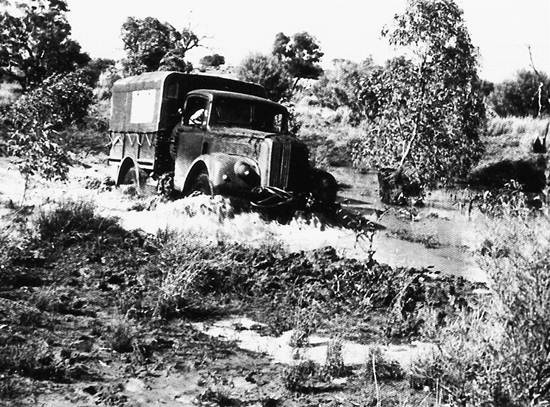
Figure 6.2: Morris 4x4 truck crossing the flooded ‘Hamilton’ northern SA, August 1956.
At about this time two field assistants resigned and returned to Melbourne, another pulled some muscles in his back on a very cold morning, and had to be evacuated in pain to Alice Springs Hospital. By now the country had dried out a little; the party commenced the beaconing trip which would take them to the NT-SA border; only Land Rovers and the Morris would be used, the Commer being left at the Police Station, it being too cumbersome for the wet conditions. The beaconing took about a fortnight, the roads being very wet at the start but they had become reasonable by the time beaconing was completed thus providing a safe return trip to Oodnadatta. Figure 6.2 show the Morris four wheel drive truck crossing the ‘Hamilton’, during this beaconing trip.
It was now August; with the sun getting warmer a prolific growth of wild flowers and blossom on the flowering shrubs and acacias appeared almost overnight. The country began to take on a “picture book” look, many of the flowers remaining for a considerable time.
One new Field Assistant, D. Hutton, arrived from Melbourne and the party was reorganised for observing. B. Maddy now commenced observing while R. Ford began training A. Colvin.
Observing was mostly to beacons in the late afternoon but a couple of lines were to points where the “lift” of refraction was necessary to make the stations intervisible thus lights were necessary. Heliographs were also used on some long lines. As the climbs were mostly very short it was possible to use only two man parties.
There was one happening of special interest during this spell of observing; the difference between the means of sets of observations with a Wild T3 theodolite (6 arcs, double pointing method) can normally be expected to be no more than about 1.5 seconds. One observer who had now completed about five months observing found he was suddenly getting from about 2 to 4 seconds between means of sets.
The instrument was examined and found to be very tight and obviously in need of lubricant. Two drops of oil carefully applied cured the problem, the theodolite then moving smoothly in its normal manner. Observing was recommenced and the spreads in the sets were back to normal. It was noticeable that the mean of a pair of these widely spaced means of sets was close to the mean of all sets; which indicated our theodolite drill, if adhered to, should eliminate any small amount of “drag”.
At this time the theodolite drill was:
· Commence on Face Left, swing right and read each station in turn.
· Change to Face Right on last station, swing left and read each station in turn, the last station being the RO.
All arcs in the first set were done in this manner, i.e. no matter which face the instrument was on, the first movement from the RO was “swing right”.
The drill for the second set was exactly the opposite:
· Commence on Face Right, swing left and read each station in turn.
· Change to Face Left, swing right and read each station in turn, the last station being the RO.
This problem of the theodolite’s tight vertical axis was reported to the Senior Surveyor at our next meeting and discussed at length. All observers, and in particular party leaders, were to keep a close watch on the theodolites for any tendency towards this tightness. It did occur again at infrequent intervals but was quickly corrected by the application of a tiny drop of lubricant.
On the completion of observations to the Mt Dillon - Mt Crispe area, the observing parties returned to Oodnadatta for the last time. It was now early September; all stored equipment and beaconing material was collected, the Commer truck loaded and sent to Finke via the better roads to the west.
At about this time a new Traeger Transceiver radio was received. It proved an ideal light, portable set and enabled telegraphic communication to be kept both with Melbourne and the Senior Surveyor via the Royal Flying Doctor Service, however it did nothing to solve inter party communications. The call sign issued was 8ZH, formerly used by E.J. Caspers on astronomical observation trips.
Leaving Oodnadatta for the last time the observing parties picked up the work again near Mt Dillon and completed all observing possible to the beacons that had been erected to that stage, and then proceeded to Finke.
Here we met the Senior Surveyor who provided access sketches of stations northward to Mt Charlotte and Mt Rodinga which are only about sixty miles south of Alice Springs. These sketches were carbon copied and two beaconing parties were organised to complete this last phase of beaconing. Two new field assistants arrived from Melbourne and were incorporated in these parties. The Senior Surveyor left to continue the reconnaissance northward.
The beaconing of this section was completed about the end of September and all returned to Finke to prepare for observing. A. Colvin had received sufficient training by this time to become an observer in his own right. Five observing parties each of two men were mounted.
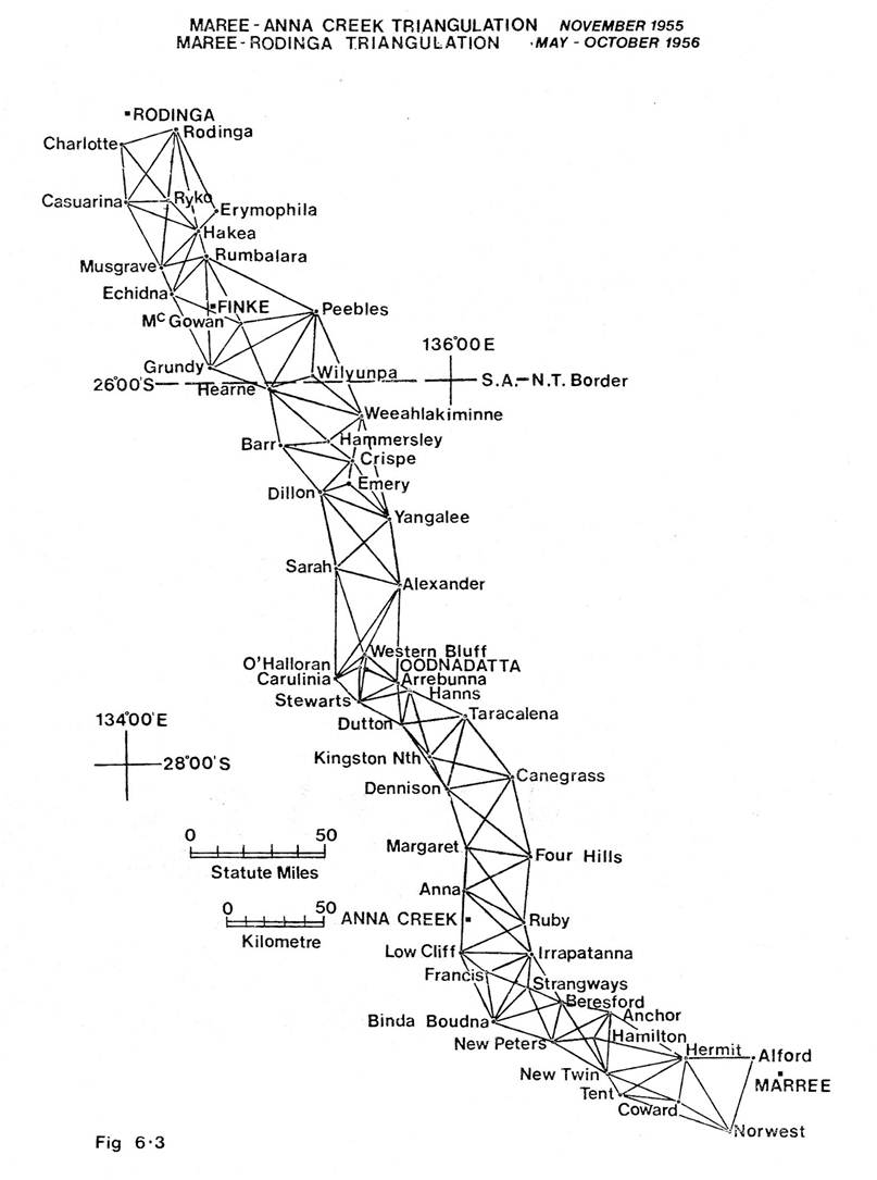
Observing commenced at the most southern stations not yet completed and with five observing parties all stations to Mt Charlotte and Mt Rodinga were completed in just under three weeks, fourteen stations in all. All returned to Finke to complete eccentric corrections and finalise triangle closures. It was found some check observing was necessary at McGowan, Wilyunpa and Barr. This was completed within one week, the results were checked and the triangle closures were now very satisfactory. This completed the year's observing (Figure 6.3 shows the triangulation diagram); the field party proceeded to Alice Springs arriving there on 1 November. Surplus beaconing material was stored, the field party and vehicles returned by train to Port Augusta and then by road to Melbourne, arriving on 9 November.
Geodimeter
A comprehensive program of measurements was carried out in 1956 by C.K. Waller.
The instrument log book lists them as:
Feb 1956 |
Mt Ainslie - Mt Stromlo |
ACT |
Feb 1956 |
Mt Ainslie - Mt Spring |
ACT |
Mar 1956 |
Somerton Base Line |
NSW |
Mar 1956 |
Jondaryn Base Line |
Qld |
Jun 1956 |
Glen Waverley - Mt Dandenong |
Vic |
Jun 1956 |
Carrieton Base Line |
SA |
Jul 1956 |
O’Hallorans - Western Bluff |
SA |
Jul 1956 |
O’Hallorans - Stewarts Hill |
SA |
Jul 1956 |
Attraction - Alford |
SA |
Jul 1956 |
Attraction - N.E. Cliff |
SA |
Jul 1956 |
Carrieton Base |
SA |
Jul 1956 |
Mt Neild - Mt Priscilla |
SA (Eyre Peninsula) |
Aug 1956 |
Winter Hill - Mt Gawler |
SA (Eyre Peninsula) |
Oct 1956 |
Atkinson - Green Hill |
Vic |
Nov 1956 |
Atkinson - Mt Aitken |
Vic |
Nov 1956 |
Mt Beenak - Gentle Annie |
Vic |
In June 1956 a new Geodimeter was tested between Glen Waverley and Mt Dandenong. After these evaluation tests this instrument was lent to the WA Lands Department and used fairly constantly in that State over the next two or three years.
Summary
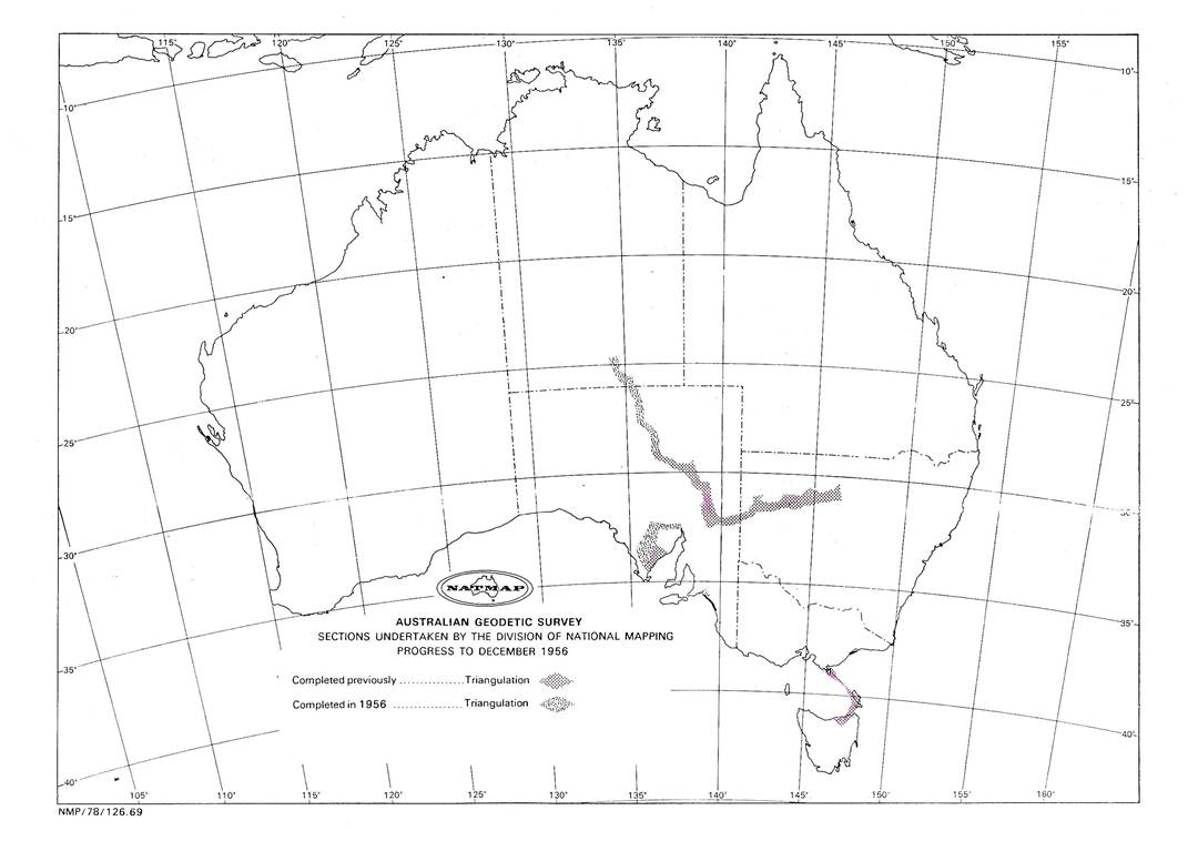
A lot had been achieved in 1956. Eyre Peninsula is nearly as big as the western half of Victoria and about three quarters of it had been covered with a primary triangulation net.
In addition, the main primary triangulation chain had been taken from William Creek in SA to within about sixty miles of Alice Springs in the Northern Territory, in spite of a very wet year when boggy country had considerably slowed down progress.
Also for the time being at least, the shortage of observers had been overcome as in conjunction with the seasons work, four had been trained.
Statistics of the year's work:
Eyre Peninsula |
William Creek – Rodinga |
Total |
|
Triangulation Chain length |
200 miles |
400 miles |
600 miles |
Stations Beaconed |
25 |
40 |
65 |
Triangles closed |
53 |
103 |
156 |
Average misclosure |
0.74" |
0.77" |
Field Party 1956
H.A. Johnson |
Senior Surveyor (Reconnaissance Party Leader - Eyre Peninsula and William Creek – Oodnadatta) |
||
R.A. Ford |
Surveyor Gr 1 (Acting) (Party Leader - Eyre Peninsula, (Northern) and Oodnadatta - Alice Springs) |
||
S. Custance |
Field Assistant (Survey) |
(few weeks only) |
|
G. Gracey |
Field Assistant (Survey) |
||
B. Maddy |
Surveyor Grade 1 (Graduate) |
||
W. Sticklan |
Field Assistant (Promoted to Field Assistant (Survey)) |
||
A. Colvin |
Field Assistant (Promoted to Field Assistant (Survey)) |
||
G. Cruickshanks |
Field Assistant |
||
M. Graetz |
Field Assistant |
(for about five months) |
|
V. Bouchard |
Field Assistant |
(for about three months) |
|
E. Knight |
Field Assistant |
(for about two months) |
|
R. James |
Field Assistant |
(Oodnadatta to Alice Springs) |
|
D. Hutton |
Field Assistant |
(Oodnadatta to Alice Springs) |
|
K. Giulieri |
Field Assistant |
(last phase, Finke to Alice Springs) |
|
J. Graham |
Field Assistant |
(last phase, Finke to Alice Springs) |
|
Geodimeter Party |
|||
C.K. Waller |
Surveyor Grade 2 |
||
N.K. Hawker |
Field Assistant (Survey) |
||
J. Slama |
Field Assistant |
||
J. Marshall |
Field Assistant |
||
R. James |
Field Assistant |
(short time–to Geodetic Field Party) |
|