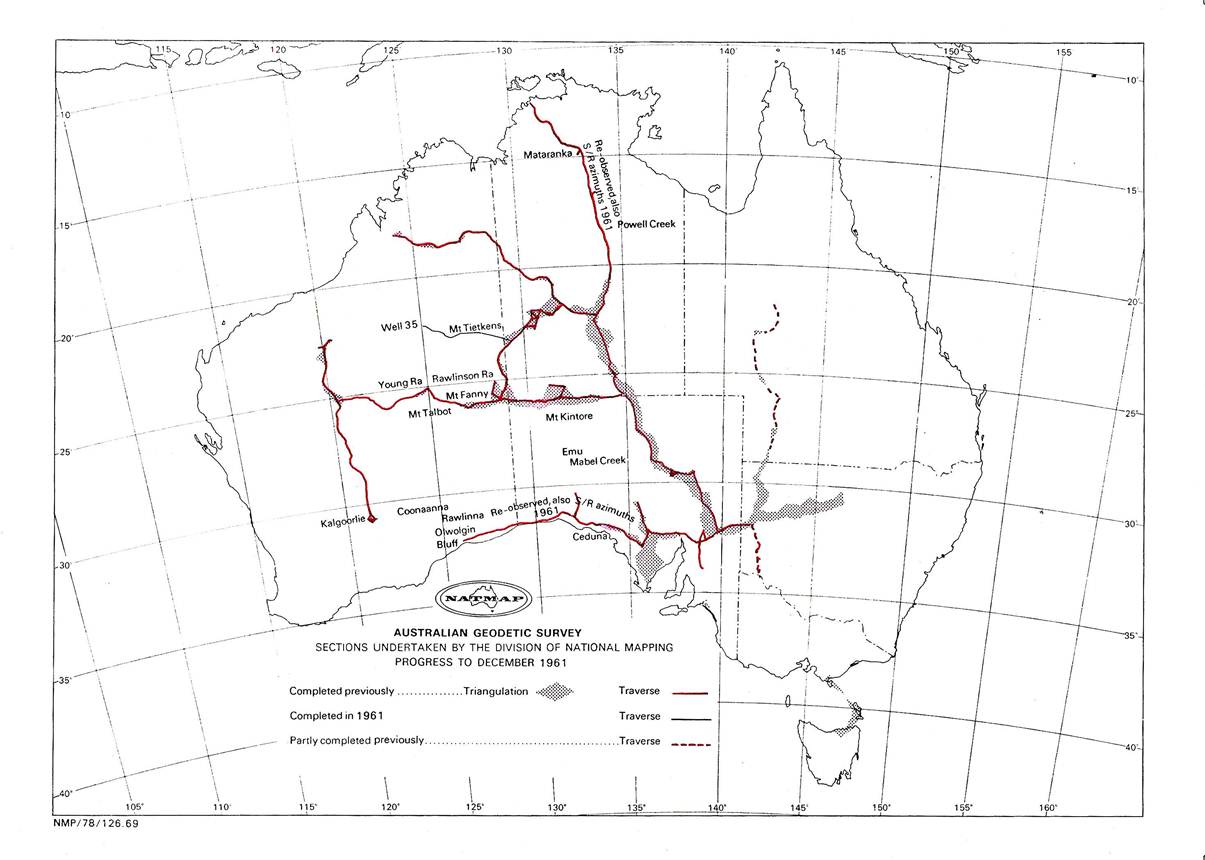
1961 Field Program
Computations of geographic coordinates of the traverse stations had been progressing steadily. These had been based on the Sydney Observatory datum and the Clarke 1858 figure of the earth. At the end of 1960 the computed values revealed a weakness in two traverses:
1. The Mataranka - Powell Creek tower traverse; after the correction of the gross errors located in 1960, this traverse was found to have a constant drift in azimuth when compared with the Laplace azimuths observed at four stations along the traverse.
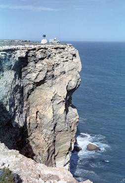
2. The Ceduna – Olwolgin Bluff traverse, much of which was along the edge of the cliffs of the Great Australian Bight, also had a similar weakness.
These factors shaped the field program drawn up for 1961 which was:
(i) Reconnaissance, beaconing, observations and measurements on a traverse from Mt Tietkens, WA west into the Gibson Desert towards Well 35 on the Canning Stock Route.
(ii) Reconnaissance, Mt Kintore to Emu, SA
(iii) Tellurometer measuring on Flinders Island, Tasmania.
O.J. Bobroff would complete these tasks.
(iv) Re-observe horizontal angles and observe simultaneous reciprocal azimuths on Sigma Octantis along all lines of the Olwolgin Bluff - Ceduna traverse and also of the Mataranka - Powell Creek tower traverse.
(v) Observe simultaneous reciprocal azimuths at some Laplace stations on the Giles - Carnarvon Range (WA) traverse. This requirement was decided late in the year.
R.A. Ford would complete these tasks.
(vi) Kalgoorlie to Rawlinna (WA). Reconnaissance, beaconing and tower erecting.
G. Humphries would complete this task.
Changes which took place at the start of or during 1961 and which are of particular interest, were:
1. Assistant Director: During 1961 the position of Assistant Director was created. The position was based in Canberra and G.R.L. Rimington who had done so much to establish the Melbourne office on a sound basis was deservedly promoted to that position, taking up duty in Canberra (for at least the second half, Ed Burke notes) of 1962.
2. The Surveyor positions were restructured, the word “Grade” was dropped and from this time the structure was, Surveyor Class 1, Surveyor Class 2 (Local Designation - Senior Surveyor) and Surveyor Class 3 (Local Designation - Supervising Surveyor). H.A. Johnson became Supervising Surveyor, Geodetic Survey Branch.
3. The Technical Officer positions came into being, i.e., Technical Officer Grade1, Grade 2 and Senior Technical Officer Grade 1. The STO1 was the most senior technical officer position allotted to National Mapping at that time. Unfortunately these technical officer positions did not help the geodetic field parties very much, they got one Senior Technical Officer Grade 1 position only; the Technical Officer Grade 1 position which became available was mainly an office position on survey computations. No Technical Officer Grade 1 positions became available for those on field duty.
R.A. Ford, Surveyor Grade 1 (Acting), became Senior Technical Officer Grade 1 and Field Assistant (Survey) G.J. Cruickshanks became Technical Officer Grade 1, however this meant he was not available for much field duty thereafter.
4. A.H. Spowers transferred to the Topographic Survey Branch; a new Surveyor Class 1, J.W. Witzand commenced duty.
5. R. James, an experienced observer resigned at the end of the 1960 field season but returned to duty in July. Taking a vehicle, he then joined O.J. Bobroff's party on the Mt Tietkens - Well 35 traverse. G. Humphries, an ex-sergeant of the British Ordnance Survey joined the Division as a Field Assistant (Survey).
Simultaneous Reciprocal Azimuths
A few years earlier Major A.G. Bomford of the British Army Ordnance Survey was on exchange duty with the Australian Army Survey Corps. While in the field he experimented with simultaneous reciprocal astronomical azimuths, the theory being the same as for simultaneous reciprocal vertical angles, i.e. any influence which causes the line to diverge from a direct line has the same value to both observers but the sign of this divergence is the reverse. Thus the mean of any pair of simultaneous reciprocal azimuths should be free from horizontal refraction. See his paper in “Empire Survey Reviews” Vol, XV October 1960.
Before returning to Britain, Major Bomford discussed this with senior officers of National Mapping and from this came the decision to use the method.
Coincidently just about the time the field parties were to commence observing simultaneous reciprocal azimuths, it was announced that A.G. Bomford would be joining National Mapping as a Surveyor Class 2 later in 1961.
Flinders Island Tellurometer Traverse
Early in 1961 a small party under O.J. Bobroff spent about two weeks on Flinders Island measuring lines and observing angles. These involved lines from Mt Killiecrankie and Brougham Sugarloaf along sides of triangles of the Division's earlier triangulation scheme. These became the first lines measured of the Tellurometer traverse linking the mainland with Tasmania, to be completed a few years later.
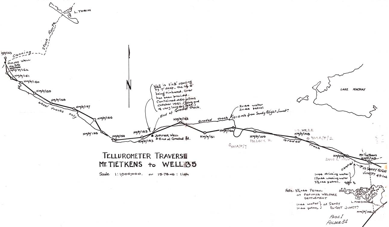
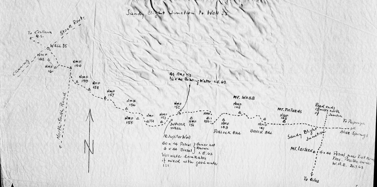
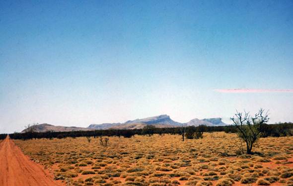
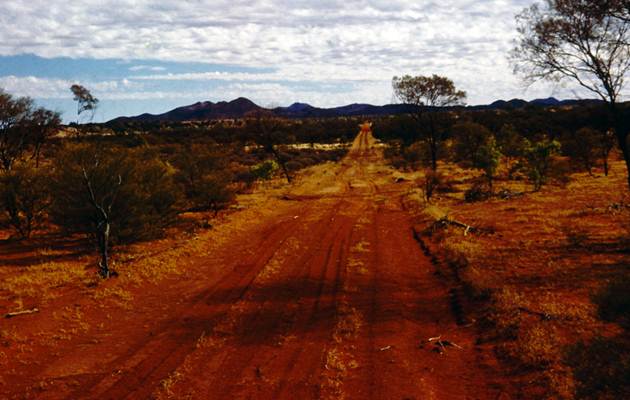
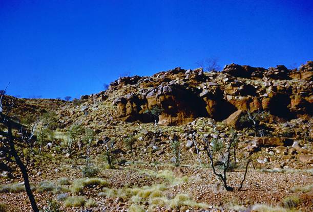
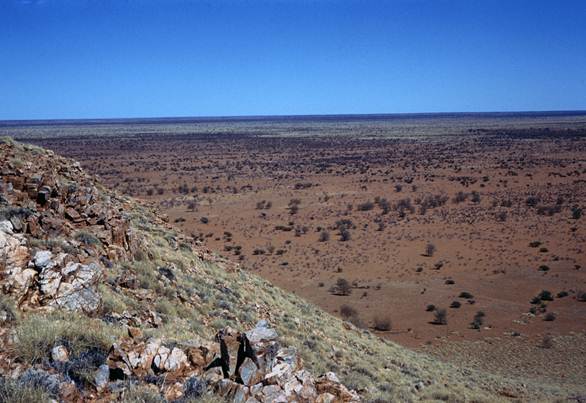
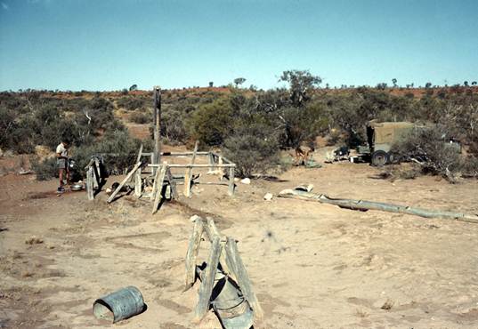
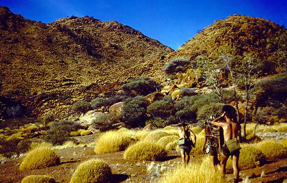
Mt Tietkens, WA - Well 35 (Canning Stock Route, WA)
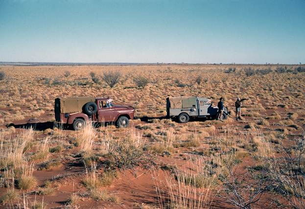
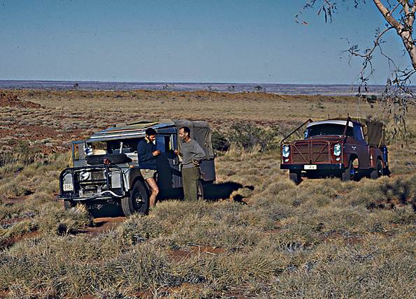
This party under O.J. Bobroff left Melbourne early in June and proceeded to Alice Springs where final preparations were made for a long desert trip. J.W. Witzand was with the party for a short time to gain experience in the Division's survey techniques. R. James and D. Hutton were the observers, O.J. Bobroff would do the reconnaissance and be the Master Tellurometer operator. He would also do simultaneous reciprocal vertical angles with the operator at the Remote end.
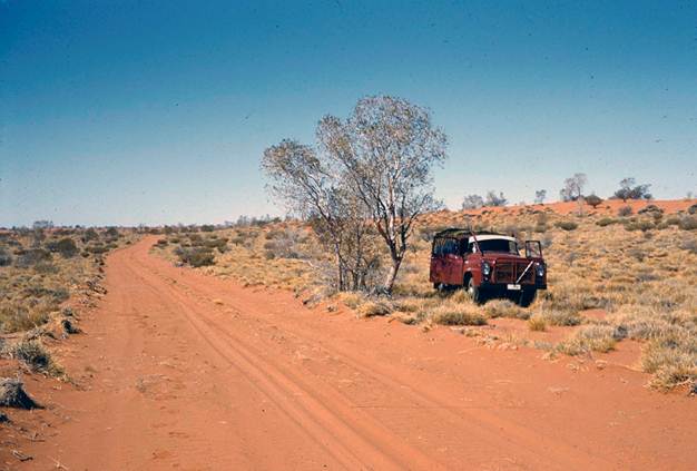
L. Beadell of WRE had graded a track from “Sandy Blight Junction” near Mt Leisler westward past Mt Tietkens, Mt Webb and on to 100 miles past Pollock Hills.
Observing started at Mt Tietkens and the first few lines to Dover Hills, Mt Webb and Pollock Hills were of quite good length but thereafter as most stations were established on sandhills or gravel rises, the lines became shorter to average about twelve miles.
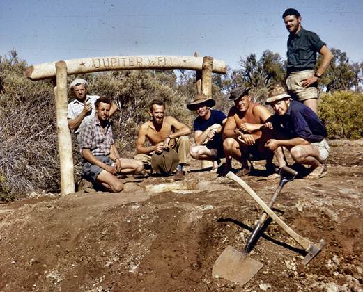
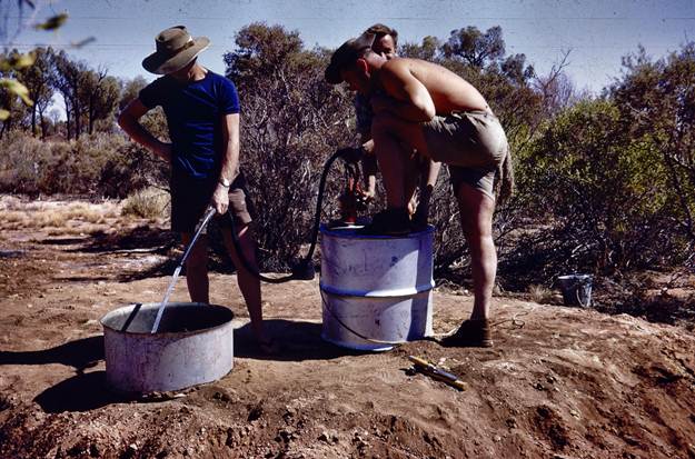
Near the end of the graded track a well was dug on a ti-tree flat and damp soil was located at the end of the first days excavating. It was fairly slow going, as the sides had to be shored up all the way; water was located on the second day and although very brackish was quite usable. This saved the enormous problem of carting water; in a remote area like this it costs about one gallon of petrol to bring in one gallon of water. The well was named Jupiter Well because when looking down the well in the dark to see if it had “made water” the first thing they saw was the reflection of the planet Jupiter in the water which had seeped in.
O.J. Bobroff completed the reconnaissance to Well 35, Senior Surveyor, H.A. Johnson who was visiting the party at the time accompanied him. The route was pre-planned on aerial photo mosaics to avoid any unnecessary sandridge crossings and the position of Well 35 as identified in the office was confirmed as being accurate. Theirs were the first vehicles to reach this part of the Canning Stock Route.
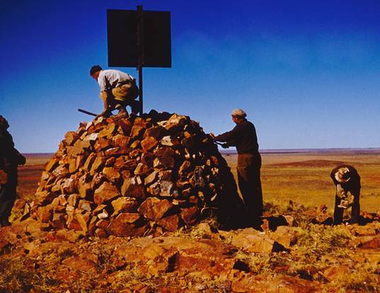
With all the stations selected the party was able to push ahead with the beaconing, marking, observing and measuring. At the stations on sandridges, a recovery mark was established on the loamy flat between the ridges and a bearing read to it from a distant traverse station, the distance station mark to recovery mark being measured. A circular trench six feet in radius and 18 inches wide was dug around the mark; a large bush tripod was also erected.
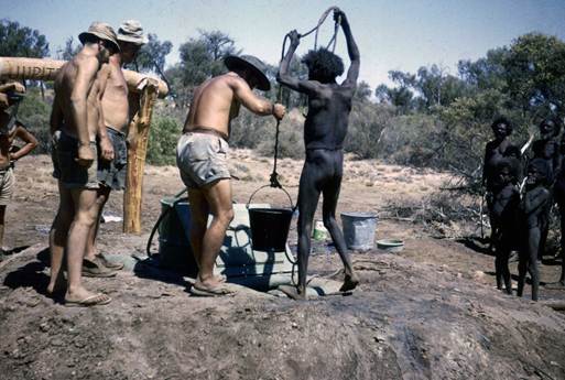
During this survey small family units of Pintubi aboriginals were occasionally encountered and many times when returning to old campsites their tracks were seen.
The traverse was completed by mid-October and the field party then returned to Alice Springs - eighteen stations covering 260 miles were completed.
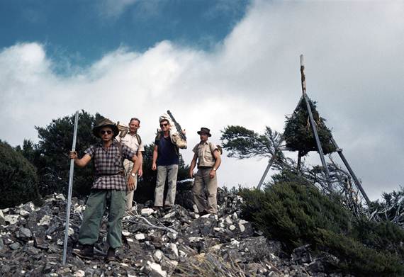
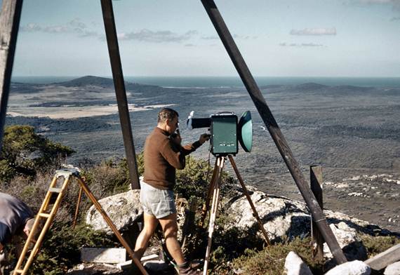
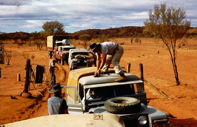
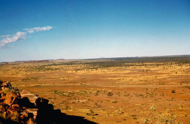
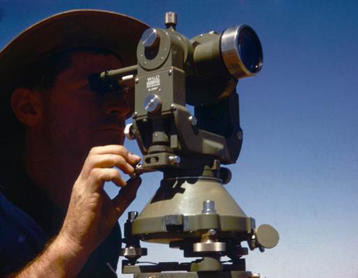
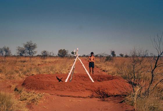
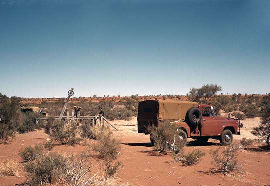
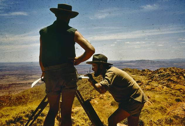
From Alice Springs the party moved to the Mt Kintore area, SA, which is just beyond the western end of the Musgrave Ranges. O.J. Bobroff reconnoitred a traverse from there to Emu; a feasibility reconnaissance was also done from Mabel Creek to Emu. Figure 1, a plane table set up for reconnaissance at Mt Kintore.
Eyre - Ceduna reobserving and simultaneous reciprocal azimuths
For this task an experienced observing team was organised, R. Ford would be in charge and be one observer, G. Cruickshanks would be the other. R. Ford would train R. Maruff as an observer and G. Cruickshanks would have G. Humphries as booker so that he could become familiar with Australian outback conditions and National Mapping's methods.
The party drove from Melbourne to Olwolgin Bluff, the most western station near Eyre, and commenced observing immediately. It was mid March. Sights were not easy for horizontal angles, the white limestone cairns on the edge of the white limestone cliffs blended together making the target hard to locate, however once found the black vanes made a good target. No great change was found in the horizontal angles, a small amount plus here, a small amount minus there. R. Maruff was soon doing a share of the horizontal angles and the azimuths.
The simultaneous reciprocal azimuths on Sigma Octantis were going quite well, computations were kept up to date although it meant working very late at night.

Figure 1: Commencing plane table reconnaissance at Mt Kintore : O.J. (Bob) Bobroff at plane table with R.W. (Bob) Goldsworthy.
The simultaneous reciprocal azimuths were not showing up any significant influence of horizontal refraction. Cloud which formed along the coast in the evening caused a fair amount of delay.
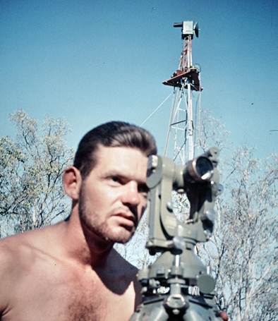
At NM/E/92 the line to NM/E/91 was some thirty miles long across water, and lights had to be shown from on line with the beacon. Horizontal angles observed at NM/E/91 were found to be some seven seconds different from the original fieldwork. A check of the eccentric data showed that for the original observations the light must have been shown from on line with the instrument at NM/E/92 and this fact had not been recorded in the field book. When this was taken into account that part of the traverse so far checked was in good agreement with the simultaneous reciprocal azimuths. Figures 2 and 3 give some idea the terrain along the cliffs of the Great Australian Bight.
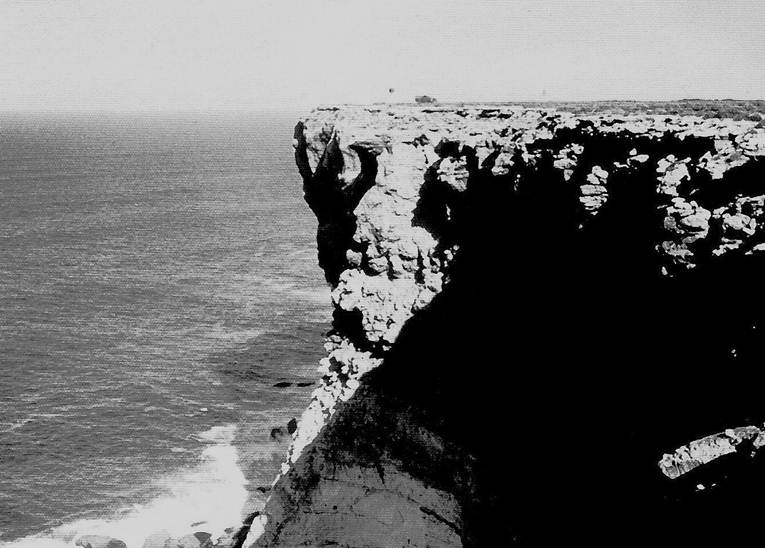
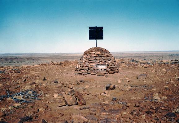
Figure 2: Cairn and observing screen on cliff edge Great Australian Bight : cairn is of almost white limestone.
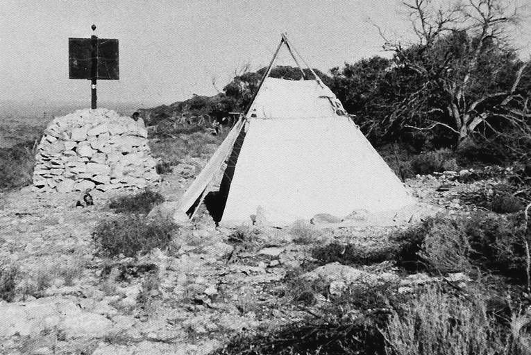
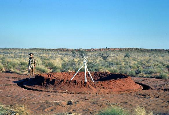
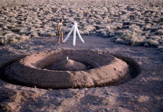
Figure 3: Observing setup Great Australian Bight : Note oregon pole of beacon with Lucas lamp set centrally at top for azimuth observing.
However the long line NM/E/92-91 still caused trouble because of constant cloud it took ten days to complete the azimuth observations. By 13 April work had been completed from Olwolgin Bluff to the vicinity of Nullarbor HS. On the next section of the work at one of the traverse stations near Penong an error was found in the recording of the original angle from the station mark to the distant station, this angle being required to calculate the eccentric correction. This caused an error of three or four seconds in the calculation of the eccentric correction for that direction.
When this was taken into account the whole traverse was of first order standard; the extra horizontal angles just observed helping in this respect, and the simultaneous reciprocal azimuths giving proof of the quality.
Work was completed by 4 May and the party returned to Melbourne. 22 stations were observed for horizontal angles and simultaneous reciprocal azimuths, distance covered approximately 450 miles.
Mataranka - Powell Creek Tower Traverse, reobserving and simultaneous reciprocal azimuths
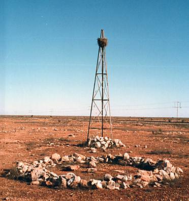
Sufficient thirty foot windmill towers had been purchased to leave one at each station as a station marker and to improve the quality of the observations concrete blocks with bolts would be made and the tower securely bolted down. The sliding adjustment at the feet designed by O.J. Bobroff during the previous year had been incorporated in the new towers. He had also designed a traversing tower head which could be locked in position once the tower was plumbed; they were on order and should arrive in time for the observing. Plans to scale of the observing towers (Plan No. D1108) and the tower head (Plan No. 68S) are held in the Technical Services Branch Dandenong, Victoria (possibly in Archives now – Ed.).
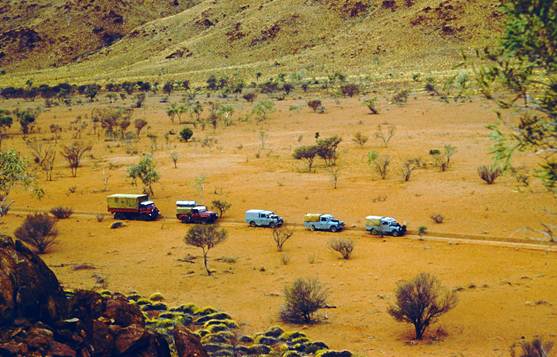
After returning to Melbourne from the Ceduna - Eyre observing, the party had to be rearranged and enlarged. R. Ford would lead the party and be one observer; R. Maruff would be the other, as G. Cruickshanks would be staying in the office doing survey computations. Two new Field Assistants (Survey), I. Cameron and R. Scott, were to be trained in observing; they both had some experience in the Engineering Survey area. The party now comprising 8 persons left Melbourne on 24 May collected the windmill towers in Adelaide and arrived in Alice Springs on 1 June. Two new field assistants with a new vehicle would follow later and bring the new tower heads.
At Alice Springs the scaffolding was loaded on the vehicles while R. Maruff with the help of a local engineering firm made some very useful threaded brass attachments for attaching the lights to the tower head. The party then moved to the Mataranka area, some training in azimuth observations being given to I. Cameron and R. Scott enroute.
All the party assembled at NM/G/115 to erect the first tower and scaffolding and to devise the most suitable procedure both to erect and dismantle it, keeping in mind that in the next few months 49 sets of scaffolding would have to be built and dismantled. A suitable method was soon decided upon once the team became confident of working at heights they became most proficient. A suitable procedure for erecting towers, plumbing the head and scaffold erection is laid down in National Mapping's training Manual Volume 1-3.7 and Volume 2-8.
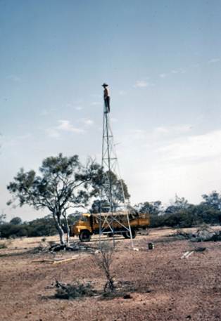
A tower erecting party was formed under F. Combe. They would move down the highway, locating each station in turn, set in the concrete footings complete with bolts, paint the blazed tree or blaze a tree and paint where necessary, also assemble and paint the tower. This would be done over a few days to allow the concrete to dry thoroughly. A return trip was then made; the towers erected and bolted down. See Figures 4 and 5
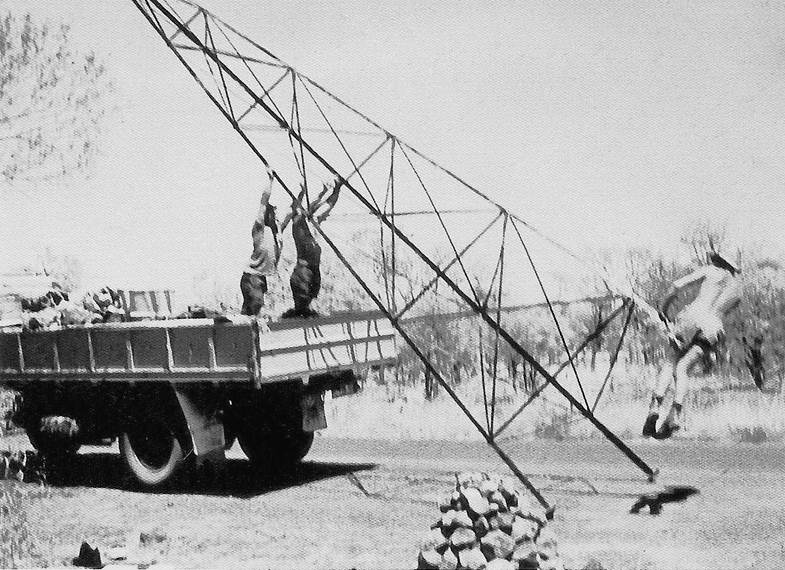
Figure 4: Erecting thirty foot observing tower by “backing” vehicle.
Figure 5: Painting blazed tree. J. (John) Allen.
The two observing parties were also formed, R. Ford would train I. Cameron and R. Maruff would train S. Scott; when sufficiently trained they would share the observing at each station. The observing parties would combine to erect and later dismantle the scaffolding; there was enough for five full sets but only three sets of floor boards.
The old steel tower heads were used for a fortnight and were reasonably satisfactory apart from a poor attachment to the top of the tower. No trouble was experienced in plumbing even though the head had no traversing movement, the adjustment at the feet being sufficient.
The two new Field Assistants, J. Allan and E. Gillespie arrived with the new vehicle and the traversing heads. These heads were found to be beautifully made of brass; however two difficulties had to be overcome before they could be used satisfactorily:
(i) The plate of the head is about one foot in diameter while the top of the tower is only about three inches in diameter. The brackets holding the head had to taper in to this 3 inch neck. This made the head rather unstable. This was overcome by making three angle iron stay bars about 2½ feet long. The top of each of these was attached to the bolts near the outer edge of the head plate and the bottom to the bolts of the first girt of the tower, elongated holes providing adjustment. This modification made the tower head quite steady under most conditions.
(ii) The brass tower head was badly affected by any change of temperature and in that hot climate it was necessary to try and keep it shaded all day.
The first few stations were observed using lights after dark, then instructions were received from the Senior Surveyor in Melbourne to experiment with hessian sun screens on the scaffold to shield the tower and to try observing to lights in the late afternoon. It was found this could be done satisfactorily if care was taken to shield the tower head all day, erect the sun screens a couple of hours before observations were to begin and no chinks were left for the sun to enter. Screening the towers in this manner was only possible because at that time of the year in that area conditions are fairly calm, and also the trees gave some shelter from what wind there was. A black cloth was placed behind the light and in the good visibility the light looked like a jewel sparkling on a sheet of velvet. It was a good target and these daylight observations helped improve the quality of the horizontal angles.
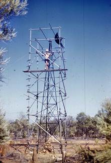
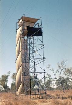
Figure 6 shows the scaffold erecting team in action and Figure 7 shows the observing tower partly shielded from the sun with hessian screens.
Two nights’ horizontal angles were observed at each station and simultaneous reciprocal azimuths also along all lines, some on two nights where computations showed a difference on the first night. Computations of the azimuths were done immediately after the observations had concluded, sometimes taking until well after midnight. This was necessary to enable a decision regarding the dismantling of scaffolding to be known by dawn.
The simultaneous reciprocal azimuths were proving their worth by showing up the lines where horizontal refraction was present. The cause of the horizontal refraction was the line running down the cleared line of the road. This gave the effect of observing in a long trench and with the shadows creeping across the trench; pockets of unevenly heated air were created. The line running through this unevenly heated air was diverted from a direct path. Both before and after dark, one could often see the sets changing by noticeable amounts, the change tending in the one direction. The horizontal angles which held close to the simultaneous reciprocal azimuths were mainly observed in daylight before the shadows across the road had time to create pools of air of differing temperatures.
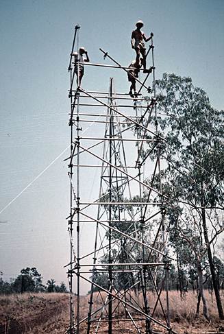
Figure 6: Erecting “Mills” scaffolding around 30ft observing tower.
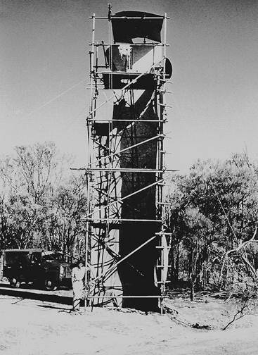
Figure 7: Observing tower some time prior to commencement of observations : Hessian sun screens only partly shield the tower at this stage : R.A. (Reg) Ford on left.
Generally the comparison between the observations at each end of the simultaneous reciprocal azimuth line (after allowing for the calculation for the 'reverse' azimuth), were in the order of one second or less with some of two or three seconds. However on at least two occasions the comparison showed a difference of about six seconds. In these cases another nights observations were taken and the comparison between ends on this occasion showed a difference of only about two seconds. However in each case the means of the simultaneous reciprocal azimuths which were 6 seconds different agreed closely with the means of the azimuths taken on the second night and which were only about two seconds different.
Computation of latitude, longitude and reverse azimuth was carried forward using the mean of our simultaneous reciprocal azimuth on the first line as the commencing azimuth. It was found that the astronomical azimuth gradually drifted out to -4 seconds from the carried forward geodetic azimuth, hovering around the -2 to -3 seconds for a long time.
The astronomical azimuth then swung fairly quickly to + 0.9 seconds then again drifted out to -4 seconds before swinging back to -1 second and then -1.8 seconds at the conclusion of the traverse. It was pleasing to keep the quality of the traverse under continuous examination in this way and see that it was now of First Order standard. During the observing it was found that the bad disagreement of one of the Laplace azimuths was caused by the RO light being set over a reference mark instead of the station mark.
When the traverse was about 3/4 complete, H.A. Johnson visited the party and was impressed with the technique adopted for the task and particularly the way the geodetic azimuth from the horizontal angles was holding so closely to the mean of the simultaneous reciprocal azimuths.
The whole traverse was completed three months after the first observations were commenced. 51 stations (49 on towers) were observed, blazed trees painted, new blazes being made where necessary and small rock cairns built over all station marks. This traverse covered approximately 240 miles.
Simultaneous Reciprocal Azimuths, Giles - Young Range, WA
The party returned to Alice Springs to find they had a new task. Simultaneous reciprocal azimuths were required along three lines which at present had single ended Laplace azimuths. In addition two other simultaneous reciprocal azimuths were required.
This meant a tremendous amount of travelling; Young Range the most westerly point is over 800 miles from Alice Springs. The two vehicles containing the towers and scaffolding were taken to Kulgera and left at the police station while the trip west was undertaken. It took six days to travel to the area.
Simultaneous reciprocal azimuths and horizontal angles were read along the lines Young Range - Mt Everard, Mt Samuel - NM/F/19, Mt Rawlinson - Mt Clianthus, Mt Talbot - Mt Harvest and Mt Fanny - Rawlinson Range. All azimuths were calculated before leaving the stations and no large discrepancies with the Laplace azimuths were found; in fact the results were:
|
Rawlinson Range - Mt Fanny |
SR azimuth was +0.45 seconds |
|
Mt Talbot - Mt Harvest |
SR azimuth was -1.23 seconds |
|
Young Range - Mt Everard |
SR azimuth was -1.55 seconds |
The main reason behind the hurried trip was that at Mt Talbot the Laplace azimuth had swung away from the geodetic azimuth by 8 seconds as compared with the Laplace azimuth to the east at Rawlinson Range - Mt Fanny, and some five seconds with that to the west at Young Range - Mt Everard.
Unfortunately at that time insufficient data about plumb line deflection in that area was available, when this information did become available about twelve months later there was found to be a large anomaly in the Mt Talbot - Mt Harvest area.
The observing parties completed their task and returned to Melbourne on 24 October leaving the scaffolding stored at WRE Salisbury SA for work in WA in 1962. Just as the observing was finished F. Combe was asked to take a small party back to Mataranka to dismantle the towers left along the railway line between that point and Larrimah, as Commonwealth Railways were not happy about the towers being left as survey markers. They completed this task and left the towers stored at Cook SA for the Nullarbor traverse in 1962, returning to Melbourne late in November.
Reconnaissance Kalgoorlie - Rawlinna WA
G. Humphries took a small party mainly of WRE personnel to reconnoitre a traverse from Kalgoorlie eastward. He selected, cleared and beaconed seven stations before towers became necessary. These stations involved considerable clearing. Twelve tower stations were selected along the cleared line of the railway between Coonaanna Hill and Rawlinna. The station marks were set in, also concrete blocks for the “feet” and towers erected.
Unfortunately in trying to get the greatest length of line possible the towers were set too close to the actual train line and the Engineer in Charge requested their removal. This was done and he agreed they could be re-erected again in 1962 for a short time to complete the observations and measurements. (This was the reason for the hurried trip of the NT party to remove the towers between Martaranka and Larrimah).
This reconnaissance and beaconing task was completed during November and the party returned to Melbourne.
Azimuth Test, Khancoban N.S.W
On the return to Melbourne of the field party which had been involved in the extensive simultaneous reciprocal azimuth program most of the observers went to Khancoban to engage in a series of azimuth observations for research purposes.
A.G. Bomford was in charge of this research; in addition, he along with F.L. Johnston of the Snowy Mountain Authority also took part as observers using the Wild T4 theodolite. The other observers used the Wild T3 theodolite and split-hand stopwatch.
Full details of these tests are given in Technical Report No 2, “Report on the Khancoban azimuth test of the accuracy obtainable with the Wild T4 and T3 theodolites” by K. Leppert, March 1963.
It is sufficient to mention here that the conclusion reached was “Wild T3 or Tavistock azimuths are nearly as accurate as Wild T4 azimuths”.
Summary
The field parties had once again completed a good season’s work including considerable reconnaissance and some beaconing for the next field season.
In addition problems with the use of towers had been overcome and with the techniques developed first order results could now be expected. The simultaneous reciprocal azimuth had proved its worth and a team of observers, experienced in astronomical observations for azimuth on Sigma Octantis, was now available.
Statistics of the years work:
|
Mt Tietkens to Well 35 |
|
Traverse - 18 stations, 260 miles approx. |
|
|
|
Eyre, WA - Eucla – Ceduna, SA |
|
Angles & simultaneous reciprocal azimuths - 22 stations, 450 miles approx. |
|
|
|
Mataranka - Powell Creek, NT |
|
Angles & simultaneous reciprocal azimuths - 51 stations, 240 miles approx. |
|
|
|
Young Range - Giles area, WA |
|
Angles and simultaneous reciprocal azimuths - 10 stations |
|
|
|
Mt Kintore, SA - Emu - Mabel Creek, SA |
|
Reconnaissance |
|
|
|
Kalgoorlie – Rawlinna, WA |
|
Reconnaissance and some beaconing - 19 stations, 240 miles |
Field Parties 1961
|
Flinders Island Traversing |
|||
|
|
|
|
|
|
O.J. Bobroff |
Surveyor Class 1 |
|
|
|
J.W. Witzand |
Surveyor Class 1 |
(for experience) |
|
|
D. Hutton |
Field Assistant (Survey) |
|
|
|
D. Wicks |
Field Assistant |
|
|
|
R. Goldsworthy |
Field Assistant |
|
|
|
|
|
|
|
|
Mt Tietkens - Well 35, WA |
|||
|
|
|
|
|
|
O.J. Bobroff |
Surveyor Class 1 |
|
|
|
J.W. Witzand |
Surveyor Class 1 |
(short time only) |
|
|
R. James |
Field Assistant (Survey) |
|
|
|
D. Hutton |
Field Assistant (Survey) |
|
|
|
R. Goldsworthy |
Field Assistant |
|
|
|
E. Burke |
Field Assistant |
|
|
|
J. Combe |
Field Assistant |
|
|
|
F. Crowe |
Field Assistant |
|
|
|
L. Boss |
Field Assistant WRE |
|
|
|
A. Hooper |
Field Assistant WRE |
|
|
|
|
|
|
|
|
Reconnaissance Mt Kintore - Emu - Mabel Creek, SA |
|||
|
|
|
|
|
|
O.J. Bobroff |
Surveyor Class 1 |
|
|
|
R. James |
Field Assistant (Survey) |
|
|
|
D. Hutton |
Field Assistant (Survey) |
|
|
|
R. Goldsworthy |
Field Assistant |
|
|
|
E. Burke |
Field Assistant |
|
|
|
J. Combe |
Field Assistant |
|
|
|
J. Allen |
Field Assistant |
|
|
|
L. Boss |
Field Assistant WRE |
|
|
|
A. Hooper |
Field Assistant WRE |
|
|
|
|
|
|
|
|
Eyre, WA – Ceduna, SA |
|||
|
|
|
|
|
|
R.A. Ford |
Senior Technical Officer Grade 1 |
|
|
|
G.J. Cruickshanks |
Technical Officer Grade 1 |
|
|
|
R. Maruff |
Field Assistant (Survey) |
|
|
|
G. Humphries |
Field Assistant (Survey) |
|
|
|
F. Combe |
Field Assistant (Survey) |
|
|
|
|
|
|
|
|
Mataranka - Powell Creek, NT and Giles - Young Range, WA |
|||
|
|
|
|
|
|
R.A. Ford |
Senior Technical Officer Grade 1 |
|
|
|
R. Maruff |
Field Assistant (Survey) |
|
|
|
I. Cameron |
Field Assistant (Survey) |
|
|
|
R. Scott |
Field Assistant (Survey) |
|
|
|
F. Combe |
Field Assistant |
|
|
|
J. Allen |
Field Assistant |
|
|
|
J. Carlisle |
Field Assistant |
|
|
|
N. Mathwyn |
Field Assistant |
|
|
|
E. Gillespie |
Field Assistant |
|
|
|
D. Wicks |
Field Assistant |
|
|
|
|
|
|
|
|
Kalgoorlie – Rawlinna, WA |
|||
|
|
|
|
|
|
G. Humphries |
Field Assistant (Survey) |
|
|
|
I. McLean |
Field Assistant |
|
|
|
J. Coles |
Field Assistant WRE |
|
|
|
G. Stanley |
Field Assistant WRE |
|
|
|
P. Hallam |
Field Assistant WRE |
|
|
|
E. Skeen |
Field Assistant WRE |
|
|