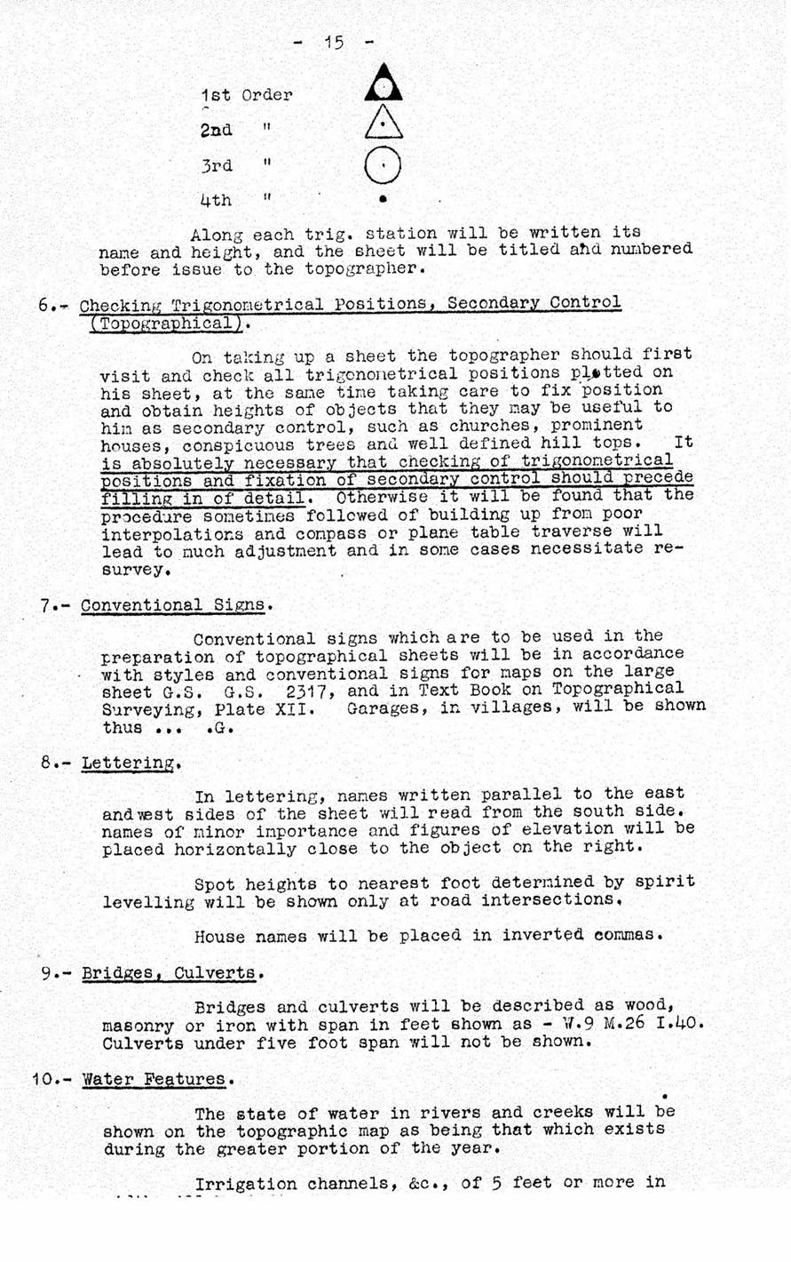
|
Australian Survey Corps - Standing Orders 1934 |
|
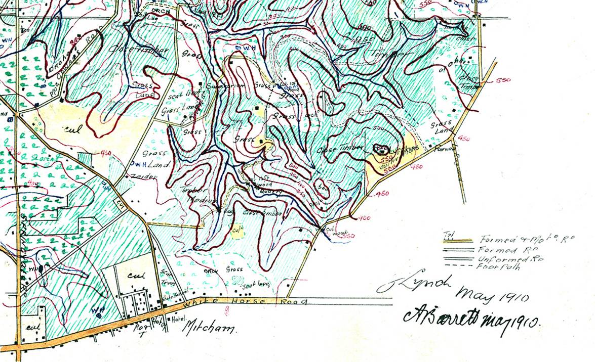
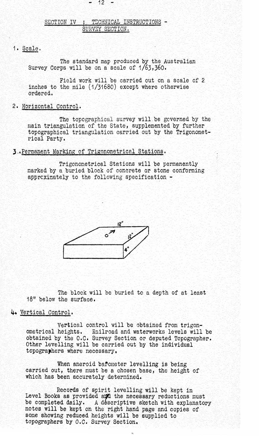
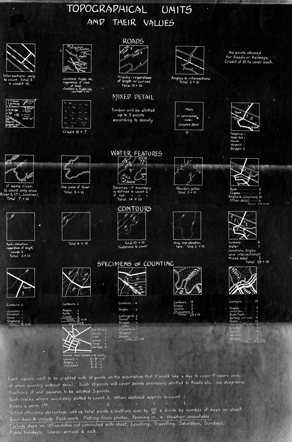
This document was kindly provided by Peter Jensen a former officer in the Royal Australian Survey Corps. The document was amongst papers provided to him by the family of the late Brigadier Don Macdonald AM (Director of Military Survey 1960-1967 and RA Survey Colonel Commandant 1967-1973). These orders contain map specifications for compiling the standard military 1 inch to 1 mile (1 : 63 360) scale map, then by plane table (see example at end) as aerial photography was only just starting to be recognised as an aid to topographic mapping. Whie the final map scale was 1 : 63 360 field work was at 1 : 31 680 (2 inches to 1 mile) otherwise known as 40 chains to 1 inch the common state cadastral scale.
|
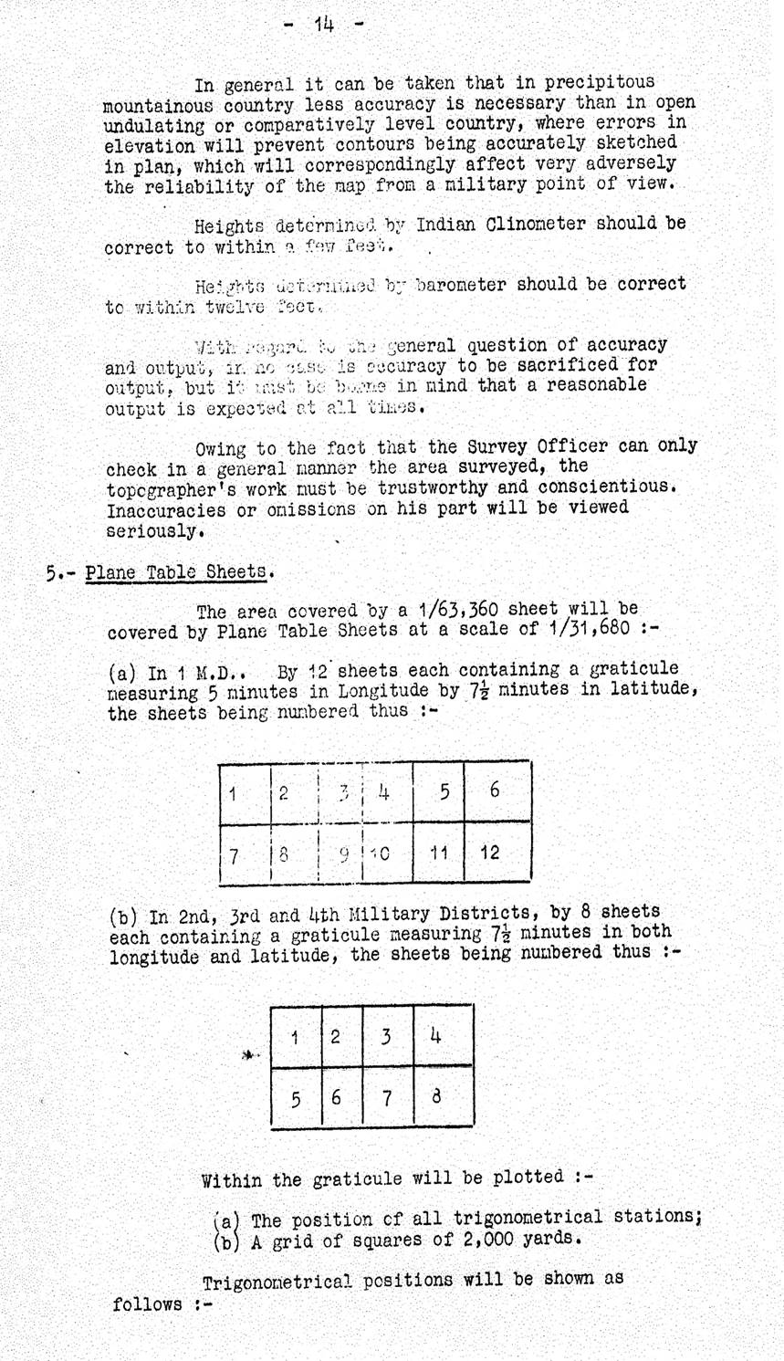
|
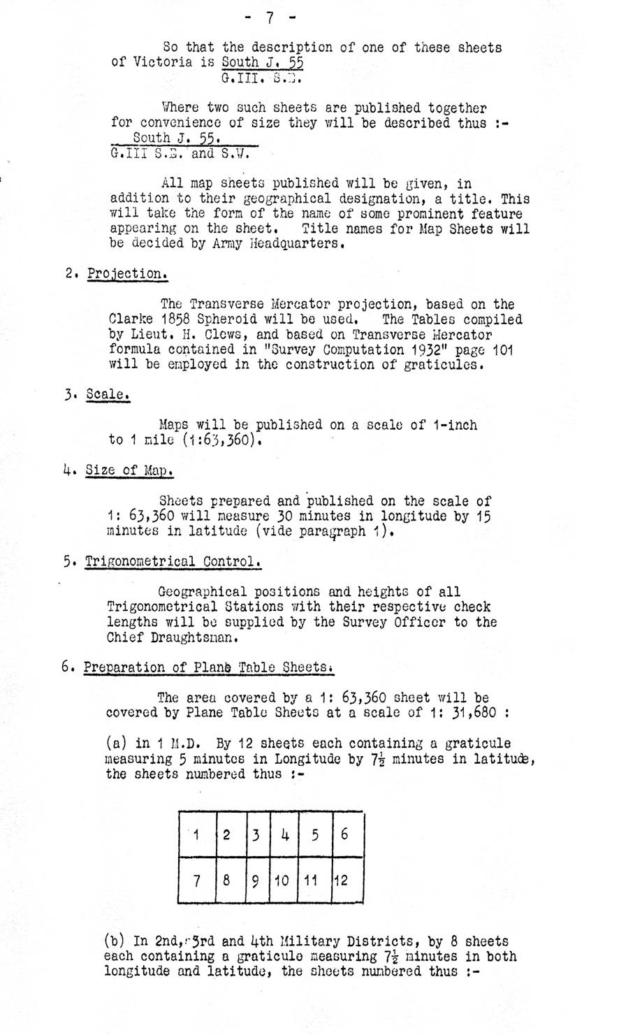
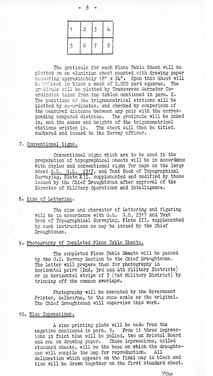
|
|
|
|
|
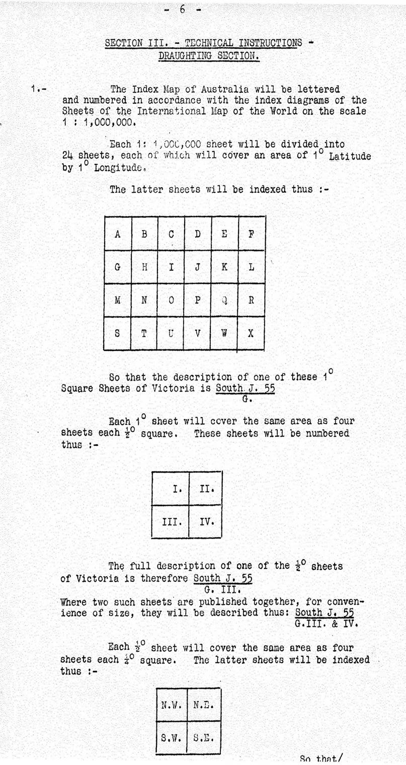
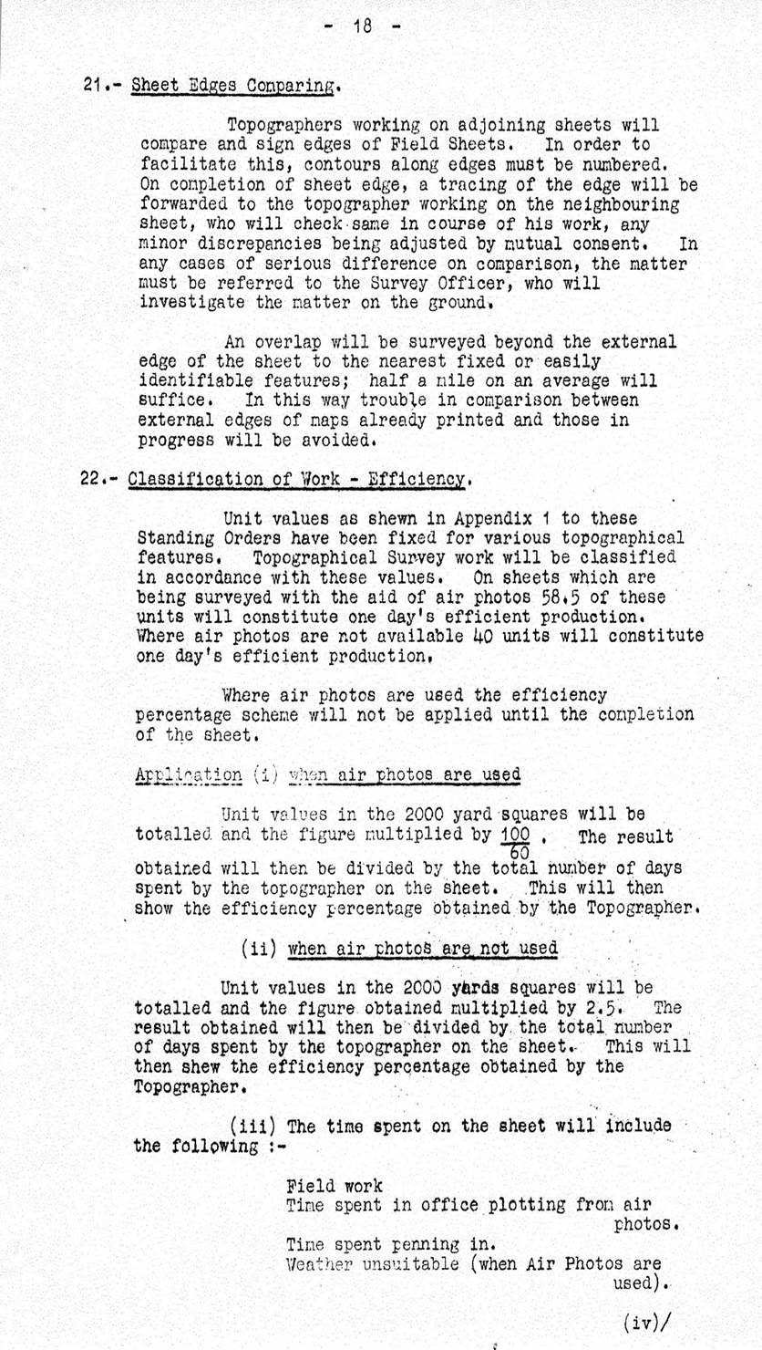
Section of Ringwood (Melbourne) map compiled by Plane Table, 1910