Con Veenstra (1930-2022)
National Mapping 1965-1987

Con Veenstra made an outstanding and high-level contribution to the mapping of Australia and its external territories during a Commonwealth public service career that extended from 1965 to 1987. His Commonwealth mapping career involved a range of diverse activities:
· professionally conducting precise field and sea-borne surveys
· giving wise day-to-day leadership for survey parties of 15-25 people, (including during field survey operations in remote areas of Australia, sea-borne surveys in Australian waters, and a survey expedition to the sub-Antarctic Australian territory of Heard Island and McDonald Islands
· fulfilling high-level management responsibilities
· providing sound leadership to an organisation of some 300 people
· proffering technical advice during Australia’s international offshore boundary treaty negotiations
· chairing national and international mapping-related bodies and forums.
After joining the Division of National Mapping in 1965, Con went on to become the Director of National Mapping from 1981 to 1987. This position was the highest mapping office within the Commonwealth public service. He was also ex officio Chairman of the National Mapping Council that coordinated Australia’s national topographic mapping activities.
However, Con only achieved high office though his persistent personal endeavours. He did not embark on a surveying and mapping career until he was in his mid-twenties and had come from a fairly modest beginning in his native Holland. As detailed below, along his journey to high office Con had to overcome some considerable obstacles which he did with the dogged determination that is said to be a characteristic of the people of his native Friesland province.
While Con’s notable achievements were due to his own self-belief, skills and determination, he readily acknowledged the kindness, consideration and support he received from many people during his life. During his early days as a new-comer to Australia, Con was particularly grateful for the courtesies and assistance given to him by complete strangers or by people with whom he had little prior acquaintance. He was later given assistance and support by numerous work colleagues. Con could not have achieved all that he did during his National Mapping career without the willing support and cooperation from colleagues and staff at all levels nor without the faith and trust that many people placed in him. Nevertheless perhaps Con’s greatest source of support and advice has come from Anne, the girl he married some 62 years ago.
Some Personal Background-early life in Holland
Cornelius Veenstra was born in 1930 at Leeuwarden, the capital of the Netherlands’ Friesland province. Leeuwarden is located about 110 kilometres north-east of Amsterdam. Con was the first of the two children (both sons) born to Willem Veenstra (1906-1965) and his wife Tetje nee van der Meulen (1904-1996). Con’s younger brother Alan was born in 1937.
Willem Veenstra was a warehouse manager in Holland and after the family moved to Australia in 1950 he worked as a storeman at the Australian National University, Canberra until his untimely death. Tetje Veenstra had a career background in nursing.
Con attended primary school at the Ferdinant Boll School in Leeuwarden from 1936 to 1942. However, his last years there were under trying circumstances. On 10 May 1940, German forces invaded Holland. Thus the Veenstra family along with the rest of the Dutch populace spent the next five years under Nazi occupation.
Life was grim during the occupation. Food was scarce but fortunately the Veenstras lived in an agricultural area. Con would cycle about 15 kilometres every day to obtain milk from a dairy farm which milked the high-yielding black and white Friesian dairy cows that were bred in Friesland.
Many Dutch locals were picked up and forced to work for the Nazi war machine. Twice Con was picked up for being outdoors after curfew; fortunately without serious consequences. Con’s early years at high school in Leeuwarden from 1942 were constrained to two days per week due to many of the town’s buildings being taken over by the occupying forces.
All people over the age of 16 years had to carry an identity card. At age 14 Con was over six feet tall but was still not entitled to an identity card. One day he was picked up by the Nazis and taken to the town square with a number of other people caught without identity cards. Fortunately a check of records was made and Con was soon released.
Con’s introduction to surveying was at the age of 14 years. It was mainly due to the shortage of able-bodied men in Holland during the occupation. Con was appointed as an air raid warden. For this task he was given first aid training and issued with a metal helmet. To fulfil this task Con had to walk about 1.5 kilometres to a high building in town and climb the stairs to his observation post at the top of the building. If a bomb was dropped on the town, Con would have to take a compass bearing to the impact point and advise a central intelligence–gathering point by telephone. At the central intelligence point, bearings from three other observation posts would also be received and this would allow accurate pin-pointing of the bomb impact site by use of the re-section method.
Fortunately, only one bomb was released over Leeuwarden. However, the airfield near the town was subject to a rather unique Royal Air Force raid. The Germans had placed a decoy fleet of wooden aircraft at the airfield. In due course the RAF came to deal with them. But perhaps to demonstrate a sophisticated observation capability and retention of a very British sense of humour, on this raid the RAF dropped only wooden bombs; such was the madness of war.
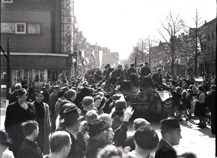
On the morning of 15 April 1945, the Royal Canadian Dragoons (Royal Canadian Armoured Corps) of the First Canadian Army supported the Dutch Resistance Force in liberating Leeuwarden from Nazi occupation. A bitter battle had raged between the Resistance and the Nazis during the night of the 14th to 15th but as the Dragoons’ C and HQ Squadrons moved in on the morning of the 15th the Nazis retreated. The citizens of Leeuwarden were forever grateful to the Canadians for their liberation from Nazi German oppression.
Citizens of Leeuwarden welcoming Canadian Forces' Stormont, Dundas and Glengarry Highlanders on 16 April 1945 (image from Canada at War website)
After liberation Con continued at high school until 1947. He then worked briefly as a laboratory assistant until he was able to obtain a junior seaman berth on the coastal vessel Noordkaap (Northern Cape). This ship traded between Holland, Scandinavia, Germany, the United Kingdom, Belgium and France. However, Con’s sea-going ambitions were not approved of by his parents. His paternal grandfather had been lost at sea in 1931 after the coastal freighter of which he was the Master founded in rough weather off the Dutch coast.
Migration to Australia-the early years
At his parents’ request, Con migrated to Australia with them and his younger brother Alan. The family left Holland on 17 October 1950 and arrived in Sydney on 27 November 1950. The family then went by train to Bathurst where they were accommodated at the Bathurst Migrant Reception and Training Centre on the Limekilns Road at Kelso just to the east of Bathurst. The centre was closed in 1952.
In response to a contractionary federal budget and a steep decline in wool prices, the Australian economy went into a sharp recession from around mid-1951 to the end of 1952. Thus, Con found employment opportunities in Bathurst to be fairly limited. However, he was determined to make his way in Australia and was prepared to start by taking any work he could get. At first he took a job for about a month as a kitchen hand in the central kitchen of the migrant camp; scrubbing pots and pans and cleaning floors and benches. Afterwards Con obtained a few weeks seasonal work at the Gordon Edgell and Sons Ltd cannery at Bathurst. Here during the pea harvesting season he would pitch fork peas still in their pods on the vines into the top of a large processing machine. The processor would shake and shudder and send shelled peas out one end and the pod and vine trash out the other end.
Again out of work, Con was walking the streets of Bathurst one day in early 1951 when a kindly gentleman said hello and asked what Con was doing. It was just after midday and the fellow was standing on the steps in front of the doorway to a building. Con explained he was looking for work but it was hard to find. The fellow then suggested that Con come back at 1:30 and go through the doors behind him and up the stairs and see the gentleman there who would be able to help.
Intrigued and hopeful of finding some work, Con climbed those stairs promptly at 1:30 pm. There he was met by another fellow who asked him a few personal questions and said Con could work there on adding figures in account books. However, the arrangement was only temporary and Con should still actively look for another job.
This fellow then mentioned the name of the gentleman whom Con had met before lunch. To this information Con could only give a blank look and ask who that person was. Con’s new employer then explained in great detail just who the gentleman was and thereafter Con was always grateful for Ben Chifley’s kindness that day.
About Ben Chifley
As a new-comer Con did not then know that Joseph Benedict Chifley (1885-1951) had been Australia’s sixteenth prime minister (from 1945 to 1949). Ben Chifley had been born in Bathurst and was the federal Member of Parliament for the local electorate of Macquarie from 1941 until his death in June 1951, just a few months after Con had met him.
Chifley grew up during the depression of the 1890s and had lived through hard times himself. Largely self-taught, Ben had been a railway engine driver and later a union advocate prior to entering parliament. Chifley was very astute and widely read in some of the classics and early Australian literature as well as economics. Within in a few months of entering federal parliament Chifley became the treasurer in John Curtin’s war time government.
One has to ponder whether Con’s meeting with Ben Chifley was just by chance or had been determined by fate. Ben had already done much to influence Con’s future career path although it would take another 30 years for this to become apparent. As a war time treasurer Ben Chifley was greatly concerned with Australia’s post-war prosperity and for the well-being of returned service men and women.
Chifley’s concerns with post-war reconstruction also included urban and regional development, resource development, immigration, and education and training as well as overall economic strategy. To address these concerns Chifley took on the newly created role of minister for post-war reconstruction in December 1942 in addition to his duties as treasurer. To run the new ministry Chifley appointed renowned economist and public servant Dr Herbert Cole (Nugget) Coombs (1906-1997). Dr HC Coombs was director-general of post-war reconstruction from 1943 to 1949 but in February 1945 Chifley was replaced as the minister by John Johnstone Dedman (1896-1973).
It was the then Department of Post-War Reconstruction that took a leading role within the Commonwealth government in advocating for a national mapping program to support post-war reconstruction activities. In 1945, the Department strongly supported the recommended creation of a National Mapping Council and the position of Director of National Mapping to lead the post-war national mapping effort. Of course, Con Veenstra went on to become the Director of National Mapping from 1981 to 1987.
In 1950, the Menzies government abolished the Department of Post-War Reconstruction. Apart from economic strategy, most of the former department’s functions were transferred to the newly created Department of National Development that Con was to join in 1965. (However, the national mapping function did not come to National Development until 1956.)
Looking for work in the early 1950s
After a few days of working on account books, Con obtained work with the Post Master General’s department digging trenches for telephone cables in the streets of Bathurst. The PMG paid fairly good money and savings from this allowed Con to later travel by train to Sydney where he hoped to join the merchant navy. At first Con stayed at the YMCA hostel in the city.
Con’s early attempt to obtain a berth on a merchant ship was unsuccessful. At first he tried at the office of the Australian National Line. But when he said he was seeking a job on one of the company’s ships all he received was a funny look and advice that all the company’s recruiting was arranged with the then Seamen’s Union of Australia (now the Maritime Union of Australia) and that he should inquire there. Con eventually found the union office in a tall city building. Here he knocked on a little window that was the only reception facility. When the window was raised Con explained that he would like to join the union. To this request he received a very curt reply: The books are closed! The window was then slammed shut.
After about a week of looking unsuccessfully for work, Con ran out of money and could no longer afford his YMCA accommodation; fortunately he was allowed to leave his suitcase there. That night Con went to sleep on a bench at Sydney’s Central Railway Station. But at about 2:00 am he was woken by a policeman: Move on or I will run you in for loitering! Con eventually found another bench for the rest of that night. For the next two nights Con slept on a bench at Wynyard station on central Sydney’s underground railway. During those three days he was sustained by only one milkshake per day; tough times indeed.
Fortunately Con then obtained work at a tannery where the pay was good and the firm kindly paid him on a daily basis. Thus he was able to stop living on the street and move back to the YMCA hostel. However, tannery work was smelly and awful and Con kept looking for a better job. He soon found work as a builder’s labourer on a new telephone exchange site in a lane off George Street near Sydney Harbour.
Seaman on the southern coastal trade 1951-1953
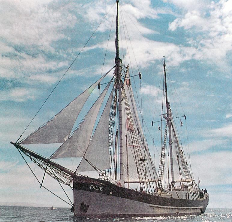
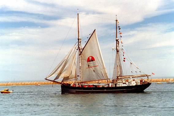
One day when walking around the harbour, Con struck up a conversation with a local chap. On hearing about Con’s aim of getting back to the sea, the friendly local told Con about small non-unionised vessels and mentioned that one such vessel was then in port. Con soon located the vessel which was the trading ketch Falie of some 300 tons and about 160 feet in length. Falie had been built in Holland in 1919 but had operated in Australian waters since 1923; during World War II she was requisitioned as HMAS Falie and spent time as a Sydney Harbour watch dog and as a cargo vessel in New Guinea waters.
The ketch Falie during South Australia’s 150 years jubilee in 1986
Con went on board the Falie and spoke to the mate, who to Con’s delight said there was a vacancy for a junior seaman. Con was signed up and then did a few return trips to Melbourne where the Falie tied up at the Altona explosives anchorage in Port Philip Bay while the ship’s crew loaded explosives for delivery to Bantry Bay to the north of Sydney Harbour. The south-bound cargo was generally heavy coils of wire. After a few trips the Falie went off-line to undergo a refit and to be fumigated to deal with the on-board rats.
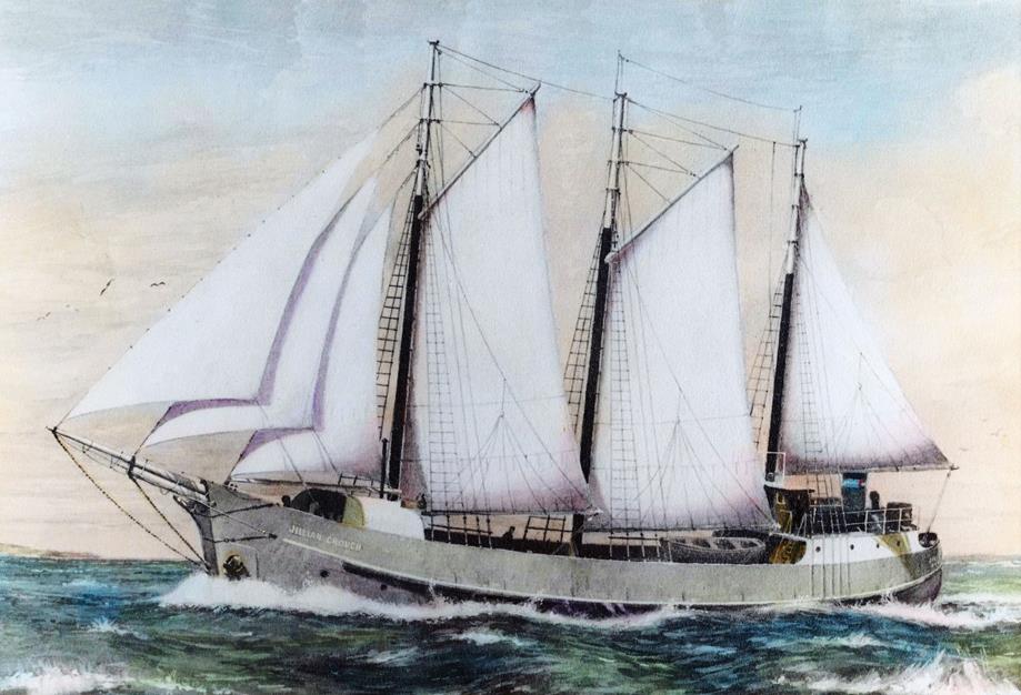
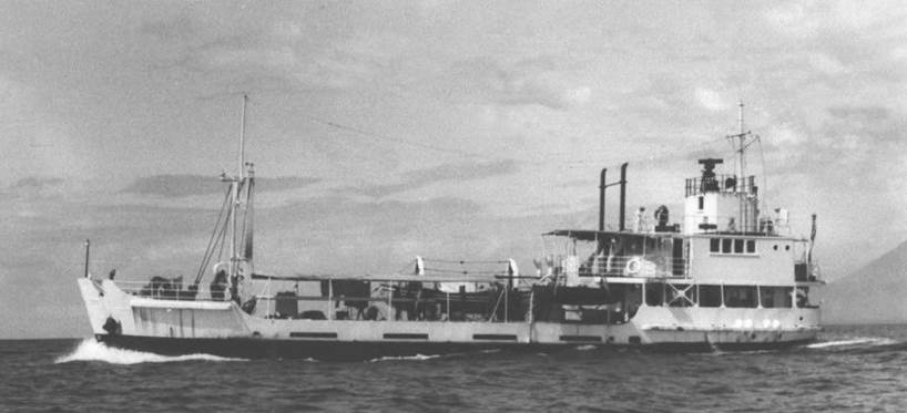
Con then signed up on another vessel. She was the 300 tons, 124 feet Jillian Crouch then a three-masted schooner with twin 240 horse power auxiliary diesel motors. She had been built at Port Adelaide in 1948 by Reginald M Crouch. When Con signed on to the Jillian Crouch under Captain HM Simms she traded between Melbourne and Tasmania. The vessel carried general cargo to Launceston and then sailed on to Bruny Island south of Hobart where it loaded timber for Melbourne.
Afterwards Con spent some time on the auxiliary ketch Leederry of about 120 tons that was built at St Helens, Tasmania in 1943 by the Anson Bay Timber Company. She had initially served with the Australian Army. When Con was on the Leederry she carried general cargo from Melbourne to Smithton and then loaded some general cargo for Melbourne. At Currie on King Island she would take on an additional Melbourne-bound loading of scheelite from a mine on the island. Scheelite is a form of tungsten used in hardening steel and other alloys. (The Leederry was lost at Clarke Island in the Furneaux Group in Bass Strait off Tasmania’s north-east coast in 1968.)
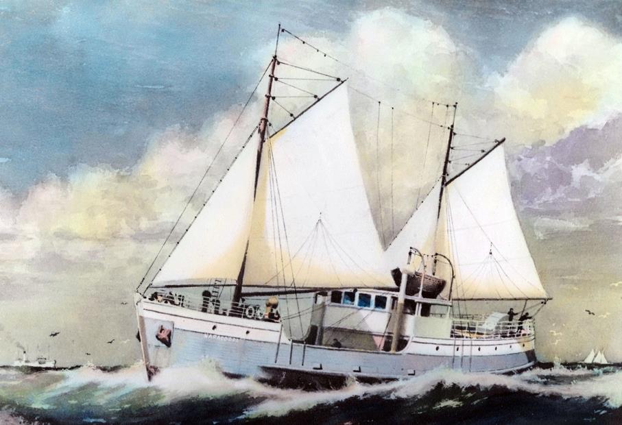
Later Con decided to give the Seamen’s Union another go and while in Melbourne went to the union pick up office in Flinders Lane. Here Con spoke with Jock Wright who was the person in charge. After listening to Con’s request, Jock said Con should wait outside and if a job came up that was of no interest to the union members he would call Con into the office and propose him as a member of the Seamen’s Union. It all worked out and Con obtained a job on the auxiliary schooner Naracoopa and joined the Seamen’s Union of Australia.
Auxiliary schooner Naracoopa (Allan A Green series image from State Library of Victoria website)
The Launceston-based Naracoopa of about 300 tons had been built by Edward A Jack in Tasmania in 1940. She was owned by the Tasmanian Transport Commission and used on the King Island, Melbourne and Launceston trade. The vessel had some passenger accommodation that was used when people travelled between the above mentioned three ports in the days before there was an air service. The Naracoopa also carried livestock (mainly cattle, horses and pigs) from King Island to Melbourne. Con found the work on the Naracoopa to be fairly light and the pay to be very good.
Con recalled one voyage in 1952 or 1953 from King Island where the Naracoopa was bound for Melbourne with a deck cargo of 56 pigs as well as 49 cattle and other cargo below. Just as the schooner nosed her way out of the port of Currie she was hit by a strong northerly wind and Captain Robert Houfe decided to shelter behind the tiny New Year Island near the north-west tip of King Island. After the weather improved the vessel weighed anchor and again set a northerly course for Melbourne.
However, just off King Island the strong northerly wind blew up again and Captain Houfe attempted to get back to the shelter of New Year Island. But by now the sea and swells were such that the vessel could not drop anchor. To try to continue north into the storm would have meant certain death for the pigs carried on the deck, thus Captain Houfe set a course south to run before what became a big storm with winds that reached some 65 knots. The crew of the Naracoopa battled the storm all the way down Tasmania’s west coast and around the south coast. This took nearly 48 hours and the vessel could not find shelter until she reached Hobart. By then she was out of water and low on provisions but all the livestock survived.
After continuing for a while as a seaman on the Melbourne to King Island run Con was able to accumulate some savings. To advance his sea-going career, Con was planning to become a deck officer (or ship’s mate) by attending the civilian Nautical College at Den Helder on the Netherlands coast to the north of Amsterdam. But first there was an important personal matter to take care of.
Marriage to Anne Martin 1953
In 1953, Con Veenstra and Anne Martin married in Melbourne. Anne was a librarian who was born at Beechworth in north-east Victoria in 1932. She was the younger of the two children (both daughters) born to Henry Martin (1894-1972) and his wife Bessie nee Spotswood (1894-1982). Henry Martin was the Secretary of Victoria’s Mental Hygiene Authority.
Con and Anne became the proud and loving parents of four daughters: Anneke (born 1953), Louise (born 1956), Virginia (born 1958) and Kristine (born 1960). Unfortunately, a significant downside of Con’s years of field survey duty was that Anne was largely left to raise their four daughters alone; particularly through the girls’ teenage years. Nevertheless Con remains eternally grateful for continuing to enjoy the delightful results of Anne’s considerable parenting skills. Con and Anne also have one much-loved grandchild, Virginia’s daughter Natalie who was born in 1983.
Den Helder Nautical College 1953-1954
In 1953 Con and Anne travelled to Holland on the P&O Line’s RMS Mooltan which was then reaching the end of her service life. Before enrolling in the deck officer’s course at the Den Helder Nautical College Con had to undergo a compulsory eyesight test; which he saw as a mere formality. With that behind him Con settled into a nearly a year of fairly exacting study.
Fortunately Anne was able to stay with Con during most of his time at Den Helder. But Con was not distracted from his studies and successfully completed all the course work. Prior to formal graduation, however, Con was required to undergo another eyesight test which he took to be just another formality. But no. This time Con was failed due to a minor weakness in one eye. With graduation denied, Con’s career ambitions were shattered and he was completely devastated. In 1954 he returned to his wife and young daughter in Melbourne and to find a new career direction.
Towards a surveying career 1954-1962
Initially after returning to Melbourne in 1954, Con obtained a position as a registry clerk with the Victorian Public Works Department. While not a long-term prospect, the position provided sufficient income to keep the home fires burning. Fortunately, while striving to become established Con and his young family were able to live with Anne’s parents at Kew. Henry and Bessie Martin’s care and generosity in those times is something that Con remains extremely grateful for to this day.
The Public Works Department included a Ports and Harbours Branch that employed hydrographic surveyors. Con recalled one of the Nautical College lecturers had talked of working on a hydrographic survey vessel. While the sea-going aspects were left to the ship’s officers and crew, it was hydrographic surveyors who carried out the sounding and positioning operations. As it was still a sea-going activity, Con was attracted to such hydrographic work.
To pursue the prospects of hydrographic survey work, Con was fortunately able to arrange an appointment with the chief engineer of the Ports and Harbours Branch. This gentleman explained to Con that to work as a hydrographic surveyor formal qualification as a surveyor was required. Thus Con’s next line of inquiry was as to how he could become a qualified surveyor. To this end it was suggested to Con that he consult prominent surveying industry figure James George Gillespie.
About JG Gillespie
Lieutenant-Colonel JG Gillespie MBE was the President of the Institution of Surveyors, Australia from 1953 to 1955. He had been registered as a surveyor by the Surveyors Board of Victoria in 1916. He served as a sergeant with 12 Field Artillery Brigade during World War I and with the Australian Survey Corps from 1940 to 1946. After the Second World War, Gillespie returned to his civilian life as a principal of the respected Melbourne survey firm Meudell, Gillespie and Company. Some prominent National Mapping surveyors had been articled to this firm including: long-serving Director Bruce Lambert in the 1930s and Assistant Director Joe Lines in the early 1950s.
Cadet Surveyor 1957-1962
JG Gillespie was kind enough to see Con and explained to him the three ways of becoming a qualified surveyor that were open to him:
· join Meudell, Gillespie and Company as a cadet surveyor, however, pay rates were very low
· join the Royal Australian Survey Corps
· join the Victorian Lands Department as a cadet surveyor.
Con decided on the third option and to this end was fortunate in arranging an appointment with Keith Chappel then Victoria’s Assistant Surveyor-General. Later Con was able to speak about his ambitions with Frank Arter the then Surveyor-General of Victoria.
In due course Con’s case was brought before the Surveyors Board of Victoria. The Board determined that Con would be allowed to sit the Board’s surveying examinations provided he first passed the final-year high school subjects of English and Physics. Later through self-study and a lot of help from those he called some nice people, Con passed the two high school exams.
In early 1957, Con left the Public Works Department and was articled as a cadet surveyor to Stewart Gulbin, a Lands Department surveyor based at Maryborough in central Victoria. Con spent about two years at Maryborough but found study to be hard due to the difficult field work conditions. During this time the Veenstras rented a house in Maryborough but Con was often away on field survey duty.
Afterwards Con returned to the Public Works Department and the Veenstra family moved to Queenscliff on the Bellarine Peninsula. Here Con was articled to Ports and Harbours hydrographic surveyor Don Currie. Domestic life was easier at Queenscliff as Con was able to be home with his family every evening. While at Queenscliff Con was promoted to the position of Senior Draftsman.
While Con was learning practical surveying techniques during the working day, he still had to study for the examinations conducted by the Surveyors Board. He had to attend the Royal Melbourne Institute of Technology for subjects such as photogrammetry and astronomy. While it was sometimes a struggle for him, Con passed his final Board exam in 1962. After obtaining his certificate of competency, Con was registered as a licensed surveyor by the Surveyors Board of Victoria on 15 June 1962; it had taken him five and a half years to obtain this qualification. His appointment as a hydrographic surveyor with the Ports and Harbours Branch soon followed.
Hydrographic Surveyor 1962-1965
Con spent the next three years working as a hydrographic surveyor. Firstly he continued with the Ports and Harbours Branch of the Public Works Department at Queenscliff. Here Con conducted hydrographic surveys in Port Philip Bay, Western Port and Apollo Bay. He also provided survey assistance with dredging operations. However, Con soon found that prospects for further promotion at Queenscliff were very limited.
Consequently, Con later took up a hydrographic surveyor position with South Australia’s Department of Harbours and Marine based in Adelaide. Here Con enjoyed both the work and working under Chief Surveyor Alan Robinson and generally found the organisation a nice place to be. Con conducted hydrographic surveys in various waters off South Australia; including at Thevenard just to the south of Ceduna. Thevenard is the western-most port in South Australia and Con’s work there included replacement of the beacons for the shipping channel.
National Mapping Melbourne 1965-1971
While Con was working in South Australia, Anne and their young family were still living in Victoria. None of the family members found this domestic arrangement to be satisfactory. While Con enjoyed his Harbours and Marine hydrographic survey work in South Australia he looked for Melbourne-based employment opportunities.
It was Anne who first spotted a possible position. She saw a newspaper advertisement by a Commonwealth government organisation that was looking for a professional surveyor to undertake topographic mapping field work and related duties. The organisation was the Division of National Mapping then within the Department of National Development.
The advertised position appealed to Con who could not resist applying. In due course Con was interviewed at the Rialto Building in 497 Collins Street Melbourne by John Dunstan (Joe) Lines who was then the Supervising Surveyor of Nat Map’s Topographic Survey Branch. Joe was to be Con’s boss for the next 5 years or so.
Thus in August 1965, Con commenced as a Surveyor Class 1 based from Nat Map’s Melbourne office in the Rialto Building. Here Con undertook a number of survey duties within the Topographic Survey Branch:
· airborne distance measuring surveys using the microwave Aerodist system to obtain horizontal ground control for the national 1:100,000 scale topographic mapping program
· Tellurometer ground-based distance measurement surveys to connect Aerodist stations to the precise geodetic survey network
· aerial photography for mapping control purposes
· aerial photography surveys along the Australian coastline to determine high and low water marks.
The Aerodist days 1965-1971
Con commenced Aerodist field work at Emerald in central Queensland in August 1965 immediately after he joined Nat Map. He continued with Aerodist until the end of the 1971 field season. He was a relieving Aerodist field party leader until 1970 when he was promoted to Senior Surveyor in charge of Aerodist and associated field operations. During his Aerodist field work days Con was involved in ground marking operations in Victoria and New South Wales. He conducted measuring operations in those States as well as in Queensland and the Northern Territory. Con worked on the various Queensland offshore Aerodist surveys from 1966 and led a major Aerodist survey over the Coral Sea in October 1971. During his Aerodist days, Con was also involved in numerous aerial photography operations including spot photography of survey control stations for mapping purposes and coastline photography to determine high and low water marks for Commonwealth-State waters delimitation.

Con Veenstra (left) testing remote units with Aerodist party members at Dubbo NSW in May 1971 (Ted Graham image)
Between 1963 and 1974 the Aerodist distance measuring system was used by National Mapping to obtain horizontal control over about 50 per cent of Australia’s mainland area for 1:100, 000 scale topographic mapping. Nat Map’s Aerodist operation was a multi-million dollar program with a field component that comprised at times around 15-20 personnel with motor vehicle and aircraft support including both fixed-wing aeroplanes and helicopters. There was also a considerable office component involved in Aerodist measurement reductions and computations as well as field planning, preparation and general support.
Aerodist flying operations were fairly complex. Prior to undertaking an Aerodist measuring flight, at least four separate two-man ground parties with microwave remote transponder units would be positioned at survey control stations. In a simplistic configuration the survey stations would be at the four corners of a quadrilateral that was one degree of longitude wide and one degree of latitude deep with each corner being close to the intersections of degree meridians and parallels.
The Aerodist quads were bounded by geodetic survey traverse loops such that the coordinated Aerodist survey stations would intensify the horizontal survey ground control needed for 1:100,000 scale topographic mapping. During Con’s Aerodist measuring days up to six Aerodist remote units could be deployed. For the 1967 field season onward as measuring operations moved into more remote areas Aerodist remote parties were often positioned by chartered helicopters.
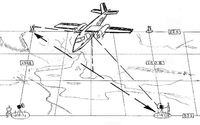
A typical Aerodist one degree braced quadrilateral measuring configuration (adapted from Else 1972
During Con’s first Aerodist measuring field season in 1965, the master measuring units were mounted in a high-wing twin engine Rockwell Aero Commander 680E fixed-wing aircraft (VH-EXY) chartered from the Melbourne-based Executive Air Services Pty Ltd. From 1966 to 1974, a larger Rockwell Grand Commander 680FL aircraft (VH-EXZ) was used; it was also chartered from Executive Air Services.
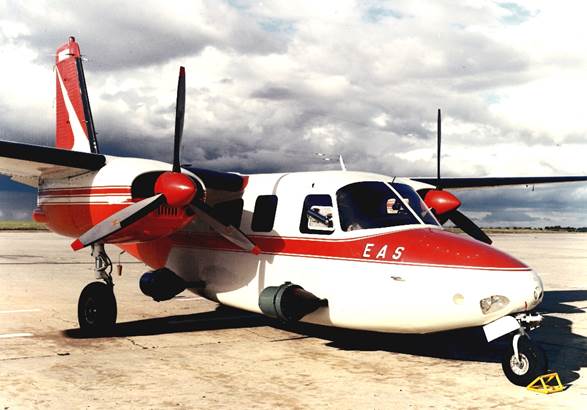
Aerodist measuring aircraft VH-EXY was used in 1965 (Nat Map image)
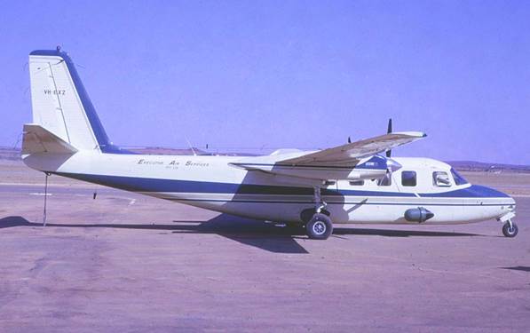
Aerodist measuring aircraft VH-EXZ was used from 1966 to 1974 (Nat Map image)
Off-shore Aerodist measuring also involved various motor vessels including Royal Australian Navy and Department of Transport ships. The 1971 Coral Sea survey that Con led covered a vast area. It ran east from Cairns to Willis Island and north to Daru off the coast of Papua New Guinea. It involved three Department of Transport Navaids vessels, principally the MV Cape Pillar and the MV Cape Don but also the MV Cape Moreton. It was supported by the fixed wing measuring aircraft and by a light helicopter. As well as the ships’ crews some 25 Nat Map staff and aircrew were involved.
MV Cape Pillar on the 1971 Aerodist Coral Sea Survey (Ted Graham image)
The Bathymetric mapping days 1971-1976 Canberra
After the end of 1971 Aerodist field season Con was seconded to Nat Map’s Canberra office where he worked on establishing and managing the Bathymetric Mapping Branch. Con was promoted to Supervising Surveyor of bathymetric mapping operations in 1973.
Nat Map’s bathymetric mapping operations were conducted over the continental shelf. Primarily these maps were to provide an aid for future resource exploration and for scientific studies but the maps were also used in numerous other applications. (The major client for the maps was the then Bureau of Mineral Resources, Geology and Geophysics.) Ultimately the program was to provide mapping from an inshore depth of 20 metres to a depth of 300 metres at the outer edge of the shelf. Bathymetric maps were compiled at a scale of 1:250,000 and showed isobaths at 10-metre depth intervals supplemented by spot depths as well as features such as islands, reefs and cays that broke the sea surface.
(Nat Map ran the bathymetric mapping program from 1971 until 1987. During that period some 227 bathymetric maps were published and a further 11 maps had been compiled awaiting publication. In July 1988, responsibility for the national bathymetric mapping program was transferred to the Hydrographic Service of the Royal Australian Navy. At that time some 41 sheets of the original 279 sheet program remained to be produced. However, for various reasons the program was never completed.)
Nat Map’s early bathymetric surveys were carried out by contractors; initially using the vessel TSMV Coralita and later the MV Murphy Star. Other vessels used by contractors on Nat Map bathymetric survey work included the HV Ataluma, the MV Manly Cove and the MV Bluff Creek.
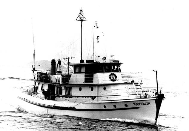
MV Coralita was used on Nat Map’s first contract bathymetric survey in 1971-1972 (Nat Map image)
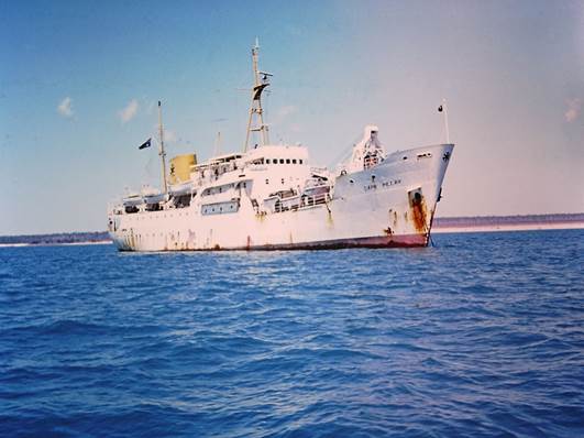
From 1972-1973 onwards Nat Map used Department of Transport Navaids vessels for most of the further offshore work; principally the Melbourne-based MV Cape Pillar but also the Perth-based MV Cape Don; both of 2,100 tons. The availability of these and other Navaids vessels was a result of the increased use of automated navigation lights that in turn reduced the DoT’s operational use of such vessels. Nat Map used the two Cape ships with Nat Map’s own survey staff and equipment.
Nat Map also chartered two other Navaids vessels from the Department of Transport. These vessels were used for closer inshore work with Nat Map survey staff and equipment. The first of these vessels was the MV Lumen of 264 gross tons that was used in the Torres Strait around 1976-1977. The second vessel was the motor launch Candela that was used in Spencer Gulf around 1977-1978.
Nat Map also provided its own survey staff and equipment for survey work using the DT Burrowaree off Tasmania’s east coast. The TSMV Febrina was used by Nat Map during the 1980s for inshore work in Great Barrier Reef waters.
On the Cape Pillar, a Doppler satellite system and Doppler sonar navigation system were used to position the vessel. The former system interrogated satellites in the world-wide US Navy Navigation Satellite System to periodically fix the position of the ship. The Doppler sonar system was linked to a gyro compass to obtain course and speed data that was used to calculate the ship’s position between satellite fixes. Water depth measurement was made with Atlas Deso 10 echo sounders. An expendable bathythermograph was occasionally deployed to determine the temperature profile of the water that was then used to set the echo sounders.
On smaller vessels such as the Febrina which used Nat Map survey staff and equipment, positioning was achieved through a Decca Hifix-6 radio positioning system (that worked on signal phase comparisons). There was also a back-up Motorola Mini-Ranger positioning system.
Royal Australian Navy Reserve Officer 1965-1988
After joining National Mapping, Con still wanted to keep in touch with his past sea-going life. To this end he soon applied to join the Royal Australian Navy’s Citizen Naval Force. On 2 November 1965 Con was commissioned as a Lieutenant in the Special Branch of the Royal Australian Navy Volunteer Reserve. Later Con undertook an induction course at the Navy shore station HMAS Cerberus on Western Port to the south-east of Melbourne. Afterwards Con was based from the shore station HMAS Lonsdale in Port Melbourne.
Some of the highlights of Con’s Navy days included carrying out a hydrographic survey in South Australia’s Spencer Gulf waters using small boats. Later he served as Officer of the Watch on the survey ship HMAS Paluma (III) while engaged in a hydrographic survey in Torres Strait with two RAN minesweepers in consort.
(HMAS Paluma (III) was built at the State Dockyard, Newcastle and launched as a 250 tons motor stores lighter (MSL 252) in 1946 but was then placed in reserve. In 1958 she was commissioned as a survey ship in the RAN Hydrographic Service. HMAS Paluma was then some 340 tons (208 tons displacement) with an overall length of about 124 feet. She gave 15 years of Navy service in St Vincent’s Gulf, Papua New Guinea waters and finally from Cooktown until being paid off in Sydney in 1973 and later sold.
During September-October 1966 under Lieutenant-Commander J B Dixon RN, HMAS Paluma supported Nat Map Aerodist operations by positioning remote parties on to off-shore features in the southern part of the Great Barrier Reef. Con was one of the Nat Mappers transported by HMAS Paluma during these 1966 Aerodist operations.)
In 1973, Con was promoted to the rank of Lieutenant-Commander. He later spent some time at the Royal Australian Navy Hydrographic Office that was then located in North Sydney. However, to his regret after being formally appointed as Director of National Mapping in 1982, Con was unable to devote much time to Navy activities.
HMAS Paluma in 1963 (John W Robinson image from World Naval Ships Forum website)
Assistant Director National Mapping Canberra 1976-1981
In 1976, Con was promoted to Assistant Director in charge of Nat Map’s Canberra-based Survey Group with responsibility for geodetic and bathymetric surveys, computation, analysis and dissemination of geodetic, and astronomical survey data, monitoring of the earth’s movements and polar rotation, and providing a national time service for communications, navigation and research.
As Assistant Director, Con was heavily involved in dealing with some of the high-level issues of the time; these included:
· initiating negotiations with the United States National Aeronautics and Space Administration that resulted in NASA funding an upgrade of National Mapping’s Lunar Laser Ranging facility that then included a time service and a photographic zenith telescope; the upgrade was completed in 1985-86 and included discontinuing use of the PZT due to superior results being obtained by laser ranging from satellites
· from 1976 onwards Con provided advice to Australian delegations through various rounds of negotiations that culminated in the signing of the Torres Strait Treaty in 1978; this work also involved consultations with Queensland officials and accompanying the Minister for Foreign Affairs and the Queensland Premier on an extensive tour of the Torres Strait Islands to provide advice to the various Island Chairmen on implications of the proposed maritime boundary treaty
· being a member of the Australian delegation during maritime boundary delimitation discussions with France and chairing technical sessions during these negotiations which resulted in the Australia-France Treaty being signed in January 1982
· being a member of Australian delegations during various rounds of maritime boundary treaty negotiations between Australia and Indonesia; this work included personally conducting technical negotiations that saw a provisional fisheries surveillance and enforcement arrangement introduced in February 1982.
Con was also involved in providing advice within the Department of National Development and Energy and other federal government agencies to assist during sensitive discussions with State government officials on matters relating to the Seas and Submerged Lands Act (1973). He was also involved in coordinating technical elements of negotiations with State government officials on matters relating to an offshore constitutional settlement dealing with State legislative powers regarding coastal waters.
From the late 1970s, Con chaired Nat Map’s Automated Data Processing Policy Steering Committee that guided the implementation of computer assisted cartography and other modern computer and data processing applications within the Division.
In 1981, Con was the Department of National Development and Energy representative on an inter-departmental review chaired by the Public Service Board to examine and report on the scope for merging Commonwealth organisations responsible for survey and mapping activities. The review group also included representatives from the Australian Survey Office, Royal Australian Survey Corps and the Royal Australian Navy Hydrographic Service. The resultant Moran Report recommendations included that…there should be no merging of the four organisations…nor any transfer of functions between organisations.
As Assistant Director, Con was active in a number of on-going mapping related technical and advisory forums, including:
· Convenor of the National Mapping Council’s Permanent Committee on Tides and Mean Sea Level
· Chairman of the National Mapping Council’s Technical Subcommittee that provided advice to the Council on mapping related matters
· Chairman of the Australian National Committee on Antarctic Research’s Subcommittee for Geodesy and Cartography
· Chairman of the Subcommittee on Geodesy and Cartography of the Australian Academy of Science’s National Committee for Solid-Earth Sciences
· Advisor at meetings of the Antarctic Research Policy Committee that provided advice to the then Minister for Science and Technology on scientific activities in the Australian Antarctic Territory
· Advisor to the Antarctic Planning Group on mapping, surveying and bathymetric activities in the Australian Antarctic Territory and adjacent waters.
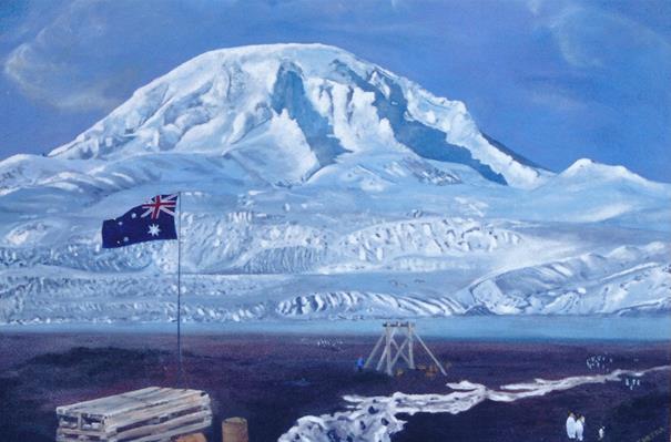
National Mapping Expedition to Heard Island and McDonald Islands 1980
In early 1980, Con led a Nat Map expedition to the sub-Antarctic Heard Island and McDonald Islands in the Department of Transport’s 2,100 tons Navaids vessel MV Cape Pillar under Captain Gordon Maxwell. This Australian territory is some 4,100 kilometres south-west of Perth. The expedition was a major undertaking that involved some 49 personnel, namely: 8 Nat Mappers, 4 Australian National Antarctic Expeditioners, 2 people from the Bureau of Mineral Resources, Geology and Geophysics, a helicopter pilot and engineer, and the ship’s crew of 33 officers and seamen. To support shore parties there as a Hughes 500 369D light turbine helicopter and the ship’s launch and LARC vehicle (a five ton aluminium lighter amphibious resupply cargo) equipped with a small crane.
The primary purpose of the expedition was to carry out a bathymetric survey of the Heard-Kerguelen plateau that was essential in establishing the international boundary between Australia (Territory of Heard Island and McDonald Islands) and France (Iles Kerguelen). The bathymetric data obtained during the survey was used to inform negotiation of the Australia-France maritime boundary treaty that was concluded in 1982. The expedition also provided an opportunity to establish survey and mapping control on Heard Island and the McDonald Islands. Zoology, marine science, botany, and geology studies were also carried out by the ANARE and BMR members of the expedition.
During the expedition the wreckage of a Royal Australian Air Force Supermarine Walrus 11 HD874 aircraft was recovered and brought back to Australia. This aircraft was designated as Snow Goose. It was a 1930s design amphibious biplane powered by a single 775 horse power Bristol Pegasus engine. The aircraft had arrived at Heard Island with an Australian expedition on 11 December 1947 on board His Majesty’s Australian Landing Ship-Tank 3501 (later renamed HMAS Labuan) under Lieutenant-Commander George Manly Dixon DSC RANVR.
The Walrus was to be engaged in aerial photography and reconnaissance flights over Heard Island but only made one such flight. On 21 December 1947, when tied down at Heard Island’s Atlas Cove during a hurricane, the Walrus was blown over and wrecked. Some parts and the equipment were salvaged but the wreckage was left at Atlas Cove until recovered by the 1980 National Mapping expedition led by Con Veenstra.
After bringing the remains of the Walrus back to Australia on the MV Cape Pillar, Con sold the wreckage back to the RAAF for a nominal fee of $1.00 in discharge of any salvage rights. The Walrus was restored between 1993 and 2002 and re-painted in its 1947 expedition colour of bright yellow by the Royal Australian Air Force. It is now held by the museum at RAAF Base Williams at Point Cook, Victoria as part of Australia’s aviation heritage.
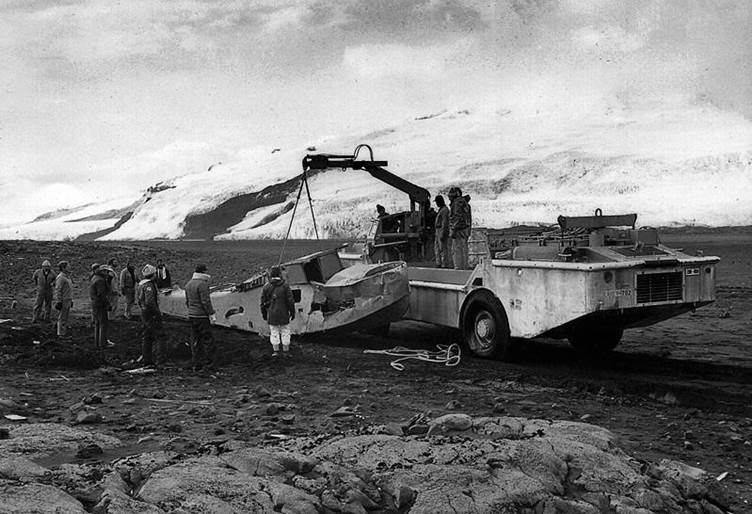
Recovering the hull of the Walrus from Atlas Cove Heard Island in March 1980 (Nat Map image)
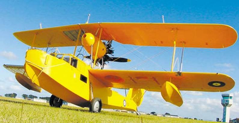
The Heard Island Walrus (HD874) in 2002 after restoration (RAAF image)
Director of National Mapping Canberra 1981-1987
In August 1981, Con assumed the duties of Director of National Mapping (Level 2) and was also ex officio Chairman of the National Mapping Council; he was formally appointed to both positions in September 1982.
As Nat Map’s Director, Con’s major focus was upward and outward rather than continually downward into the day-to-day operations of the organisations. To ensure the smooth running of the organisation he relied on the management team which he put in place and then nurtured. Nevertheless, Con maintained a keen interest in operational matters and directed a number of organisational developments. For example, in 1982 Nat Map’s Canberra office moved from Morisset House at Queanbeyan to the Cameron Offices in the Belconnen town centre.
Soon after becoming Director, Con advanced the development of Nat Map’s digital mapping capability to allow the creation of digital databases of topographic and thematic map data. This data was used to streamline Nat Map’s own map and atlas production and to provide digital mapping products for clients to use in a wide range of emerging applications.
Also in the early days as Director, Con streamlined contracting arrangements for the compilation of the 1:100,000 scale national topographic map series. Here, Con had listened to concerns raised by the Association of Consulting Surveyors. Its member firms were faced with un-necessary costs due to the stop-start nature of their work under the hitherto small size of the compilation contracts being let. That earlier approach was based on a belief that the relatively small size of the contracting firms precluded the timely fulfilment of large size map compilation contracts.
To improve these contracting arrangements, Con directed that in future only one or two contracts of much increased size be put out to tender. The photogrammetric firms in the industry immediately responded in a positive manner by forming consortia to have the capacity to undertake these larger compilation contracts. Those large contracts afforded greater work continuity for the firms and helped to reduce cost pressures. Nat Map also benefitted by having fewer contracts to arrange and administer. However, Con would not accede to industry calls for all of Nat Map’s compilation work to be outsourced. Instead he retained sufficient in-house capability to maintain Nat Map’s own compilation skills base which he saw as necessary for effective contract administration and auditing and to allow for ongoing research and development that was needed to improve compilation processes and procedures.
In March 1984, the Australian Landsat Station was transferred to National Mapping from the then Department of Science. Con had earlier worked with Don Gray, the Station’s Director to achieve this outcome. Con then directed the upgrading and development of the Landsat station to ensure it was able to process later generation Landsat data as well as data from other satellite remote sensing systems.
This process included seeking and obtaining the necessary additional resources from government and entering into a memorandum of understanding with the United States National Oceanic and Atmospheric Administration for continuing Australian access to Landsat data. Con later executed a similar agreement with the French Space Agency’s public company Spot Image for Australia to receive data from the Spot Earth observation satellite. As a result of the upgrade, the Landsat Station’s name was changed to the Australian Centre for Remote Sensing in October 1986.
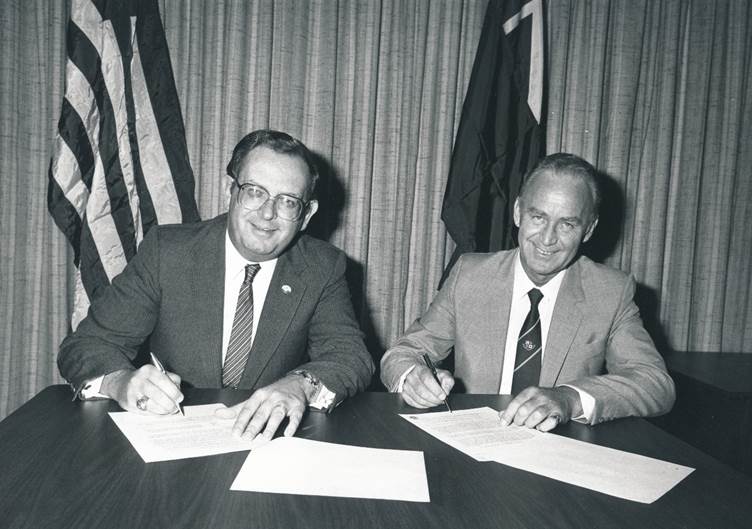
Con Veenstra (right) executing a memorandum of understanding on Landsat imagery access with Dr John McElroy Assistant Administrator of the United States National Oceanic and Atmospheric Administration in Washington DC on 13 March 1984.
Con also directed the upgrading of Nat Map’s photolithography capability. As a result, during 1985, the photolithography function was re-accommodated in the Lambert Building at the Fern Hill Technology Park in the Belconnen suburb of Bruce. The Lambert Building housed a then state of the art photolitho laboratory.
As part of his upward and outward focus as Director, Con held a number of the highest level leadership positions on national and international mapping related bodies and forums, these included:
· Chairman of the National Mapping Council that was established in 1945 as a forum to coordinate the topographic mapping activities of Commonwealth and State mapping agencies including the armed services
· Chairman of the Australian Liaison Committee on Remote Sensing by Satellite
· Chairman of the Commonwealth Users Committee on Remote Sensing by Satellite
· Department of Resources and Energy representative on the Australian Space Board
· Member of the United States Government Board of the Geosat Committee that advised on the US Navy’s Geosat Earth observation satellite launched in 1985 to gather information on the marine gravity field; Geosat operated until 1990
· Observer on the Australian Marine Sciences and Technologies Advisory Committee
· Australian Coordinator and Technical Advisor to the Management Steering Committee of the Association of South-East Asian Nations-Australia Tides and Tidal Phenomena Project which commenced in 1981 to observe and analyse tides on a cooperative basis in south-east Asian waters
· President of the Subcommission for Asia and the Pacific of the International Association of Geodesy’s Commission 10 on Continental Networks
· Secretary and International Association of Geodesy’s representative on the Scientific Committee on Antarctic Research’s Working Group on Geodesy and Cartography
· Member of the Australian Antarctic Names and Medal Committee that advised on the naming of features in the Australian Antarctic Territory and on the award of the Australian Antarctic Medal
· Leader of the Australian delegation to the Tenth United Nations Regional Cartographic Conference for Asia and the Pacific that was held in Bangkok in 1983
· Session Chairman on Computer Applications at the Conference of Commonwealth Surveyors that was held at Cambridge, UK in 1983
· Leader of the Australian delegation to the Eleventh United Nations Regional Cartographic Conference for Asia and the Pacific that was held in Bangkok in 1987
· Representative for the Australasia, Far East and Pacific Region for the 1987 Conference of Commonwealth Surveyors (British Empire and later Commonwealth survey officers have conferenced at Cambridge UK on a regular basis since 1928)
· Session Chairman on Land Information Systems, Geographic Information Systems and Land Management at the Conference of Commonwealth Surveyors that was held at Cambridge, UK in 1987
· Member of the Australian Research and Development Group
· Member of the Visiting Committee for the School of Surveying at the University of New South Wales
· Member of the Visiting Committee for the Centre for Remote Sensing at the University of New South Wales.
During Con’s time as Director, the last of the 1,646 printed map sheets in the 1:100,000 scale national topographic map series were published. Work also continued on preparing the remaining 1,416 sheets in this series that were not published due to covering the lesser settled areas of Australia. However, all 3,062 sheets at 1:100,000 scale were used to derive an updated and fully contoured national topographic map coverage of Australia at 1:250,000 scale. Publication of the maps in this series was completed in 1991.
As well as continuing apace with Nat Map’s various mapping and surveying programs, under Con’s direction the Tactual Atlas of Australia was released incorporating varied texture surfaces and braille writing. Nat Map was the first organisation in the world to prepare such a national document as a resource for blind people.
Professional memberships
During his surveying and mapping career that spanned over 30 years, Con was an active member of a number of professional bodies, namely:
· Member of the Institution of Surveyors, Australia
· Member of the Australian Institute of Cartographers
· Member of the Mapping Sciences Institute, Australia
· Fellow of the Australian Institute of Company Directors.
Professional papers
As a senior professional surveyor and a national and international leader on mapping and related surveying matters, Con prepared a number of papers presented at various forums; Con’s known papers are listed in the Appendix.
After National Mapping
Con left Nat Map and the Commonwealth public service in the latter part of 1987 after the Nat Map organisation had been joined with the Australian Survey Office to form the Surveying and Land Information Group (later renamed AUSLIG). This organisation change was part of numerous changes to administrative arrangements announced soon after the 1987 federal elections.
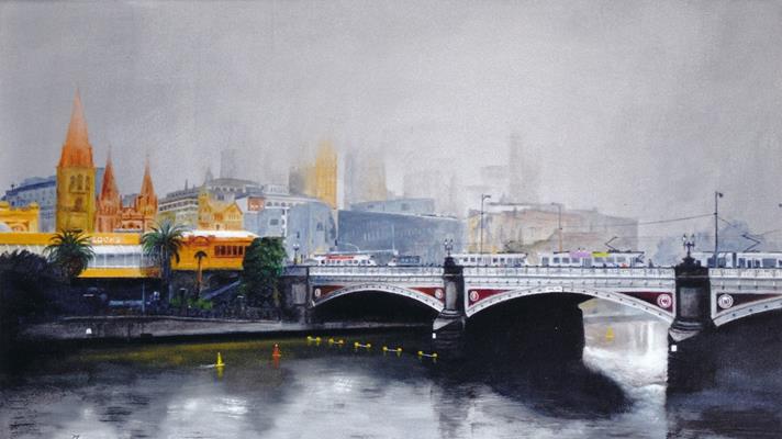
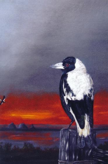
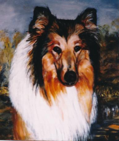
Con and his wife Anne later moved to Brisbane where Con worked for a couple of years as Director of Strategic Planning with the Queensland government Department of Geographic Information. While in Brisbane Con took up painting as a hobby and demonstrated considerable skill with his portraits, still life studies, and outdoor scenes. Later Con worked briefly with the Cleveland-based survey firm Cottrell Cameron & Steen Surveys Pty Ltd.
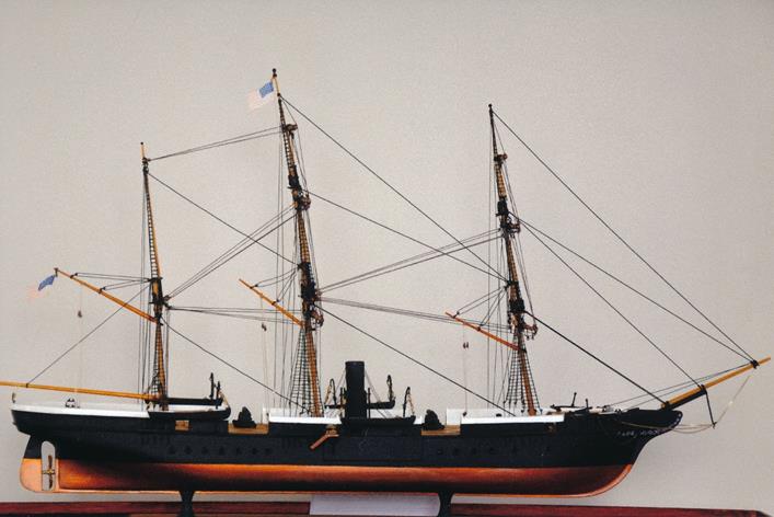
As well as paintings, another retirement project that Con was pleased to complete was the building of a scale model of the USS Kearsarge. She was a sloop-of-war named after Mt Kearsarge in New Hampshire and launched in 1861. She fought in the civil war but was wrecked in 1894. Con had started the project in Canberra but did not complete it until moving back to Victoria after retirement. Glimpses of some of Con’s paintings and hand craft work are provided in the Photo Gallery below.
Con eventually retired in 1992 and a couple of years later after trying life on Bribie Island for a while he and Anne moved back to Victoria where they settled at the coastal village of Clifton Springs on the Bellarine Peninsula to the south-west of Melbourne. Here they both continued to enjoy their retirement years.
Vale Anne Veenstra 2019
Anne Veenstra passed away peacefully on 18 August 2019, she was 86 years of age. Anne had suffered a major stroke some months earlier. Anne was survived by Con, her husband of some 66 years, and by their 4 daughters Anneke, Louise, Virginia and Kristine, sons-in-law Mack, and Derek and granddaughter Natalie. Anne's funeral service was held on 23 August 2019 at the William Sheahan Funerals Chapel on the corner of High Street and Murradoc Road Drysdale, the service commenced at 11am. Afterwards Anne's remains were privately cremated.
Vale Con Veenstra 2022
A year or so after Anne's death, and with his own health declining, Con Veenstra moved from his seaside home in Beacon Point Road Clifton Springs to the nearby Drysdale Grove Aged Care facility at the corner of Palmerston and Wyndham Streets in Drysdale. Sadly, Con Veenstra died at Drysdale Grove on 5 December 2022, he was 92 years of age. Con was survived by his and Anne's 4 daughters Anneke, Louise, Virginia and Kristine, sons-in-law Mack, and Derek and granddaughter Natalie.
Con Veenstra's funeral service was held on 14 December 2022 at the William Sheahan Funerals Chapel on the corner of High Street and Murradoc Road Drysdale; the service commenced at 11am. Afterwards Con's remains were privately cremated and later on 3 December 2023 his ashes were scattered in the ocean below the Queenscliff Lighthouse, a place where he and Anne had shared many happy memories.
Con's many friends and former work colleagues in the National Mapping community extend their sincere sympathies for their sad loss to Con's family members.
This article was prepared by Laurie McLean in consultation with Con Veenstra during August-September 2015, and last updated in December 2023.
Con Veenstra’s known published papers
Offshore Boundaries and the Torres Strait Treaty, technical paper presented at the 22nd Australian Survey Congress, Institution of Surveyors, Australia, 1980.
Expedition to the Australian Territory of Heard and McDonald Islands 1980, Division of National Mapping Technical Report 31, Department of National Development and Energy, Canberra 1982; co-authored with John Manning, a Nat Map senior surveyor on the expedition.
Geodetic Model of Australia 1982, Division of National Mapping Technical Report 33, Department of Resources and Energy, Canberra 1984; co-authored with Dr John Stuart Allman AM, University of New South Wales.
Mapping the Australian Continental Shelf, paper presented at the Twelfth International Cartographic Association Conference, Perth 1984.
Coping with New Technology, paper presented at the First Australian Surveying and Mapping Industry Conference, Brisbane 1985.
Geodesy and Mapping, paper presented at the University of New South Wales annual research seminars, Sydney 1985.
Modern Map Production, paper presented at a map production forum held at the University of New South Wales annual research seminars, Sydney 1986; co-authored with Drew Clarke, a Nat Map senior surveyor.
Report on Progress in Surveying and Mapping in Australia during 1983-1986, paper presented at the Eleventh United Nations Regional Cartographic Conference for Asia and the Pacific, Bangkok 1987.
Technological Change and the Emergence of a Geographic Information Industry, paper presented at the Third Australian Surveying and Mapping Industry Conference, Perth 1987; co-authored with Laurie McLean, a Nat Map principal research officer.
Survey in Australasia, Far East and Pacific Region, paper presented to the Conference of Commonwealth Surveyors, Cambridge, United Kingdom, 1987; co-authored with Laurie McLean, a Nat Map principal research officer.
References
Anonymous (1950), 300-Ton Amateur Built Schooner in Port, news article in The Mercury newspaper, Hobart, Friday 23 June 1950, page 20, accessed through the National Library of Australia’s Trove service on 10 September 2015 at: http://trove.nla.gov.au/ndp/del/article/26711067
Anonymous (2011), The Korean war boom and the horror budget, a section in Arthur Fadden: Treasurer in a Golden Age, a report in Economic Roundup, Issue 4, accessed on Australian Government Treasury website on 30 August 2015 at: http://www.treasury.gov.au/PublicationsAndMedia/Publications/2011/Economic-Roundup-Issue-4/Report/Arthur-Fadden-Treasurer-in-a-golden-age
Anonymous (undated), The Liberation of Leeuwarden, an article on the Royal Canadian Dragoons website accessed on 3 September 2015 at: http://www.dragoons.ca/leeuwarden2010.html
Anonymous (undated), The Liberation of the Netherlands, a section of the Canada at War website, accessed on 3 September 2015 at: http://www.canadaatwar.ca/content-52/world-war-ii/liberation-of-the-netherlands/
Anonymous (undated), Leederry, Auxiliary Ketch, entry on the Ferneaux Group Ship Wrecks listing, accessed on 6 September 2015 at: http://oceans1.customer.netspace.net.au/furneaux-wrecks.html
Anonymous (undated), HMAS Paluma (1946), entry on the Wikipedia website accessed on 8 September 2015 at: https://en.wikipedia.org/wiki/HMAS_Paluma_(1946)
Anonymous (undated), Lieutenant-Colonel James George Gillespie, entry on They Shall Not Grow Old website, accessed on 7 September 2015 at: http://users.netconnect.com.au/~ianmac/travis.html
Else, Harvey Lee (1972), The Map Makers, an article on the 1971 National Mapping Aerodist helicopter contract published in the Airfast News 1972, a newsletter published by the Airfast Aviation Group, Sydney; accessed in September 2015 from the XNatmap website.
Green, Allan (undated), Auxiliary Ketch Naracoopa, image H91.325/2255 on State Library of Victoria website accessed on 10 September 2015 at: http://handle.slv.vic.gov.au/10381/31006
Hall, Chris (2003), MV Falie Easter 2002 Part 1, article in Marine Life Society of South Australia Ltd Newsletter No 97, March 2003, accessed on 5 September 2015 at: http://www.dragonsearch.asn.au/cgi-bin/Publications.cgi?topic=nletters/MLSSA_NL_297_March_2003.htm&hash=1
McLean, Lawrence William (2013), RAAF Supermarine Walrus II HD874 Snow Goose-The Heard Island Walrus, an article on the XNatmap website accessed during September 2015.
McLean, Lawrence William (2014), Len Turner (1932-2002): Nat Map’s Consistent Quiet Achiever, an article on the XNatmap website accessed during September 2015.
McLean, Lawrence William (2015), The Aerodist Years: Recollections of the Division of National Mapping’s Airborne Distance Measuring Program 1963-1974, forthcoming article for the XNatmap website.
Menzies, Rod and Wise, Paul (2011), The 1:100,000 Scale Topographic Mapping Program-Assisted by Technology, paper presented to the 100 Years of Topographic Mapping Conference, held in Canberra during 28-29 March 2011 and accessed from the XNatmap website during March 2015.
Nix, Henry (undated), Coombs, Herbert Cole (Nugget) (1906–1997), article in Obituaries Australia, National Centre of Biography, Australian National University, accessed on 6 September 2015 at: http://oa.anu.edu.au/obituary/coombs-herbert-cole-nugget-246/text247
O’Donnell, Ian (2006), The Status of National Mapping: 400 Years On, a paper presented to the 400 Years of Mapping Australia Conference, held in Darwin during 23-25 August 2006. Accessed during December 2014 from the XNatmap website.
Spaull, Andrew (1993), Dedman, John Johnstone (1896–1973), article in the Australian Dictionary of Biography, National Centre of Biography, Australian National University, accessed on 10 September 2015 at: http://adb.anu.edu.au/biography/dedman-john-johnstone-303/text17607
Spencer, PA (1989), Administrative History of the Division of National Mapping, an article in The Australian Surveyor, September 1989, Vol. 34, No. 7, pp 674-681, accessed from XNatmap website on 4 September 2015.
Surveyors Board of Victoria (undated), Historical Registers of Surveyors, accessed during September 2015 at: http://odi.surveyorsboard.vic.gov.au/archive.asp
Veenstra, Con (1970-2015), Personal communications and work-related conversations over some 45 years.
Veenstra, Con, (2014-2015), Perusal of personal papers and correspondence.
Waterson, DB (1993), Chifley, Joseph Benedict (Ben) (1885–1951), article in the Australian Dictionary of Biography, National Centre of Biography, Australian National University, accessed on 7 September 2015 at: http://adb.anu.edu.au/biography/chifley-joseph-benedict-ben-9738/text17199
Wise, Paul Joseph (2014), Natmap’s Physical and Administrative Locations, an article on the XNatmap website.
Wise, Paul Joseph (2014) and Watson, Charles Wesley (2015), Bathymetric Mapping-Natmap’s Unfinished Program.