John Manning
National Mapping and Antarctic Surveyor
Prepared by Laurie McLean April 2018
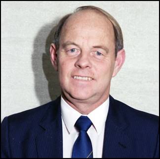
John Manning in the1980s.
An XNatmap image.
After qualifying in Tasmania, John Manning worked as a field surveyor in Australia and Antarctica. His work in Antarctica from 1966 included field survey activities during 11 summers, and one winter season as well as several visits to sub-Antarctic islands. John also worked as a Nat Map field surveyor and survey field party leader in remote areas of Australia during the late 1960s and early 1970s. Later John undertook senior surveyor and senior manager roles in Nat Map and successor organisations.
Early Life
John Manning was born in Sydney, New South Wales in 1937. He grew up in Alexandria an inner city area about three miles south of the Sydney central business district. John’s formal education commenced at the Alexandria Primary School in Park Road. For 10 years during the formative period of his younger life, John was a member of the then Redfern Boy Scout Troop. At age 16 years he qualified for the coveted Queens Scout Award; the highest youth award achievable.
In 1955, John completed the Leaving Certificate at Sydney Boys High School that was located in nearby Cleveland Street Moore Park. While at High School, John qualified for the Bronze Medallion of the Australian Life Saving Society and later for the higher level Award of Merit. John progressed from the Boy Scout environment to extensive extreme bushwalking mainly in New South Wales. Manning Saddle in the Moss Vale area of the Southern Highlands was named for John when he pioneered a new route into Ettrema Gorge through that site.
Early Career
During 1957-58, John worked as a cadet draughtsman with the New South Wales Forests Commission and as a field assistant with a city surveyor in Sydney.
To Tasmania
To further his bushwalking and climbing pursuits, John went to Tasmania in the winter of 1958 to climb the then inaccessible Mount Anne (4 669 feet) under snow in the rugged south-west region. Deciding to stay on in Tasmania, he became articled to Surveyor‑General, Frank Miles in 1958.
In recognition of his bushwalking level of endurance, John was coerced into joining an athletics club in Hobart. In just one season he progressed from a rookie athlete to the Tasmanian State Champion for race walking and record holder for the one and two mile track events. Unfortunately for John there were no race walking events for the longer Olympic distances.
After completing the Board of Surveyors examinations, John qualified as a licensed surveyor in 1965 after seven years of service with the Lands Department in Tasmania.
Marriage to Beth Wilkins
In 1961, John Manning and Beth Wilkins married in Hobart. Beth was then working in the Library at the University of Tasmania. John and Beth were to have two children, daughters Kylie (born 1962) and Tonya (born 1967).
To the Division of National Mapping
John joined Nat Map in October 1966 as a surveyor in a temporary position to winter in Antarctica for the year of 1967. However, instead of returning to Tasmania in 1968 John decided to stay with Nat Map with the prospect of further Antarctic and remote area Australian field survey work. For the next decade he undertook extensive mapping field surveys in Antarctica and Australia. John was surveyor-in-charge of field operations in a number of Australian National Antarctic Research Expeditions between 1966 and 2002.
Antarctic Field Work Activity
During the 1966-67 summer changeover period at Mawson station, John was involved in helicopter-supported Tellurometer survey operations building the Framnes Mountains geodetic network.
In 1967; John was the ANARE wintering surveyor at Mawson. With support from other Expeditioners, John spent more than six months in the field through that calendar year. This field work included Tellurometer and theodolite observations building the regional geodetic network. It completed the Framnes Mountains framework and extended it to the Gustav Bull Mountains to the east of Mawson. As well, John provided intersected positional fixes to features, including the coastal bastions, Scullin and Murray Monoliths. Another major oversnow geodetic traverse was re-run, between Mount Twintop, in the Framnes Mountains and Depot Peak the northern outlier of the Prince Charles Mountains; see Corry (1969). This traverse was further controlled by high level astrofixes at each end.
In completing the Framnes Mountains primary geodetic framework, Onley Hill was a key station which was connected to Lucas Nunatak and Béchervaise Island. In early 1968 Onley Hill was connected to Mt Twintop, Anniversary Nunataks and McNair and Van Hulssen Nunataks. A resection was observed to these points from the summit of Mt Henderson. A definitive precise astronomic fix was observed on Béchervaise Island during winter. It provided the origin for the extended geodetic network which eventually extended as a continuous network from Davis through the southern Prince Charles Mountains and Enderby Land to the Russian station Molodezhnaya.
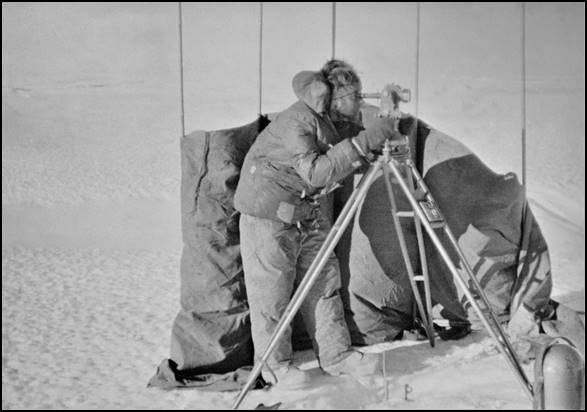
John Manning observing with Wild T3 theodolite at Frustration Dome in September 1967. John Manning supplied image.
1967-68: during summer survey operations, a field party comprising Max Rubeli, Max Corry and George Hamm (incoming officer‑in‑charge Mawson) began a coastal Tellurometer traverse on the eastern side of the Amery Ice Shelf. When the relief vessel MV Nella Dan arrived at Mawson, it carried Commander Austin Yeager from US Coast and Geodetic Service.
Commander Yeager selected occupation sites for camera observations of the PAGEOS passive geodetic earth orbiting satellite being used to establish a satellite-based worldwide geodetic network. John Manning provided a precise position and azimuth for the Mawson site and later also at the site of the (under construction) Casey station. On the return voyage from Mawson, John also observed an isolated astrofix for mapping on the western side of the Amery Ice Shelf.
1968-69: John’s summer operations were supported by fellow Nat Mapper Jeff Fox and surveyor Max Rubeli who had wintered at Mawson in 1968. These operations involved completing a Tellurometer and theodolite survey traverse from Davis station to the northern Prince Charles Mountains, which had been reached by ground survey the previous year. A temporary operational base was set up at Landing Bluff, near the location used the previous summer as an unloading point for wintering the 1968 Amery Ice party. From this tent city on the edge of the Ice Shelf, helicopter support for the survey and geology was provided using fuel depots established at various sites using the Beaver fixed-wing aircraft; such as Beaver Lake and the Larsemann Hills.
The major fuel depots in the northern Prince Charles Mountains at Moore Pyramid and Depot Peak had previously been established by tractor train from Mawson by earlier wintering parties from 1965 to 1968. Fuel was also available from Davis station.
1970-71: summer survey operations to extend the geodetic network through the northern Prince Charles Mountains south along the Lambert Glacier were undertaken by a Nat Map survey party that comprised John Manning, Norm Edwards and John Ely.
1971-72: during this summer John was again in charge of helicopter‑supported survey operations that further extended the geodetic framework into the southern Prince Charles Mountains with fellow Nat Mappers Ed Burke, Mick Skinner and Andrew Greenall. A massive fuel depot had been established near Mt Cresswell by Caterpillar D5 tractor train from Mawson by the 1971 wintering party, and this was used as a temporary operational base for the summer.
1972-73: during this summer aircraft-supported survey operations were undertaken from the fuel depot at Mt Cresswell in the southern Prince Charles Mountains. The depot had been refurbished by the 1972 Mawson wintering party. The summer survey party comprised Nat Mappers John Manning, Simon Cowling and Reg Helmore.
A start was made on flying high altitude vertical photography in the fixed-wing Pilatus Porter (VH‑FSB) on charter from Forrester Stephen. The aircraft was flown to its maximum ceiling (21 000 feet) and block photography was flown over the southern Prince Charles Mountains for the first time. Wild RC9 aerial survey camera (serial number 616) was used and colour Kodak 2445 film was trialled. The aerial photography of the southern Prince Charles Mountains was completed.
On one aerial photography flight John was the navigator but was suffering from influenza. During the flight he collapsed due to oxygen deprivation when the excess moisture in his face mask froze and blocked his oxygen supply. Camera operator Reg Helmore had to resuscitate John while pilot Errol Driver quickly spiralled the aircraft down to below 10 000 feet where there was sufficient atmospheric oxygen to breathe normally.
During this summer season, John Manning and geologist Dick England made the first known ground visit to the remote Komsomolskiy Peak (75° 45' South 63° 25' East) the southern-most rock feature in East Antarctica.
These expeditioners flew to the summit in Hughes 500 helicopters to collect geology samples. (Komsomolskiy Peak was discovered during a flight by a Soviet aircrew in 1958 and was photographed by ANARE in 1960. Komsomolskiy Peak was first accurately positioned by John Manning by intersecting theodolite observations from stations in the southern Prince Charles Mountains network.
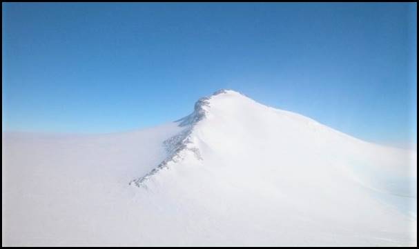
West face of Komsomolskiy Peak in 2003.
Mike Woolridge image from ANARE website, catalogue ID: IA16478.
1973-74: during summer survey operations in the southern Prince Charles Mountains, the survey party comprised Nat Mappers John Manning, Andrew Turk, Terry Mulholland and Geoff Wood. John Manning again camped at a survey station at 3 228 metres on Menzies Massif. High altitude block photography was also carried out over the northern Prince Charles Mountains by Terry Mulholland and Geoff Wood flying in Pilatus Porter VH-FSB.
One of the chartered Jayrow helicopters (VH-CHK) crashed on Burke Ridge when a skid caught as the relatively inexperienced pilot tried to move the aircraft to the right along the ridge in the face of a severe up-draught. The aircraft tumbled over the ridge on to rocks but did not catch fire. Fortunately Andrew Turk and the pilot Col Scott, the only persons on board, were only slightly injured. The aircraft was destroyed.
While much had been achieved, the near fatal incident caused a premature close to the operations in the remote southern Prince Charles Mountains. However, further survey work was then undertaken by helicopters flying from Mawson. That work strengthened and completed the survey geodetic link to Enderby Land by an inland route (as started in 1964-65) and then back through coastal sites to Mawson.
During that summer, John became the first person to revisit the location of Sir Douglas Mawson’s British, Australia and New Zealand Antarctic Research Expedition 1931 landing site at Scullin Monolith and the site of Robert Dovers’ 1954 ANARE visit at Scullin Monolith.
1975-76: helicopter and fixed-wing aircraft supported summer survey operations were based near Mt King in Enderby Land and extended west to the Russian base at Molodezhnaya. This was a major project well supported by Nat Map. The experienced survey party comprised Nat Mappers John Manning, Carl McMaster, Oz Ertok, Michael Morgan and Andrew Greenall.
The aerial photography party (Michael Morgan and Ozcan Ertok) operated a Wild RC9 aerial survey camera in Pilatus Porter VH-FZB and achieved considerable coverage.
During this summer trip, John extended the Australian Antarctic geodetic network from Davis to the Russian station of Molodezhnaya. Notably John was able to visit together with a geology party member, the landing site of Mawson’s 1930 British, Australia and New Zealand Antarctic Research Expedition landing site at Proclamation Island. This was the first time the site had been revisited since 1930. The day before surveyor Carl McMaster established a survey station alongside the original flagpole and located the historic hand-written territorial proclamation left by Mawson.
1976-77: John was again involved in summer operations including a survey of aircraft landing sites (on rock) in the Vestfold Hills area near Davis station.
1998-99: John was engaged on a round summer voyage with GPS survey operations at Heard Island with Australian National University geophysicist Dr Paul Tregonning and in establishing permanent GPS trackers at Davis and Mawson.
2002: John was an invited surveyor with the United States Geological Survey and flew from New Zealand in a Hercules transport aircraft to undertake survey work with United States Antarctic survey team in the vicinity of the eastern border of the Australian Antarctic Territory in Trans Antarctic Mountains.
Sub-Antarctic Survey Activities
Earlier when returning from Antarctica, John made brief stopovers at Macquarie Island in 1969, 1972, 1973 and 1976. While bad weather curtailed operations for aerial photography and ground survey, John began work on Tellurometer-supported geodetic surveys.
In the summer of 1974‑75, John travelled to Macquarie Island on the station changeover relief voyage. During the few days he was on the Island, John extended the survey work onto the high plateau using a Wild T2 theodolite and CA 1000 Tellurometers. He also operated a JMR Doppler satellite receiver to capture the first accurate position of the new geodetic survey at the Macquarie Island base.
In early 1980, John was the senior surveyor on a Nat Map expedition to the sub-Antarctic Australian Territory of Heard Island and McDonald Islands. This ambitious survey and bathymetric expedition was under the overall leadership of the experienced Con Veenstra, then a Nat Map Assistant Director. The objective was to improve the positional accuracy of Heard Island and to map the undersea nature of the extensive Kergulen Plateau using bathymetric remote sensing techniques develop in the Great Barrier Reef.
The expedition ship was the MV Cape Pillar under Captain Gordon Maxwell. The Cape Pillar was a 2 000 ton Department of Transport Navaids vessel designed for servicing lighthouses and other navigation aids. On this expedition John worked on ground surveys with CA 1000 Tellurometers and JMR satellite-receiving equipment to obtain mapping control as the basis for a subsequent international boundary determination with the French Territory Les îles Kerguelen to the north.
John Manning led a shore party that camped for a week during the first-ever occupation of McDonald Island, to the north of Heard Island. (The McDonald Islands then comprised McDonald Island, Flat Island and Meyer Rock. During subsequent volcanic activity Flat Island merged with McDonald Island.)
At McDonald Island John undertook ground control surveys for mapping. With Nat Mapper Ted Graham, John also undertook aerial photography from a Hughes 500 helicopter (VH-TIY) on charter from Central Australian Helicopters. With pilot Des Ross and engineer Roy Rayner, the helicopter travelled south from Fremantle to Heard Island onboard the Cape Pillar.
John returned to Heard Island for further survey operations with an Australian National Antarctic Research Expedition in 1984 on the MV Ice Bird and undertook further precise global satellite positioning system observations at both ends of the island.
Australian Field Work Activity
In Australia, John first worked as a Nat Map field survey party leader with the Aerodist ground marking party in the Western Australian deserts during the winter months of 1969. Later that year John worked with the Aerodist measuring party in north western Queensland and on the Great Barrier Reef. During 1970 and 1971 John was the field survey party leader for extensive periods during Aerodist measuring operations in the Simpson and Tanami Deserts; in the south-west of the Northern Territory; and in the northern Gibson and Great Sandy Deserts of Western Australia.
Based in the Rialto office between field duty assignments, John was engaged in Aerodist data reductions and computations and in research and development activities.
As a senior surveyor, John headed Nat Map’s Antarctic Mapping Section from 1972 to 1977 but also undertook extensive periods as relief field survey party leader for Nat Map’s Australian operations.
In early 1977 Nat Map’s Melbourne office was restructured and moved from the Rialto Building in the CBD to Ellery House in Dandenong. As a consequence, between 1977 and 1979. John was moved to the new position of the executive surveyor in Nat Map’s Dandenong office.
In 1978 John also undertook a six-month period of duty in Nat Map’s Canberra office as executive officer reporting directly to the Director of National Mapping. However, he decided not to take up the opportunity that was offered to go forward in this bureaucratically constrained field of public service administration. Instead John preferred to return to the more satisfying technical-based work in 1979.
Between 1980 and 1985, John was the supervising surveyor of Nat Map’s Dandenong-based Topographic Control Branch. From 1985 to 1987, John was the Assistant Director Topography, responsible for Nat Map’s Dandenong-based topographic mapping activities.
After Nat Map
Following the 1987 federal elections the government decided to amalgamate National Mapping with the Australian Survey Office under the latter’s administrative structure. As a consequence John was obliged to move to Canberra that year to maintain the existing level of his departmental position. There he became the Manager of the Special Services Unit, in the newly established Australian Surveying and Land Information Group within the Department of Administrative Services.
Later John became the Manager of the Canberra-based Geodesy Program initially within the Australian Surveying and Land Information Group and afterwards within Geoscience Australia. John was also the chair of the National Geodesy Committee of the Intergovernmental Committee for Surveying and Mapping for 12 years. Through that committee John was instrumental in deciding and executing the moving of the geodetic datum some 200 metres so that coordinates would be directly compatible with positions obtained from global positioning satellites.
International Activities
John was extensively involved as both a member and the convenor of international geodesy programs for both Antarctica and the Asia Pacific region. John Manning’s international activities included:
· Member of the Asia Pacific Geodynamics Program (APSG) Management Board
· Member of the International GPS Service (IGS) Governing Board
· Invited member of the Integrated Global Geodetic Observing System (IGGOS) steering committee
· Chairman of the International Federation of Surveyors’ Permanent Committee on GIS Infrastructure for Asia and the Pacific (PCGIAP) Regional Geodesy Working Group
· Member of the PCGIAP Executive Board
· Chief Officer of the SCAR Geospatial Information Group of Experts (SCAR-the Scientific Committee on Antarctic Research is a committee of the International Council for Science)
· Chief Officer of the SCAR Working Group on Geodesy and Geographic Information
· Convenor of the SCAR Geodetic Infrastructure of Antarctica Program
· Chairman of the IAG Regional Sub-Commission on Asia and the Pacific (IAG is the Association Géodésique Internationale or in English the International Association of Geodesy)
· Member of the IAG Commission 1 Executive Committee
· Member of the IGLOS Steering Committee (GLONASS pilot project) (GLONASS is Globalnaya Navigazionnaya Sputnikovaya Sistema, the Russian Global Navigation Satellite System.)
· Member of the IGS TIGA Steering Committee; a global sea level change monitoring project. (IGS is the International Global Navigation Satellite System Service and TIGA is its Tide Gauge Benchmark Monitoring project)
· Secretary of the Local Organising Committee for joint general assemblies of IAG, IAPSO and IABO in the Dynamic Planet Conference held in Cairns in August 2005 (IAPSO is the International Association for the Physical Sciences of the Oceans; IABO is the International Association of Biological Oceanography).
Recognition
For his outstanding contribution to global geodesy John was recognised with the award of a Fellow of the prestigious International Association of Geodesy. He is also a Fellow of the Mapping Sciences Institute of Australia. John was also a Member of the Institution of Surveyors, Australia.
In November 1969, John was awarded the Polar Medal for his service as the Australian National Antarctic Research Expeditions surveyor at Mawson station in 1967. In 1990, John was awarded the President’s Medal by the Australian Institute of Cartographers. In 2001, John was awarded the Public Service Medal for outstanding public service in the field of geodesy and in enhancing Australia's international profile as a world leader in this area.
In recognition of his outstanding contributions to a number of Australian National Antarctic Research Expeditions, three geographic features in Antarctica were officially named for John Manning. These features are:
· Manning Glacier located at 73° 10' 56" South 68° 12' 22" East is just south of Harbour Bluff in the Mawson Escarpment and flows into the Lambert Glacier. Named after John Manning, surveyor-in-charge of field survey operations during the ANARE Prince Charles Mountains surveys in 1969, 1971, 1972, 1973 and 1974.
· Manning Island located 69° 21' 18" South 76° 20' 00" East is about 1.9 km north of Broknes Peninsula in the Larsemann Hills. This feature was named after John Manning, surveyor at Mawson in 1967, and senior surveyor in the Prince Charles Mountains surveys of 1968-69 and 1971-72. John carried out a survey traverse from Sandefjord Bay to Davis in 1968-69.
· Manning Massif located at 70° 42' 56" South 67° 45' 12" East is a rock massif in the eastern part of the Aramis Range in the Prince Charles Mountains. It was first visited by a party from the ANARE Prince Charles Mountains survey in 1969. This feature was named after John Manning, surveyor at Mawson in 1967, and surveyor-in-charge of field survey operations during the ANARE Prince Charles Mountains surveys of 1969, 1971 and 1972.
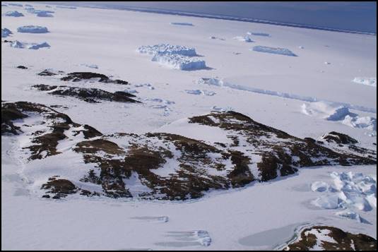
Manning Island Antarctica in 2009.
ANARE image by Rick Oates Catalogue ID: IA21803.
For John Manning’s contribution to the success of the 1980 National Mapping expedition to the Australian Territory of Heard Island and McDonald Islands, a geographical feature on Heard Island was named for him:
· Manning Lagoon is located on Heard Island at 53° 11' 29" South 73° 30' 37" East. It is coastal lagoon about 5 kilometres long near Long Beach on Heard Island. This feature was named after John Manning, senior surveyor with the Division of National Mapping as a member of the National Mapping Expedition to Heard Island in 1980.
Manning Lagoon on Long Beach, Heard Island in 1986.
ANARE image by Peter Keage Catalogue ID 1909C2.
John Manning-Author
Since the late 1970s, John Manning has been an energetic and prolific author of papers and other publications on surveying, mapping or environmental management topics. John has been published as both an individual author and as a co-author with one or more colleagues. A list of some of John Manning’s known papers and other publications is provided in the Appendix.
Outback Ventures
During his spare time in the 1980s, John travelled into the more remote regions of outback Australia to act as navigator and surveyor on some ventures that were being filmed as television documentaries.
The three ventures were:
· 1982: The Madigan Line where John undertook the navigation for a re-enactment of Dr Cecil Thomas Madigan's 1939 expedition that achieved the first crossing of the Simpson Desert using camels. During the 1982 re-enactment, camels were used along with vehicle support. John researched Madigan’s original route and campsites by analysing the narrative and photos from Madigan’s journal. This route was then plotted on 1:100 000 scale topographic compilation sheets supplemented with interpretations from aerial photographs. Then on-foot John guided the 1982 re-enactment party along Madigan’s original route to Madigan’s various campsites between Andado and Birdsville.
· 1985: Down the Diamantina where John navigated for a party using rubber duck boats with outboard motors to travel down the river from Birdsville to Lake Eyre when it was in the flood.
· 1987: The O'Donnell Expedition where John relocated the route of the 1887 horse-based expedition led by William O'Donnell with William Carr-Boyd. The 1887 expedition travelled from Darwin to the Ord River and Kimberley Ranges to inspect leases taken up sight unseen by the Cambridge Downs Pastoral Association; a Melbourne pastoral company.
Retirement from Geoscience Australia
John retired in 2004 as the Group Leader of the Earth Monitoring Program at Geoscience Australia in Canberra. Soon after retiring from Geoscience Australia, John took up a position as Visiting Fellow in the School of Surveying and Spatial Information Systems at The University of New South Wales. John was also an Adjunct Researcher in the School of Earth Sciences at Monash University.
Academic Studies
During his time with Nat Map John successfully took up academic studies. In December 1982, he was awarded the degree of Master of Environmental Science from the Graduate School of Environmental Science in the Faculty of Science at Monash University. As well completing three years of course work, a major thesis was submitted: The Environmental Management of Heard and McDonald Islands. In December 1987, John was awarded the degree of Master of Business Administration from the Faculty of Economics and Politics at Monash University. In 2012 John was awarded the degree of Doctor of Philosophy from the School of Philosophical, Historical and International Studies at Monash University for his thesis: The Influence of Individuals in Shaping Australian Antarctic Policy 1900‑1991.
John Manning Today
Since retiring, John and his wife Beth have lived at Newcastle where John’s interests include researching and writing on mapping and Antarctica related topics.
This profile was prepared by Laurie McLean during March-April 2018 in consultation with John Manning.
Appendix
Some of John Manning’s Papers and Publications
Manning, John (1968), Surveyor's Report – 1967 (that outlines survey work and related matters at Mawson, Antarctica during 1967), from 2018 available on XNatmap website at: http://www.xnatmap.org/daat/docs/manningj/67SurveyorsRpt.htm
Manning, J (1977) Australian Mapping Activities in Antarctica, a paper presented to the Sixteenth Conference Australian and New Zealand Association for the Advancement of Science (ANZAAS), Melbourne.
Manning, J; and McMaster, C (1980) Mapping organisations in a changing social environment, a paper in the proceedings of the Second Australian Cartographic Congress, Australian Institute of Cartographers, Hobart, 1980.
Manning, J; Snell, J; and Strachan, D. (1981) An Environmental Study of the Aireys Creek Region, School of Environmental Science, Faculty of Science, Monash University, Melbourne.
Manning, J (1982) The Environmental Management of Heard and McDonald Islands, Master of Environmental Science Thesis, Graduate School of Environmental Science, Faculty of Science, Monash University, Clayton, Victoria.
Veenstra, C; and Manning, J; and others (1982) Expedition to the Australian Territory of Heard Island and McDonald Islands 1980, Division of National Mapping Technical Report 31, Department of National Development and Energy, Canberra; available online at: http://www.xnatmap.org/report_tdnm/31%20HEARD_IS.pdf
Manning, J (1983) Accuracy Checks on Topographic Maps, in the Technical Papers, Twenty-fifth Australian Survey Congress, Institution of Surveyors, Australia, Melbourne, 1983; available online at: http://www.xnatmap.org/adnm/ops/prog/mrev/83mapaccoview/83mapaccoview.htm
Manning, J; and Henderson, D (1984) Aerial Camera Calibration Facilities in Australia, Commission I Part A1, Fifteenth Conference International Society for Photogrammetry and Remote Sensing, Rio De Janeiro, Brazil, 1984. Commission I Part A1, pages 114-120; available online at: http://www.isprs.org/proceedings/XXV/congress/part1/114_XXV-part1.pdf
Trinder, J C; Manning, J; and Wise, P J (1986) The use of SIR-B and LFC space images for mapping, in the proceedings of International Society for Photogrammetry and Remote Sensing, Commission IV, Symposium, Edinburgh, September 1986. An online version of this paper by Trinder is at : https://www.xnatmap.org/adnm/ops/proj/86sirb.pdf
Manning, J (1986) The Impact of Revision on the Accuracy of Topographic Data, Part 1 of Obsolescence-the ongoing problem for Cartographic Information Systems, Technical Papers, Sixth Australian Cartographic Conference, Australian Institute of Cartographers, Melbourne, 1986; available online at: http://www.xnatmap.org/adnm/ops/prog/mrev/86comrevkccjm/86comrevkccjm.htm
Manning, J (1987) The Topographic Application of Large Format Camera Space Imagery, in Technical Papers, Fourth Australian Remote Sensing Conference, Remote Sensing Society of Australia, Adelaide, 1987; available online at: http://www.xnatmap.org/adnm/ops/proj/86gbr/86gbr.htm
Manning, J (1987) Professional Regulation, a paper presented to a Search Conference on Registration of Surveyors held on 25 May 1987, Melbourne.
Manning, J; and Derkacz, L (1987) GPS Applications in Aerotriangulation, a paper presented at the Royal Melbourne Institute of Technology Centenary Conference, held in August 1987 at Melbourne.
Manning, J; and Menzies, R (1988) Vertical Control for Australian Topographic Mapping, Technical Papers, Thirtieth Australian Survey Conference, Institution of Surveyors, Australia, Sydney, 1988; available online from the XNatmap website at: http://www.xnatmap.org/adnm/ops/prog/vertcont.pdf
Manning, J (1988) Navigation Techniques in Antarctica, a paper presented to Australian Institute of Navigation, Sydney.
Gray, D J; Holland P R; and Manning J (1988) The Marine Remote Sensing Experience of the Australian Surveying and Land Information Group, a paper in the proceedings of a Symposium on Remote Sensing of the Coastal Zone, September 1988, Brisbane; available online from the XNatmap website at: http://www.xnatmap.org/bals/docs/MARINE_RS.pdf
Manning, J; and Evans, M (1988) The Revision of Medium Scale Topographic Maps using Space Imagery, a paper in the proceedings of the Sixteenth Congress International Society for Photogrammetry and Remote Sensing, July 1988, Kyoto, Japan; available online at: http://www.xnatmap.org/adnm/ops/prog/mrev/88spacimrev/88spacimrev.htm
Manning, J (1988) From Aerial Photography to Remote Sensing: A History of Aerial Photography and Space Imagery Acquisition in Australia, Technical Papers, Sixth Australian Cartographic Conference, Australian Institute of Cartographers, August 1988, Sydney; available online at: http://www.xnatmap.org/adnm/ops/prog/aphhistjm.htm
Manning, J (1988) Australian Surveying and Mapping in Eastern Antarctica, a paper in the proceedings of a Symposium on Modern Geodesy and Cartography in Antarctica, Twentieth Conference, Scientific Committee on Antarctic Research, Hobart, 6 September 1988.
Manning, J (1989) The AUSLIG Laser Terrain Profiler, in Technical Papers, Thirty-first Australian Survey Congress, Institution of Surveyors, Australia, April 1989, Hobart; available online at: https://www.xnatmap.org/adnm/ops/prog/laps.htm
Manning, J (1989) The Role of Geography in Australian Antarctic Research, a paper presented at the Antarctica Research Evaluation Group Workshop, Social Science in Antarctica, May 1989, Hobart.
Manning, J (1989) Quality Control through AUSLIG Survey Examination, a paper presented to a Workshop on Quality of Surveying in the ACT, May 1989, Canberra.
Lindsay, G K; and Manning, J (1989) Satellite Image Mapping of the Larsemann Hills, Antarctica, a paper in the proceedings of the Fourteenth International Cartographic Conference, August 1989, Budapest, Hungary; available online at: https://www.xnatmap.org/bals/docs/laars.pdf
Manning, J (1989) Exploration and Australian Cartography in East Antarctica, an article in Cartography Vol 18, No 2, December 1989 pages 2-14; Journal of the Australian Institute of Cartographers.
Govind, R; and Manning J (1990), Antarctic Geoid from High Order Geopotential Model, a paper presented to Scientific Committee on Antarctic Research Working Group Seminar, Frankfurt, Germany June 1990.
Manning, J; Morrison, T; and Murphy, B (1990) The Transition to GPS: Australian Experience in Antarctica with Satellite Positioning, a paper in the proceedings of the International Federation of Surveyors (FIG) X1X International Congress, Commission 5, pages 296-311, FIG, Helsinki. Finland.
Manning, J; and Rogers, P (1990) Contemporary Cartography: The Beaver Lake 1:100 000 Image Map, in Cartography Vol 19, No 2, December 1990 pages 11-13; Journal of the Australian Institute of Cartographers; available online at: https://www.xnatmap.org/bals/docs/BEAVER.htm
Manning, J; and Wise, P (1991) Shallow Water Mapping from Satellite Imagery, Presented at the 3rd South West Pacific Congress, Port Vila, Vanuatu, 6-10 May 1991; available online at: https://www.xnatmap.org/bals/docs/MARINSWM.htm
Manning, J; and Morgan, P (1992) Antarctica: where is it and where is it going? An article in The Australian Surveyor, Vol 37, No 1 pages 5-12, March 1992; Journal of the Institution of Surveyors, Australia.
Manning, J; and Harvey, W (1992) A National Geodetic Fiducial Network, an article in The Australian Surveyor Vol 37, No 22, pages 87-90, Journal of the Institution of Surveyors, Australia.
Manning, J; and Morgan, P (1992) The use of Geodetic Reference Frames in Antarctica, a paper presented to symposium on Modern Applications of Geodesy in Antarctica, XX Scientific Committee on Antarctic Research, Bariloche, Argentina.
Morgan, P; and Manning J (1992) What is IGS and why is it important to Australia, an article in The Australian Surveyor Vol 37, No 22, pages 91-10, Journal of the Institution of Surveyors, Australia.
Manning, J (1994) The SCAR Geodetic Program Paper, in the proceedings of the International Federation of Surveyors (FIG) XX International Congress, Special Session on Antarctic, FIG, Melbourne.
Manning, J and Harvey, B (1994) Status of the Australian Geocentric Datum, an article in The Australian Surveyor, March 1994, Vol 39, No 1, pages 28-33.
Manning, J (1994) A new international perspective - Closing the Timor Gap by a zone of co-operation, a paper presented to the Twenty-second Australian Survey Congress, Canberra, the Institution of Surveyors, Australia.
Manning, J (1994) New developments in Horizontal and Vertical Geodetic Surveying: The application of the Global Positioning System, Background Paper for the Thirteenth UN Regional Cartographic Conference for Asia and the Pacific, held in Beijing, China, 10-18 May 1994.
Manning, J; and Hendy, M (1994) A Fiducial GPS Network to Monitor the Motion of the Australian Plate, a paper presented to an International Conference on Deformation, held in Istanbul Turkey.
Manning, John and Steed, James (1994), Geodetic Coordinate Systems in Australia, Preview, Publication by Australian Society of Exploration Geophysicists, Issue.51, August 1995, pp.19-26.
Manning, J. and Hendy, M. (1995)
The Australian Regional GPS network and its role in defining a national
geodetic infrastructure, a paper presented to an International Union of Geodesy and Geophysics (IUGG)
Special Session on SE ASIA, at Boulder, Colorado, USA. Manning, J (1995) Geodetic
Datums in a regional setting, a paper in the proceedings of an International
Symposium on GIS, held at the Korean Defence Academy, Seoul, South Korea. Manning, J. (1996) The
Western Pacific and the APSG SLR Networks, in the Proceedings of the
Technical Workshop for APT and APSG 1996, TWAA96; pages 26-32, Kashima,
December 1996 Manning, John; and Govind, Ramesh
(1997) The Asia and the Pacific Regional Geodetic Project, Geodynamics
of South and South East Asia (GEODYSSEA) Project seminar, held at Penang
Malaysia 14‑18 April 1997; available online at: http://www.ga.gov.au/webtemp/image_cache/GA5053.pdf Manning, J (1997) Australian
National Antarctic Research Expeditions (ANARE): mapping and geodesy 1947-1997,
paper presented at the Australian National Antarctic Research Expeditions
Jubilee Science Symposium, Hobart, July 1997 and later published in Marchant,
HJ; Lugg, DJ; and Quilty, PG (Eds) (2002) Australian Antarctic Science: the
first 50 years of ANARE, pages 251-261, Australian Antarctic Division,
Hobart. Manning J; and Steed, J.
(1998) GDA – The Basis for Better Spatial Business in a Regional Setting,
in the proceedings of the Mapping Sciences Conference, held at Fremantle,
Western Australia; Australian Surveying and Land Information Group version
available online at: http://www.ga.gov.au/pdf/auslig/msgps.pdf Manning, J; Govind, R; and
Holland, P (1998) The Monitoring of National and Regional Geodetic Networks,
in the proceedings of an International Workshop on Advances in GPS Deformation Monitoring, held at the
Curtin University of Technology, Bentley, Western Australia held 24-25
September 1998; available online at: http://www.xnatmap.org/adnm/ops/prog/jmpap1/curtin.pdf Manning, J (1998) The
Asia Pacific VLBI campaign October 1997, in the proceedings of a Workshop
on Regional Geodetic Networks, held by the Permanent Committee on GIS
Infrastructure for Asia and the Pacific in Canberra 2-4 July 1998. Manning, J (1998) The Asia and the Pacific Region Spatial Data
Infrastructure Project, in the
proceedings of an International Conference on Spatial Information Science and
Technology held at Wuhan, China. Manning, J (1999) Transformation
from Local to Regional Geodetic datums, pages 145-146 in the proceedings of
the Second Workshop on Regional Geodetic Network, held at Ho Chi Minh City,
Vietnam, 12-13 July 1999. Manning, J; and Steed, J
(2000) Absolute Accuracy for Spatial Data - A Daring Proposition, a paper
presented to the Thirtieth Mapping Sciences Conference, September 2000, Sydney. Manning, J (2000) The Asia Pacific Space Geodynamics, pages 271‑275 in the Project
Proceedings GEMSTONE Workshop, held at Koganei Japan. Manning, J and Luton, G
(2000) The PCGIAP Regional Geodetic Campaigns, a paper in the proceedings
in the Trans Tasman Survey Conference, held by the NZ Institution of Surveyors,
Queenstown, New Zealand. Manning, J; and Steed, J
(2001) Positional Accuracy: A Spatial Data Foundation, a paper presented
to International Symposium on Spatial Data Infrastructure, held at The University
of Melbourne, 19-20 November 2001; available online at: https://www.xnatmap.org/adnm/ops/prog/jmpap1/posaccuracy.pdf Dawson, J; Govind, R; and
Manning J (2001) The AUSLIG Online GPS Processing System (AUSPOS), Third
Satellite Navigation Conference, September 2001, Canberra. Also in papers of the
Forty‑second Australian Surveyors Congress, held at Brisbane, 25‑28 September
2001; available online at: http://www.isaust.org.au/innovation/2001-Spatial_Odyssey/pdf/dawson.pdf Manning, J (2001), The
SCAR Geodetic Infrastructure of Antarctica, pages 22-30 in SCAR Report No
20, May 2001, International Council for Science, Scott Polar Research
Institute, Cambridge, UK; also available online at: https://www.geoscience.scar.org/geodesy/ags99/giant.pdf Manning, J; and Wilson, T
(2001), Antarctic Neotectonics, pages 31‑34 in SCAR Report No 20,
May 2001, International Council for Science, Scott Polar Research Institute,
Cambridge, UK; available online at: https://www.webarchive.org.uk/wayback/archive/20140320232312/http://www.scar.org/publications/reports/20/Rep20c.html#neotectonics Manning, J (2002) ANARE Mapping and Geodesy, an article in Marchant, Harvey J; Lugg, D J; and Quilty, P G (2002), Australian Antarctic Science: The First 50 Years of ANARE, Australian Antarctic Division, Tasmania pp 541-559. Manning, J. (2002), SCAR
Geodesy in Antarctica, pages 30-33 in SCAR Report No 21, International
Council for Science, Scott Polar Research Institute, Cambridge, UK; available
online at: https://www.scar.org/scar-library/reports-and-bulletins/scar-reports/4194-scar-report-21/ also available in colour at: https://www.geoscience.scar.org/geodesy/ags01/giant.pdf Manning, J; Johnston, G; and
Digney, P (2002), GPS Connections at Antarctic Tide Gauge Bench Marks in
2000-2001 Summer, pages 25‑29 in SCAR Report No 21, International
Council for Science, Scott Polar Research Institute, Cambridge, UK; available online
at: https://www.scar.org/scar-library/reports-and-bulletins/scar-reports/4194-scar-report-21/ Dawson, J; Govind, R; and
Manning, J (2002), Application of the NMD-GA Online GPS Processing System
(AUSPOS) to Antarctica, pages
42-49 in SCAR Report No 21, International
Council for Science, Scott Polar Research Institute, Cambridge, UK; available
online at: https://www.scar.org/scar-library/reports-and-bulletins/scar-reports/4194-scar-report-21/ Johnston, G; Digney, P; and
Manning, J (2002), Upgrades to the Australian Antarctic Geodetic Network, 2000-2001,
pages 19-24 in SCAR Report No 21, International Council for Science, Scott
Polar Research Institute, Cambridge, UK; available online at: https://www.scar.org/scar-library/reports-and-bulletins/scar-reports/4194-scar-report-21/ Johnston, G; Digney, P; and
Manning, J (2002), Extension of the Antarctic Geodetic Network in the Grove
Mountains, pages 34-37 in SCAR Report No 21, International Council for
Science, Scott Polar Research Institute, Cambridge, UK; available online at: https://www.scar.org/scar-library/reports-and-bulletins/scar-reports/4194-scar-report-21/ also available on line in an Australian Surveying and
Land Information Group colour version at: ftp://ftp.ga.gov.au/geodesy-outgoing/miscell/AAD/2001_Groves.pdf Johnston, G; Digney, P; and
Manning, J. (2002), Connections between Geodetic Networks in the Larsemann
Hills 2000-2001, pages 38-41 in SCAR Report No 21, International Council
for Science, Scott Polar Research Institute, Cambridge, UK; available online at:
https://www.scar.org/scar-library/reports-and-bulletins/scar-reports/4194-scar-report-21/ Manning, John (2002) Geodetic
Activities and History of Geodesy in Antarctica; a chapter contributed to
the Cybercartographic Atlas of Antarctica development project; the subject
chapter is available online at: https://www.geoscience.scar.org/geog/ottawa/manning_geodesy_chapter.pdf
Manning, John (2002) SCAR Working Group on Geodesy and Geographic Information (WG-GGI), a presentation made to XXVII Scientific Committee on Antarctic Research Delegates Meeting, held at Shanghai, China, during 22-26 July 2002; available online at:
https://www.geoscience.scar.org/meetings/.../ggi_presentation_to_scar_delegates.ppt
Manning, J; and Brown, N (2003)
Positional Frameworks for SDI, pages 301-311 in Williamson, I P; Rajabifard,
A; and Feeney; M-E F (Eds), Developing Spatial Data Infrastructures: from concept
to reality, an International Symposium on Spatial Data Infrastructures held
in 2001 at The University of Melbourne; published by Taylor and Francis,
London, ISBN 041530265X. Manning, J (2003) The
Australian Geodetic Datum Experience, the keynote address at the launch of
the Malaysian Geocentric Datum, Kuala Lumpur, August 2003. Manning, J (2003) The Evolution
of the SCAR GIANT Program, a paper presented at the Antarctic Geodesy
Symposium AGS03 held at Lviv Ukraine in September 2003; in SCAR Report 23 of
April 2005, pages 1-7; available online at: https://www.scar.org/library/scar-reports-and-bulletins/scar-reports/2701-scar-report-23/ Johnston, G; Manning, J;
Dawson, J; Digney, P; Baessler, M (2003) Geodesy Activities in PCMEGA
(Prince Charles Mountains Expedition Germany Australia), a paper presented at the Antarctic Geodesy
Symposium AGS03 held at Lviv Ukraine in September 2003; in SCAR Report 23 of
April 2005, pages 7-10; available online at: https://www.scar.org/library/scar-reports-and-bulletins/scar-reports/2701-scar-report-23/ Jia, M; Dawson, J;
Luton, G; Johnston, G; Govind, R; Manning, J (2003) Crustal Motion in East Antarctica Derived
from GPS Observations, a paper
presented at the Antarctic geodesy Symposium AGS03, held at Lviv, Ukraine in
September 2003; in SCAR Report 23 of April 2005, pages 76-81;
available online at: https://www.scar.org/library/scar-reports-and-bulletins/scar-reports/2701-scar-report-23/ Sarti, P; Manning, J; Capra,
A; and Vittuari, L (2003) A project on local ties and co-locations in
Antarctica, a paper presented at the Antarctic Geodesy Symposium AGS03,
held at Lviv, Ukraine in September 2003; in SCAR Report 23 of April 2005, pages
57-58; available online at: https://www.scar.org/library/scar-reports-and-bulletins/scar-reports/2701-scar-report-23/ Holland, Peter; Williamson,
Ian; Rajasbifard, Abbas; and Manning, John (2005) Making the SDI Concept
Relevant to Asia-Pacific Countries: the PCGIAP Experience, paper presented
to From Pharaohs to Geoinformatics, International Federation of Surveyors’ FIG
Working Week 2005 and GSDI-8; Cairo, Egypt 16-21 April 2005; available online
at: https://minerva-access.unimelb.edu.au/bitstream/handle/11343/33847/66202_00001086_01_ts50_03_holland_etal.pdf?sequence=1&isAllowed=y Manning, J (2005) Report
on Development of a cooperative PCGIAP Geodetic Infrastructure, a paper
presented to the International Federation of Surveyors’ Permanent Committee on
GIS Infrastructure for Asia and the Pacific (PCGIAP) Regional Geodesy Workshop,
Cairns, Queensland, August 2005. Manning, J (2005) Report
on the activities of the PCGIAP Regional Geodesy Working Group, International
Federation of Surveyors’ Permanent Committee on GIS Infrastructure for Asia and
the Pacific (PCGIAP) Executive Board Meeting, Eighth South East Asia Survey
Conference Brunei Darussalam, November 2005. Stephenson, J; Budd, G;
Manning, J; and Hansbro, P (2005) Major eruption-induced changes to the
McDonald Islands, Southern Indian Ocean, in Aurora Vol 25 No 1 September
2005, Journal of the ANARE Club; available online at: https://www.researchgate.net/publication/231917761_Major_eruption-induced_changes_to_the_McDonald_Islands_southern_Indian_Ocean Manning, J (2006) The
Australian national geodetic survey, paper presented to 400 Years of
Mapping Australia Conference, held at Darwin 23-25 August 2006, by the Mapping
Sciences Institute Australia; published in conference proceedings as Paper 8
and on line at: http://www.xnatmap.org/adnm/conf_06_11/c06/aPaper%2008.pdf Manning, John (2007), Reference
Frame for South-East Asia and Pacific: Report for the Period 2003–2007; International
Association of Geodesy (IAG), Report of IAG Commission 1 Reference Frames
for the period 2003-2007, Sub-Commission 1.3e, pages 38-40; available online
at: http://www.iag-aig.org/attach/9316bd52b9894897de444a340660ae5f/commission1.pdf Clancy, R and Manning J
(2007) The cartographic discovery of Antarctica, a booklet published to
accompany Antarctic Map exhibition, Central Mapping Authority, Bathurst, New
South Wales. Manning, J (2010) The 1939
Australian Map of Antarctica, a paper published in The Globe No 65,
pages 19-27, Journal of the Australian and New Zealand Map Society, ISSN 0311-3930. A copy of this paper from the Mapping Sciences Institute, Australia website is available at this link Manning, J (2011) The
History of Geodesy in Australia paper presented to the 100 years of
Topographic Mapping, Mapping Sciences Institute of Australia Canberra;
published in conference proceedings as Paper 4 and on line at: http://xnatmap.org/adnm/conf_06_11/c11/Paper%2004.pdf Manning, J (2011) Australian
Topographic Mapping in Antarctica, paper presented to the Mapping Sciences
Institute of Australia Conference held in Canberra in March 2011; published in
conference proceedings as Paper 11 and available on line at: http://xnatmap.org/adnm/conf_06_11/c11/Paper%2010.pdf Manning, J (2012) Mapping
Surveys in the Prince Charles Mountains of Antarctica; available online at:
http://www.xnatmap.org/daat/docs/pcmtns/0 svypcm.pdf Manning, J (2012) The
influence of individuals in the shaping of Australian Antarctic policy
1900-1991, thesis submitted for the degree of Doctor of Philosophy from the
School of Philosophical, Historical and International Studies at Monash
University; available online at: https://figshare.com/articles/The_influence_of_individuals_in_the_shaping_of_Australian_Antarctic_policy_1900-1991/4664167 Clancy, Robert; Manning,
John; Brolsma, Henk (2012) Mapping Antarctica: A Five Hundred Year Record of
Discovery, Springer Books, Netherlands; also available on line as an e-book
from: http://www.springer.com/gp/book/9789400743205 Manning, John (2014) Mapping
Surveys in the Prince Charles Mountains; paper presented to the
forty-second Australia and New Zealand Map Society Conference, held at Auckland, New Zealand, 3-5 September 2014. Monmonier, Mark (Editor)
(2015) The History of Cartography, Volume 6, Cartography in the Twentieth
Century, (includes four contributions from John Manning, namely: Mapping
Antarctica, Topographic Mapping in Australia, Land Surveying in Australia and
New Zealand, Geodetic Surveying in Australia). The History of Cartography is
published by The University of Chicago Press Books, and is also available on
line as an e-book from: http://www.press.uchicago.edu/books/aboutEbooks.html?publisher=pu3430623_3430810 McLean, Laurie; and Manning,
John (2015) National Mapping’s Aerodist surveys in Western Australia
1971-74: Horizontal control for the national topographic map series, paper in
The Globe, No 78, 2015, pages 25-42, Journal of the Australian and New
Zealand Map Society, ISSN 0311-3930; also available on line at: http://www.xnatmap.org/adnm/ops/prog/aaerod/aerodist7174.pdf Manning, John; and Turk,
Andrew (2016) How Terrain Becomes Landscape: Antarctica Landscape Language
Case Study; Landscape Values: Place and Praxis Conference, held at the Centre
for Landscape Studies, National University of Ireland, Galway 29 June to 2 July
2016; later published as pages 178-182 in Collins, Tim; Kindermann, Gesche;
Newman, Conor; and Cronin, Nessa (Eds) Landscape Values Place and Praxis Conference;
available online at: https://pub.epsilon.slu.se/15020/1/Landscape%20Values%20Place%20and%20Praxis%20-%202016-06%20%28Internet%20Version%29.pdf Manning, John (2017) Mapping a Stateless Continent, an article published in The Globe, No 81, 2017, pages 1-20, Journal of the Australian and New Zealand Map Society, ISSN 0311-3930; also available on line at: http://www.xnatmap.org/daat/docs/manningj/stateless.htm. Manning, John and
other field survey party members (2018) The 1967 Church Mountain Survey
Traverse – Mawson Antarctica, an article on the XNatmap website at: http://www.xnatmap.org/daat/docs/manningj/Church%20Saga%2067.htm Manning, John (2018)
Anniversary Nunataks Survey January 1968, an article on the XNatmap
website at: http://www.xnatmap.org/daat/docs/manningj/Anniversary.htm Manning, John and
other field survey party members (2018) The Mawson 1967 Spring - Summer
Survey Traverse: Mount Twintop to Depot Peak, an article on the XNatmap
website at: http://www.xnatmap.org/daat/docs/manningj/Depot_Peak.htm Monmonier, Mark (Editor)
(2018) The History of Cartography, Volume 5, Cartography in the Nineteenth Century,
(includes five contributions from John Manning, namely: Mapping Antarctica,
Topographic Mapping in Australia, Land Surveying in Australia and New Zealand,
Geodetic Surveying in Australia, Property Mapping in Australia, New Zealand,
and Oceania); The University of Chicago Press Books (currently in press).