30 Years of SPOT Data
Introduction
In July 2016 our planet will have been under continuous observation from space for 44 years. After the launch of the United States, Earth Resources Satellite-1 (ERTS-1), later called Landsat-1 (for Land or Land sensing Satellite) on 23 July 1972 a series of Landsat satellites followed with Landsat-8 being the operational satellite today. Landsat-2 to -5 carried a sensor known as the Multi-Spectral Scanner (MSS) which captured data from four discrete regions of the Electromagnetic Spectrum. Its resolution was 80 metres which initially was not a shortcoming because for the first time these images from space showed us so much of our home we were overwhelmed by their content. Gradually however, as analysis of the content of these images began to evolve the demand for higher resolution imagery grew. Aboard Landsat-5, launched on 1 March 1984, was the Thematic Mapper (TM) instrument. Now, not only could data be captured from seven discrete regions of the Electromagnetic Spectrum, the resolution of six sensors was 30 metres with the seventh 120 metres. But there was more to come.
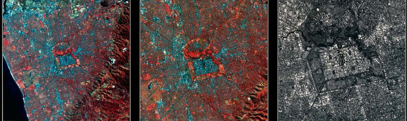
Figure 1 : Central Adelaide acquired by (left) 30 metre Thematic Mapper, (centre) 20 metre SPOT multispectral, and (right) 10 metre SPOT panchromatic.
The French SPOT Satellite
For around ten years, earth observing had been the domain of the United States. In the early 1980s however, the French started to promote their SPOT satellite. SPOT (originally Systeme Probatoire d’Observation de la Terre, today Satellite Pour l’Observation de la Terre or Satellite for Observation of the Earth) was developed by CNES (Centre National d'Etudes Spatiales or the French Space Agency) with different capability than Landsat. SPOT would capture data with two independent instruments. The XS or multispectral instrument would collect its data from three discrete regions of the Electromagnetic Spectrum, with a resolution of 20 metres, and the PA or panchromatic instrument would collect its data from a single region of the Electromagnetic Spectrum, with a resolution of 10 metres. SPOT was to also have a special feature that allowed it to be programmed to look off-nadir or sideways and scan the same strip of terrain twice under two consecutive overpasses. The two different visual angles on the same area would give a stereoscopic effect, and make it possible to determine elevation. SPOT-1 was launched on 22 February 1986 and lived up to expectations. Figure 1 demonstrates the resolution of SPOT and TM over central Adelaide while Figure 2 is the poster tracing SPOT’s evolution.
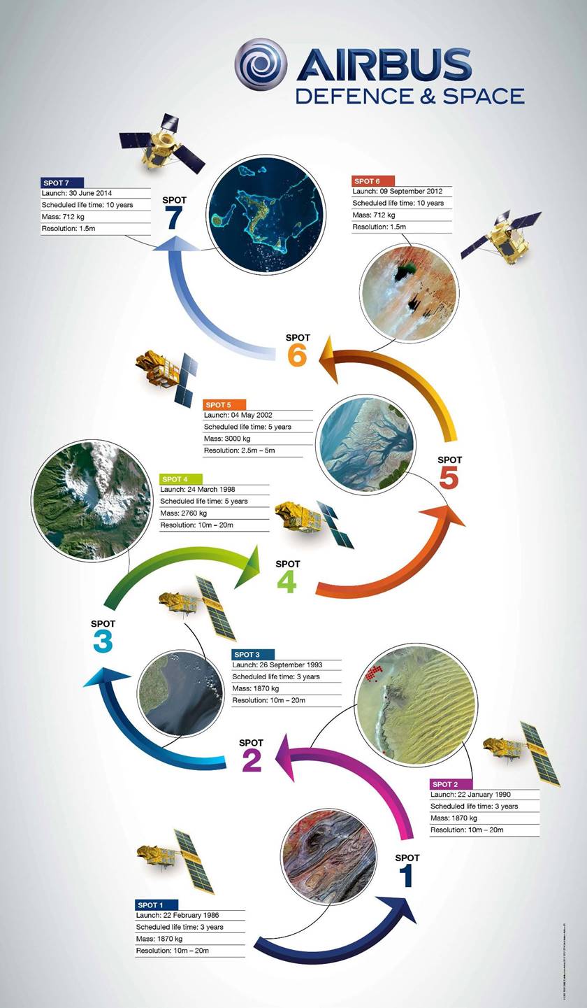
Figure 2 : Poster tracing SPOT’s evolution.
30 Years of SPOT
The first five SPOT satellites were financed by CNES and built by the prime contractor Airbus Defence and Space, with their expertise being in platforms and high-resolution optical systems. To ensure long-term continuity of the high resolution SPOT data, Airbus Defence and Space decided in 2009 to completely finance the two successors SPOT 6 and SPOT 7. Today the constellation of SPOT-6 and -7, are the operational platforms meaning that SPOT has now been observing the Earth for 30 years. The Airbus press release stated that SPOT satellites have covered the land area of the Earth more than 700 times, setting a world record for spatial observation.
Compiled by Paul Wise, April 2016.