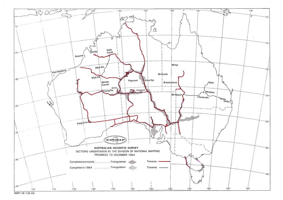
Program 1964
As the field party which had been working in New Guinea didn't return until the end of January, and would again be required for further duty in that country in early October, the 1964 field program had to be modified to suit those arrangements, it was to be:
(i) Theodolite/Tellurometer traverse, Dalby - Charleville - Mt Howitt, Queensland
This traverse had been proved, beaconed and cleared in 1963.
(ii) Reconnaissance and beaconing, Mt Isa - Breadalbane and Mt Guide Breadalbane
Beaconing Whiskey - Kotri, Queensland
J.W. Witzand would complete these tasks
(iii) Theodolite/Tellurometer traverse, Halls Creek - Well 35, Canning Stock Route, WA, including beaconing and track making,
R.A. Ford would complete this task.
(iv) Reconnaissance, Young Range - Well 35, WA
H.A. Johnson would complete this task.
(v) Papua New Guinea triangulation and Tellurometer measuring
The required personnel would be withdrawn from field parties in September and H.A. Johnson would direct this task
O.J. Bobroff would take over administration in Melbourne as the Supervising Surveyor would be absent from headquarters for most of the year.
As usual there were certain staff changes. I. Johnson and J. Pearson resigned then R. Scott a little later; however E. Burke and R. Goldsworthy were now ready to take over observing parties.
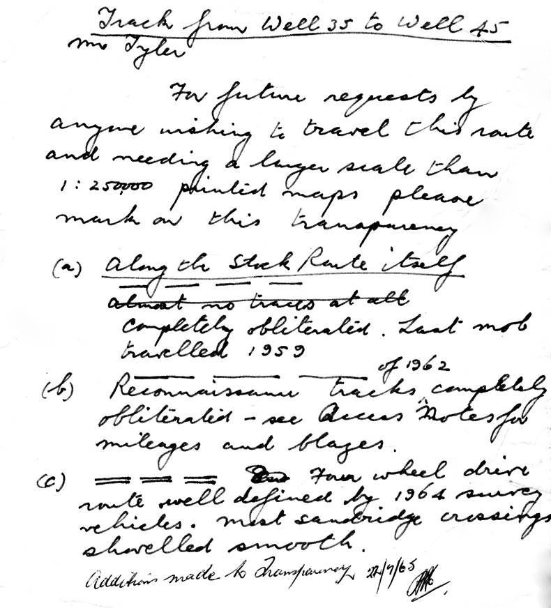
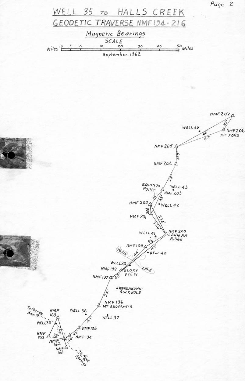
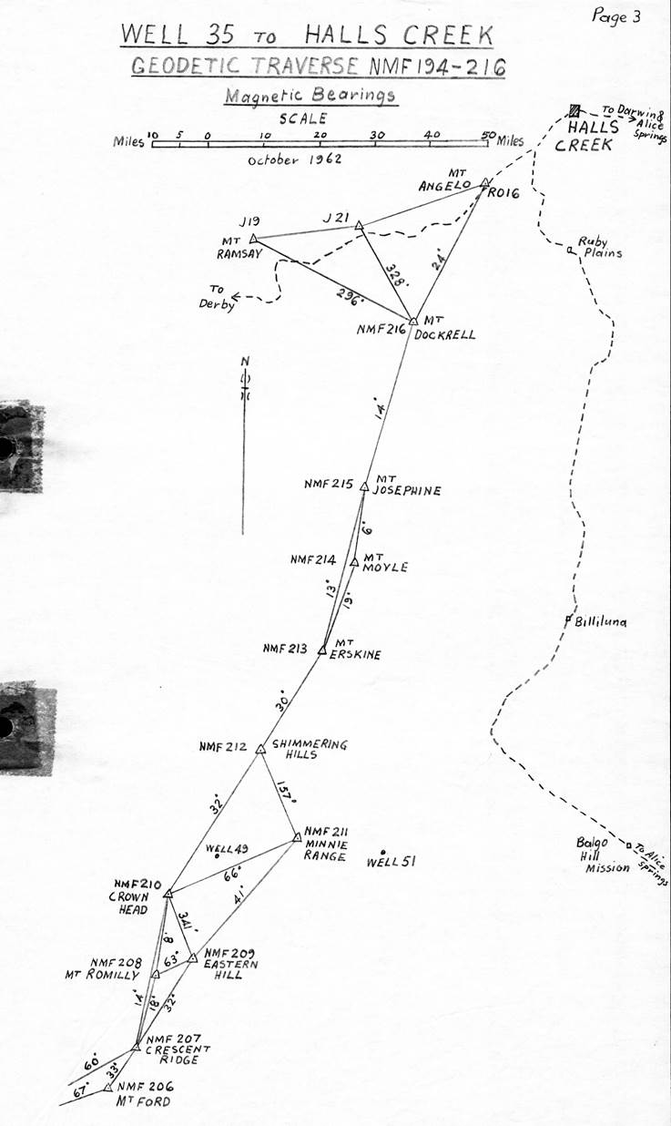
Halls Creek – Well 35 Canning Stock Route, WA, Theodolite/Tellurometer Traverse
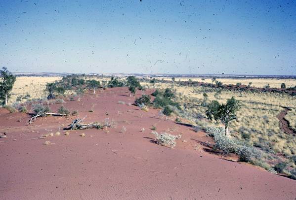
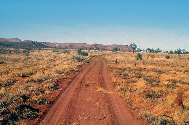
Considerable advance preparation was necessary to make this difficult traverse a success. National Mapping had paid a contractor to grade a track from the vicinity of Old Billiluna Homestead a distance of 160 miles to Well 45. This route was generally clear of sandridges but the terrain was very rough and a graded track to the start of the formidable sandridges would be a great help.
(Thanks to Des Young, H.A. Johnson’s and R.G. Ford’s notes and reconnaissance maps are available. In a note dated 20 January 1966 (after the survey) Reg states “In 1964 a contractor, Mr.W. Moyle of Carranya H.S., lightly graded a track from the vicinity of Old Billiluna to Well 45, and the National Mapping field party continued a light grading to a point just south of Well 41. From this point southward only solid wheel tracks left by 5 vehicles exist to the graded track, near Well 35. All sandridge crossings were shovelled clear of mounds and spinifex”. A further note (probably by H.A. Johnson states “ The new track left the Billiluna - Balgo Mission road (near the Sturt Creek), to Well No. 52, thence lightly clearing the old track (of ant-nests and spinifex) to the vicinity of Crown Heads , and thence continued as a new track to Well 45.
The clearing was to be the lightest clearing and smoothing scrape possible to give a smooth clear run at the sandridges. Most of these runs were to be square to the slopes, unless a definite terrace was available. It may have been necessary on some tops to make turns to obtain a two-way crossing. It was not intended that this was to be other than a route for International 1 ton 4 x 4 or Landrover vehicles”. – Ed.)
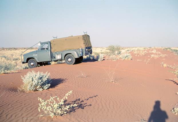
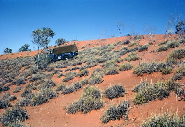
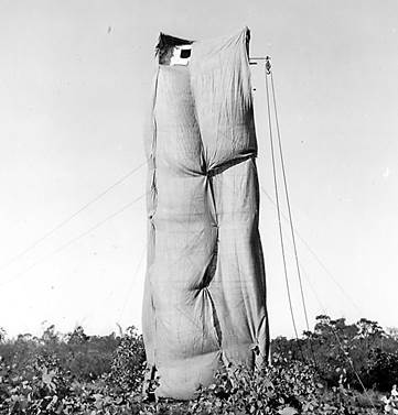
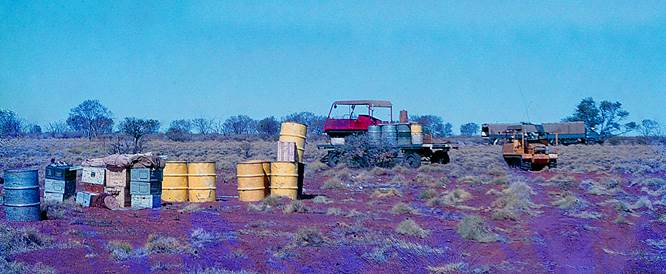
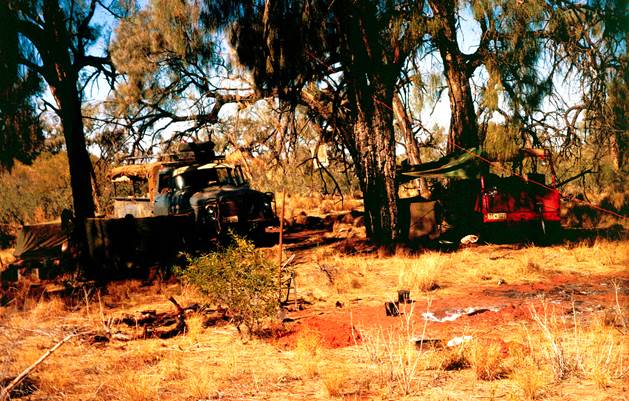
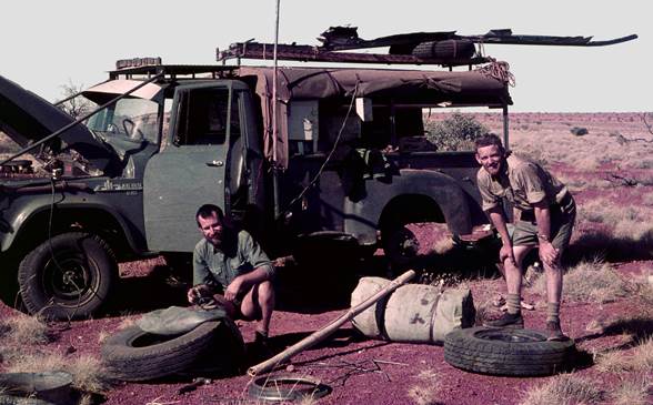
The Supervising Surveyor wanted the field party to scrape a track over the sandridges from Well 45 to Well 35 a distance of 200 miles. The Bureau of Mineral Resources had two Bombardiers, a very light weight tracked vehicle designed for pulling snow ploughs; to go with these was a tracked trailer. They assured National Mapping these vehicles were good performers in the sand. One Bombardier was to pull the track scraper used in 1962 which had been modified to improve its performance. The other was to tow the tracked trailer loaded with petrol and beacons etc. Figure 1 is a photo of one of these Bombardiers.
The field party was not ready to leave Melbourne until late April. R. Ford would be party leader and observer, J. Allen and D. Hutton would be Observer/Tellurometer operators and F. Combe would have charge of track scraping and beaconing operations.
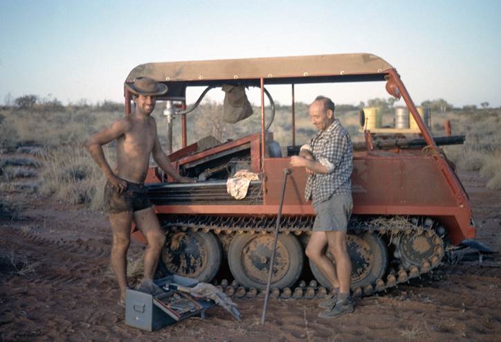
Figure 1: A Bombardier at Well 45 with Kevin Snell left and John Driscoll right;
the tracked trailer is just visible in the background.
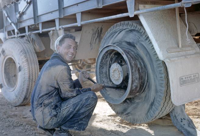
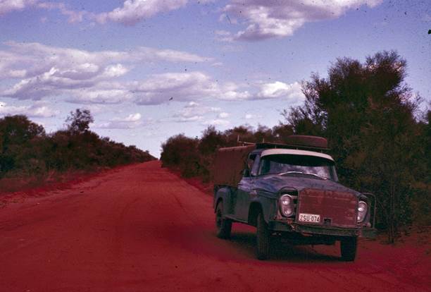
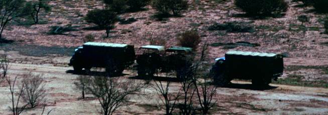
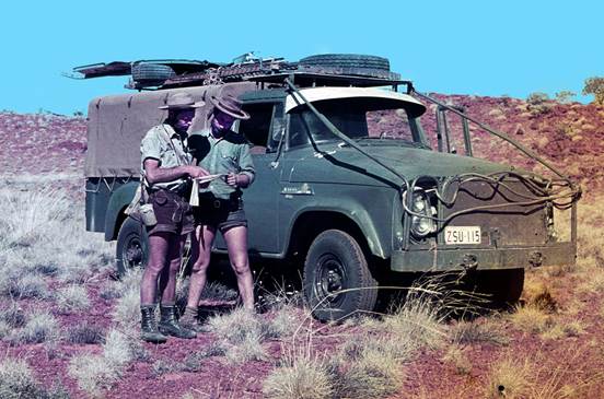
Figure 2: John Coles repairs a Bedford truck with a blown out rear tyre, enroute Halls Creek.
The measuring would be done with MRA-2 Tellurometers which had been received just in time for the New Guinea operations. Three WRE drivers and vehicles joined the field party as it passed through Adelaide.
The Bombardiers and tracked trailer were picked up at Kalgoorlie railway yards and loaded on a full trailer for the trip north. The original intention had been to start at Well 35 and work north, but at Kalgoorlie the Supervising Surveyor advised by telephone that the party was to go direct to Halls Creek and work south to Well 35.
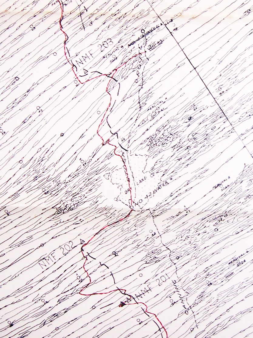
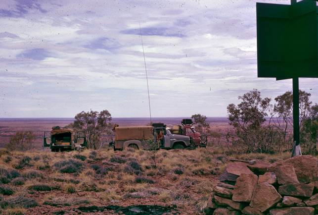
The field party arrived in the Halls Creek area on 21 May after a slow trip marred by considerable vehicle trouble. Figure 2 shows one of the minor problems encountered, a Bedford truck with a blown out rear tyre. Once in the area F. Combe commenced beaconing southward and the observing parties commenced task by occupying the established stations. The lines south from Halls Creek are reasonably long, so there was plenty of quick moving required while on this section. Simultaneous reciprocal azimuths were observed along every fourth line; in addition the Supervising Surveyor requested position line astronomical observations at certain stations. Photo identification of all points on aerial photography was also required. All work was completed to Well 45 in four weeks; this included inspecting the track so that the contractor could be paid. Eleven new stations plus two established stations had been observed, distance 225 miles. It was now 22 June.
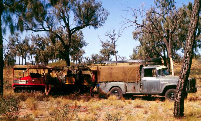
Now came the time for the Bombardiers to prove their worth and they failed. The tracked trailer was much too heavy to be towed over the high sandridges in this area with any load; the scraper could be towed along the flat but not over the sandridges unless both Bombardiers were used in tandem.
As the field party had to try and scrape the track there was only one solution - do not take the trailer - load F. Combe's International with the beacons (with some small help from the observers vehicles) cement, petrol, etc. Luckily on this traverse the stock route wells would provide water which is so heavy to cart.
While the observing parties stayed at Well 45 finalising field books and preparing for the desert trip ahead, R. Ford and F. Combe reconnoitred ahead towards the first sandridge station, testing the scraper and the Bombardier's ability to tow it.
They had with them a very good large scale strip map taken from the map compilation which showed H.A. Johnson's reconnaissance route, station sites, wells and every detail of the sandridges. Unfortunately this didn't cover the two most northerly stations so these could only be located by bearing and distance from the access sketch.
During a long delay while the track scraping party sorted out some vehicle problems, the party leader walked ahead for a considerable distance and his diary entry reads:
“After a long walk during which no sign of the 1962 wheel tracks could be seen, ahead on the sandridge I was then following could be seen a rather higher area. I climbed the ridge here and found the bearing to the rear (northern) station was correct. This indicated I was close to the right point but there was no sign of the bush tripod shown on the access sketch. After examining with binoculars all the other ridges for tripods and searching back and forth on this ridge, I returned to the high point almost convinced this was the selected position but where was the tripod? While further searching the area with binoculars I suddenly looked at the ground at my feet and saw a bundle of sticks. There was nothing remarkable about this as there are always sticks lying around on sandridges, but these had been cut with an axe. In fact they were the bush tripod which had apparently toppled over and closed up in a bundle.”
Suddenly everything fell into place, the blazed trees were found on the south side of the sandridge with the blaze facing south and therefore not visible from our northern approach. This information gave confidence in finding the station sites ahead – we must expect smaller tripods than anticipated, they may be down, and the blazes on the trees would be facing south as during the reconnaissance the Supervising Surveyor had expected the field party would approach from that direction.
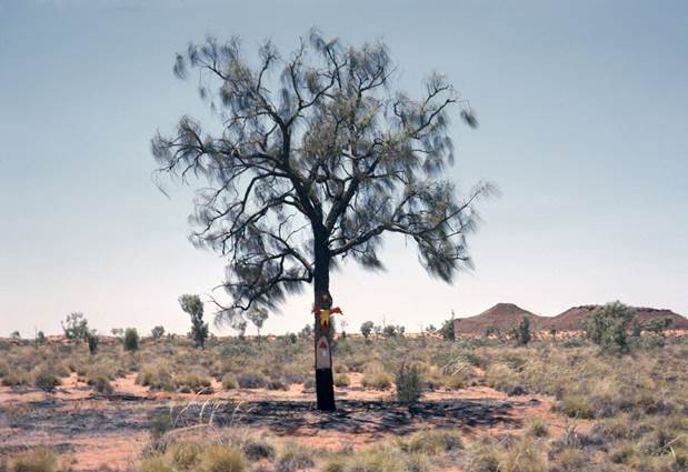
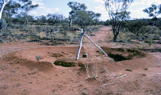
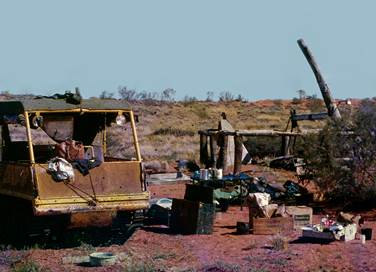
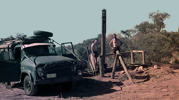
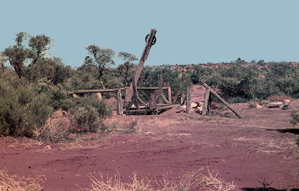
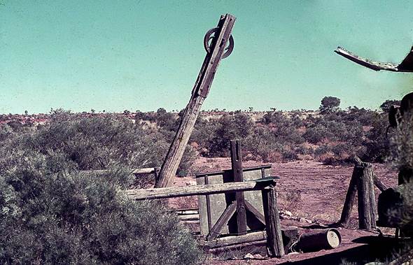
A beacon was erected at this station; the party pushed south and located the next station. Once again the tripod was down. With this beacon erected and some knowledge of the Bombardiers likely performance, the party returned to Well 45 to prepare for the major task ahead. A photograph of Well 43 is shown at Figure 3.
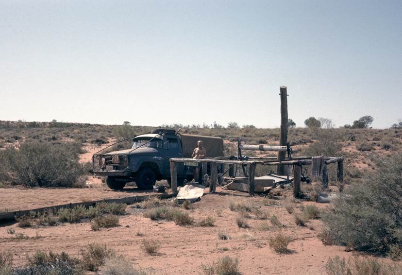
Figure 3: Well 43, Canning Stock Route, June 1964.
Generator trouble was now experienced with one of the Bombardiers. They are of unusual design, having the radiator horizontal and fairly high above the engine; thus a very large vertical fan was required to circulate air across the engine and up through the radiator. This large fan was proving too much for the generator bearings - a spare generator was fitted but only lasted a couple of days. After a third generator breakdown it was decided just to use the fan for circulating air and not driving the generator. Batteries were changed between Bombardiers each morning so that a fully charged battery was available to serve the distributor for the days run.
As the field parties moved into the desert the Bedford trucks under J. Coles of WRE moved north to Halls Creek. They were to remain there and keep daily contact by radio in case of emergency, until the point of no return had been reached, approximately halfway to Well 35. During the last week in July they were asked to begin their long, 1400 mile, trip to Well 35 via Derby, Broome and Port Hedland, collecting a load of petrol and food etc from the last named town.
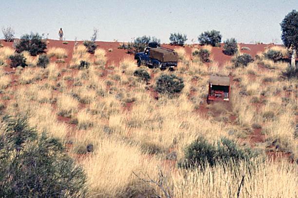
The beaconing and observing parties were now well into the sandridge country and they were a forbidding sight, often only 100 yards apart, making driving a continual strain. There was only one method of getting over them; keep to the spot where the track had been scraped across the ridge, move to second gear low ratio on the approach and put the foot down hard. In this way the heavily laden internationals handled the ridges without too much engine or transmission strain, however one always worried about the steering and suspension.
Towing the scraper, the two Bombardiers in tandem just managed to get it over the ridges; watching them do this reminded one of a dog on a slippery floor - all movement and no traction. The track made by the scraper on the flat was fairly good but the Bombardiers loosened up the sand too much on the ridges, particularly for the first vehicle following.
As was inevitable one eventually began blowing smoke and lost all power, the constant strain on the motor being too much for the six cylinder Chrysler side valve engine. This meant all track scraping operations ceased near Well 41; about ninety miles of track being completed and about 110 miles still to go to reach Well 35.
The beaconing party now concentrated on hand shovelling the tussocks aside to form the sandridge crossings; these proved very satisfactory but it was very hard work for those involved. The going was a bit rougher between the ridges now there was no scraped track but overall the party felt a sense of relief now that the scraper was not being towed - it had been as heavy a weight on a few people's minds as it had been on the under powered, undersized Bombardiers.
Progress on the observing, measuring, simultaneous reciprocal azimuths, recovery mark emplacement and measuring was steady; observing conditions in June and July in that area are at their best, and all the observers were experienced in this type of work. Position Line astronomical observations were taken at the stations requested.
With about 70-80 miles still to go F. Combe reported a failed rear differential on the heavy laden International carrying the beaconing material. K. Snell who was a pretty good mechanic repaired it as a “fixed diff”; the vehicle was able to continue its job and arrived at Well 35 without further trouble.
The Supervising Surveyor arrived in the area via Well 35 and met the field parties near Well 36 about 3 August. The traverse was nearly completed by this time and in just over a week all were at Well 35. All field work on the traverse was finalised by 12 August; the Bedford’s had arrived with petrol, a spare International rear differential, and supplies, a few days earlier.
This was one traverse which gave those who worked on it a sense of having achieved something well worthwhile. The distance Well 45 to Well 35 was 201 miles, twelve stations were beaconed and observed in 7½ weeks, while overall from Halls Creek to Well 35 twenty three new stations plus three old stations had been observed in about twelve weeks.
Beaconing - Astronomical Observations, Well 35 - Windy Corner area, WA
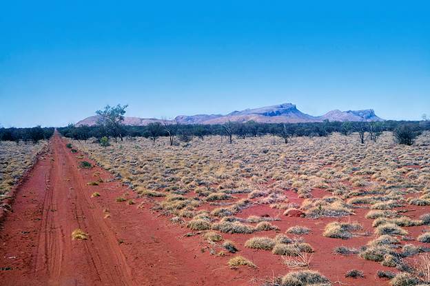
Before joining the field party at Well 36 the Supervising Surveyor had completed a reconnaissance from Young Range almost due north to Well 35 generally along the line of L. Beadell's recently graded track from Young Range to Garry Junction near Well 35.
L. Beadell had also graded an east-west track from Windy Corner past Well 23 on the Canning Stock Route to the station tracks near Balfour Downs and Talawana Homesteads.
The field party was now given two tasks to complete before quitting the area. F Combe and the beaconing party were to beacon south towards Young Range and the observing parties were to complete some astronomical observations for latitude and longitude at selected points as part of the 1:250 000 scale mapping program. These included one very long cross country trip by J. Allen to complete two observations.
Also Beadell's previously mentioned graded tracks were to be identified and marked on aerial photographs of the required 1:250 000 scale map sheets.
These tasks were completed by 24 August; the Bedfords and the beaconing party returned via Papunya and Alice Springs, while the observing parties who had finished at Windy Corner returned via Giles and Kulgera. They arrived in Melbourne on 1 September to prepare for duty in Papua New Guinea in October.
F. Combe and the beaconing party went to Queensland for further beaconing and station marking under the direction of J.W. Witzand.
Papua New Guinea October 1964 - January 1965
The following was completed:
Six new stations observed.
Three terminal stations of the previous survey re-occupied and observed to continue the triangulation westward.
941 miles of Tellurometer measurements.
One line of 121 miles; Aird Hills - Bosavi Peaks.
This finalised the Melbourne based Geodetic Survey Branch's part in the main geodetic survey of Papua New Guinea.
Theodolite/Tellurometer first order traverse Dalby - Charleville - Mt Howitt, Qld.
Owing to the Papua New Guinea operations the field party was not able to leave Melbourne until May. J.W. Witzand was party leader and had R. James as an experienced observer with E. Burke and R. Goldsworthy who were partly trained. A. Colvin went out with the field party to provide help in their final training. About the start of July a Surveyor Class 1, A. Roelse joined the party. Most of the field assistants had no more than one year’s experience.
Progress was steady and speeded up as the observers became more familiar with their task. Two 30 foot towers and scaffolding were erected for observations at Kogan and Winbin.
Towards the end of September R. Goldsworthy, E. Burke, D. Price and L. Wilson returned to Melbourne to join the survey party which was to proceed to Papua New Guinea. By this time training had been given to J. Marshall and A. Roelse had become familiar with Australian conditions and National Mapping's requirements.
On this traverse 29 new and 3 existing stations were observed, all lines measured, simultaneous reciprocal azimuths along every fourth line and position line astronomical observations at the nominated stations. The distance was approximately 570 miles. The survey party then returned to Whiskey to commence work on the northern traverse.
Theodolite/Tellurometer first order traverse Whiskey - Kotri, Central Queensland.
At the end of September, Field Assistant (Survey) F. Combe and approximately 4 Field Assistants arrived from WA and completed the beaconing on the Whiskey - Kotri traverse. They then beaconed the Mt Isa - Breadalbane traverse in readiness for 1965 observing. On completion of that task they returned to Melbourne.
The observing party on the Whiskey - Kotri traverse found visibility conditions deteriorating towards the end of October; some thunderstorms delayed progress. Six new stations and two established stations were observed; the distance was 170 miles. The party completed the traverse during November and returned to Melbourne.
Field Parties 1964
Dalby - Charleville - Mt Howitt Traverse Queensland
J.W. Witzand Surveyor Class 2
A. Roelse Surveyor Class 1 (part of time only)
R. James Field Assistant (Survey)
E. Burke Field Assistant (Survey)
R. Goldsworthy Field Assistant (Survey)
J. Marshall Field Assistant
J. Fox Field Assistant
R. Gray Field Assistant
D. Price Field Assistant
G. Grant Field Assistant
I. Wilson Field Assistant
A. Colvin Technical Officer Grade 1 (part of time only)
Halls Creek - Well 35 Traverse WA
R.A. Ford Senior Tech. Officer Grade I
J. Allen Field Assistant (Survey)
D. Hutton Field Assistant (Survey)
F. Combe Field Assistant (Survey) (also beaconing Qld.)
J. Combe Field Assistant (also beaconing Qld.)
W. Bannerman Field Assistant (also beaconing Qld.)
R. Francis Field Assistant
C. Golya Field Assistant
K. Snell Field Assistant
J. Coles Field Assistant WRE
E. Graefling Field Assistant WRE
J. Driscoll Field Assistant WRE
Reconnaissance Young Range - Well 35 WA
H.A. Johnson Supervising Surveyor
Territory of Papua New Guinea, Triangulation and Measuring
H.A. Johnson Supervising Surveyor
D.P. Cook Resident Surveyor
R.A. Ford Senior Technical Officer Grade 1
J. Allen Field Assistant (Survey)
D. Hutton Field Assistant (Survey)
E. Burke Field Assistant (Survey) (2/3 of period only)
R. Goldsworthy Field Assistant (Survey)
L. Wilson Field Assistant
D. Price Field Assistant
J. Carlisle Field Assistant
R. Francis Field Assistant
A. Roelse Surveyor Class 1 (1/4 of period only)